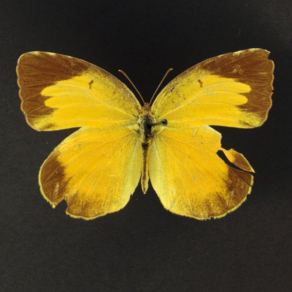
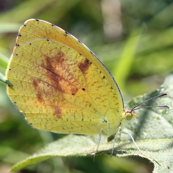
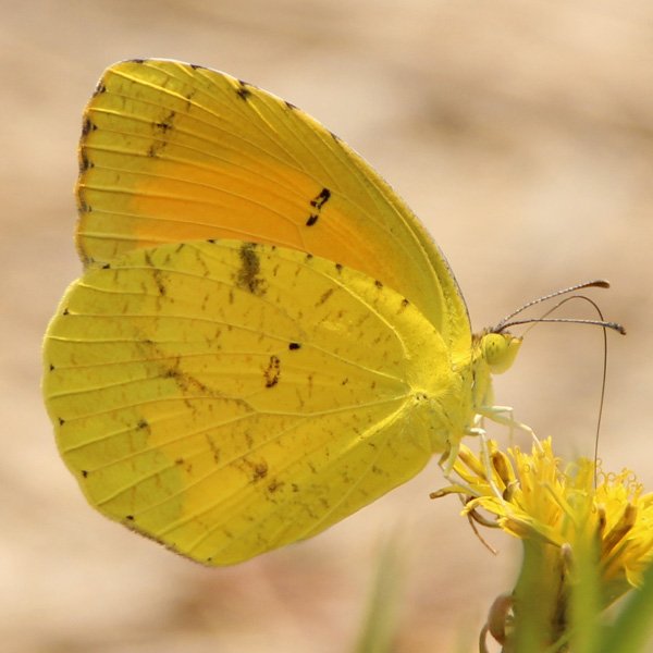
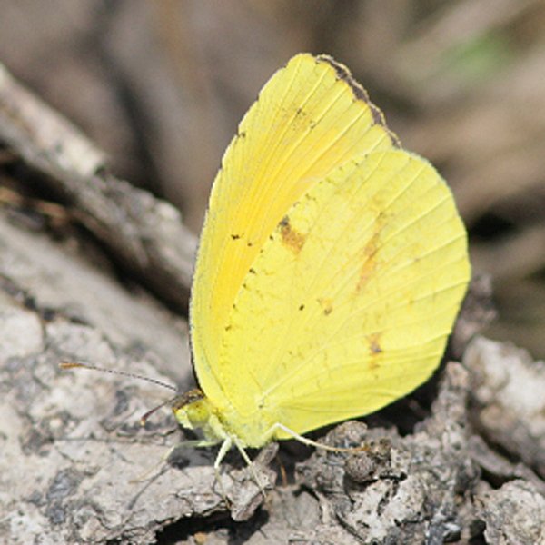
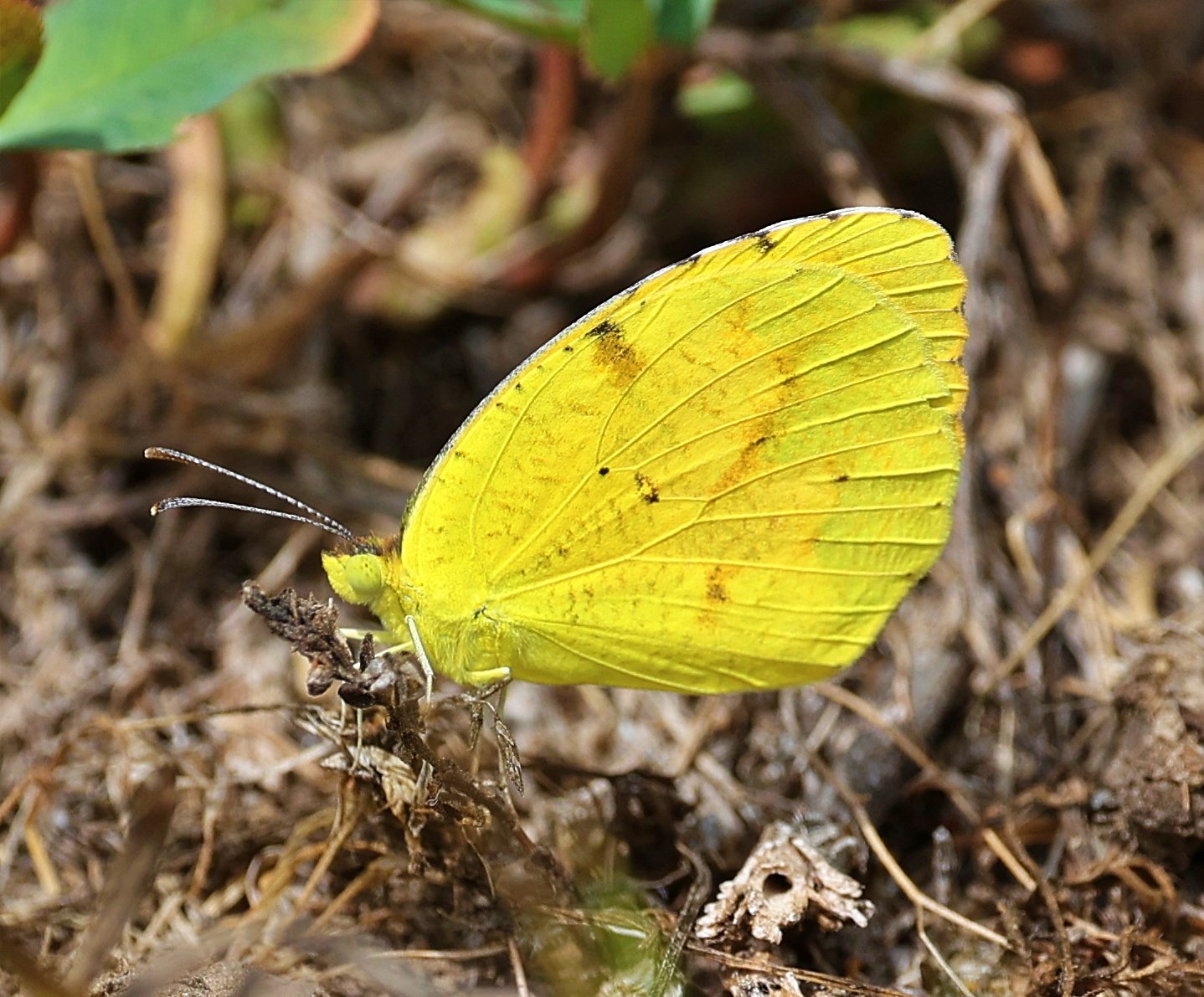
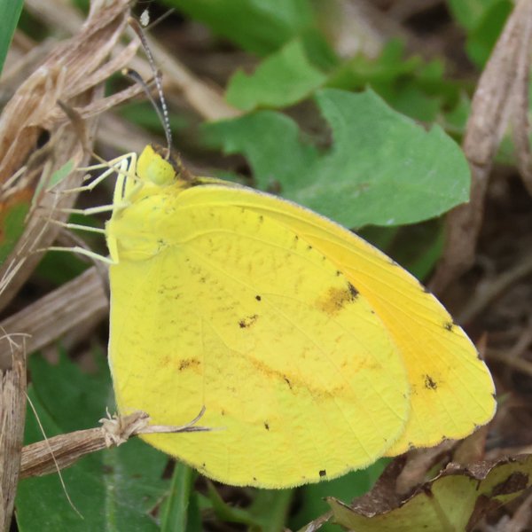
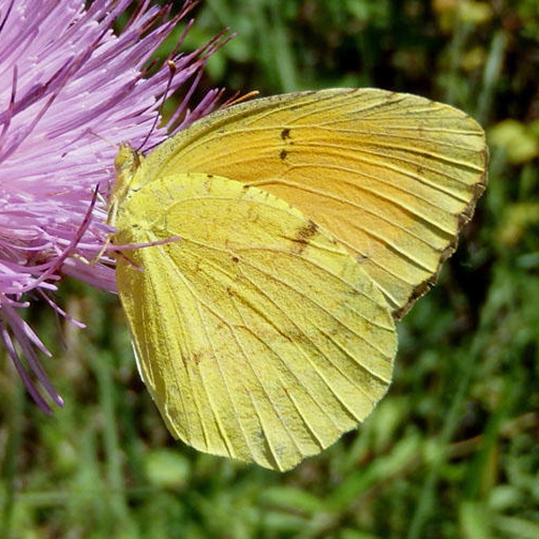
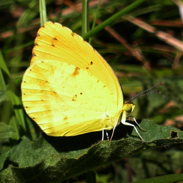
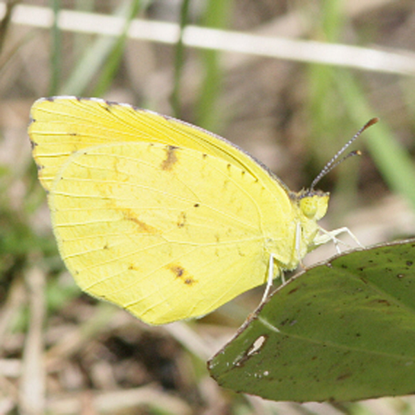
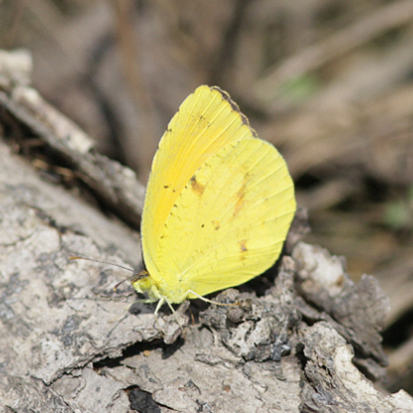
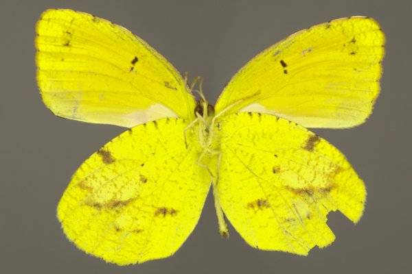
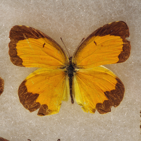
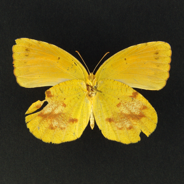
Sleepy Orange (Abaeis nicippe), (Cramer, 1779) - 4242.000000 - 77a0404
Wingspan: 1 3/8 - 2 1/4 inches (3.5 - 5.7 cm).
Flight time: July.
Distinguishing features: Upperside of wings orange in both sexes; orange-yellow form rare. Forewing with small black cell spot. Male with sharply defined black borders on outer and costal margins; female borders not so well-defined. In winter form, underside of hindwing is brick red, brown, or tan; in summer form it is orange-yellow.
Natural History: Males patrol flats and gullies for females. Females lay eggs singly under host plant leaves. Caterpillars eat leaves. Dry season form overwinters and lays eggs in spring.


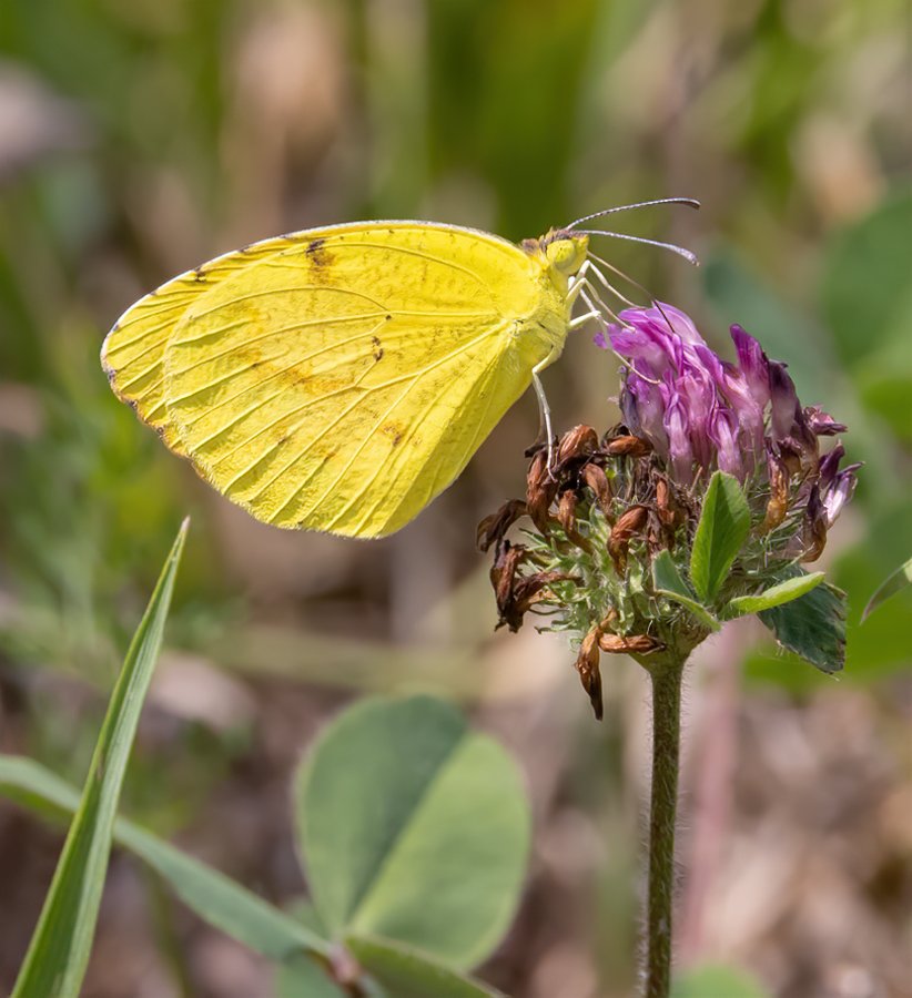
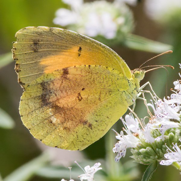
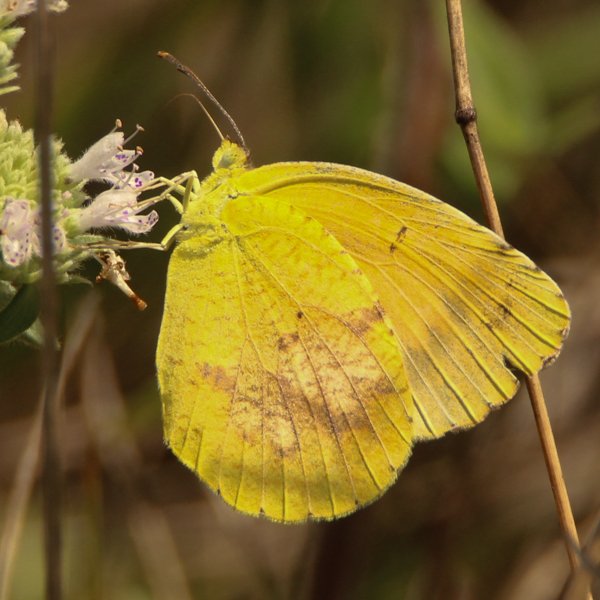
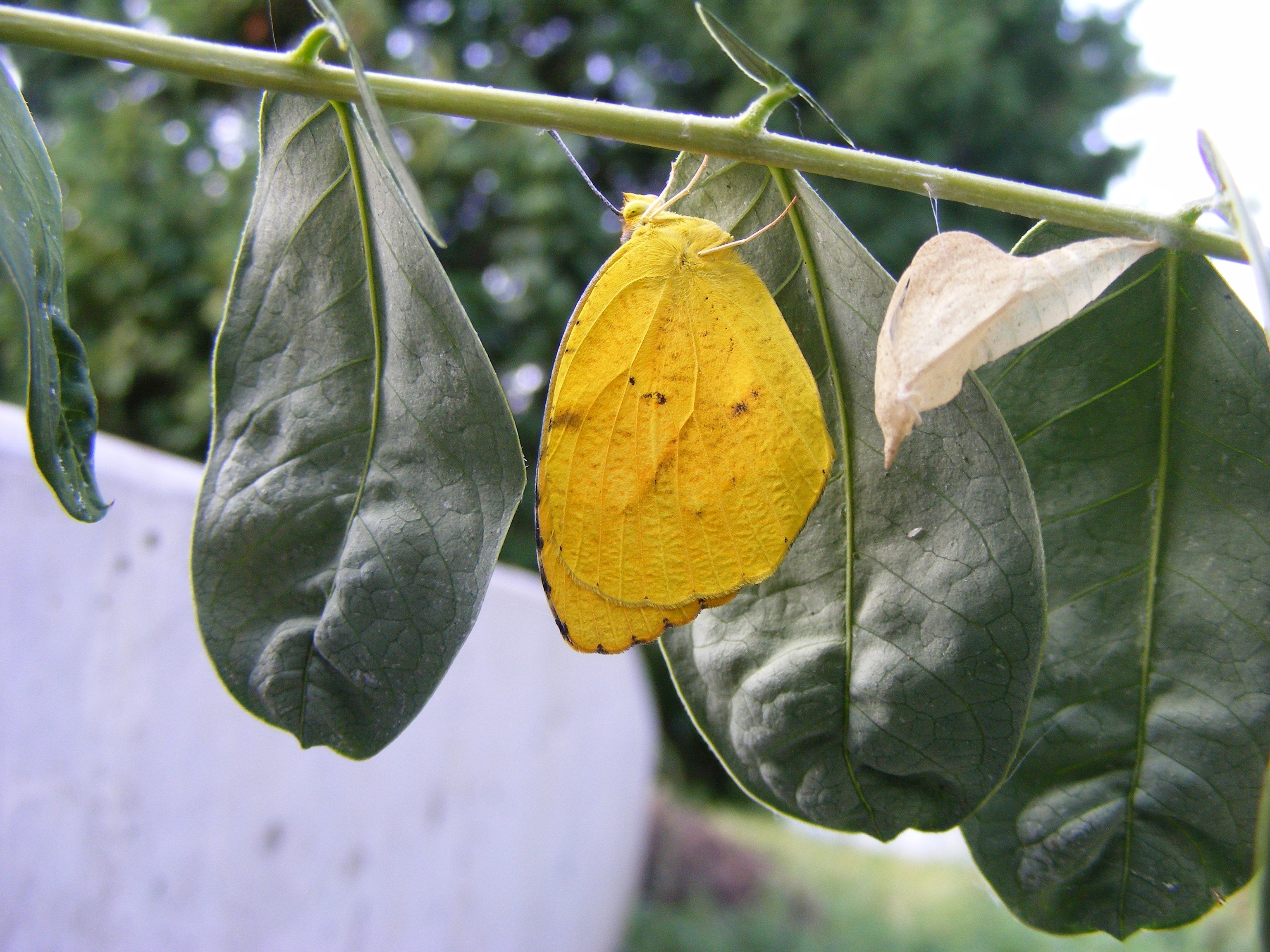
Photos


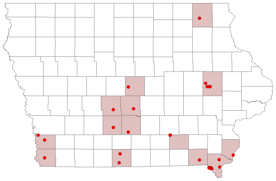
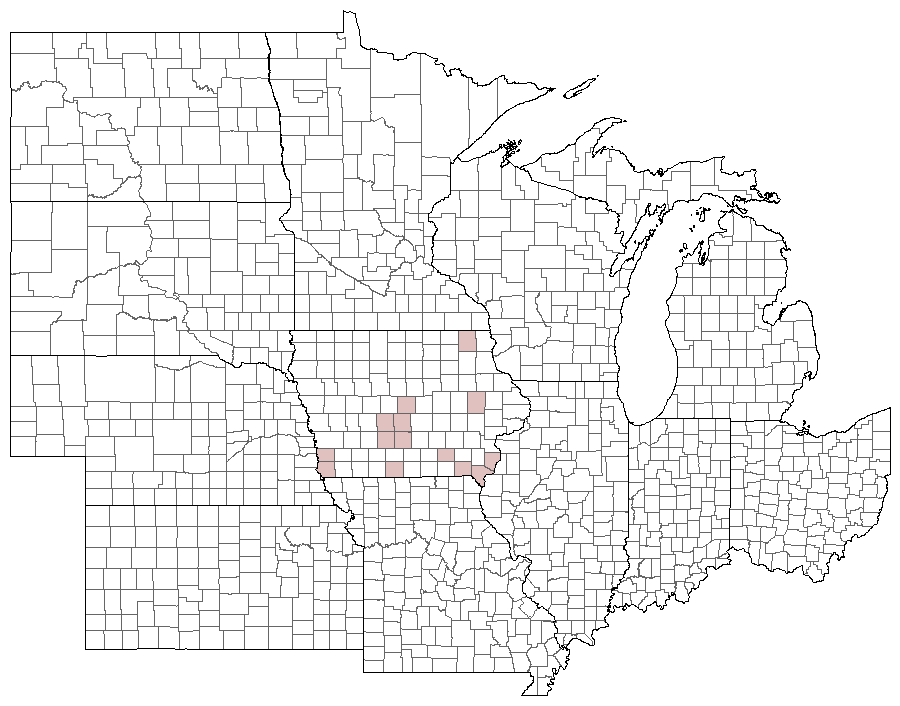
Records
| Record # | Date | Locale | State | Lat/Lon | Collected By | Count |
|---|---|---|---|---|---|---|
| 346943 | 2023-08-05 | Folsom Point Preserve | Iowa | 41.154432 -95.799393 | Jay Gilliam | 1 |
 336786 336786
|
2023-06-25 | Turkey Run Wildlife Area, Lee County | Iowa | 40.558358 -91.683908 | Mark Madsen | 4 |
 343174 343174
|
2023-06-25 | Turkey Run Wildlife Area, Lee County | Iowa | 40.558681 -91.682163 | Mark Brown | 1 |
 346241 346241
|
2023-06-25 | Turkey Run Wildlife Area, Lee County | Iowa | 40.557863 -91.680371 | Jay Gilliam | 5 |
| 350275 | 2023-06-25 | Turkey Run Wildlife Area, Lee County | IA | 40.558402 -91.679173 | Chris Edwards | 4 |
 275224 275224
|
2020-08-08 | Eddyville Sand Prairie Park | Iowa | 41.154568 -92.618726 | Jay Gilliam | 2 |
 271739 271739
|
2020-08-04 | Eddyville Sand Prairie Park | Iowa | 41.1543329 -92.61797536 | Mark Brown | 1 |
| 281042 | 2020-08-04 | Turkey Run Wildlife Area, Lee County | Iowa | 40.558402 -91.679173 | Chris Edwards | 6 |
| 241069 | 2019-09-07 | Wickiup Hill Outdoor Learning Area | Iowa | 42.08398 -91.7651 | Frank Olsen | 1 |
 270507 270507
|
2019-08-04 | Burlington | Iowa | 40.79292 -91.096853 | David Berry | 1 |
 233702 233702
|
2019-07-07 | Eddyville Sand Prairie Park | Iowa | 41.153999 -92.6201 | Mark Brown | 1 |
 181873 181873
|
2016-08-06 | Medora Prairie | Iowa | 41.209512 -93.627408 | Mark Brown | 9 |
| 180530 | 2016-07-21 | Noelridge Park | Iowa | 42.02694 -91.6575 | Frank Olsen | 1 |
| 180514 | 2016-07-15 | Medora Prairie | Iowa | 41.209512 -93.627408 | Frank Olsen | 3 |
| 68811 | 2014-09-07 | Shimek State Forest, Croton Unit East | Iowa | 40.54555556 -91.62611111 | Tom Jantscher | 1 |
| 115022 | 2014-09-07 | Belfast Road | Iowa | 40.550814 -91.652855 | Chris Edwards | 1 |
| 8498 | 2010-09-12 | Shimek State Forest, Croton Unit East | Iowa | 40.546981 -91.620559 | Tom Jantscher | 2 |
| 3354 | 2010-08-15 | Turkey Run Wildlife Area, Lee County | Iowa | 40.557104 -91.678773 | BAMONA | 1 |
| 8497 | 2010-08-15 | Shimek State Forest, Croton Unit East | Iowa | 40.5458333 -91.6172222 | Tom Jantscher | 2 |
 9333 9333
|
2010-08-15 | Heron Bend Conservation Area | Iowa | 40.5722222 -91.4244444 | Tom Jantscher | 1 |
| 115024 | 2010-08-15 | Turkey Run Wildlife Area, Lee County | Iowa | 40.558402 -91.679173 | Chris Edwards | 6 |
| 247062 | 2010-08-15 | Turkey Run Wildlife Area, Lee County | Iowa | 40.558402 -91.679173 | Tom Jantscher | 6 |
 208637 208637
|
2010-07-25 | Slip Bluff County Park | Iowa | 40.65255 -93.84534 | Aaron Brees | 1 |
 208636 208636
|
2010-07-25 | Slip Bluff County Park | Iowa | 40.65255 -93.84534 | Aaron Brees | 1 |
 138193 138193
|
2010-07-25 | Slip Bluff County Park | Iowa | 40.65255 -93.84534 | Aaron Brees | 19 |
| 8496 | 2010-07-10 | Shimek State Forest, Croton Unit West | Iowa | 40.5619444 -91.6394444 | Tom Jantscher | 2 |
| 115023 | 2010-07-01 | Turkey Run Wildlife Area, Lee County | Iowa | 40.558402 -91.679173 | Chris Edwards | 4 |
| 55805 | 2007-09-27 | Wickiup Hill Outdoor Learning Area | Iowa | 42.08398 -91.7651 | Frank Olsen | 1 |
 12371 12371
|
2000-09-30 | Panther Creek Park | Kentucky | 37.71538 -87.21873 | Jim Durbin | 1 |
 144308 144308
|
1990-06-17 | Rock Island Botanical State Preserve | Iowa | 42.026205 -91.726516 | Frank Olsen | 1 |
 138118 138118
|
1960-07-15 | Ames, Paul | Iowa | 42.02064 -93.623952 | Paul Martsching | 1 |
| 3350 | 1950-08-01 | Dallas County | Iowa | 41.612003 -93.987846 | USGS - NPWRC | 1 |
| 3351 | 1950-08-01 | Decatur County | Iowa | 40.814648 -93.824821 | USGS - NPWRC | 1 |
| 3352 | 1950-08-01 | Sidney | Iowa | 40.74004 -95.645798 | USGS - NPWRC | 1 |
| 3353 | 1950-08-01 | Lee County | Iowa | 40.706867 -91.443466 | USGS - NPWRC | 1 |
| 3355 | 1950-08-01 | Linn County | Iowa | 42.027289 -91.67275 | USGS - NPWRC | 1 |
| 3356 | 1950-08-01 | Madison County | Iowa | 41.292236 -93.987846 | USGS - NPWRC | 1 |
| 3357 | 1950-08-01 | Mills County | Iowa | 41.06245 -95.645798 | USGS - NPWRC | 1 |
| 3358 | 1950-08-01 | Polk County | Iowa | 41.627842 -93.500343 | USGS - NPWRC | 1 |
| 3359 | 1950-08-01 | Van Buren County | Iowa | 40.700115 -91.909927 | USGS - NPWRC | 1 |
| 3360 | 1950-08-01 | Winneshiek County | Iowa | 43.236259 -91.909927 | USGS - NPWRC | 1 |