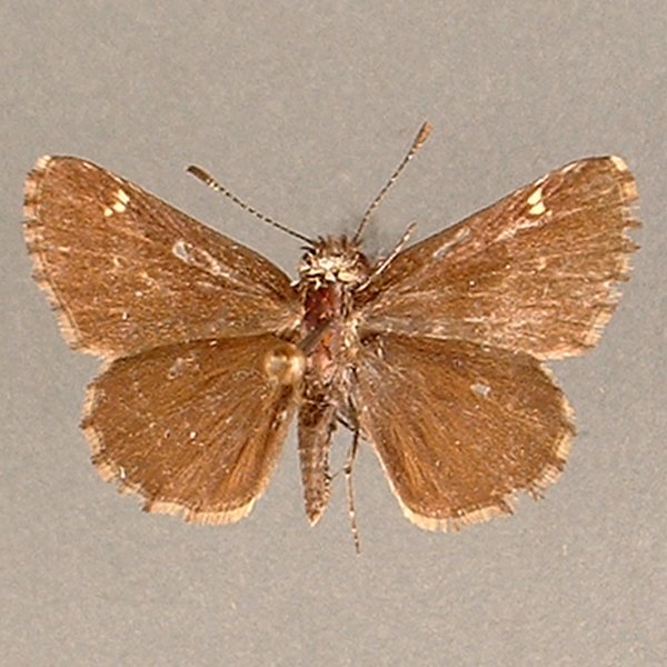
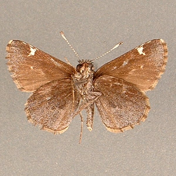
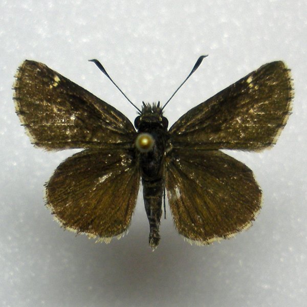
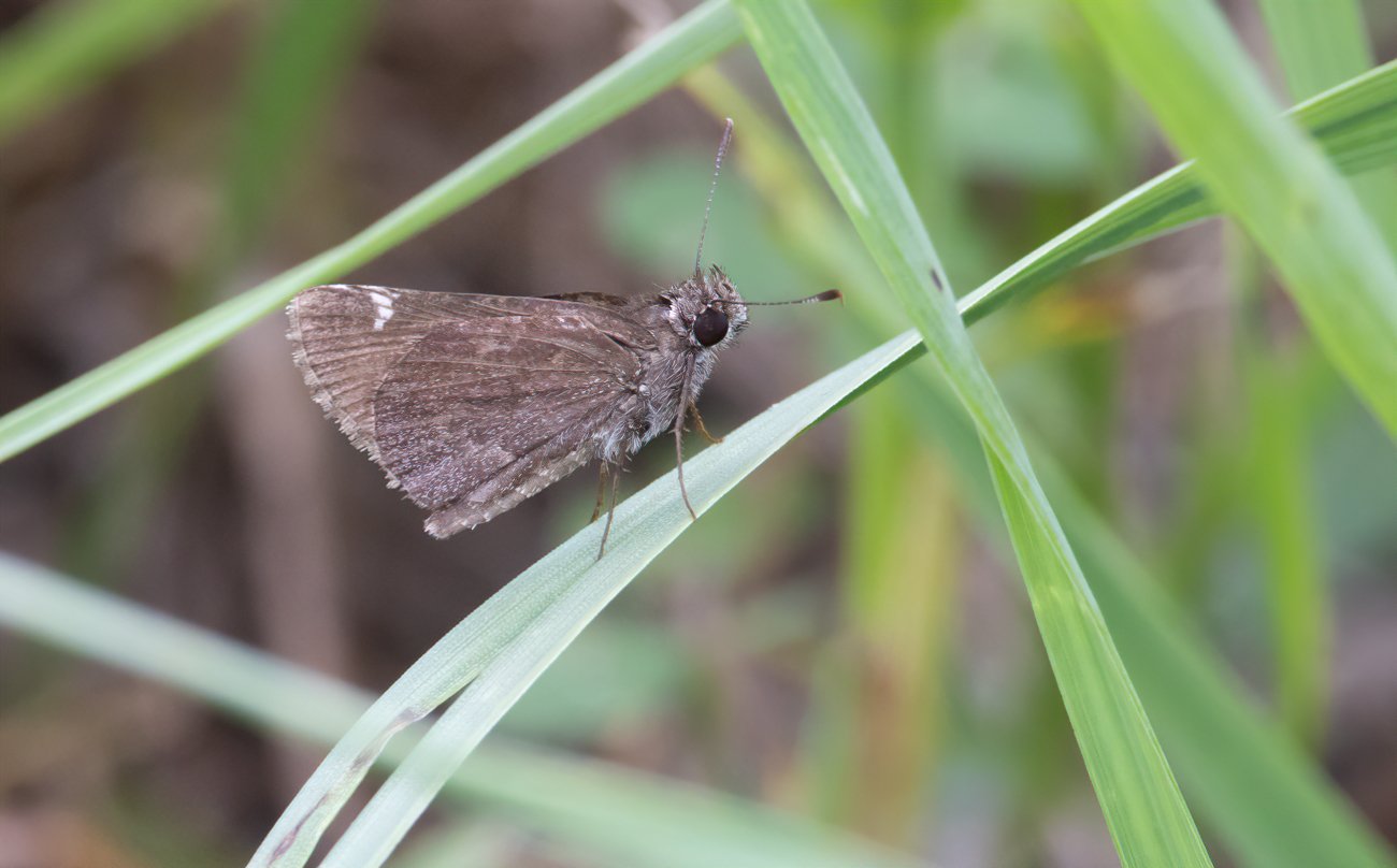
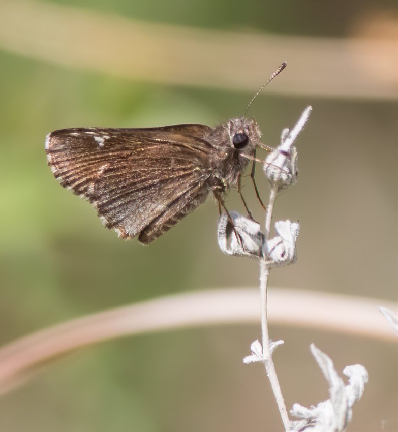
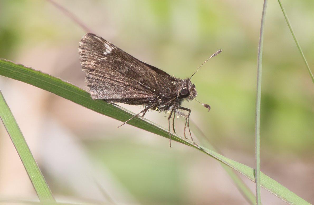
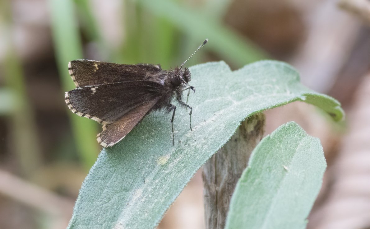
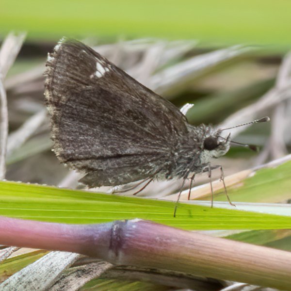
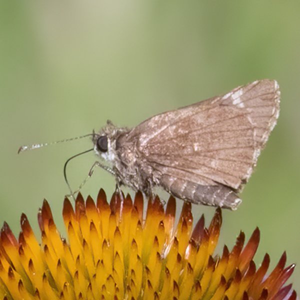
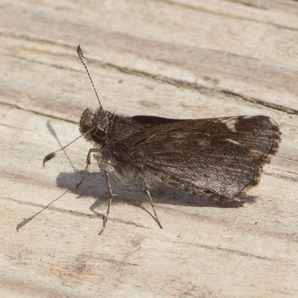
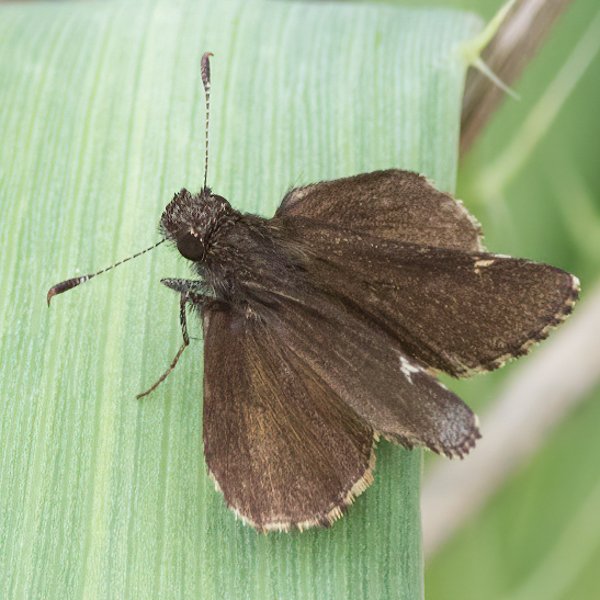
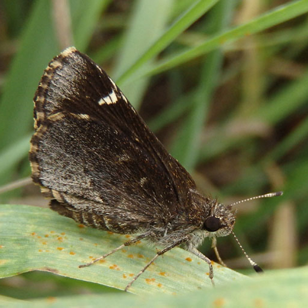
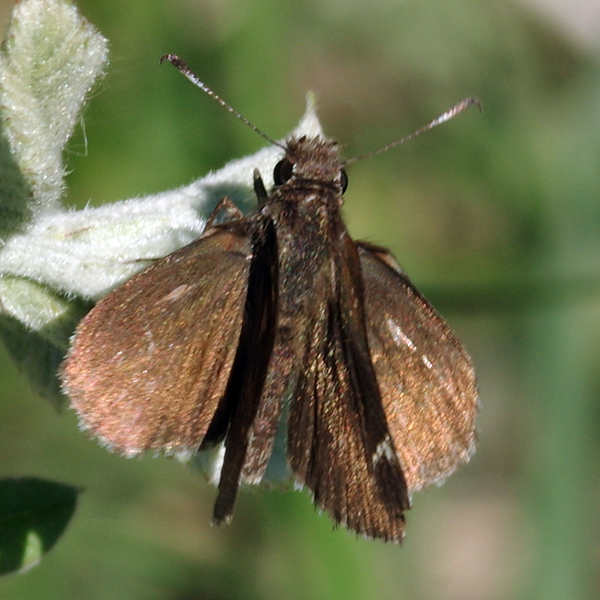
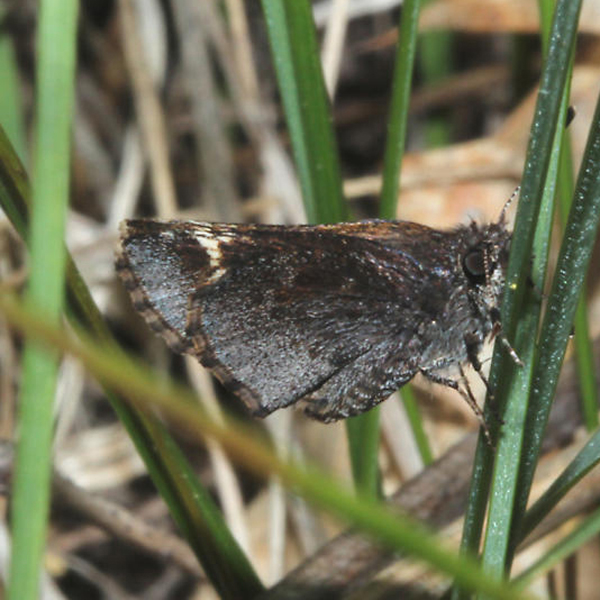
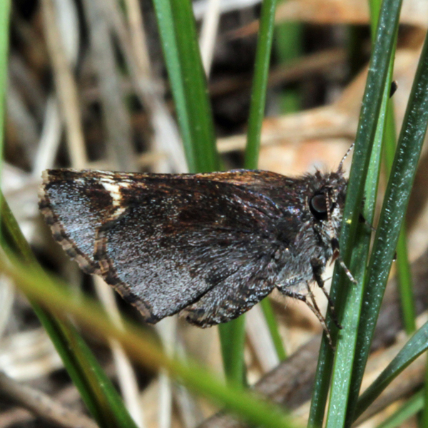
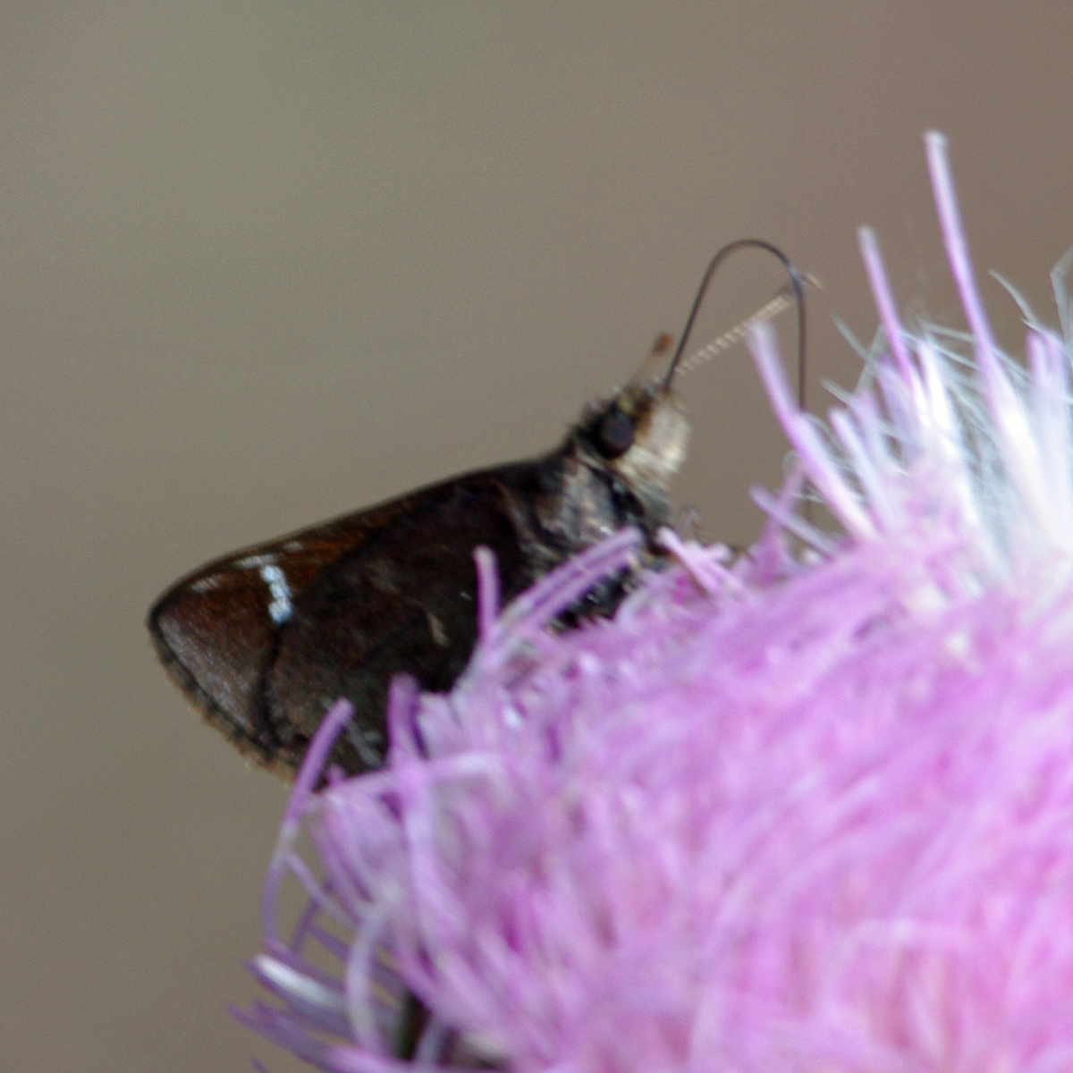
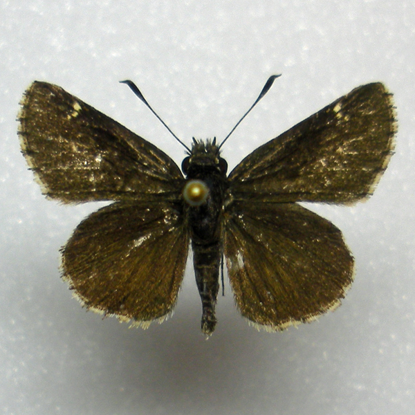
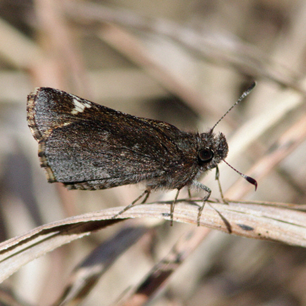
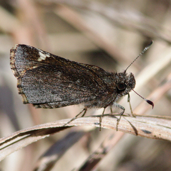
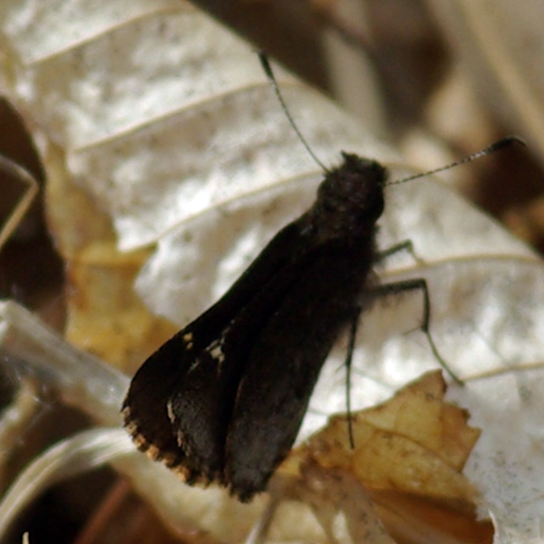
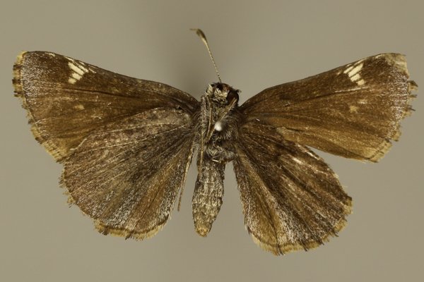
Wing span: 2.5 cm.
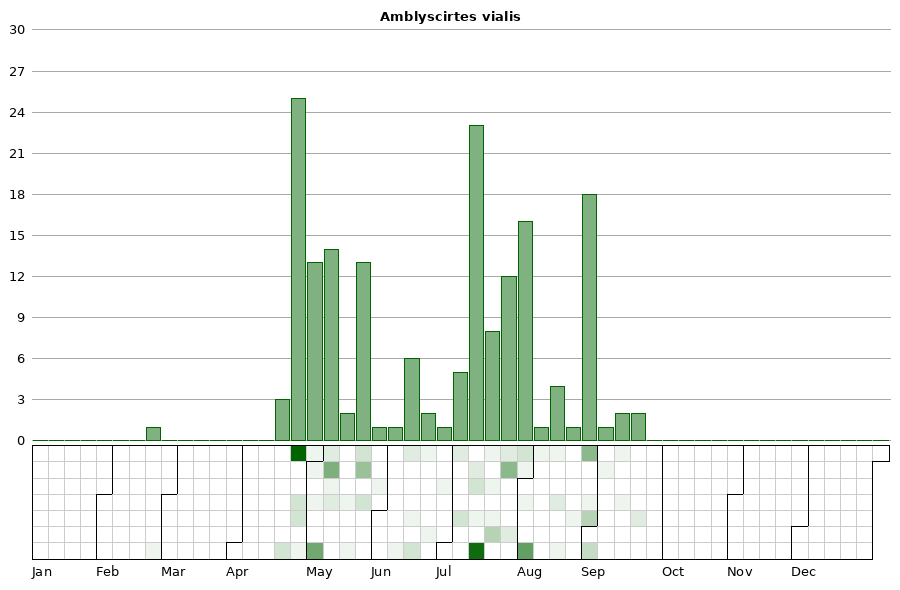
Flight time: Apparently double-brooded, with the first flight occurring from late April to early June, and the second from early July through early August. Bivoltine populations have previously been only reported from Illinois and the Delaware River south (Opler and Krizek 1984).
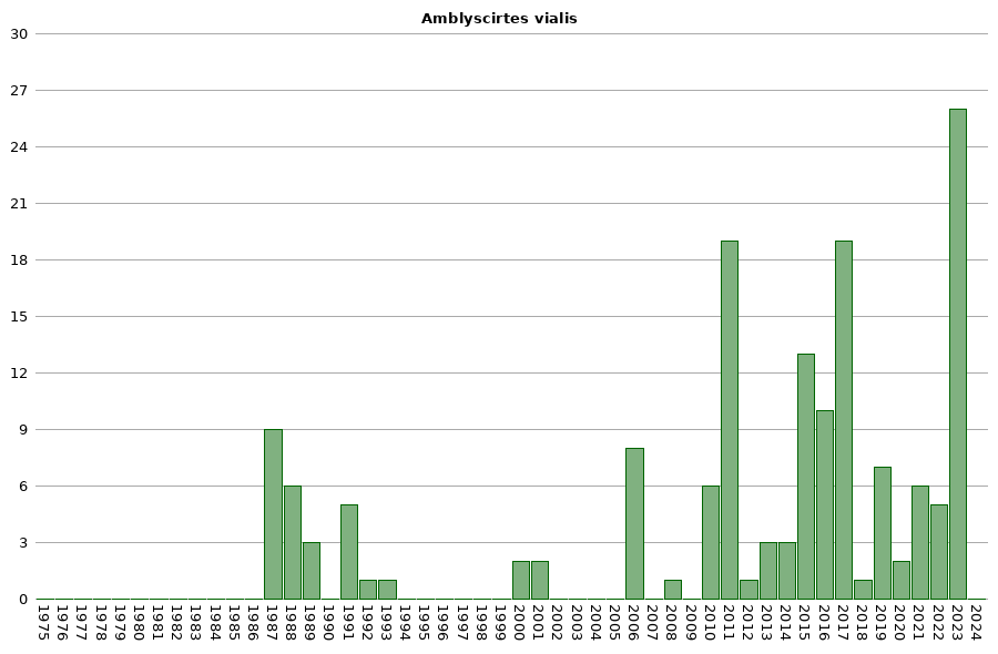
Status: Infrequent breeding resident.
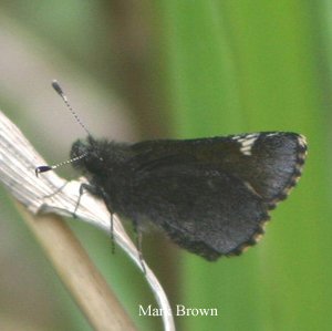
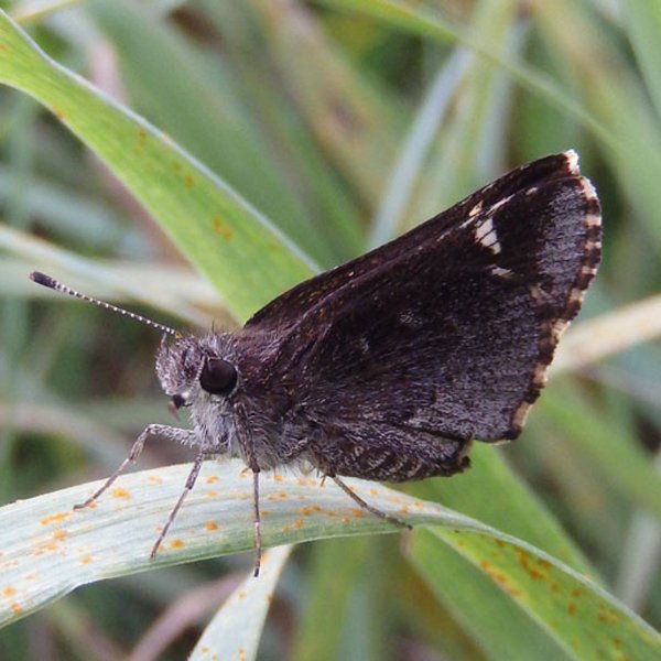
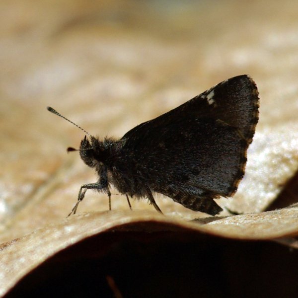
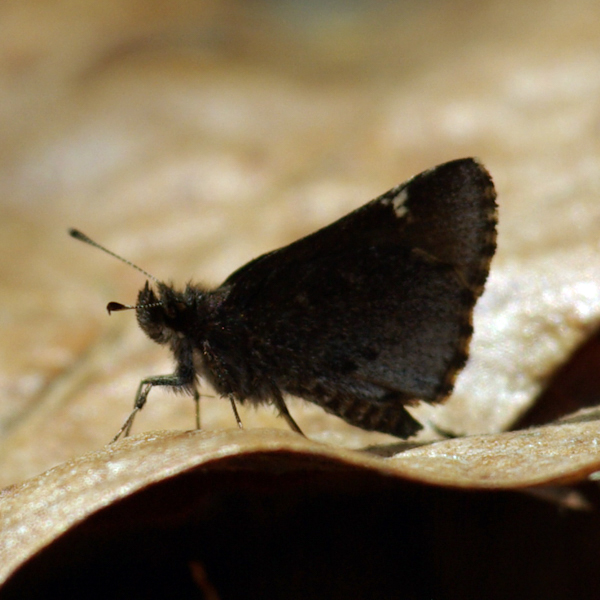
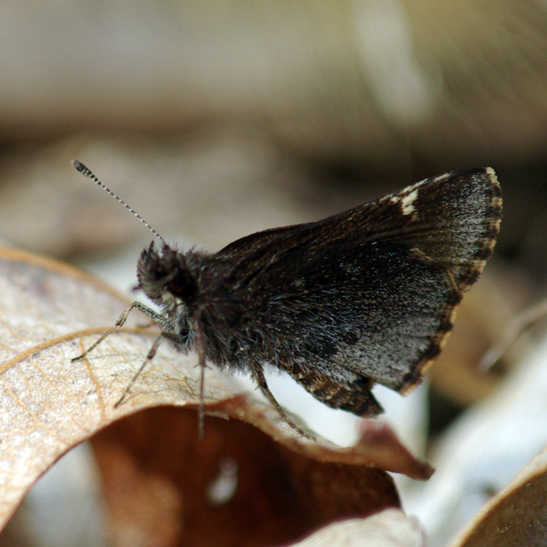
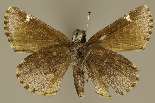
Distinguishing features: This species is small and dark with checkered edges and a violet overscaling on the hindwing below.
Distribution and habitat: The Roadside Skipper is limited to the southern third of Iowa, with populations extending north along the Loess Hills and the Mississippi River. It is restricted to xeric prairie habitats, including Loess Hill prairie, sand prairie, and limestone and sandstone glades.
Natural History: The Roadside Skipper overwinters in the pupal stage. While its larvae have been reported elsewhere to consume a wide variety of weedy grasses, its limitation to high quality prairies suggests that this is not the case in Iowa.


| Record # | Date | Locale | State | Lat/Lon | Collected By | Count |
|---|---|---|---|---|---|---|
 346364 346364
|
2023-08-05 | Folsom Point Preserve | Iowa | 41.154432 -95.799393 | Jay Gilliam | 11 |
 346360 346360
|
2023-07-30 | Folsom Point Preserve | Iowa | 41.154432 -95.799393 | Jay Gilliam | 2 |
| 346936 | 2023-07-30 | Sylvan Runkel State Preserve | Iowa | 42.104116 -95.973382 | Jay Gilliam | 1 |
 346313 346313
|
2023-05-21 | Folsom Point Preserve | Iowa | 41.154432 -95.799393 | Jay Gilliam | 1 |
 346314 346314
|
2023-05-21 | Waubonsie State Park | Iowa | 40.670911 -95.693287 | Jay Gilliam | 2 |
 346259 346259
|
2023-05-06 | Waubonsie State Park | Iowa | 40.670911 -95.693287 | Jay Gilliam | 3 |
| 346425 | 2023-05-06 | Folsom Point Preserve | Iowa | 41.154432 -95.799393 | Jay Gilliam | 6 |
 318467 318467
|
2022-08-27 | Folsom Point Preserve | Iowa | 41.154432 -95.799393 | Jay Gilliam | 3 |
 318295 318295
|
2022-07-31 | Folsom Point Preserve | Iowa | 41.154432 -95.799393 | Jay Gilliam | 1 |
 317959 317959
|
2022-06-18 | Folsom Point Preserve | Iowa | 41.154432 -95.799393 | Jay Gilliam | 1 |
| 298369 | 2021-08-13 | Armund Bartz Prairie | Iowa | 43.429821 -91.311254 | Armund Bartz | 1 |
 300400 300400
|
2021-05-22 | Loess Hills Scenic Overlook | Iowa | 41.905198 -95.945582 | Jay Gilliam | 1 |
 300409 300409
|
2021-05-22 | Folsom Point Preserve | Iowa | 41.154432 -95.799393 | Jay Gilliam | 4 |
| 280284 | 2020-08-30 | Waubonsie State Park | Iowa | 40.677029 -95.691183 | Chris Edwards | 1 |
| 280283 | 2020-08-29 | Hitchcock Nature Center | Iowa | 41.414366 -95.856707 | Chris Edwards | 1 |
| 240938 | 2019-08-27 | Waubonsie State Park | Iowa | 40.676 -95.689 | Frank Olsen | 5 |
| 249366 | 2019-08-24 | Big Creek State Park | Iowa | 41.802522 -93.733288 | IBSN | 1 |
| 249367 | 2019-06-23 | Mustard Seed Community Farm | Iowa | 42.157084 -93.739256 | IBSN | 1 |
 216468 216468
|
2018-07-21 | Waubonsie State Park | Iowa | 40.676 -95.689 | Harlan Ratcliff | 1 |
| 249369 | 2017-09-13 | Reiman Gardens Area, Ames | Iowa | 42.010791 -93.637846 | IBSN | 1 |
| 186770 | 2017-04-23 | Waubonsie State Park | Iowa | 40.676 -95.689 | Frank Olsen | 9 |
| 199873 | 2017-04-23 | Waubonsie State Park | Iowa | 40.676 -95.689 | Frank Olsen | 9 |
| 188570 | 2016-09-20 | Reiman Gardens Area, Ames | Iowa | 42.0118 -93.6382 | Nathan Brockman | 1 |
| 249368 | 2016-09-20 | Reiman Gardens Area, Ames | Iowa | 42.010791 -93.637846 | IBSN | 1 |
| 180824 | 2016-09-01 | Waubonsie State Park | Iowa | 40.676 -95.689 | Frank Olsen | 1 |
| 180838 | 2016-09-01 | Waubonsie State Park | Iowa | 40.676 -95.689 | Frank Olsen | 2 |
| 180858 | 2016-09-01 | Waubonsie State Park | Iowa | 40.676 -95.689 | Frank Olsen | 1 |
 181782 181782
|
2016-08-15 | Hitchcock Nature Center | Iowa | 41.41733 -95.85388 | Mark Brown | 1 |
 182428 182428
|
2016-08-15 | Hitchcock Nature Center | Iowa | 41.41733 -95.85388 | Mark Brown | 1 |
| 190670 | 2016-08-01 | Thomas Mitchell Park | Iowa | 41.64 -93.3823 | IBSN | 1 |
| 190627 | 2016-07-27 | Big Creek State Park | Iowa | 41.801614 -93.753022 | IBSN | 1 |
| 131400 | 2015-08-31 | Waubonsie State Park | Iowa | 40.676 -95.689 | Frank Olsen | 4 |
| 131042 | 2015-07-21 | Allamakee County, Iowa | Iowa | Location Protected | Frank Olsen | 3 |
| 127803 | 2015-06-27 | Westphal Timber, Jones | Iowa | 42.1349 -90.95348 | Jeff Westphal | 1 |
 125792 125792
|
2015-05-30 | Sylvan Runkel State Preserve | Iowa | 42.1069444 -95.9730556 | Jim Durbin | 1 |
 138404 138404
|
2015-05-10 | Allamakee County, Iowa | Iowa | Location Protected | MJ Hatfield | 1 |
 145841 145841
|
2015-05-10 | Allamakee County, Iowa | Iowa | Location Protected | MJ Hatfield | 1 |
| 145065 | 2015-05-07 | Allamakee County, Iowa | Iowa | Location Protected | Kyle E. Johnson | 1 |
 186669 186669
|
2015-02-25 | Okaloacoochee Slough State Forest | Florida | 26.595681 -81.334134 | Jim Durbin | 1 |
 67845 67845
|
2014-05-24 | Loess Hills Wildlife Management Area | Iowa | 42.119793 -95.959922 | Tom Jantscher | 1 |
| 67846 | 2014-05-24 | Loess Hills Wildlife Management Area | Iowa | 42.119793 -95.959922 | Tom Jantscher | 1 |
| 67848 | 2014-05-24 | Sylvan Runkel State Preserve | Iowa | 42.105 -95.98233 | Tom Jantscher | 1 |
| 359026 | 2013-08-06 | Weymiller Hill Prairie | Iowa | 43.4535 -91.303 | Kirk J. Larsen | 1 |
| 358591 | 2013-07-23 | Mile Long Prairie | Iowa | 43.4065 -91.563833 | Kirk J. Larsen | 1 |
 315826 315826
|
2013-04-27 | Matsell Bridge Natural Area | Iowa | 42.13131 -91.38886 | Jim Durbin | 1 |
| 7577 | 2012-09-09 | Waubonsie State Park | Iowa | 40.676 -95.689 | Tom Jantscher | 1 |
| 6463 | 2011-07-24 | Folsom Point Preserve | Iowa | 41.153044 -95.796881 | Aaron Brees | 4 |
| 6465 | 2011-07-24 | Sylvan Runkel State Preserve | Iowa | 42.105 -95.98233 | Aaron Brees | 4 |
| 6462 | 2011-05-22 | Folsom Point Preserve | Iowa | 41.153044 -95.796881 | Aaron Brees | 2 |
| 6461 | 2011-05-08 | Folsom Point Preserve | Iowa | 41.153044 -95.796881 | Aaron Brees | 6 |
| 6466 | 2011-05-08 | Hitchcock Nature Center | Iowa | 41.416 -95.8495 | Aaron Brees | 1 |
 138227 138227
|
2011-05-08 | Folsom Point Preserve | Iowa | 41.160988 -95.798044 | Aaron Brees | 1 |
 208431 208431
|
2011-05-08 | Folsom Point Preserve | Iowa | 41.158349 -95.799158 | Aaron Brees | 1 |
| 6464 | 2010-09-04 | Folsom Point Preserve | Iowa | 41.153044 -95.796881 | Aaron Brees | 1 |
| 50156 | 2010-07-02 | Waubonsie State Park | Iowa | 40.676 -95.689 | Frank Olsen | 2 |
 228104 228104
|
2010-04-22 | Panther Creek Park | Kentucky | 37.71578 -87.21985 | Jim Durbin | 1 |
 228105 228105
|
2010-04-22 | Panther Creek Park | Kentucky | 37.71578 -87.21985 | Jim Durbin | 1 |
 228106 228106
|
2010-04-22 | Panther Creek Park | Kentucky | 37.71578 -87.21985 | Jim Durbin | 1 |
 208432 208432
|
2008-07-09 | Slip Bluff County Park | Iowa | 40.65255 -93.84534 | Aaron Brees | 1 |
 14645 14645
|
2006-06-17 | Golden Eagle Lodge | Minnesota | 48.05537 -90.39812 | Jim Durbin | 1 |
 14646 14646
|
2006-06-17 | Golden Eagle Lodge | Minnesota | 48.05537 -90.39812 | Jim Durbin | 1 |
 14647 14647
|
2006-06-17 | Golden Eagle Lodge | Minnesota | 48.05537 -90.39812 | Jim Durbin | 1 |
| 50148 | 2006-04-27 | Hitchcock Nature Center | Iowa | 41.41733 -95.85388 | Frank Olsen | 2 |
| 50157 | 2006-04-26 | Waubonsie State Park | Iowa | 40.676 -95.689 | Frank Olsen | 3 |
 14648 14648
|
2001-08-19 | Wickiup Hill Outdoor Learning Area | Iowa | 42.08398 -91.7651 | Jim Durbin | 1 |
 14650 14650
|
2001-07-28 | White Pine Hollow State Preserve | Iowa | 42.62803 -91.09843 | Jim Durbin | 1 |
 14649 14649
|
2000-07-17 | Shimek State Forest, Croton Unit East | Iowa | 40.54693 -91.61435 | Jim Durbin | 1 |
 240204 240204
|
2000-07-15 | Shimek State Forest, Croton Unit East | Iowa | 40.54693 -91.61435 | Jim Durbin | 1 |
| 359044 | 1993-06-15 | Wheaton College Science Station | South Dakota | 43.061667 -103.409167 | Kirk J. Larsen | 1 |
| 106619 | 1992-04-28 | Sergeant Floyd Monument | Iowa | 42.462464 -96.377962 | Tim Orwig | 1 |
| 50158 | 1991-07-23 | Waubonsie State Park | Iowa | 40.676 -95.689 | Tim Orwig | 1 |
| 50154 | 1991-07-20 | Sioux City State Prairie Preserve | Iowa | 42.5241 -96.4362 | Tim Orwig | 1 |
| 50149 | 1991-07-06 | Loess Hills Wildlife Management Area | Iowa | 42.08 -95.9765 | Tim Orwig | 1 |
| 50150 | 1991-07-06 | Loess Hills Wildlife Management Area | Iowa | 42.08 -95.9765 | Tim Orwig | 1 |
| 106614 | 1991-07-06 | Monona County | Iowa | 42.050426 -95.953652 | Tim Orwig | 1 |
| 50146 | 1989-07-21 | Five Ridge Prairie State Preserve | Iowa | 42.67867 -96.53473 | Tim Orwig | 1 |
 14651 14651
|
1989-07-15 | Tim Orwig Specimen No data-x | Iowa | 42.64444 -96.35806 | Tim Orwig | 1 |
| 50151 | 1989-05-07 | Preparation Canyon State Park | Iowa | 41.89133 -95.91407 | Tim Orwig | 1 |
| 106616 | 1988-07-12 | Brown' s Lake Bigelow Park | Iowa | 42.30647 -96.326991 | Tim Orwig | 1 |
| 50153 | 1988-05-19 | Sioux City State Prairie Preserve | Iowa | 42.5241 -96.4362 | Tim Orwig | 1 |
| 106615 | 1988-05-16 | Fowler Forest Preserve | Iowa | 42.232523 -95.945211 | Tim Orwig | 1 |
| 106618 | 1988-05-05 | Sergeant Floyd Monument | Iowa | 42.462464 -96.377962 | Tim Orwig | 1 |
| 106617 | 1988-05-02 | South Ravine Park | Iowa | 42.455455 -96.369567 | Tim Orwig | 1 |
| 50144 | 1988-04-30 | Chimney Rock Park | Iowa | 43.423163 -91.93934 | J. Nehuevaj | 1 |
| 50155 | 1987-07-11 | Clear Creek Fen | Iowa | 43.455306 -91.42388 | J. Nehuevaj | 1 |
| 358071 | 1987-07-11 | Potter's Prairie | Iowa | 43.4825 -91.412333 | John G. Nehnevaj | 1 |
| 358072 | 1987-07-11 | Potter's Prairie | Iowa | 43.4825 -91.412333 | John G. Nehnevaj | 1 |
| 50152 | 1987-07-10 | Sioux City State Prairie Preserve | Iowa | 42.5241 -96.4362 | Tim Orwig | 1 |
| 50147 | 1987-06-11 | French Creek Wildlife Management Area | Iowa | 43.39075 -91.412 | J. Nehuevaj | 1 |
| 355170 | 1987-06-11 | French Creek Township | Iowa | 43.391486 -91.436751 | John G. Nehnevaj | 1 |
| 106613 | 1987-06-10 | Big Sand Mound Prairie Preserve, Muscatine County | Iowa | 41.341015 -91.086545 | Dennis Schlicht | 1 |
| 106612 | 1987-05-09 | Big Sand Mound Prairie Preserve, Muscatine County | Iowa | 41.341015 -91.086545 | Dennis Schlicht | 1 |
| 50145 | 1987-04-30 | Five Ridge Prairie State Preserve | Iowa | 42.67867 -96.53473 | Tim Orwig | 1 |
| 1629 | 1950-07-15 | Allamakee County | Iowa | 43.243076 -91.443466 | USGS - NPWRC | 1 |
| 1630 | 1950-07-15 | Clayton County | Iowa | 42.77853 -91.289101 | USGS - NPWRC | 1 |
| 1631 | 1950-07-15 | Sidney | Iowa | 40.74004 -95.645798 | USGS - NPWRC | 1 |
| 1632 | 1950-07-15 | Harrison County | Iowa | 41.693386 -95.814285 | USGS - NPWRC | 1 |
| 1633 | 1950-07-15 | Jefferson County | Iowa | 41.023636 -91.909927 | USGS - NPWRC | 1 |
| 1634 | 1950-07-15 | Lee County | Iowa | 40.706867 -91.443466 | USGS - NPWRC | 1 |
| 1635 | 1950-07-15 | Louisa County | Iowa | 41.193298 -91.289101 | USGS - NPWRC | 1 |
| 1636 | 1950-07-15 | Lucas County | Iowa | 40.991203 -93.33889 | USGS - NPWRC | 1 |
| 1637 | 1950-07-15 | Marion County | Iowa | 41.317383 -93.177963 | USGS - NPWRC | 1 |
| 1638 | 1950-07-15 | Mills County | Iowa | 41.06245 -95.645798 | USGS - NPWRC | 1 |
| 1639 | 1950-07-15 | Monona County | Iowa | 42.001595 -95.983261 | USGS - NPWRC | 1 |
| 1640 | 1950-07-15 | Muscatine County | Iowa | 41.51569 -91.1353 | USGS - NPWRC | 1 |
| 1641 | 1950-07-15 | Plymouth County | Iowa | 42.776665 -96.152695 | USGS - NPWRC | 1 |
| 1642 | 1950-07-15 | Pottawattamie County | Iowa | 41.391151 -95.477783 | USGS - NPWRC | 1 |
| 1643 | 1950-07-15 | Scott County | Iowa | 41.63932 -90.639374 | USGS - NPWRC | 1 |
| 1644 | 1950-07-15 | Woodbury County | Iowa | 42.316616 -95.983261 | USGS - NPWRC | 1 |