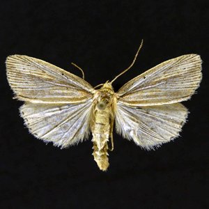
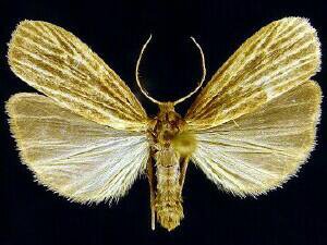
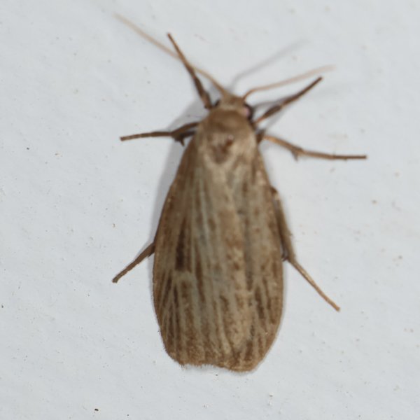
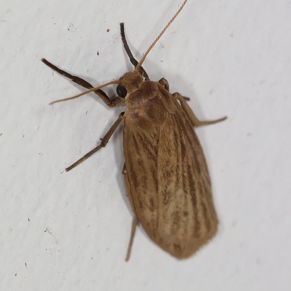
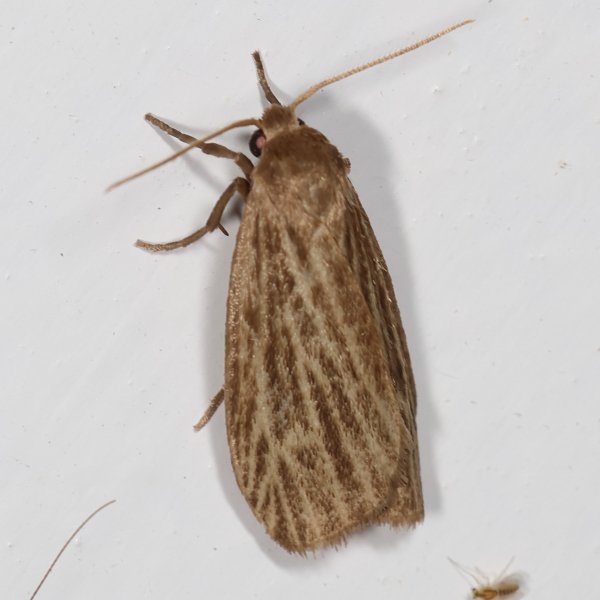
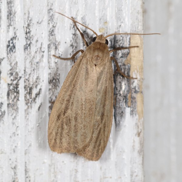
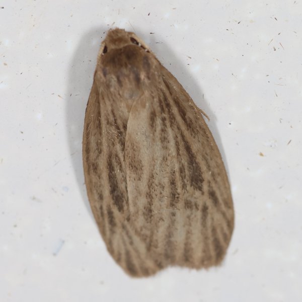
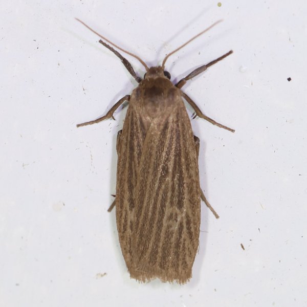
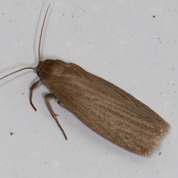
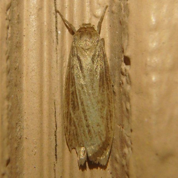
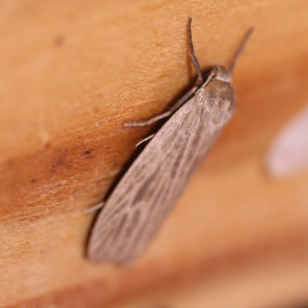
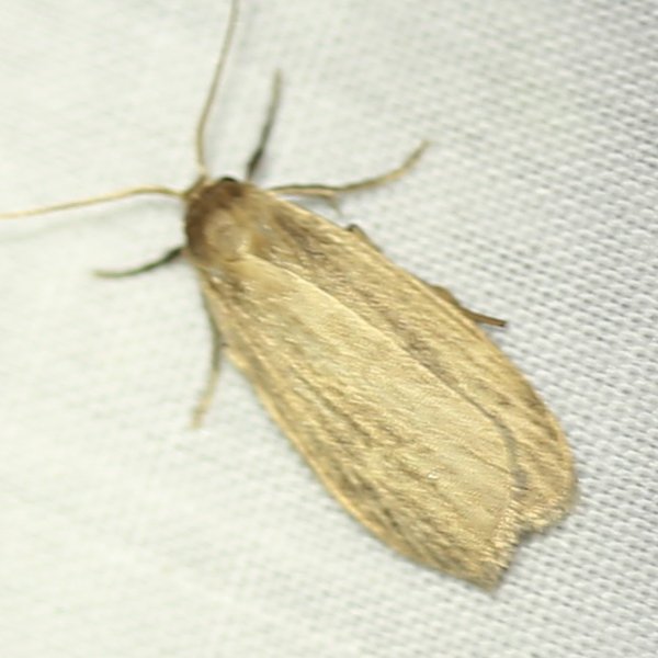
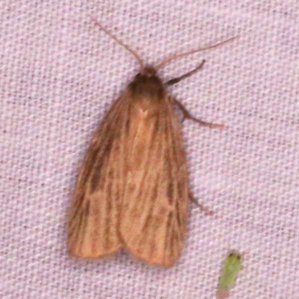
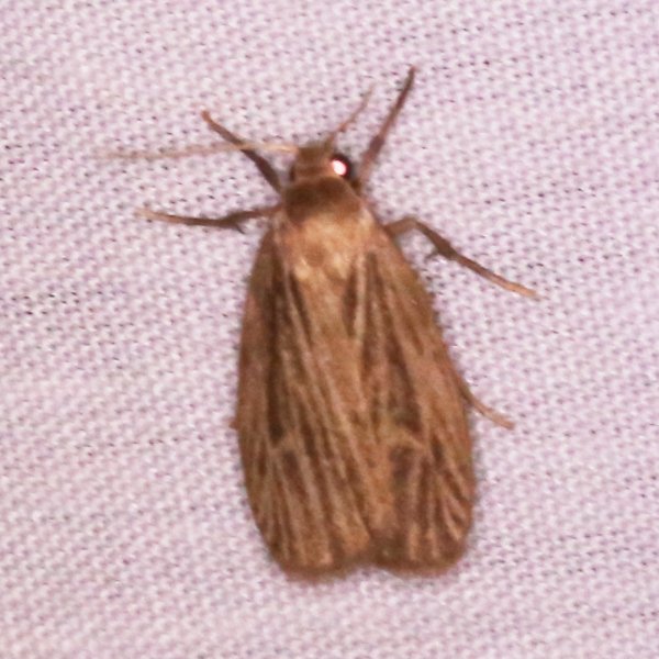
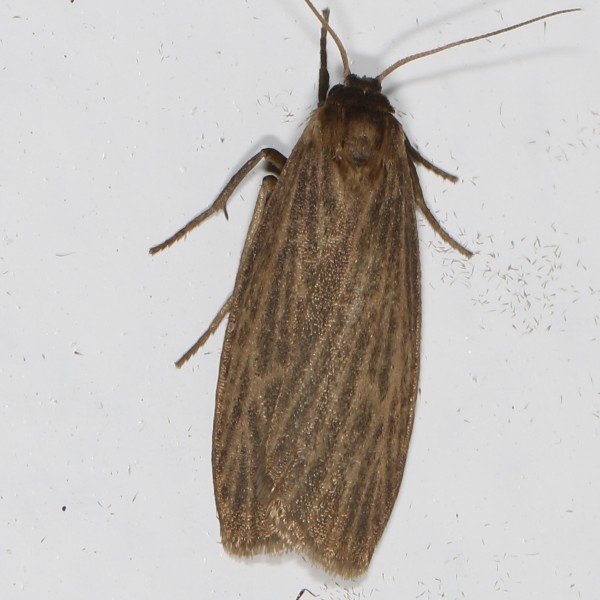
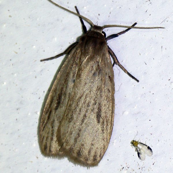
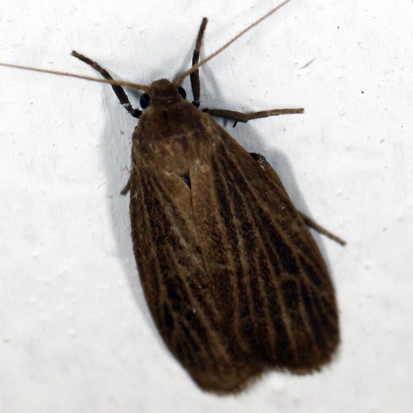
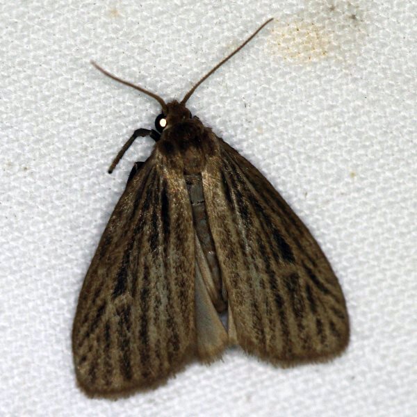
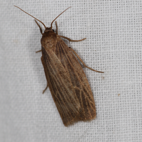
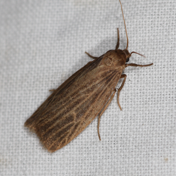
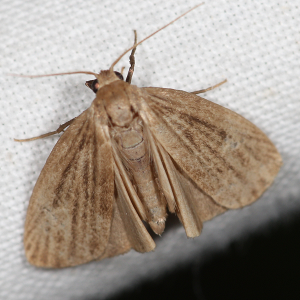
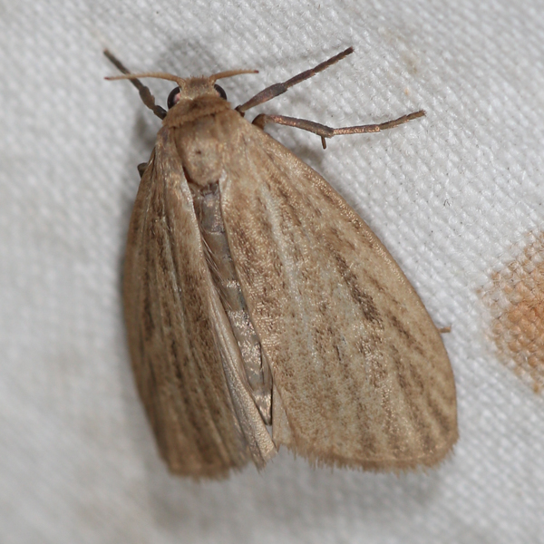
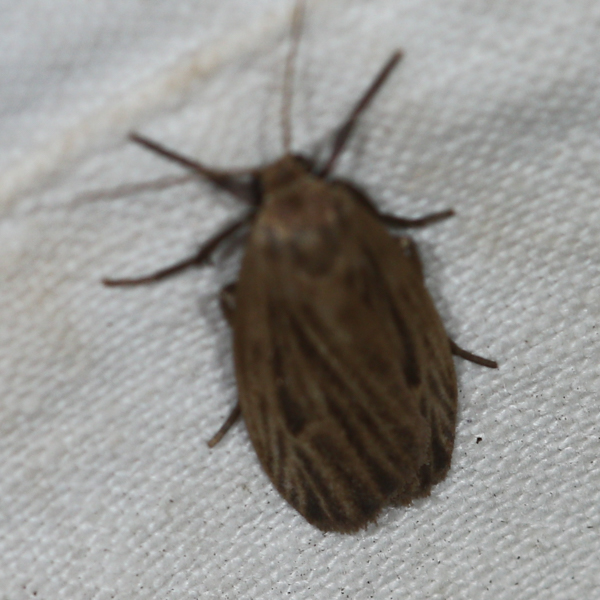
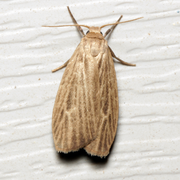
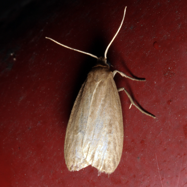
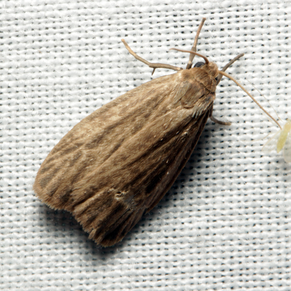
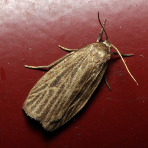
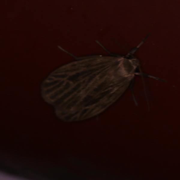
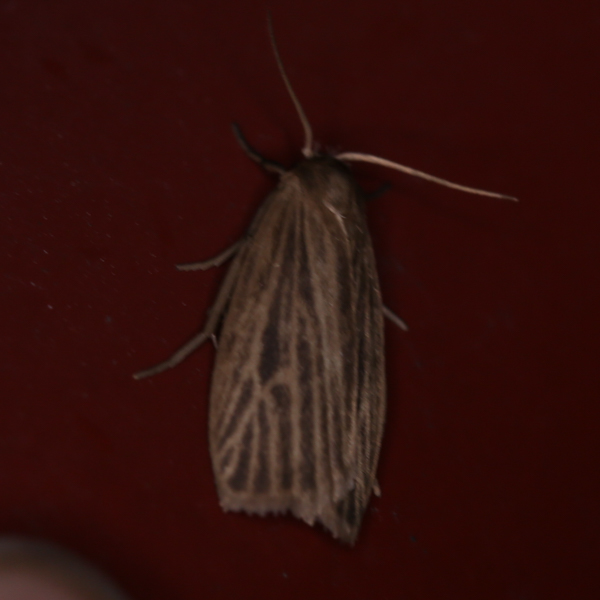
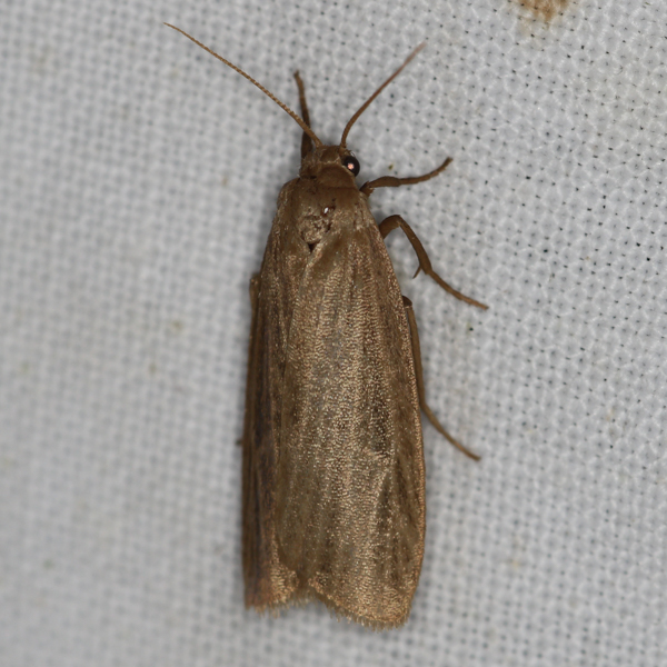
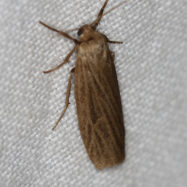
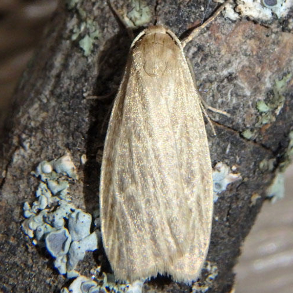
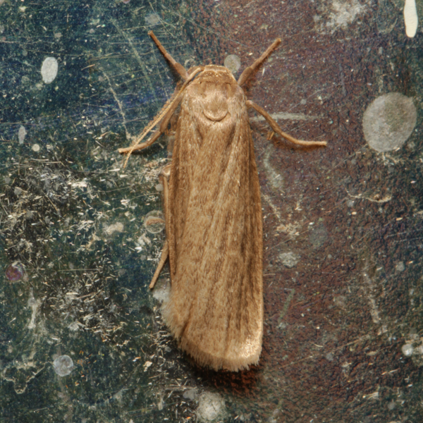
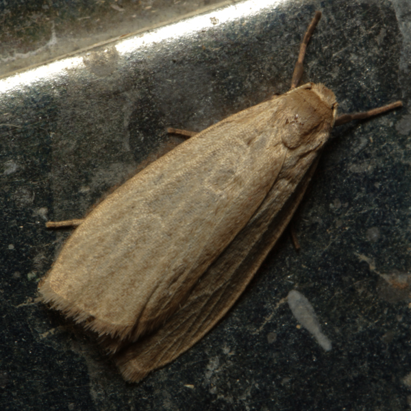
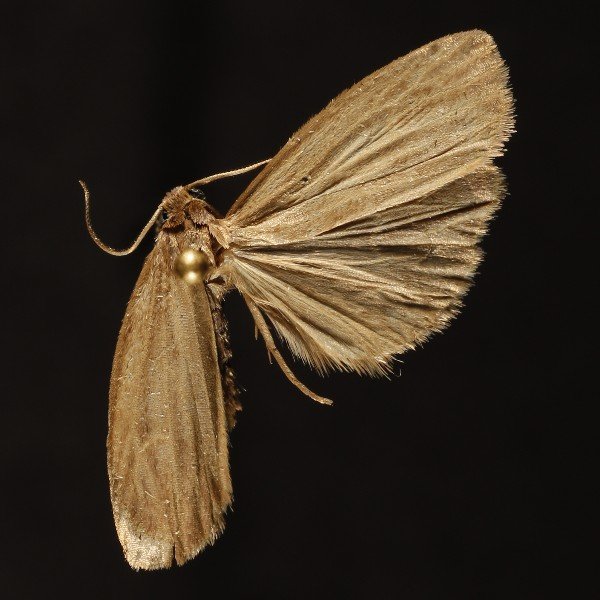
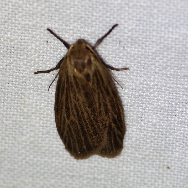
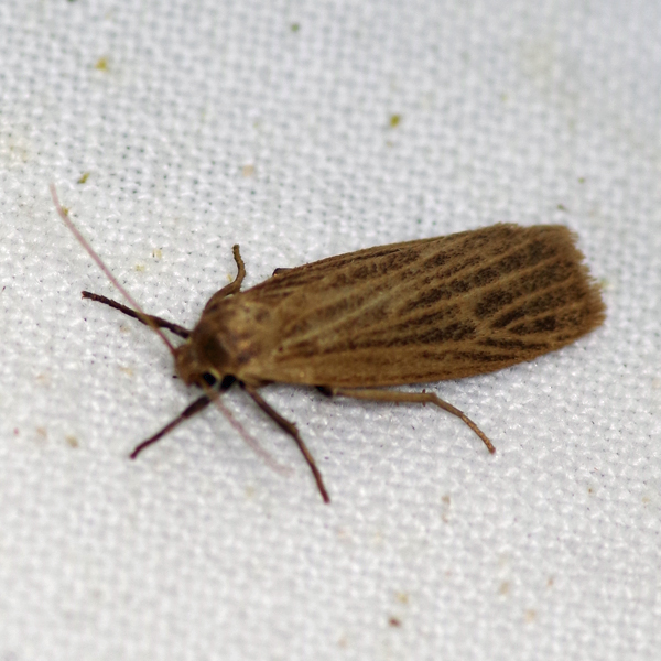
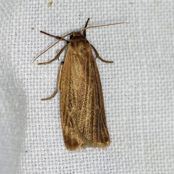
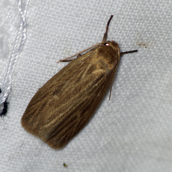
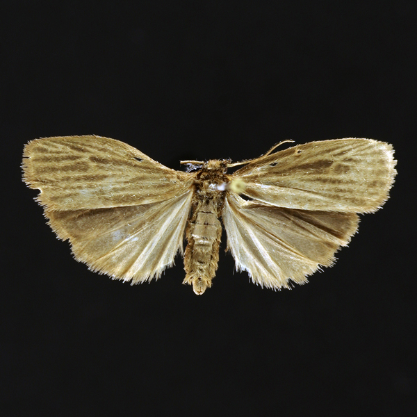
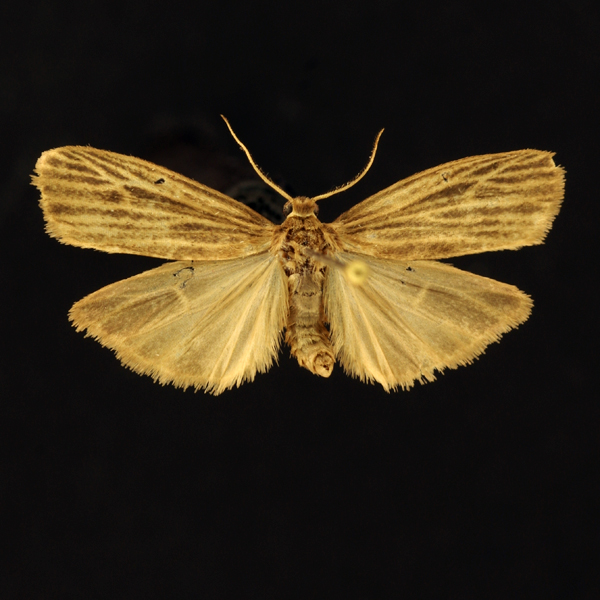
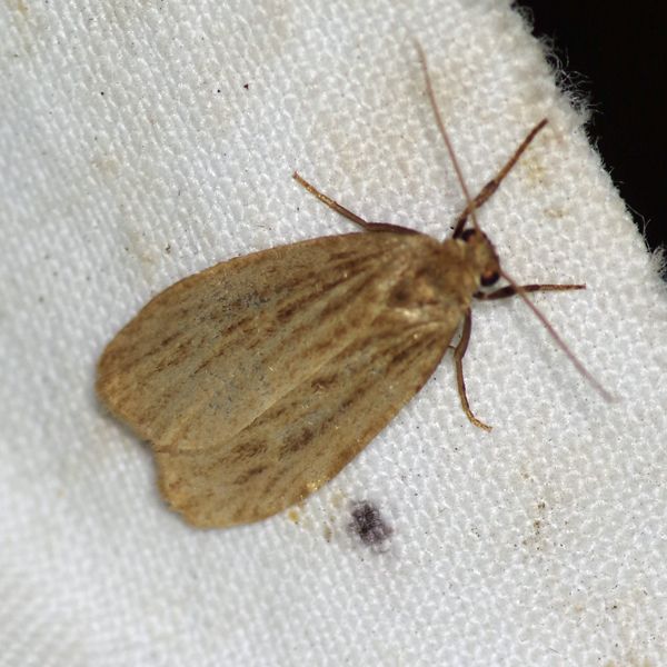
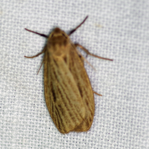
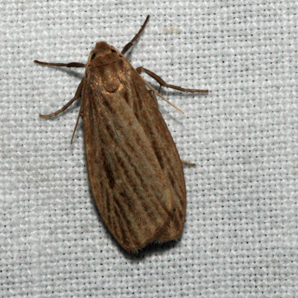
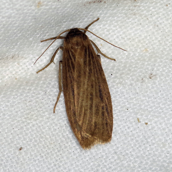
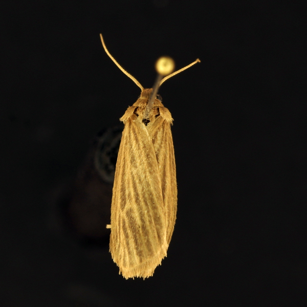
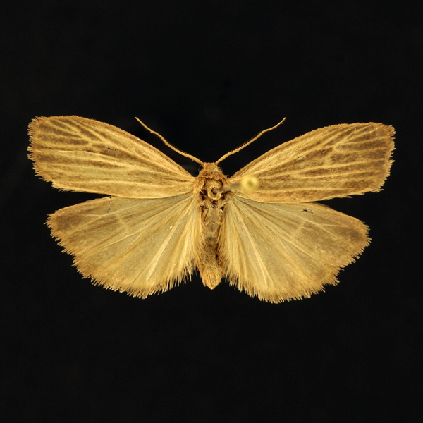
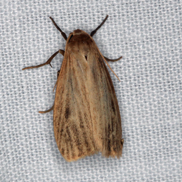
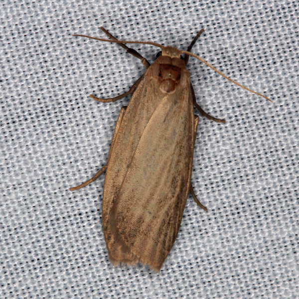
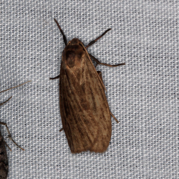
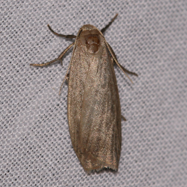
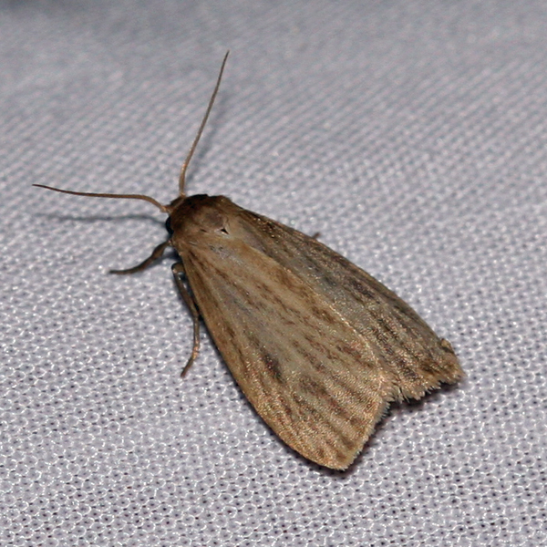
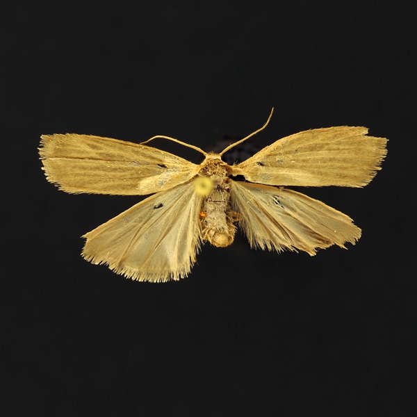
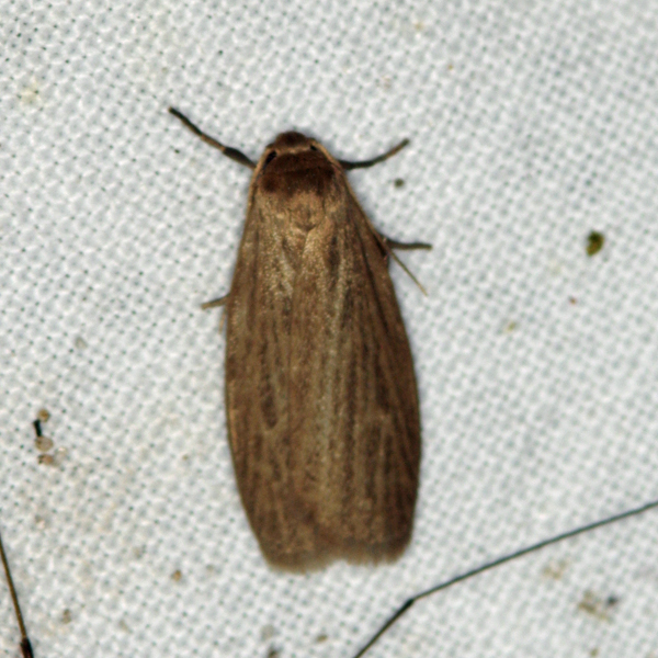
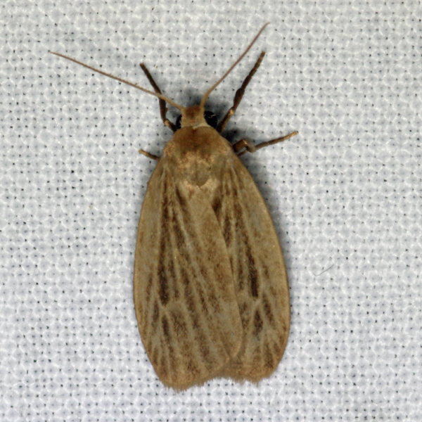
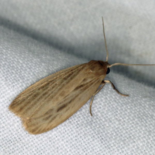
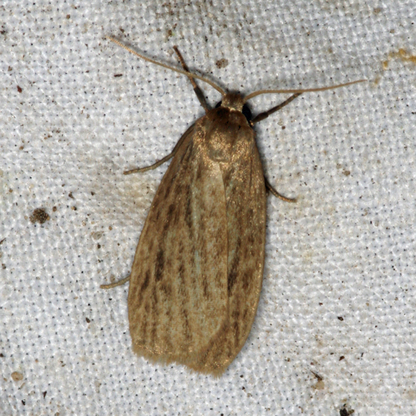
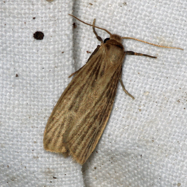
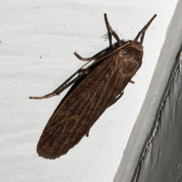
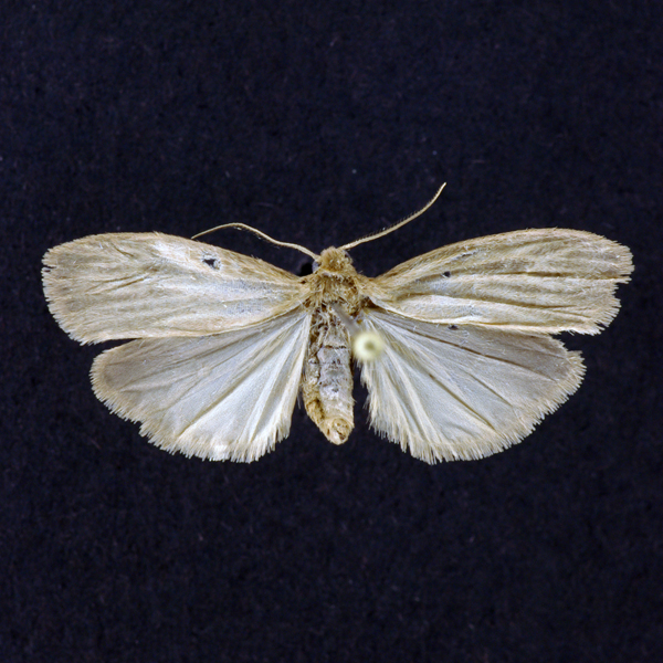
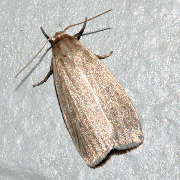
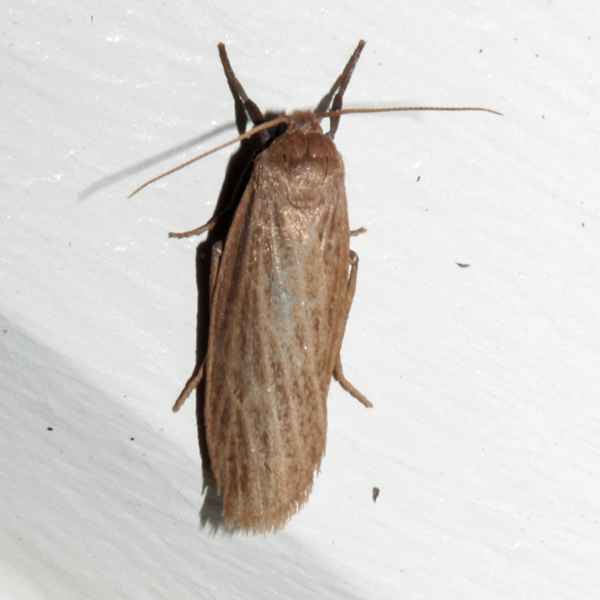
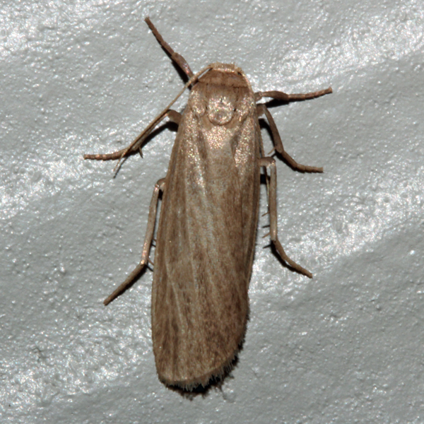
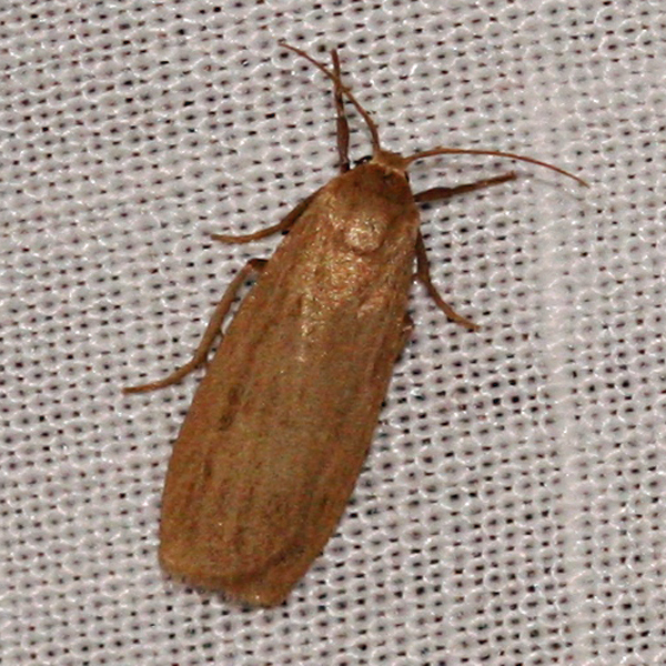
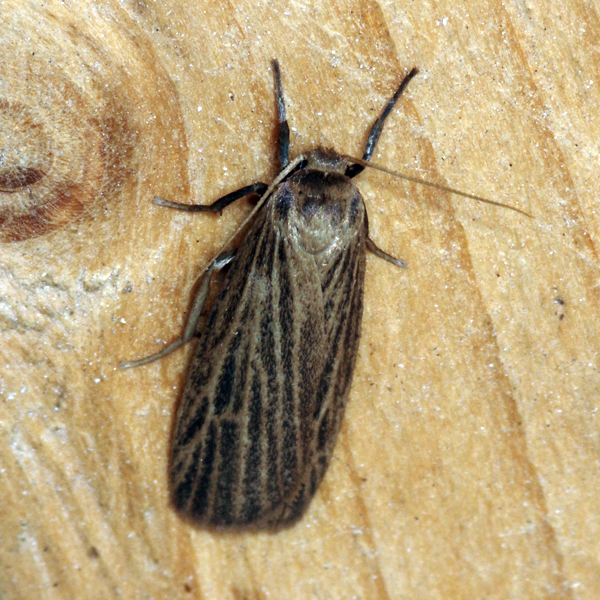
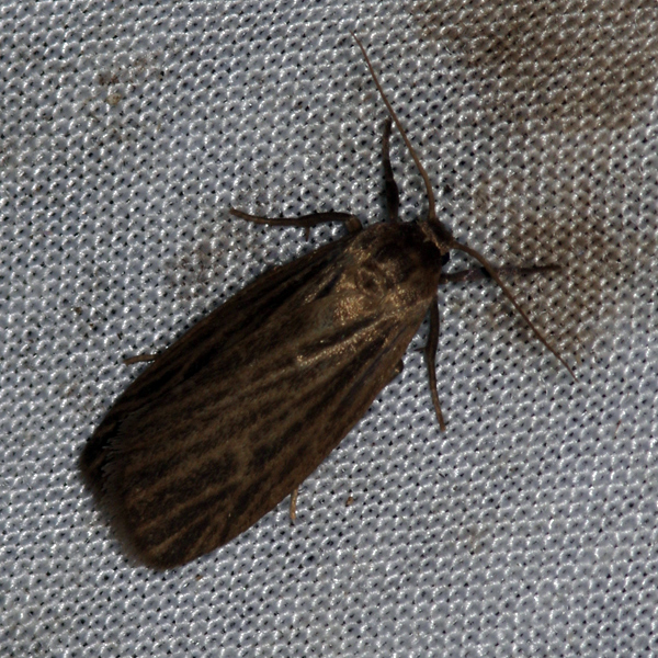
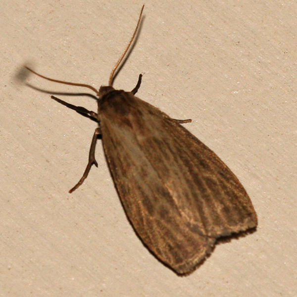
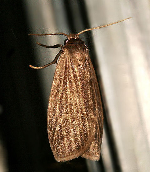
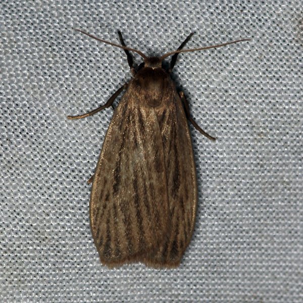
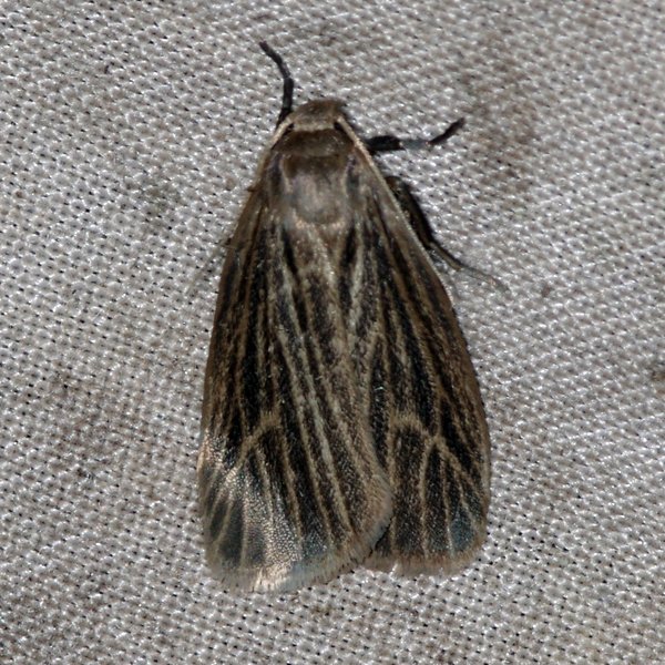
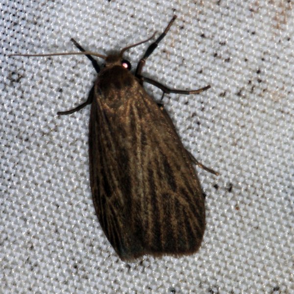
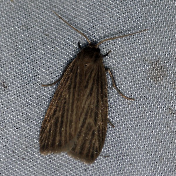
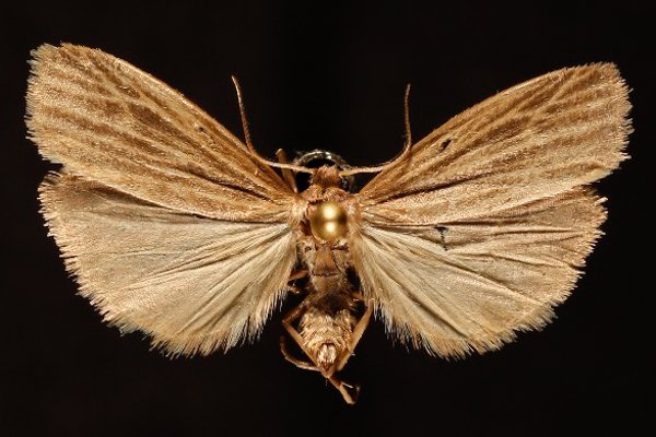
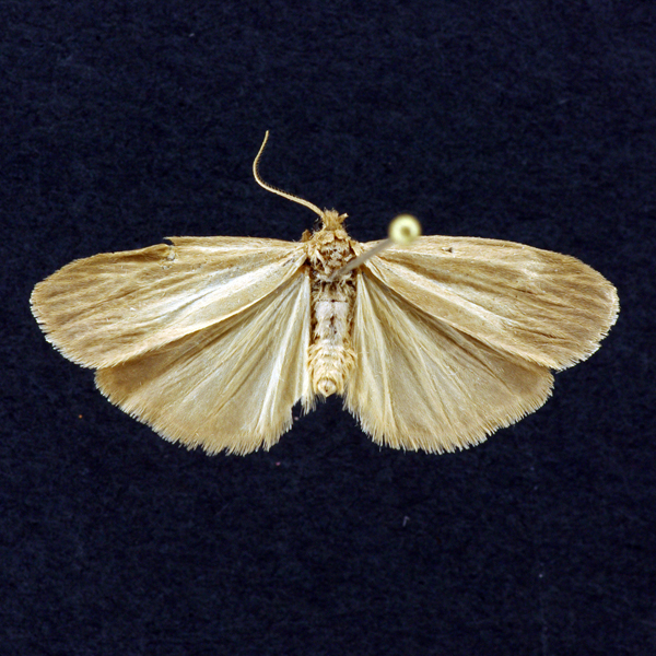
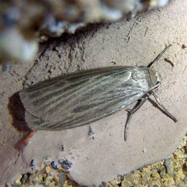
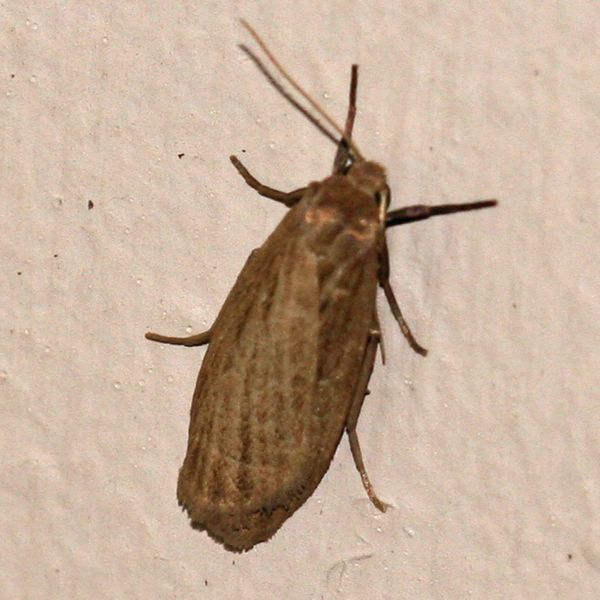
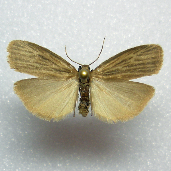
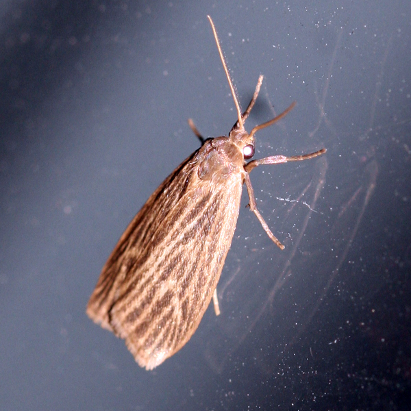
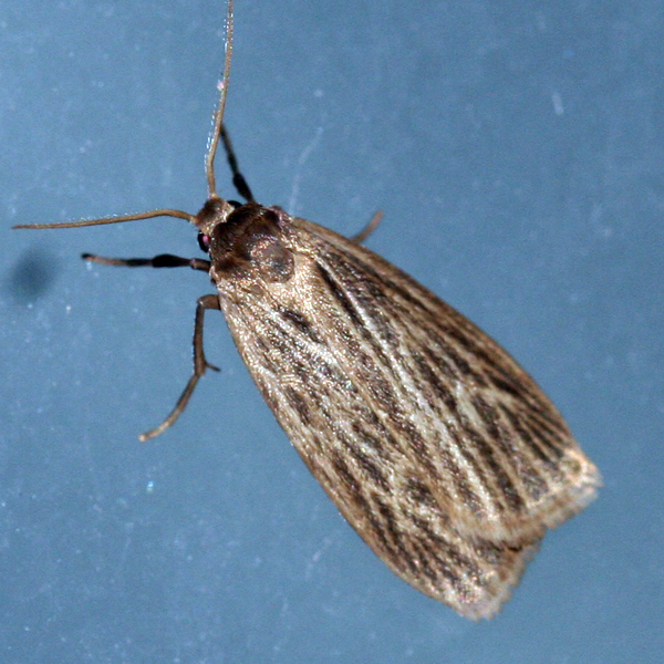
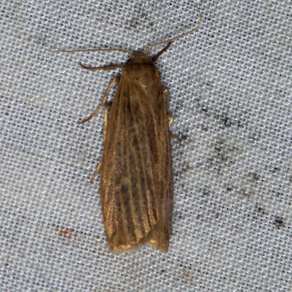
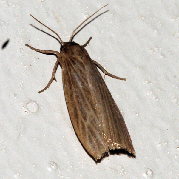
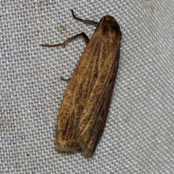
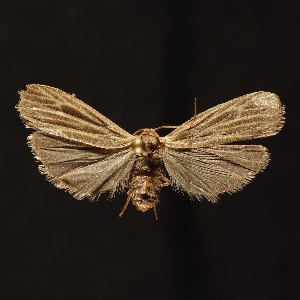
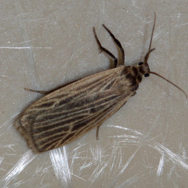
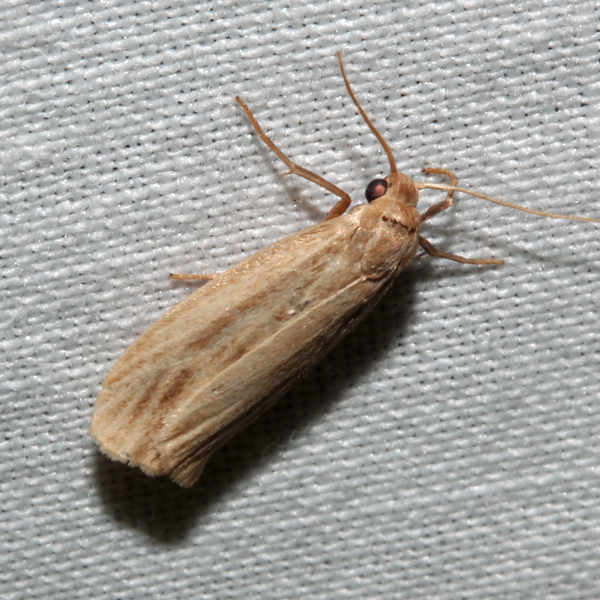
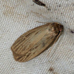
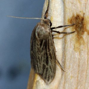
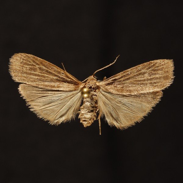
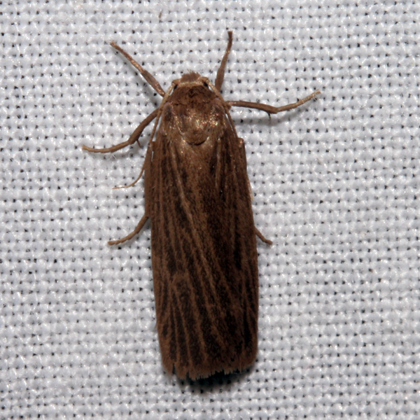
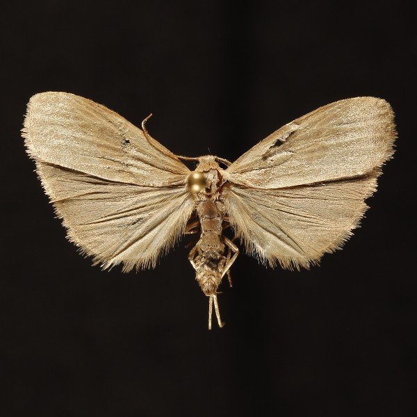
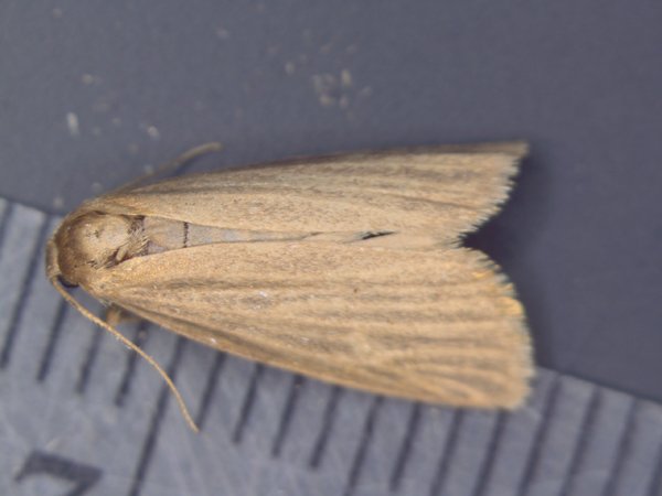
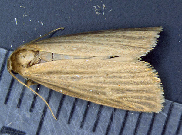
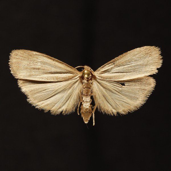
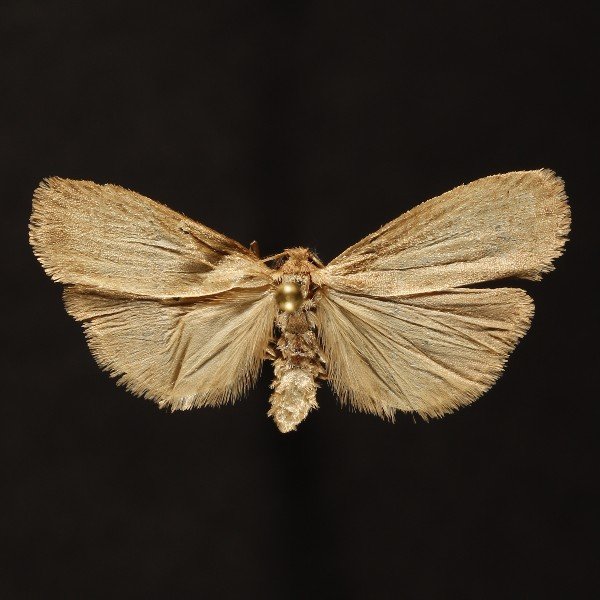
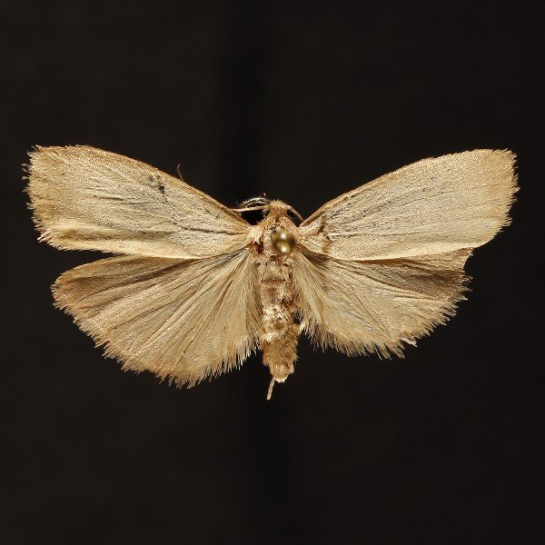
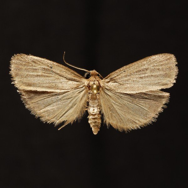
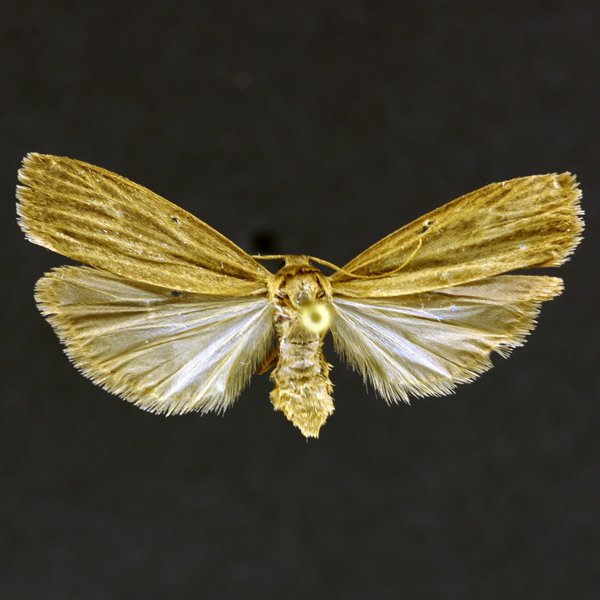
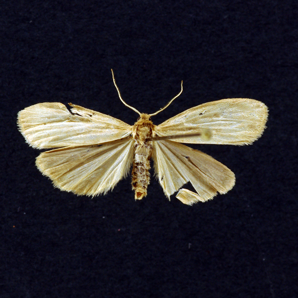
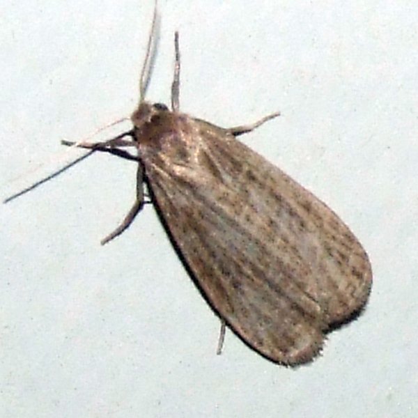
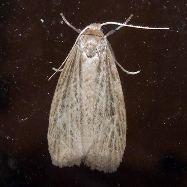
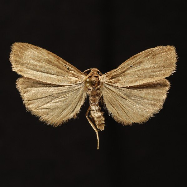
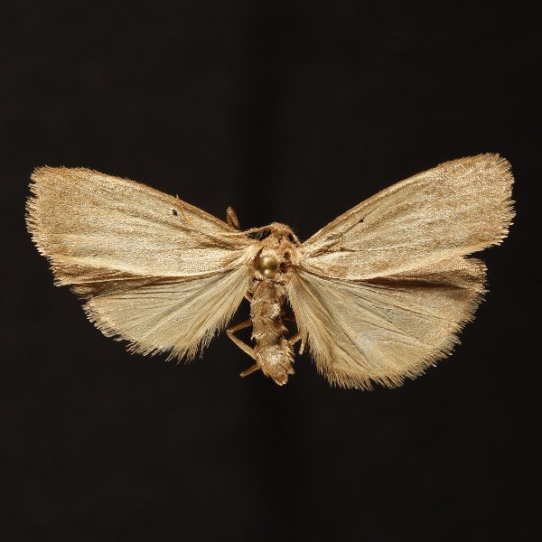
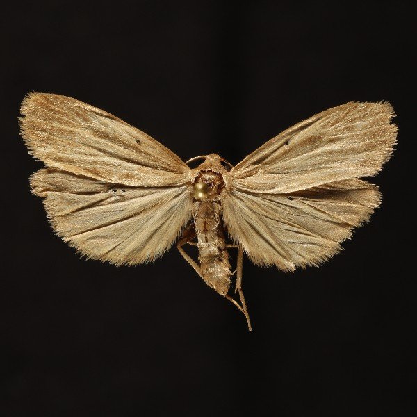
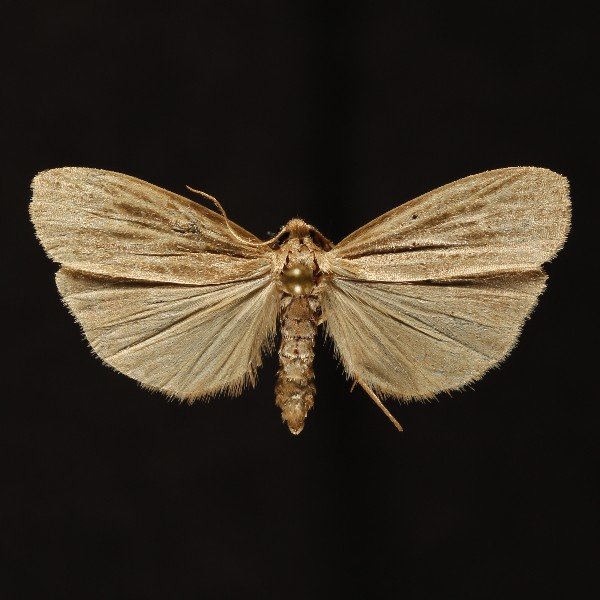
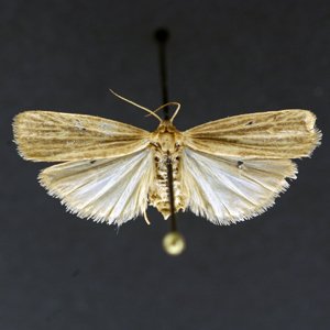
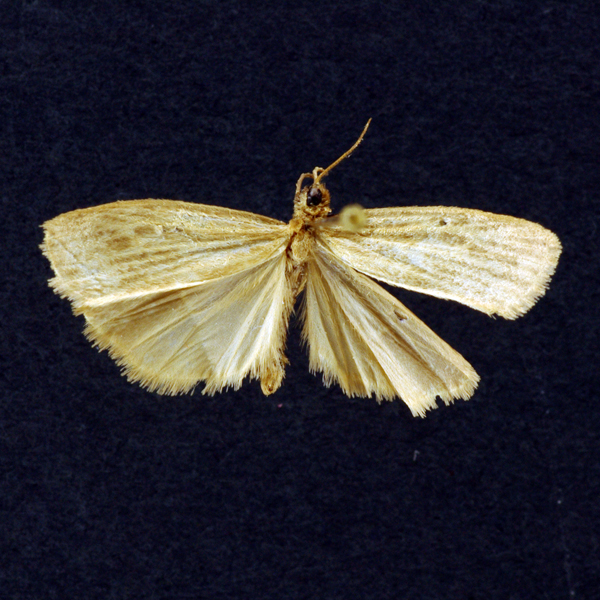
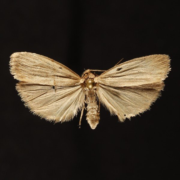
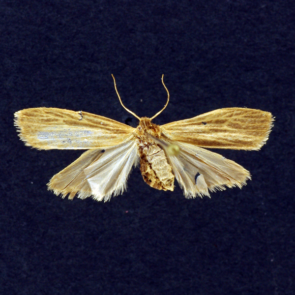
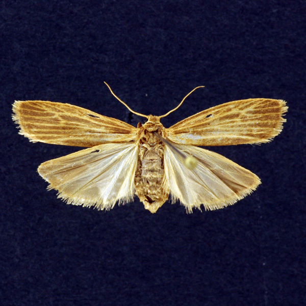
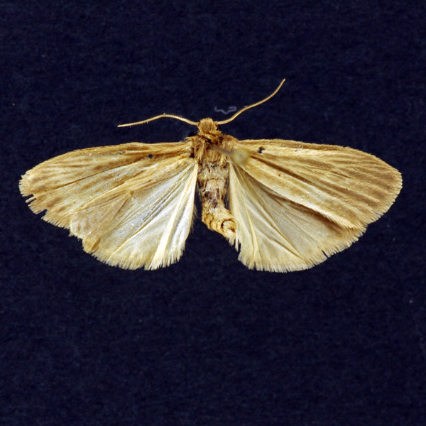
Pale Lichen Moth (Crambidia pallida), Packard, 1864 - 8045.100000 - 930219
Wing span: 24mm
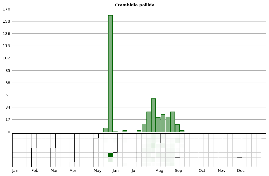
Flight time: May - August


Photos


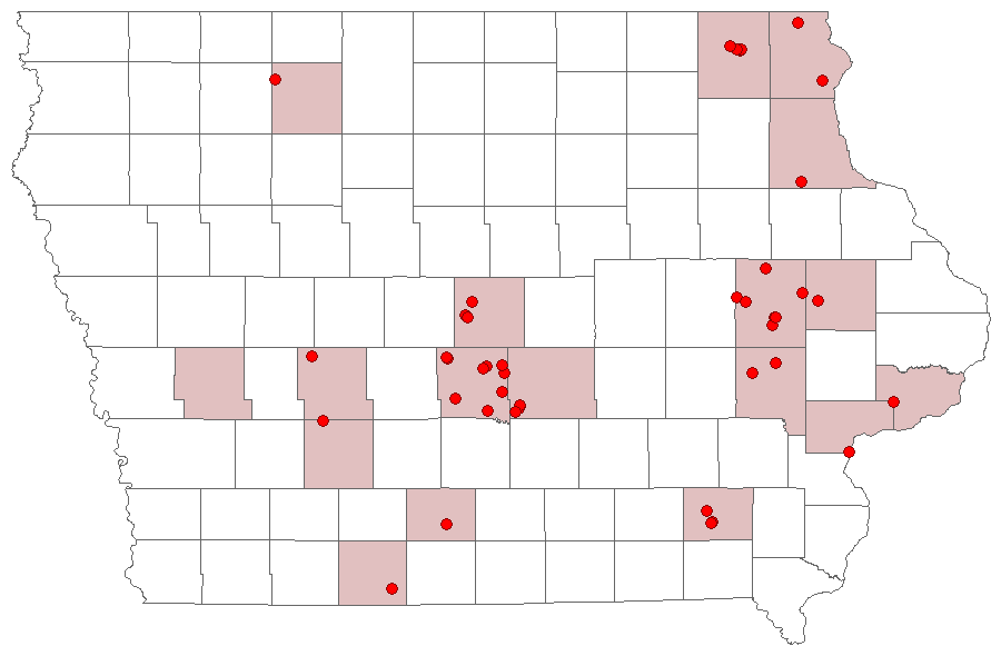
Records
| Record # | Date | Locale | State | Lat/Lon | Collected By | Count |
|---|---|---|---|---|---|---|
 339875 339875
|
2023-08-17 | Big Sand Mound Prairie Preserve, Muscatine County | Iowa | 41.34031372 -91.0810559 | Jim Durbin | 1 |
 340264 340264
|
2023-08-15 | Matsell Bridge Natural Area | Iowa | 42.13218339 -91.38536314 | Jim Durbin | 1 |
 339178 339178
|
2023-08-02 | Wanatee County Park | Iowa | 42.00997111 -91.5665254 | Jim Durbin | 1 |
 338617 338617
|
2023-07-22 | F. W. Kent Park | Iowa | 41.73493888 -91.7219024 | Jim Durbin | 1 |
 313588 313588
|
2022-08-17 | Wanatee County Park | Iowa | 42.01012074 -91.56658753 | Jim Durbin | 1 |
 313606 313606
|
2022-08-17 | Wanatee County Park | Iowa | 42.01012074 -91.56658753 | Jim Durbin | 1 |
 313086 313086
|
2022-08-10 | Matsell Bridge Natural Area | Iowa | 42.13198835 -91.38532446 | Jim Durbin | 1 |
 320654 320654
|
2022-07-24 | Johnson County, Iowa | Iowa | Location Protected | Mark Brown | 1 |
 312195 312195
|
2022-07-18 | Wanatee County Park | Iowa | 42.01008617 -91.56657306 | Jim Durbin | 1 |
 294915 294915
|
2021-08-27 | Hitaga Sand Ridge Prairie Preserve | Iowa | 42.25082009 -91.63219999 | Jim Durbin | 1 |
 296754 296754
|
2021-08-10 | MacBride Nature Recreation Area | Iowa | 41.78675752 -91.56846026 | Mark Brown | 1 |
| 298665 | 2021-07-26 | Ames, Paul | Iowa | 42.011732 -93.615039 | Paul Martsching | 1 |
| 298650 | 2021-07-24 | Ames, Paul | Iowa | 42.011732 -93.615039 | Paul Martsching | 1 |
 307276 307276
|
2021-07-21 | Near Fairfield | Iowa | 41.05061219 -92.02396433 | Moni Hayne | 1 |
 307428 307428
|
2021-07-21 | Near Fairfield | Iowa | 41.05061219 -92.02396433 | Moni Hayne | 1 |
| 279222 | 2020-08-25 | Ames, Paul | Iowa | 42.012091 -93.613772 | Paul Martsching | 1 |
| 279221 | 2020-08-24 | Ames, Paul | Iowa | 42.012091 -93.613772 | Paul Martsching | 1 |
| 279220 | 2020-07-29 | Ames, Paul | Iowa | 42.012091 -93.613772 | Paul Martsching | 1 |
| 279219 | 2020-07-28 | Ames, Paul | Iowa | 42.012091 -93.613772 | Paul Martsching | 1 |
| 279218 | 2020-07-24 | Ames, Paul | Iowa | 42.012091 -93.613772 | Paul Martsching | 1 |
| 279217 | 2020-07-23 | Ames, Paul | Iowa | 42.012091 -93.613772 | Paul Martsching | 1 |
 286817 286817
|
2020-07-22 | Near Fairfield | Iowa | 41.05009748 -92.02398156 | Moni Hayne | 1 |
 286900 286900
|
2020-07-22 | Near Fairfield | Iowa | 41.05009748 -92.02398156 | Moni Hayne | 1 |
 269345 269345
|
2020-07-18 | Johnson County, Iowa | Iowa | Location Protected | Mark Brown | 1 |
 238146 238146
|
2019-09-05 | Wickiup Hill Outdoor Learning Area | Iowa | 42.087352 -91.767107 | Jim Durbin | 1 |
 238240 238240
|
2019-09-04 | Johnson County, Iowa | Iowa | Location Protected | Mark Brown | 1 |
| 243429 | 2019-08-25 | Ames, Paul | Iowa | 42.02064 -93.623952 | Paul Martsching | 1 |
 236546 236546
|
2019-08-19 | Wickiup Hill Outdoor Learning Area | Iowa | 42.087352 -91.767107 | Jim Durbin | 1 |
 237264 237264
|
2019-08-18 | Johnson County, Iowa | Iowa | Location Protected | Mark Brown | 1 |
 236441 236441
|
2019-08-17 | Hitaga Sand Ridge Prairie Preserve | Iowa | 42.25226 -91.63040167 | Jim Durbin | 1 |
 236120 236120
|
2019-08-14 | Hitaga Sand Ridge Prairie Preserve | Iowa | 42.250886 -91.632106 | Jim Durbin | 1 |
 235634 235634
|
2019-08-11 | Wickiup Hill Outdoor Learning Area | Iowa | 42.087343 -91.767109 | Jim Durbin | 1 |
 235666 235666
|
2019-08-11 | Wickiup Hill Outdoor Learning Area | Iowa | 42.087343 -91.767109 | Jim Durbin | 1 |
| 243428 | 2019-08-10 | Ames, Paul | Iowa | 42.02064 -93.623952 | Paul Martsching | 1 |
 235516 235516
|
2019-08-08 | Pleasant Creek State Recreation Area, Linn County | Iowa | 42.109891 -91.826883 | Jim Durbin | 1 |
| 243427 | 2019-08-04 | Ames, Paul | Iowa | 42.02064 -93.623952 | Paul Martsching | 1 |
| 243426 | 2019-08-03 | Ames, Paul | Iowa | 42.02064 -93.623952 | Paul Martsching | 2 |
| 243425 | 2019-08-01 | Ames, Paul | Iowa | 42.02064 -93.623952 | Paul Martsching | 1 |
| 243424 | 2019-07-26 | Ames, Paul | Iowa | 42.02064 -93.623952 | Paul Martsching | 1 |
 219445 219445
|
2018-08-25 | Hitaga Sand Ridge Prairie Preserve | Iowa | 42.250604 -91.629962 | Jim Durbin | 1 |
 219525 219525
|
2018-08-25 | Hitaga Sand Ridge Prairie Preserve | Iowa | 42.250604 -91.629962 | Jim Durbin | 1 |
 219192 219192
|
2018-08-19 | Wickiup Hill Outdoor Learning Area | Iowa | 42.087352 -91.767107 | Jim Durbin | 1 |
 218111 218111
|
2018-08-08 | Hitaga Sand Ridge Prairie Preserve | Iowa | 42.250957 -91.632098 | Jim Durbin | 1 |
 218221 218221
|
2018-08-08 | Hitaga Sand Ridge Prairie Preserve | Iowa | 42.250957 -91.632098 | Jim Durbin | 1 |
 218222 218222
|
2018-08-08 | Hitaga Sand Ridge Prairie Preserve | Iowa | 42.250957 -91.632098 | Jim Durbin | 1 |
| 355325 | 2018-08-08 | Spilde Woods | Iowa | 43.317783 -91.812417 | Lena Schmitt | 1 |
| 352716 | 2018-08-07 | Anderson Prairie, Decorah | Iowa | 43.315099 -91.800701 | Lena Schmitt | 1 |
 222246 222246
|
2018-08-02 | Shelby County, Iowa | Iowa | Location Protected | MJ Hatfield | 1 |
 222228 222228
|
2018-07-25 | Jefferson County Park | Iowa | 40.98639 -91.99111 | MJ Hatfield | 1 |
 222229 222229
|
2018-07-25 | Jefferson County Park | Iowa | 40.98639 -91.99111 | MJ Hatfield | 1 |
 222232 222232
|
2018-07-25 | Jefferson County Park | Iowa | 40.98639 -91.99111 | MJ Hatfield | 1 |
 229959 229959
|
2018-07-25 | Jefferson County Park | Iowa | 40.98639 -91.99111 | Moni Hayne | 1 |
 229974 229974
|
2018-07-25 | Jefferson County Park | Iowa | 40.98639 -91.99111 | Moni Hayne | 1 |
 216109 216109
|
2018-07-23 | Hitaga Sand Ridge Prairie Preserve | Iowa | 42.250957 -91.632098 | Jim Durbin | 1 |
 216122 216122
|
2018-07-23 | Hitaga Sand Ridge Prairie Preserve | Iowa | 42.250957 -91.632098 | Jim Durbin | 1 |
| 226696 | 2018-07-23 | Ames, Paul | Iowa | 42.02064 -93.623952 | Paul Martsching | 1 |
 217871 217871
|
2018-07-19 | 100 Acre Wood-x | Iowa | 0 0 | MJ Hatfield | 1 |
| 226695 | 2018-07-18 | Ames, Paul | Iowa | 42.02064 -93.623952 | Paul Martsching | 1 |
| 356476 | 2018-07-18 | Jewell Prairie | Iowa | 43.320278 -91.826944 | Lena Schmitt | 1 |
| 356880 | 2018-07-18 | Lionberger Environmental Preserve | Iowa | 43.334148 -91.871215 | Lena Schmitt | 1 |
| 352717 | 2018-07-17 | Anderson Prairie, Decorah | Iowa | 43.315099 -91.800701 | Lena Schmitt | 1 |
| 355326 | 2018-07-17 | Spilde Woods | Iowa | 43.317783 -91.812417 | Lena Schmitt | 1 |
| 215034 | 2018-07-15 | MacBride Nature Recreation Area | Iowa | 41.786729 -91.568057 | Mark Brown | 1 |
 225545 225545
|
2018-07-15 | MacBride Nature Recreation Area | Iowa | 41.786729 -91.568057 | Mark Brown | 1 |
 217812 217812
|
2018-07-14 | 100 Acre Wood-x | Iowa | 0 0 | MJ Hatfield | 1 |
 217813 217813
|
2018-07-14 | 100 Acre Wood-x | Iowa | 0 0 | MJ Hatfield | 1 |
| 226694 | 2018-07-11 | Ames, Paul | Iowa | 42.02064 -93.623952 | Paul Martsching | 1 |
| 226693 | 2018-07-09 | Ames, Paul | Iowa | 42.02064 -93.623952 | Paul Martsching | 1 |
| 355946 | 2018-06-17 | Hickory Ridge Woods | Iowa | 43.3178 -91.7959 | Lena Schmitt | 1 |
 196245 196245
|
2017-08-30 | Hitaga Sand Ridge Prairie Preserve | Iowa | 42.250957 -91.632098 | Jim Durbin | 1 |
| 197761 | 2017-08-28 | Ames, Paul | Iowa | 42.02064 -93.623952 | Paul Martsching | 3 |
| 197760 | 2017-08-26 | Ames, Paul | Iowa | 42.02064 -93.623952 | Paul Martsching | 2 |
| 197759 | 2017-08-25 | Ames, Paul | Iowa | 42.02064 -93.623952 | Paul Martsching | 1 |
 195866 195866
|
2017-08-23 | Hitaga Sand Ridge Prairie Preserve | Iowa | 42.250957 -91.632098 | Jim Durbin | 1 |
 195964 195964
|
2017-08-23 | Hitaga Sand Ridge Prairie Preserve | Iowa | 42.250957 -91.632098 | Jim Durbin | 1 |
 196293 196293
|
2017-08-18 | Wickiup Hill Outdoor Learning Area | Iowa | 42.087567 -91.767578 | Jim Durbin | 1 |
| 197758 | 2017-08-06 | Ames, Paul | Iowa | 42.02064 -93.623952 | Paul Martsching | 1 |
 194808 194808
|
2017-08-01 | Matsell Bridge Natural Area | Iowa | 42.131126 -91.388999 | Jim Durbin | 1 |
 194815 194815
|
2017-08-01 | Matsell Bridge Natural Area | Iowa | 42.131126 -91.388999 | Jim Durbin | 1 |
| 197757 | 2017-07-26 | Ames, Paul | Iowa | 42.02064 -93.623952 | Paul Martsching | 2 |
| 197756 | 2017-07-25 | Ames, Paul | Iowa | 42.02064 -93.623952 | Paul Martsching | 4 |
| 197755 | 2017-07-24 | Ames, Paul | Iowa | 42.02064 -93.623952 | Paul Martsching | 5 |
| 197754 | 2017-07-23 | Ames, Paul | Iowa | 42.02064 -93.623952 | Paul Martsching | 2 |
 194267 194267
|
2017-07-22 | Hitaga Sand Ridge Prairie Preserve | Iowa | 42.250957 -91.632098 | Jim Durbin | 1 |
| 197753 | 2017-07-20 | Ames, Paul | Iowa | 42.02064 -93.623952 | Paul Martsching | 1 |
 197752 197752
|
2017-07-18 | Ames, Paul | Iowa | 42.02064 -93.623952 | Paul Martsching | 1 |
 177035 177035
|
2016-08-27 | Ames, Paul | Iowa | 42.02064 -93.623952 | Paul Martsching | 1 |
 174882 174882
|
2016-08-21 | Hitaga Sand Ridge Prairie Preserve | Iowa | 42.250957 -91.632098 | Jim Durbin | 1 |
 174610 174610
|
2016-08-15 | Hitaga Sand Ridge Prairie Preserve | Iowa | 42.250957 -91.632098 | Jim Durbin | 1 |
 200312 200312
|
2016-08-15 | Hitaga Sand Ridge Prairie Preserve | Iowa | 42.250957 -91.632098 | Don F. Becker | 1 |
 173961 173961
|
2016-08-09 | Hitaga Sand Ridge Prairie Preserve | Iowa | 42.250957 -91.632098 | Jim Durbin | 1 |
| 178680 | 2016-08-09 | Ames, Paul | Iowa | 42.02064 -93.623952 | Paul Martsching | 1 |
| 178679 | 2016-08-05 | Ames, Paul | Iowa | 42.02064 -93.623952 | Paul Martsching | 1 |
 177034 177034
|
2016-07-31 | Ames, Paul | Iowa | 42.02064 -93.623952 | Paul Martsching | 1 |
| 178678 | 2016-07-30 | Ames, Paul | Iowa | 42.02064 -93.623952 | Paul Martsching | 1 |
| 178677 | 2016-07-29 | Ames, Paul | Iowa | 42.02064 -93.623952 | Paul Martsching | 1 |
 177036 177036
|
2016-07-27 | Ames, Paul | Iowa | 42.02064 -93.623952 | Paul Martsching | 1 |
 183008 183008
|
2016-07-27 | Jefferson County Park | Iowa | 40.98639 -91.99111 | MJ Hatfield | 1 |
 183015 183015
|
2016-07-27 | Jefferson County Park | Iowa | 40.98639 -91.99111 | MJ Hatfield | 1 |
 183062 183062
|
2016-07-27 | Jefferson County Park | Iowa | 40.98639 -91.99111 | MJ Hatfield | 1 |
 184688 184688
|
2016-07-27 | Jefferson County Park | Iowa | 40.98639 -91.99111 | Moni Hayne | 1 |
 184896 184896
|
2016-07-27 | Jefferson County Park | Iowa | 40.98639 -91.99111 | Moni Hayne | 1 |
 175463 175463
|
2016-07-25 | Ames, Paul | Iowa | 42.02064 -93.623952 | Paul Martsching | 1 |
 172739 172739
|
2016-07-24 | Hitaga Sand Ridge Prairie Preserve | Iowa | 42.250957 -91.632098 | Jim Durbin | 1 |
 172917 172917
|
2016-07-24 | Hitaga Sand Ridge Prairie Preserve | Iowa | 42.250957 -91.632098 | Jim Durbin | 1 |
| 178676 | 2016-06-11 | Ames, Paul | Iowa | 42.02064 -93.623952 | Paul Martsching | 1 |
 129577 129577
|
2015-08-26 | Indian Creek Nature Center | Iowa | 41.968932 -91.586884 | Jim Durbin | 1 |
 129590 129590
|
2015-08-26 | Indian Creek Nature Center | Iowa | 41.968932 -91.586884 | Jim Durbin | 1 |
 129220 129220
|
2015-08-03 | Matsell Bridge Natural Area | Iowa | 42.131959 -91.388307 | Jim Durbin | 1 |
 129237 129237
|
2015-08-03 | Matsell Bridge Natural Area | Iowa | 42.131959 -91.388307 | Jim Durbin | 1 |
 129246 129246
|
2015-08-03 | Matsell Bridge Natural Area | Iowa | 42.131959 -91.388307 | Jim Durbin | 1 |
 130851 130851
|
2015-08-03 | Grand River Grasslands / Kellerton Bird Conservation Area | Iowa | 40.657259 -94.110879 | Logan Crees | 1 |
 146952 146952
|
2015-07-25 | 100 Acre Wood-x | Iowa | 0 0 | MJ Hatfield | 1 |
 131933 131933
|
2015-07-23 | Ames, Paul | Iowa | 42.02064 -93.623952 | Paul Martsching | 1 |
| 131932 | 2015-07-20 | Ames, Paul | Iowa | 42.02064 -93.623952 | Paul Martsching | 1 |
 146855 146855
|
2015-07-19 | 100 Acre Wood-x | Iowa | 0 0 | MJ Hatfield | 1 |
 146867 146867
|
2015-07-19 | 100 Acre Wood-x | Iowa | 0 0 | MJ Hatfield | 1 |
 146896 146896
|
2015-07-19 | 100 Acre Wood-x | Iowa | 0 0 | MJ Hatfield | 1 |
| 146915 | 2015-07-19 | 100 Acre Wood-x | Iowa | 0 0 | MJ Hatfield | 1 |
 129071 129071
|
2015-07-18 | Walcott | Iowa | 41.59151 -90.781632 | Moni Hayne | 1 |
| 204495 | 2014-08-24 | Ames, Paul | Iowa | 42.02064 -93.62395 | Paul Martsching | 4 |
 64538 64538
|
2014-08-22 | Pleasant Creek State Recreation Area, Linn County | Iowa | 42.110327 -91.822988 | Jim Durbin | 1 |
 64684 64684
|
2014-08-22 | Pleasant Creek State Recreation Area, Linn County | Iowa | 42.110327 -91.822988 | Jim Durbin | 1 |
 120702 120702
|
2014-08-19 | Near Fairfield | Iowa | 41.0503 -92.024 | Moni Hayne | 1 |
 128762 128762
|
2014-08-19 | Near Fairfield | Iowa | 41.0503 -92.024 | Moni Hayne | 1 |
 50115 50115
|
2014-08-18 | Wanatee County Park | Iowa | 42.01007 -91.566739 | Jim Durbin | 1 |
 49951 49951
|
2014-08-13 | Pleasant Creek State Recreation Area, Linn County | Iowa | 42.110327 -91.822988 | Jim Durbin | 1 |
 10712 10712
|
2014-08-08 | Pleasant Creek State Recreation Area, Linn County | Iowa | 42.110327 -91.822988 | Jim Durbin | 1 |
 10774 10774
|
2014-08-08 | Pleasant Creek State Recreation Area, Linn County | Iowa | 42.110327 -91.822988 | Jim Durbin | 1 |
 10494 10494
|
2014-08-05 | Hitaga Sand Ridge Prairie Preserve | Iowa | 42.24944 -91.63056 | Jim Durbin | 1 |
 135602 135602
|
2014-07-27 | Ames, Paul | Iowa | 42.02064 -93.623952 | Paul Martsching | 1 |
 110171 110171
|
2014-07-26 | I-80 Rest Stop near Adair | Iowa | 41.497 -94.572 | Mark Brown | 1 |
| 204494 | 2014-07-26 | Ames, Paul | Iowa | 42.02064 -93.62395 | Paul Martsching | 1 |
 120623 120623
|
2014-07-23 | Jefferson County Park | Iowa | 40.993 -91.987 | Moni Hayne | 1 |
 108357 108357
|
2014-07-13 | Clear Creek Wildlife Management Area | Iowa | 43.44916667 -91.42111111 | Tom Jantscher | 1 |
 66353 66353
|
2013-08-26 | Near Fairfield | Iowa | 41.0503 -92.024 | Moni Hayne | 1 |
 66354 66354
|
2013-08-26 | Near Fairfield | Iowa | 41.0503 -92.024 | Moni Hayne | 1 |
| 111255 | 2013-08-24 | Polk County, Iowa | Iowa | Location Protected | Aaron Brees | 1 |
 22295 22295
|
2013-08-21 | Matsell Bridge Natural Area | Iowa | 42.13131 -91.38886 | Jim Durbin | 1 |
 66318 66318
|
2013-08-21 | Near Fairfield | Iowa | 41.0503 -92.024 | Moni Hayne | 1 |
 66306 66306
|
2013-08-16 | Near Fairfield | Iowa | 41.0503 -92.024 | Moni Hayne | 1 |
 22294 22294
|
2013-07-31 | Wapsipinicon State Park | Iowa | 42.09038 -91.2861 | Jim Durbin | 1 |
 22293 22293
|
2013-07-06 | Ohio County, Kentucky | Kentucky | Location Protected | Jim Durbin | 1 |
 22292 22292
|
2013-07-02 | 5031 Old Lyddane Bridge Road | Kentucky | 37.746807 -87.185997 | Jim Durbin | 1 |
 146104 146104
|
2012-08-15 | Plymouth Rock-x | Iowa | 0 0 | MJ Hatfield | 1 |
 146097 146097
|
2012-08-06 | Plymouth Rock-x | Iowa | 0 0 | MJ Hatfield | 1 |
 22301 22301
|
2012-07-29 | Matsell Bridge Natural Area | Iowa | 42.13131 -91.38886 | Jim Durbin | 1 |
 22300 22300
|
2012-07-19 | Wanatee County Park | Iowa | 42.01026 -91.57381 | Jim Durbin | 1 |
 22286 22286
|
2011-08-06 | Wanatee County Park | Iowa | 42.0094 -91.56623 | Jim Durbin | 1 |
 66971 66971
|
2011-07-25 | 100 Acre Wood-x | Iowa | 0 0 | MJ Hatfield | 1 |
| 22288 | 2011-05-18 | Puccoon Prairie | Iowa | 41.73528 -93.36417 | Keith Summerville | 1 |
| 22289 | 2011-05-18 | Chichaqua Bottoms Sandhill Prairie | Iowa | 41.77278 -93.385 | Keith Summerville | 1 |
| 22290 | 2011-05-18 | Polk County, Iowa | Iowa | Location Protected | Keith Summerville | 1 |
| 22291 | 2011-05-18 | Chichaqua Bottoms Sandhill Prairie | Iowa | 41.77167 -93.38361 | Keith Summerville | 1 |
 22283 22283
|
2010-08-06 | Lost Island County Park | Iowa | 43.17582 -94.89189 | Jim Durbin | 1 |
 22287 22287
|
2010-07-17 | 100 Acre Wood-x | Iowa | 0 0 | MJ Hatfield | 1 |
 138425 138425
|
2010-07-16 | 100 Acre Wood-x | Iowa | 0 0 | MJ Hatfield | 1 |
 22280 22280
|
2010-07-12 | Yellow River State Forest | Iowa | 43.1676 -91.254 | Jim Durbin | 1 |
 22281 22281
|
2010-07-12 | Yellow River State Forest | Iowa | 43.1676 -91.254 | Jim Durbin | 1 |
 22282 22282
|
2010-07-12 | Yellow River State Forest | Iowa | 43.1676 -91.254 | Jim Durbin | 1 |
 22299 22299
|
2010-07-12 | Yellow River State Forest | Iowa | 43.1676 -91.254 | Jim Durbin | 1 |
 22285 22285
|
2010-05-29 | 2505 Tullamore Lane, Ames | Iowa | 42.088653 -93.578813 | MJ Hatfield | 1 |
 22298 22298
|
2009-08-28 | Near Fairfield | Iowa | 41.0503 -92.024 | Moni Hayne | 1 |
 135601 135601
|
2009-08-28 | Ames, Paul | Iowa | 42.02064 -93.623952 | Paul Martsching | 1 |
| 204493 | 2009-08-28 | Ames, Paul | Iowa | 42.02064 -93.62395 | Paul Martsching | 2 |
 22296 22296
|
2009-08-11 | Near Fairfield | Iowa | 41.0503 -92.024 | Moni Hayne | 1 |
 22297 22297
|
2009-08-11 | Near Fairfield | Iowa | 41.0503 -92.024 | Moni Hayne | 1 |
 22277 22277
|
2009-07-17 | Bixby State Preserve | Iowa | 42.67502 -91.3988 | Jim Durbin | 1 |
 22278 22278
|
2009-07-17 | Bixby State Preserve | Iowa | 42.67502 -91.3988 | Jim Durbin | 1 |
 22272 22272
|
2008-08-17 | Linn County, Iowa | Iowa | Location Protected | Jim Durbin | 1 |
 22273 22273
|
2008-08-17 | Linn County, Iowa | Iowa | Location Protected | Jim Durbin | 1 |
 22274 22274
|
2008-08-14 | Red Fern Timber | Iowa | 40.98317 -93.75317 | Frank Olsen | 1 |
 135591 135591
|
2008-08-05 | Ames, Paul | Iowa | 42.02064 -93.623952 | Paul Martsching | 1 |
 22271 22271
|
2008-08-02 | Wickiup Hill Outdoor Learning Area | Iowa | 42.08398 -91.7651 | Jim Durbin | 1 |
 135590 135590
|
2006-08-23 | Ames, Paul | Iowa | 42.02064 -93.623952 | Paul Martsching | 1 |
| 204492 | 2006-08-23 | Ames, Paul | Iowa | 42.02064 -93.62395 | Paul Martsching | 2 |
| 22275 | 2006-08-22 | Whiterock Conservancy | Iowa | 41.8201 -94.64768 | Elizabeth Hill | 1 |
 135589 135589
|
2006-08-12 | Ames, Paul | Iowa | 42.02064 -93.623952 | Paul Martsching | 1 |
 135588 135588
|
2006-07-20 | Ames, Paul | Iowa | 42.02064 -93.623952 | Paul Martsching | 1 |
| 204491 | 2006-07-20 | Ames, Paul | Iowa | 42.02064 -93.62395 | Paul Martsching | 1 |
| 22268 | 2006-05-25 | Neal Smith National Wildlife Refuge | Iowa | 41.54245 -93.2908 | Keith Summerville | 1 |
| 69644 | 2006-05-25 | Big Creek State Park | Iowa | 41.807055 -93.745185 | Keith Summerville | 7 |
| 69647 | 2006-05-25 | Thomas Mitchell Park | Iowa | 41.64 -93.3823 | Keith Summerville | 5 |
| 69649 | 2006-05-25 | Puccoon Prairie | Iowa | 41.73528 -93.36417 | Keith Summerville | 1 |
| 69652 | 2006-05-25 | Synder Farm INHF | Iowa | 41.76675 -93.484171 | Keith Summerville | 9 |
| 69655 | 2006-05-25 | Chichaqua Bottoms Sandhill Prairie | Iowa | 41.77278 -93.385 | Keith Summerville | 41 |
| 69658 | 2006-05-25 | Paul Errington Marsh Wildlife Management Area | Iowa | 41.75611 -93.50556 | Keith Summerville | 5 |
| 69659 | 2006-05-25 | Glendale Cemetery | Iowa | 41.60889 -93.69167 | Keith Summerville | 1 |
| 69662 | 2006-05-25 | Neal Smith National Wildlife Refuge | Iowa | 41.57639 -93.265 | Keith Summerville | 6 |
| 69664 | 2006-05-25 | Big Creek State Park | Iowa | 41.81167 -93.75333 | Keith Summerville | 23 |
| 69667 | 2006-05-25 | Yellow Banks Park | Iowa | 41.547615 -93.47527 | Keith Summerville | 1 |
| 69670 | 2006-05-25 | Neal Smith National Wildlife Refuge | Iowa | 41.54245 -93.2908 | Keith Summerville | 3 |
| 22269 | 2005-05-25 | Neal Smith National Wildlife Refuge | Iowa | 41.54245 -93.2908 | Keith Summerville | 1 |
| 69643 | 2005-05-25 | Big Creek State Park | Iowa | 41.807055 -93.745185 | Keith Summerville | 6 |
| 69646 | 2005-05-25 | Thomas Mitchell Park | Iowa | 41.64 -93.3823 | Keith Summerville | 2 |
| 69651 | 2005-05-25 | Synder Farm INHF | Iowa | 41.76675 -93.484171 | Keith Summerville | 6 |
| 69654 | 2005-05-25 | Chichaqua Bottoms Sandhill Prairie | Iowa | 41.77278 -93.385 | Keith Summerville | 6 |
| 69657 | 2005-05-25 | Paul Errington Marsh Wildlife Management Area | Iowa | 41.75611 -93.50556 | Keith Summerville | 2 |
| 69661 | 2005-05-25 | Neal Smith National Wildlife Refuge | Iowa | 41.57639 -93.265 | Keith Summerville | 1 |
| 69663 | 2005-05-25 | Big Creek State Park | Iowa | 41.81167 -93.75333 | Keith Summerville | 10 |
| 69666 | 2005-05-25 | Yellow Banks Park | Iowa | 41.547615 -93.47527 | Keith Summerville | 6 |
| 69669 | 2005-05-25 | Neal Smith National Wildlife Refuge | Iowa | 41.54245 -93.2908 | Keith Summerville | 1 |
| 22270 | 2004-05-25 | Neal Smith National Wildlife Refuge | Iowa | 41.54245 -93.2908 | Keith Summerville | 1 |
| 69642 | 2004-05-25 | Big Creek State Park | Iowa | 41.807055 -93.745185 | Keith Summerville | 1 |
| 69645 | 2004-05-25 | Thomas Mitchell Park | Iowa | 41.64 -93.3823 | Keith Summerville | 3 |
| 69648 | 2004-05-25 | Puccoon Prairie | Iowa | 41.73528 -93.36417 | Keith Summerville | 1 |
| 69650 | 2004-05-25 | Synder Farm INHF | Iowa | 41.76675 -93.484171 | Keith Summerville | 4 |
| 69653 | 2004-05-25 | Chichaqua Bottoms Sandhill Prairie | Iowa | 41.77278 -93.385 | Keith Summerville | 1 |
| 69656 | 2004-05-25 | Paul Errington Marsh Wildlife Management Area | Iowa | 41.75611 -93.50556 | Keith Summerville | 3 |
| 69660 | 2004-05-25 | Neal Smith National Wildlife Refuge | Iowa | 41.57639 -93.265 | Keith Summerville | 1 |
| 69665 | 2004-05-25 | Yellow Banks Park | Iowa | 41.547615 -93.47527 | Keith Summerville | 1 |
| 69668 | 2004-05-25 | Neal Smith National Wildlife Refuge | Iowa | 41.54245 -93.2908 | Keith Summerville | 1 |
| 22267 | 2003-05-15 | Neal Smith National Wildlife Refuge | Iowa | 41.5678 -93.2675 | Keith Summerville | 1 |
| 22279 | 1994-07-21 | Neal Smith National Wildlife Refuge | Iowa | 41.55889 -93.27028 | Erv Klaus | 1 |