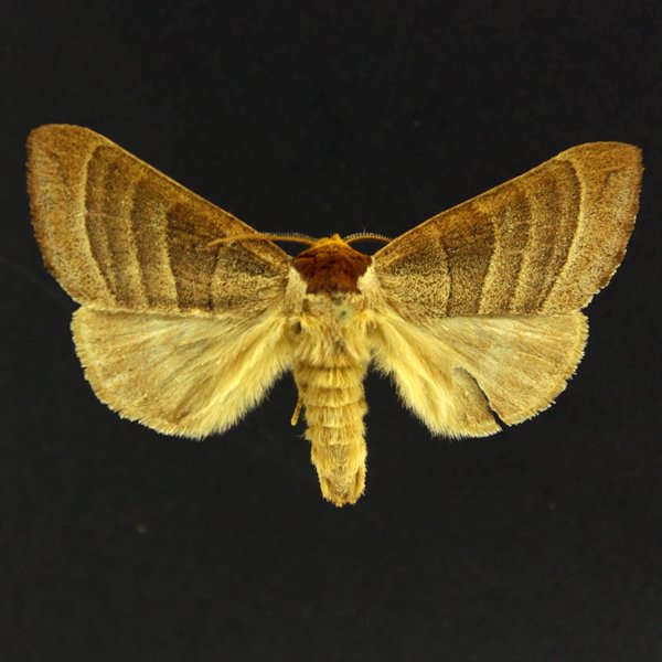
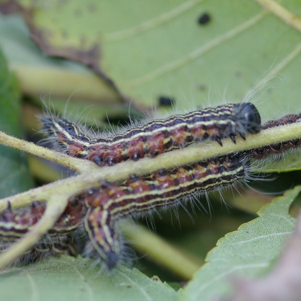
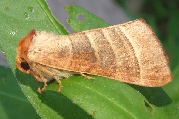
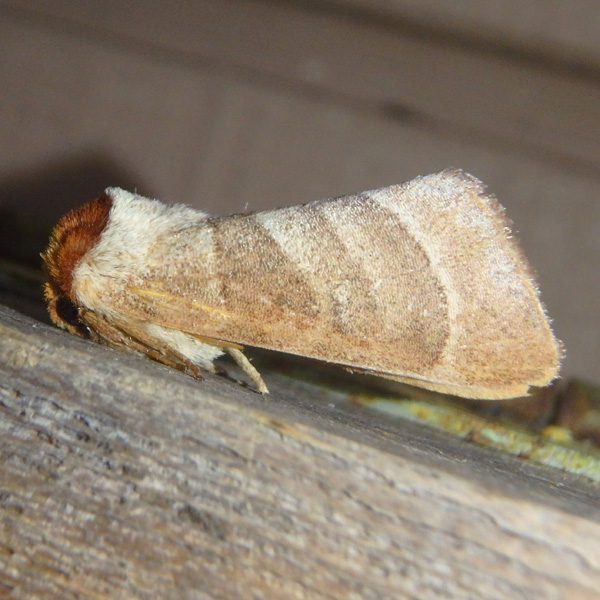
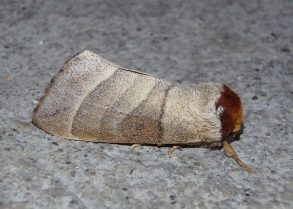
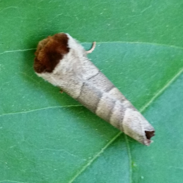
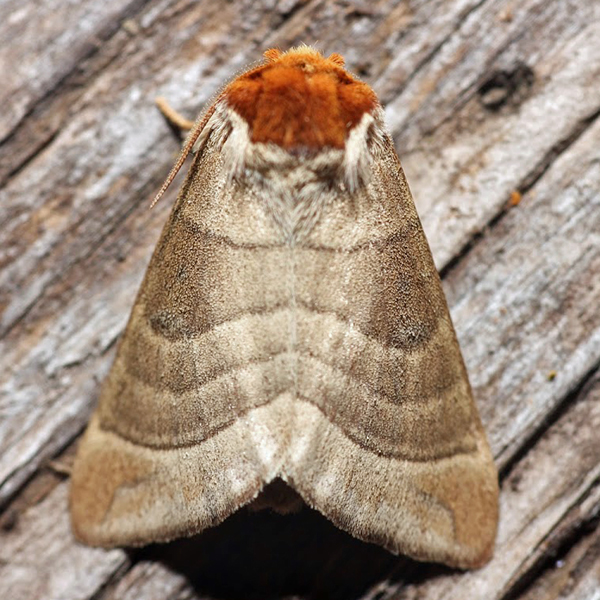
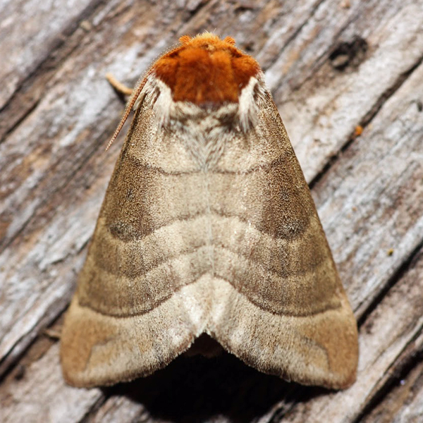
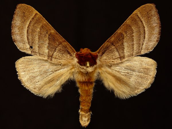
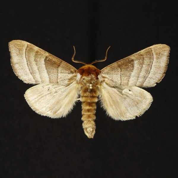
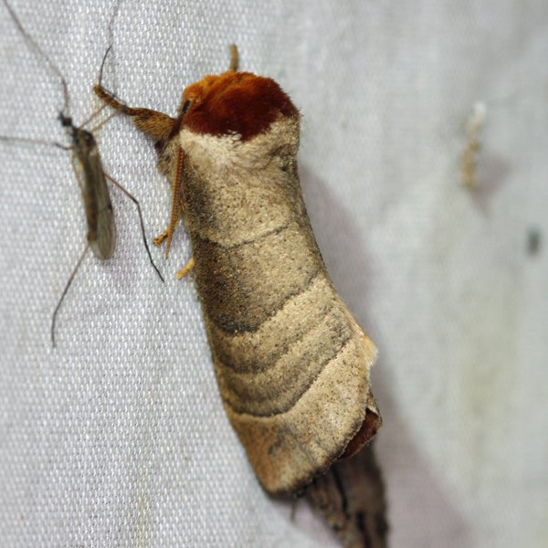
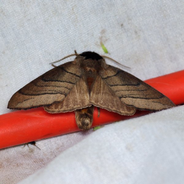
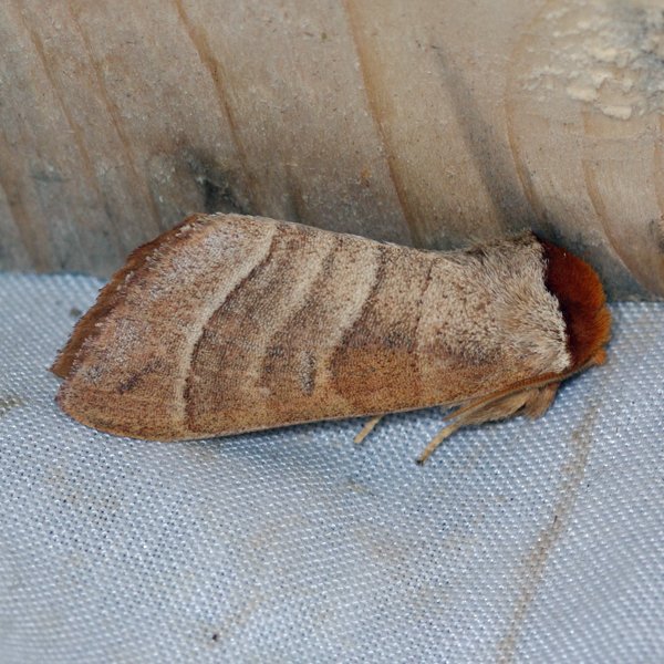
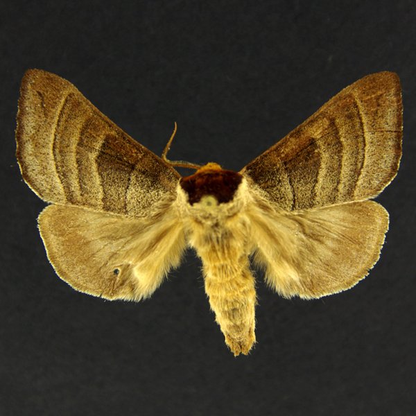
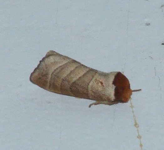
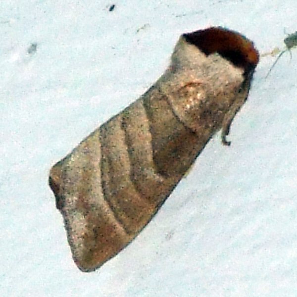
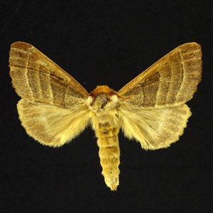
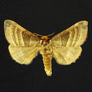
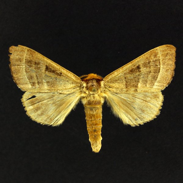
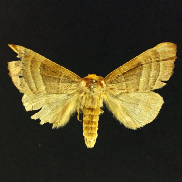
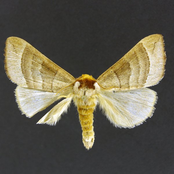
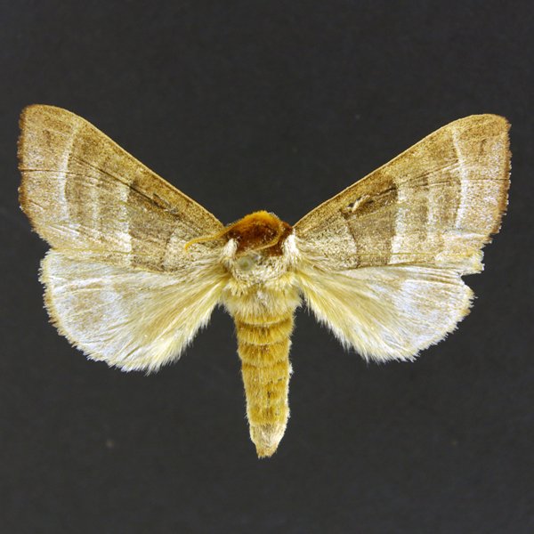
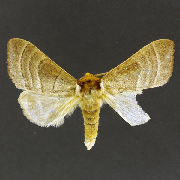
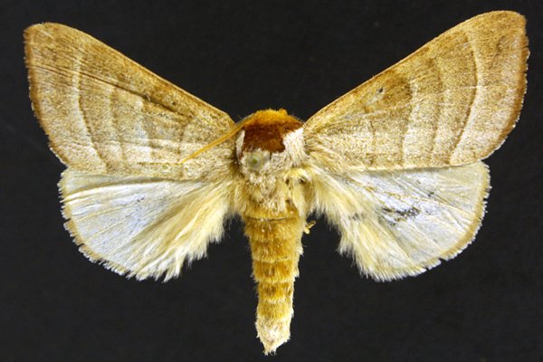
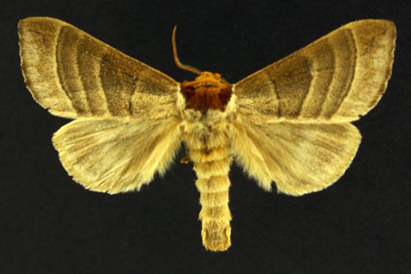
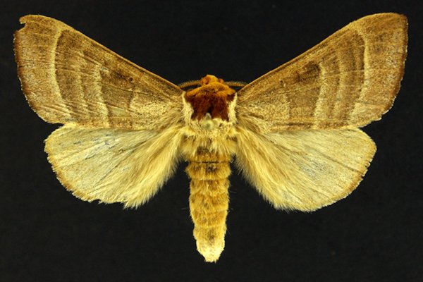
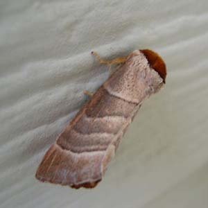
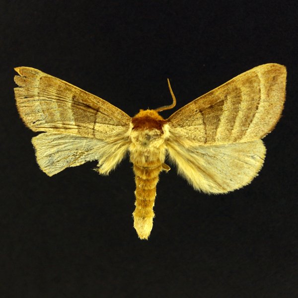
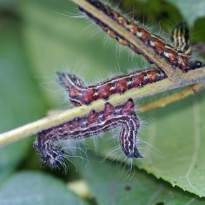
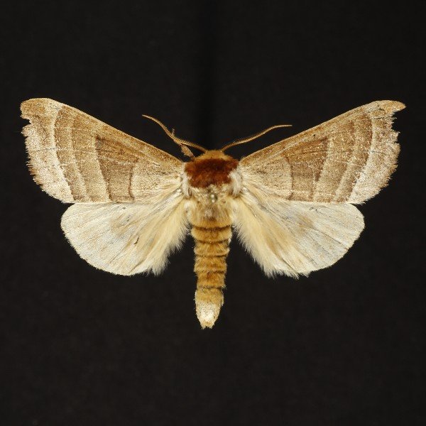
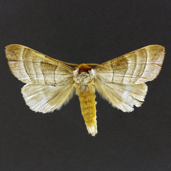
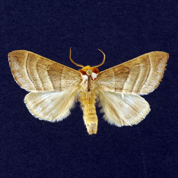
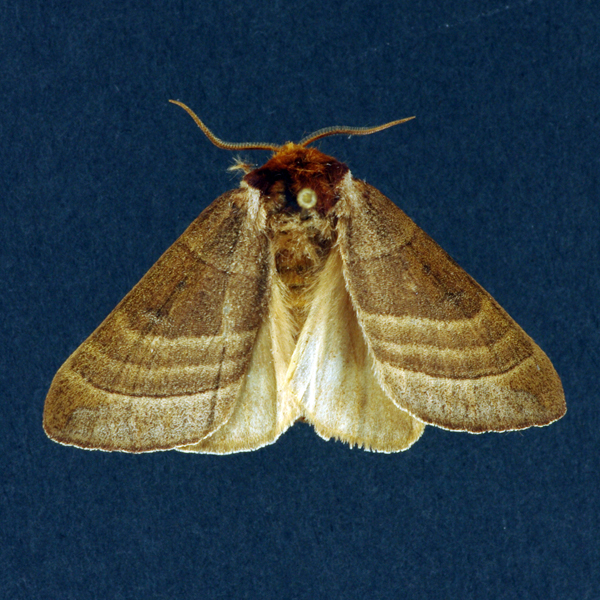
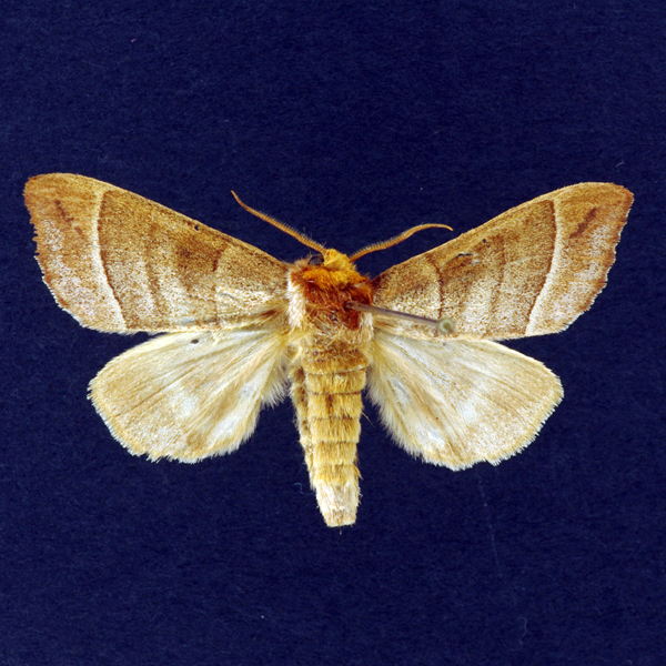
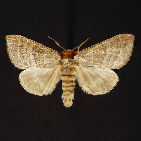
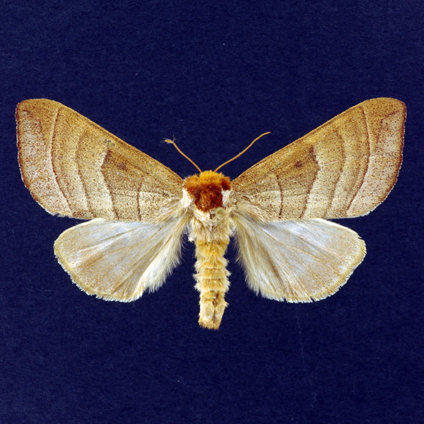
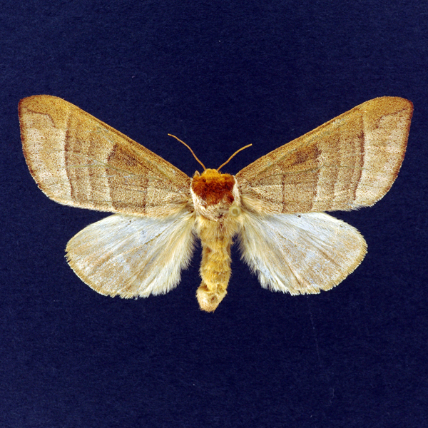
Walnut Caterpillar Moth (Datana integerrima), Grote and Robinson, 1866 - 7907.000000 - 930038
Wing span: 42mm
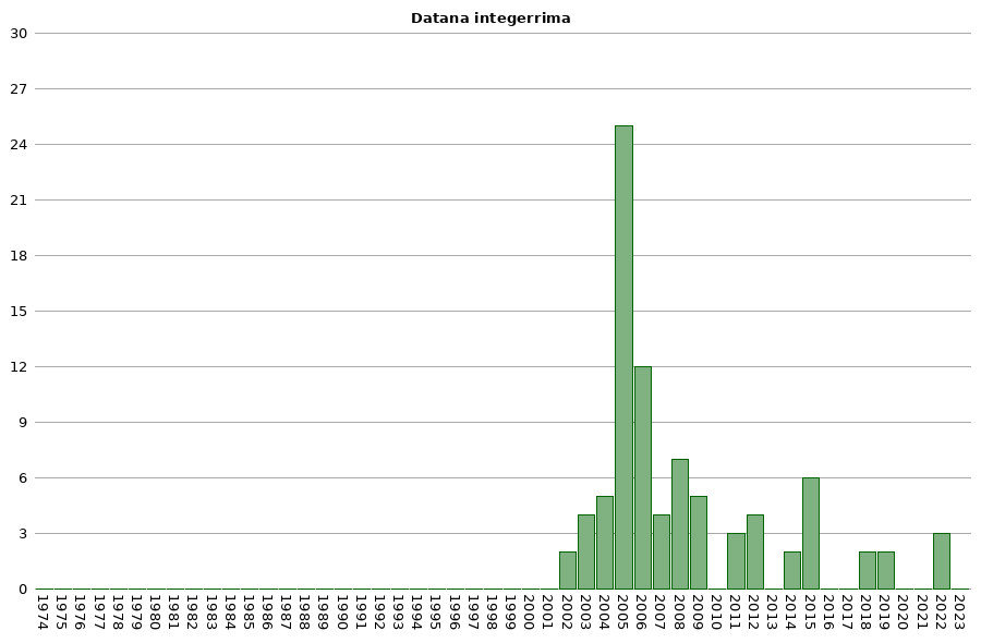
Flight time: May - September


Photos


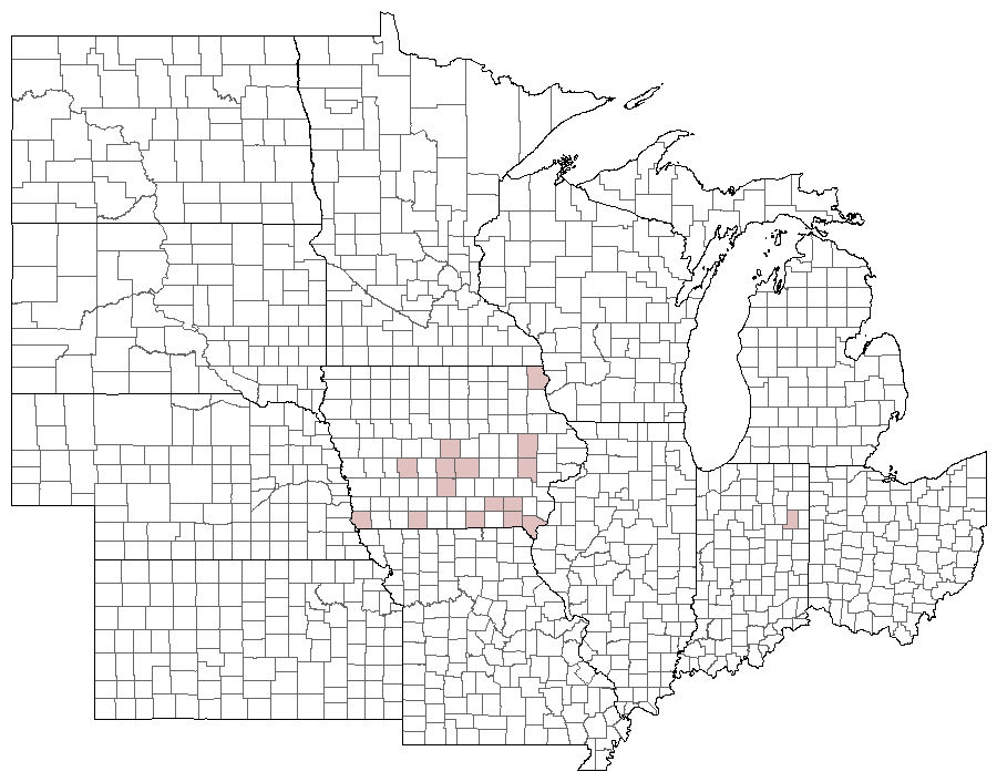
Records
| Record # | Date | Locale | State | Lat/Lon | Collected By | Count |
|---|---|---|---|---|---|---|
 320728 320728
|
2022-07-21 | MacBride Nature Recreation Area | Iowa | 41.7869394 -91.5684859 | Mark Brown | 1 |
 320819 320819
|
2022-07-17 | MacBride Nature Recreation Area | Iowa | 41.7869394 -91.5684859 | Mark Brown | 1 |
 320145 320145
|
2022-07-10 | Eddyville Sand Prairie Park | Iowa | 41.15375 -92.618925 | Mark Brown | 1 |
 233784 233784
|
2019-07-04 | MacBride Nature Recreation Area | Iowa | 41.786729 -91.568057 | Mark Brown | 1 |
 241667 241667
|
2019-06-11 | MacBride Nature Recreation Area | Iowa | 41.786729 -91.568057 | Mark Brown | 1 |
| 222269 | 2018-07-17 | Allamakee County, Iowa | Iowa | Location Protected | MJ Hatfield | 1 |
 224484 224484
|
2018-05-27 | Sundown Lake Recreation Area | Iowa | 40.830089 -92.747939 | Eric Liskey | 1 |
| 145295 | 2015-06-21 | Allamakee County, Iowa | Iowa | Location Protected | Kyle E. Johnson | 1 |
| 145296 | 2015-06-21 | Allamakee County, Iowa | Iowa | Location Protected | Kyle E. Johnson | 1 |
| 145297 | 2015-06-21 | Allamakee County, Iowa | Iowa | Location Protected | Kyle E. Johnson | 1 |
| 145298 | 2015-06-21 | Allamakee County, Iowa | Iowa | Location Protected | Kyle E. Johnson | 1 |
 133265 133265
|
2015-06-13 | Grand River Grasslands / Kellerton Bird Conservation Area | Iowa | 40.657259 -94.110879 | Logan Crees | 1 |
 130176 130176
|
2015-06-12 | Grand River Grasslands / Kellerton Bird Conservation Area | Iowa | 40.657259 -94.110879 | Logan Crees | 1 |
 65417 65417
|
2014-08-17 | Sedan Bottoms Wildlife Management Area | Iowa | 40.65027778 -92.77055556 | Tom Jantscher | 1 |
 71868 71868
|
2014-06-20 | Wickiup Hill Outdoor Learning Area | Iowa | 42.08398 -91.7651 | Frank Olsen | 1 |
 23230 23230
|
2012-06-08 | Whiterock Conservancy | Iowa | 41.80725 -94.64085 | Jim Durbin | 1 |
 23231 23231
|
2012-06-08 | Whiterock Conservancy | Iowa | 41.80725 -94.64085 | Jim Durbin | 1 |
 23191 23191
|
2012-06-02 | Ashton-Wildwood County Park | Iowa | 41.81153 -93.29551 | Jim Durbin | 1 |
 23229 23229
|
2012-06-02 | Ashton-Wildwood County Park | Iowa | 41.81153 -93.29551 | Jim Durbin | 1 |
 23224 23224
|
2011-06-13 | 1460 Douglas Ct, Marion | Iowa | 42.040069 -91.590953 | Jim Durbin | 1 |
| 23226 | 2011-05-18 | Puccoon Prairie | Iowa | 41.73528 -93.36417 | Keith Summerville | 1 |
| 23227 | 2011-05-18 | Chichaqua Bottoms Sandhill Prairie | Iowa | 41.77278 -93.385 | Keith Summerville | 1 |
 23223 23223
|
2009-07-25 | Near Fairfield | Iowa | 41.0503 -92.024 | Moni Hayne | 1 |
 23233 23233
|
2009-07-25 | Near Fairfield | Iowa | 41.0503 -92.024 | Moni Hayne | 1 |
 23221 23221
|
2009-07-24 | Wanatee County Park | Iowa | 42.0094 -91.56623 | Jim Durbin | 1 |
 23253 23253
|
2009-07-24 | Wanatee County Park | Iowa | 42.0094 -91.56623 | Jim Durbin | 1 |
 23220 23220
|
2009-07-08 | Blufton/Fort Wayne South KOA | Indiana | 40.74645 -85.19347 | Jim Durbin | 1 |
 23219 23219
|
2008-08-02 | Wickiup Hill Outdoor Learning Area | Iowa | 42.08398 -91.7651 | Jim Durbin | 1 |
 23186 23186
|
2008-07-27 | Linn County, Iowa | Iowa | Location Protected | Jim Durbin | 1 |
 23217 23217
|
2008-07-27 | Linn County, Iowa | Iowa | Location Protected | Jim Durbin | 1 |
 23218 23218
|
2008-07-27 | Linn County, Iowa | Iowa | Location Protected | Jim Durbin | 1 |
 788 788
|
2008-07-16 | Yellow River State Forest | Iowa | 43.1676 -91.254 | Jim Durbin | 1 |
 666 666
|
2008-07-13 | 1460 Douglas Ct, Marion | Iowa | 42.040069 -91.590953 | Jim Durbin | 1 |
 619 619
|
2008-07-12 | Sugar Bottom Recreational Area | Iowa | 41.759443 -91.562986 | Jim Durbin | 1 |
 23222 23222
|
2007-07-13 | Norwalk | Iowa | 41.4751 -93.6788 | Matt Melcher | 1 |
 23215 23215
|
2007-07-12 | Pleasant Creek State Recreation Area, Linn County | Iowa | 42.11952 -91.81215 | Jim Durbin | 1 |
 23216 23216
|
2007-07-12 | Pleasant Creek State Recreation Area, Linn County | Iowa | 42.11952 -91.81215 | Jim Durbin | 1 |
 23214 23214
|
2007-06-30 | Wanatee County Park | Iowa | 42.0094 -91.56623 | Jim Durbin | 1 |
 23225 23225
|
2006-09-16 | Indian Lake Park, Farmington | Iowa | 40.63518 -91.75017 | Jim Durbin | 1 |
 23210 23210
|
2006-07-22 | Shimek State Forest, Croton Unit East | Iowa | 40.54693 -91.61435 | Jim Durbin | 1 |
 23211 23211
|
2006-06-04 | Waubonsie State Park | Iowa | 40.676 -95.689 | Doug Veal | 1 |
 23209 23209
|
2006-05-29 | Leon's Farm, Ohio County | Kentucky | 37.42033 -86.77023 | Jim Durbin | 1 |
| 23212 | 2006-05-25 | Neal Smith National Wildlife Refuge | Iowa | 41.54245 -93.2908 | Keith Summerville | 1 |
| 69796 | 2006-05-25 | Big Creek State Park | Iowa | 41.807055 -93.745185 | Keith Summerville | 2 |
| 69801 | 2006-05-25 | Chichaqua Bottoms Sandhill Prairie | Iowa | 41.77278 -93.385 | Keith Summerville | 1 |
| 69803 | 2006-05-25 | Big Creek State Park | Iowa | 41.81167 -93.75333 | Keith Summerville | 3 |
| 69806 | 2006-05-25 | Neal Smith National Wildlife Refuge | Iowa | 41.54245 -93.2908 | Keith Summerville | 1 |
 135463 135463
|
2005-07-22 | Ames, Paul | Iowa | 42.02064 -93.623952 | Paul Martsching | 1 |
 135462 135462
|
2005-07-05 | Ames, Paul | Iowa | 42.02064 -93.623952 | Paul Martsching | 1 |
| 23213 | 2005-05-25 | Neal Smith National Wildlife Refuge | Iowa | 41.54245 -93.2908 | Keith Summerville | 1 |
| 69795 | 2005-05-25 | Big Creek State Park | Iowa | 41.807055 -93.745185 | Keith Summerville | 8 |
| 69797 | 2005-05-25 | Thomas Mitchell Park | Iowa | 41.64 -93.3823 | Keith Summerville | 1 |
| 69798 | 2005-05-25 | Puccoon Prairie | Iowa | 41.73528 -93.36417 | Keith Summerville | 1 |
| 69799 | 2005-05-25 | Synder Farm INHF | Iowa | 41.76675 -93.484171 | Keith Summerville | 1 |
| 69800 | 2005-05-25 | Chichaqua Bottoms Sandhill Prairie | Iowa | 41.77278 -93.385 | Keith Summerville | 2 |
| 69802 | 2005-05-25 | Paul Errington Marsh Wildlife Management Area | Iowa | 41.75611 -93.50556 | Keith Summerville | 2 |
| 69804 | 2005-05-25 | Yellow Banks Park | Iowa | 41.547615 -93.47527 | Keith Summerville | 1 |
| 69805 | 2005-05-25 | Neal Smith National Wildlife Refuge | Iowa | 41.54245 -93.2908 | Keith Summerville | 6 |
 135461 135461
|
2004-09-03 | Ames, Paul | Iowa | 42.02064 -93.623952 | Paul Martsching | 1 |
| 204292 | 2004-07-22 | Ames, Paul | Iowa | 42.02064 -93.623952 | Paul Martsching | 1 |
| 204291 | 2004-07-05 | Ames, Paul | Iowa | 42.02064 -93.623952 | Paul Martsching | 1 |
| 204290 | 2004-06-03 | Ames, Paul | Iowa | 42.02064 -93.623952 | Paul Martsching | 1 |
| 69794 | 2004-05-25 | Big Creek State Park | Iowa | 41.807055 -93.745185 | Keith Summerville | 1 |
 23207 23207
|
2003-07-30 | Wanatee County Park | Iowa | 42.00994 -91.57749 | Frank Olsen | 1 |
 135460 135460
|
2003-07-17 | Ames, Paul | Iowa | 42.02064 -93.623952 | Paul Martsching | 1 |
| 204289 | 2003-07-17 | Ames, Paul | Iowa | 42.02064 -93.623952 | Paul Martsching | 1 |
| 23208 | 2003-05-15 | Neal Smith National Wildlife Refuge | Iowa | 41.5678 -93.2675 | Keith Summerville | 1 |
 135459 135459
|
2002-07-24 | Ames, Paul | Iowa | 42.02064 -93.623952 | Paul Martsching | 1 |
| 204288 | 2002-07-24 | Ames, Paul | Iowa | 42.02064 -93.623952 | Paul Martsching | 1 |
| 2757 | 1950-07-15 | Story County | Iowa | 42.104046 -93.500343 | USGS - NPWRC | 1 |
| 23232 | 1950-07-15 | Story County | Iowa | 42.10405 -93.50034 | unknown | 1 |