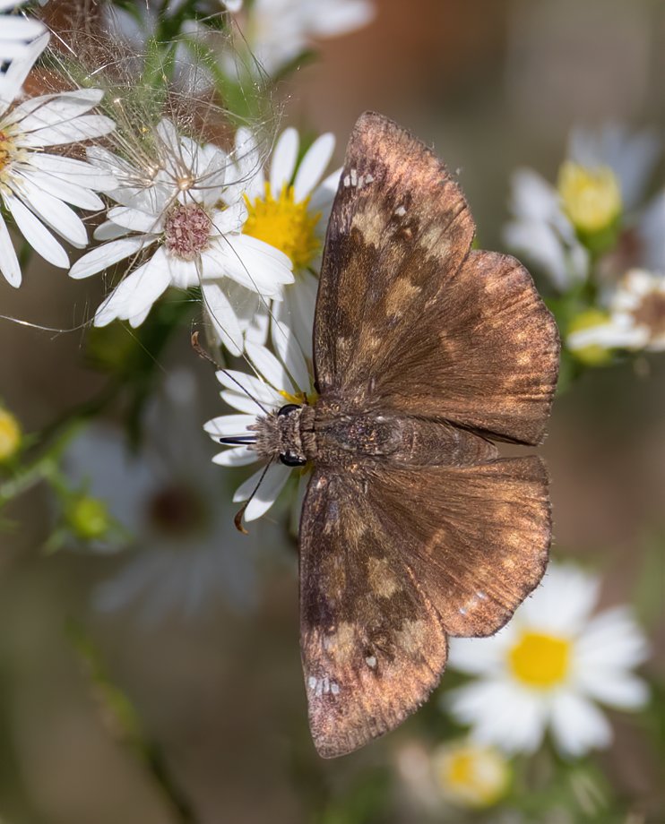
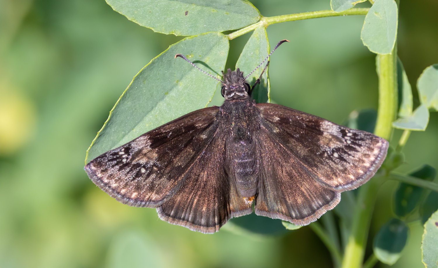
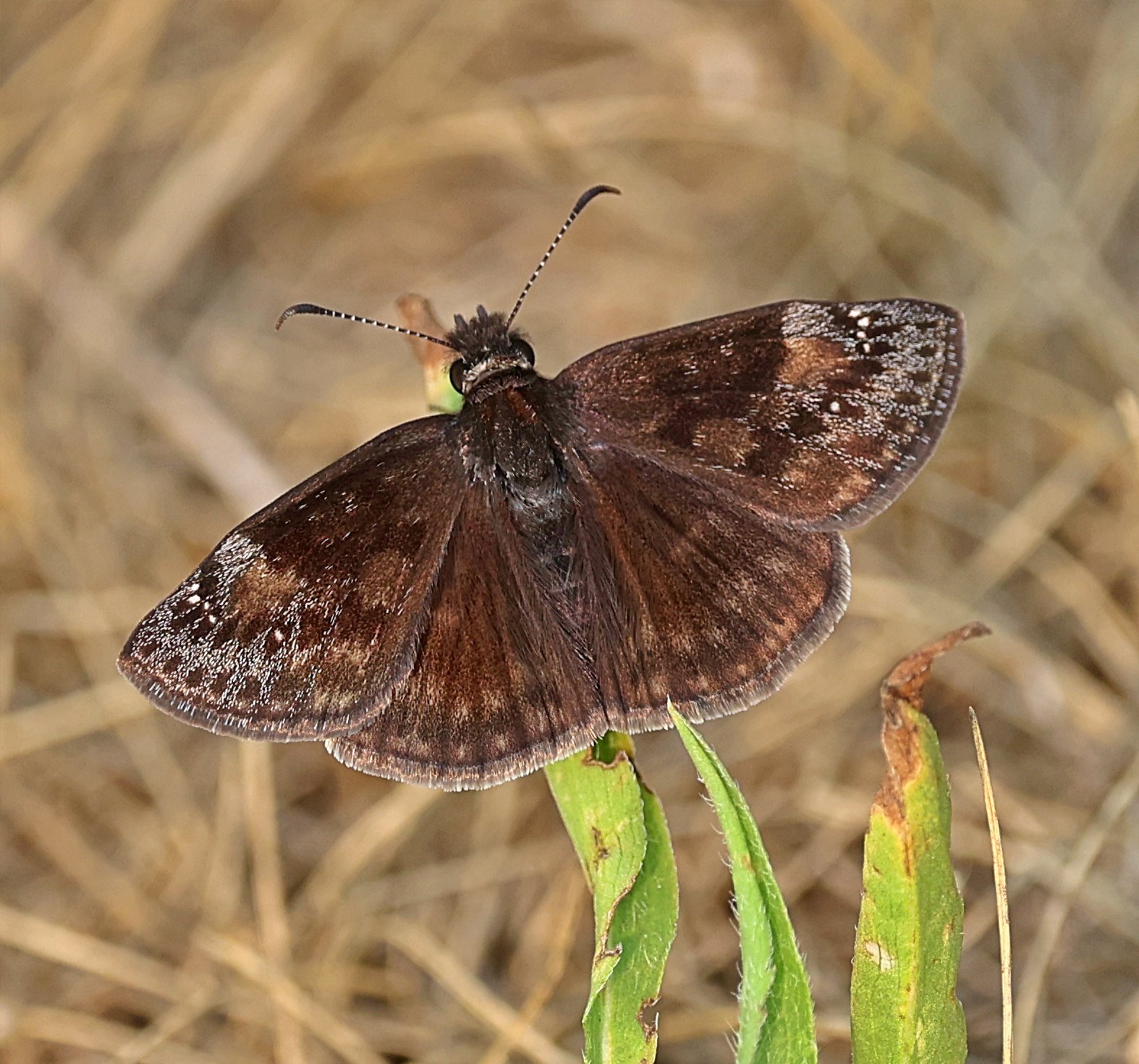
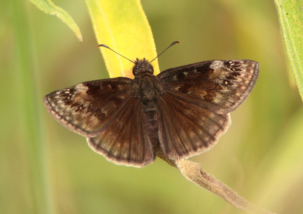
Wing span:
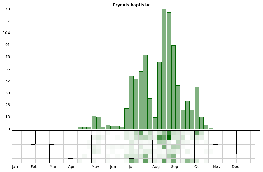
Flight time:Up to four broods emerge over the growing season. The first occurs from late April to late May, the second from late June to early July, the third from late July to mid August, with a possible fourth brood emerging from early September to early October. Native populations in Loess Hills prairie appear bivoltine with early May and July flights.
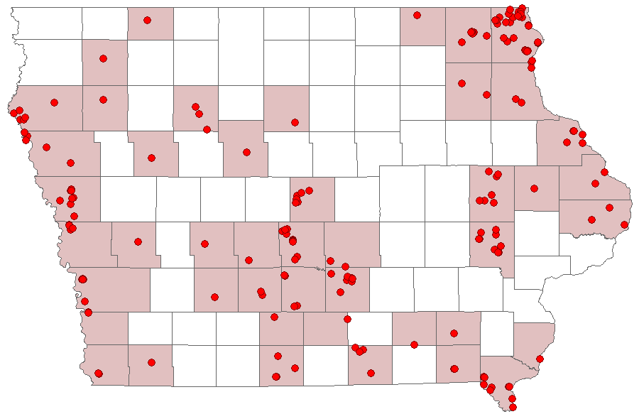
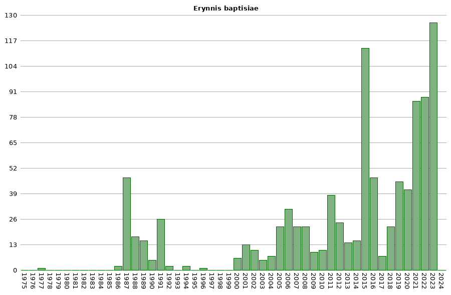
Status: Once a very rare breeding resident, populations have recently expanded, and it is now uncommon, but of regular occurrence, across the state.
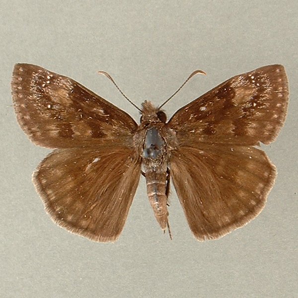
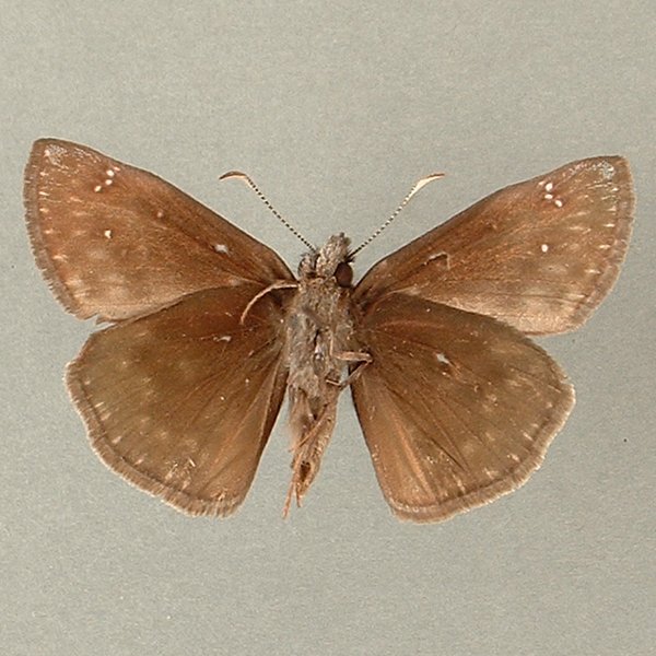
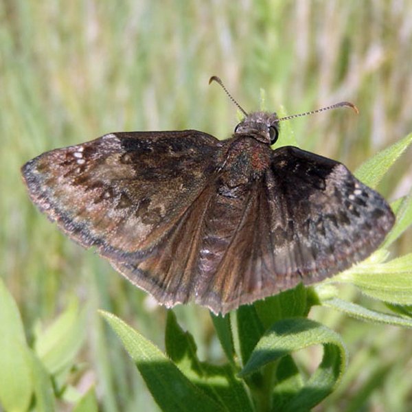
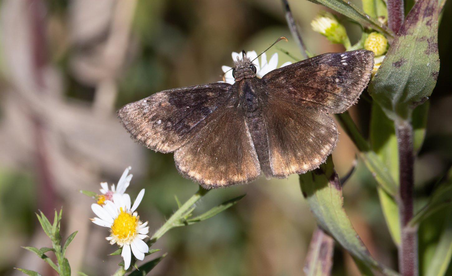
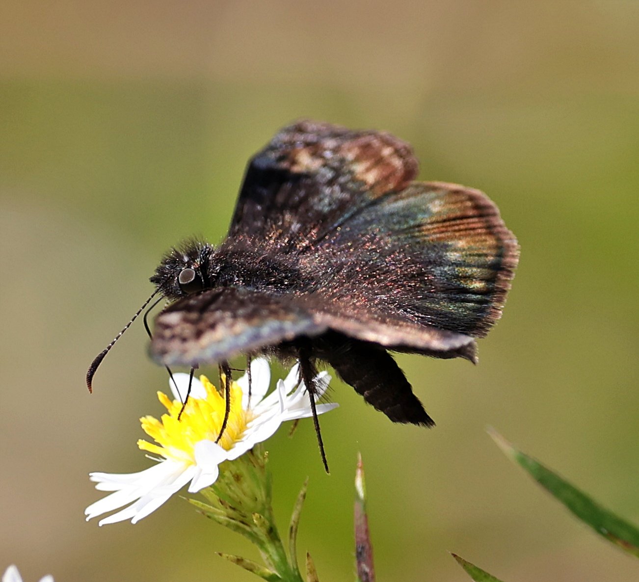
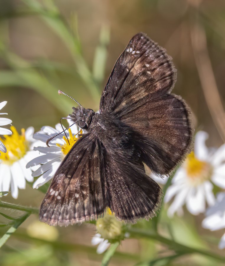
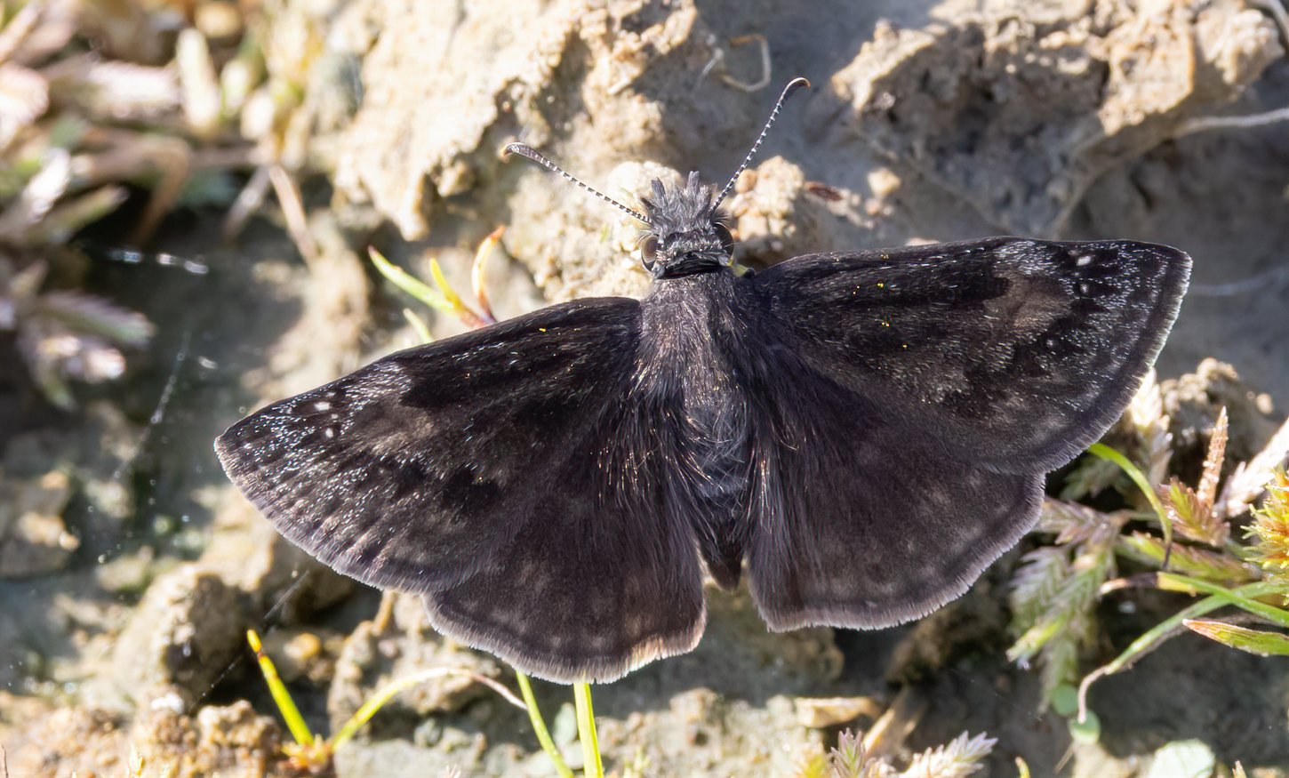
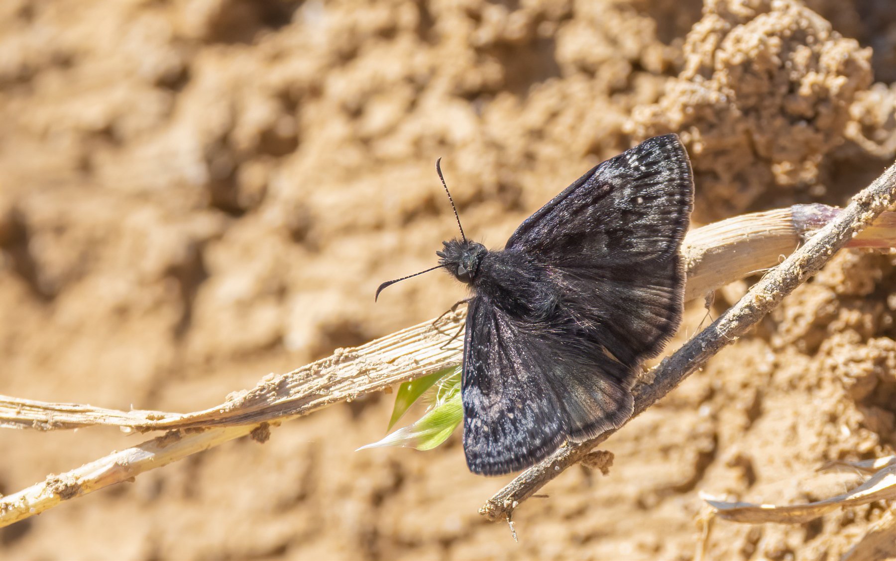
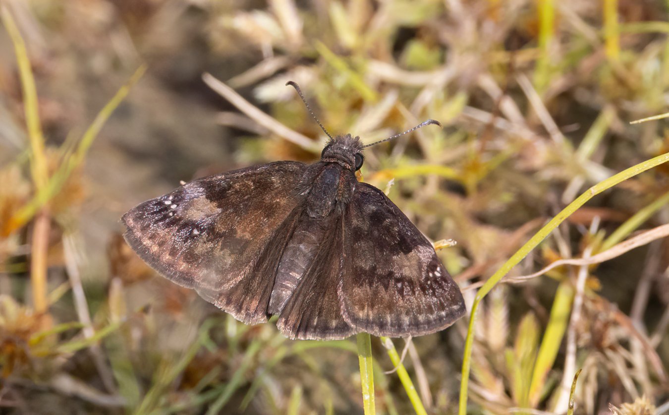
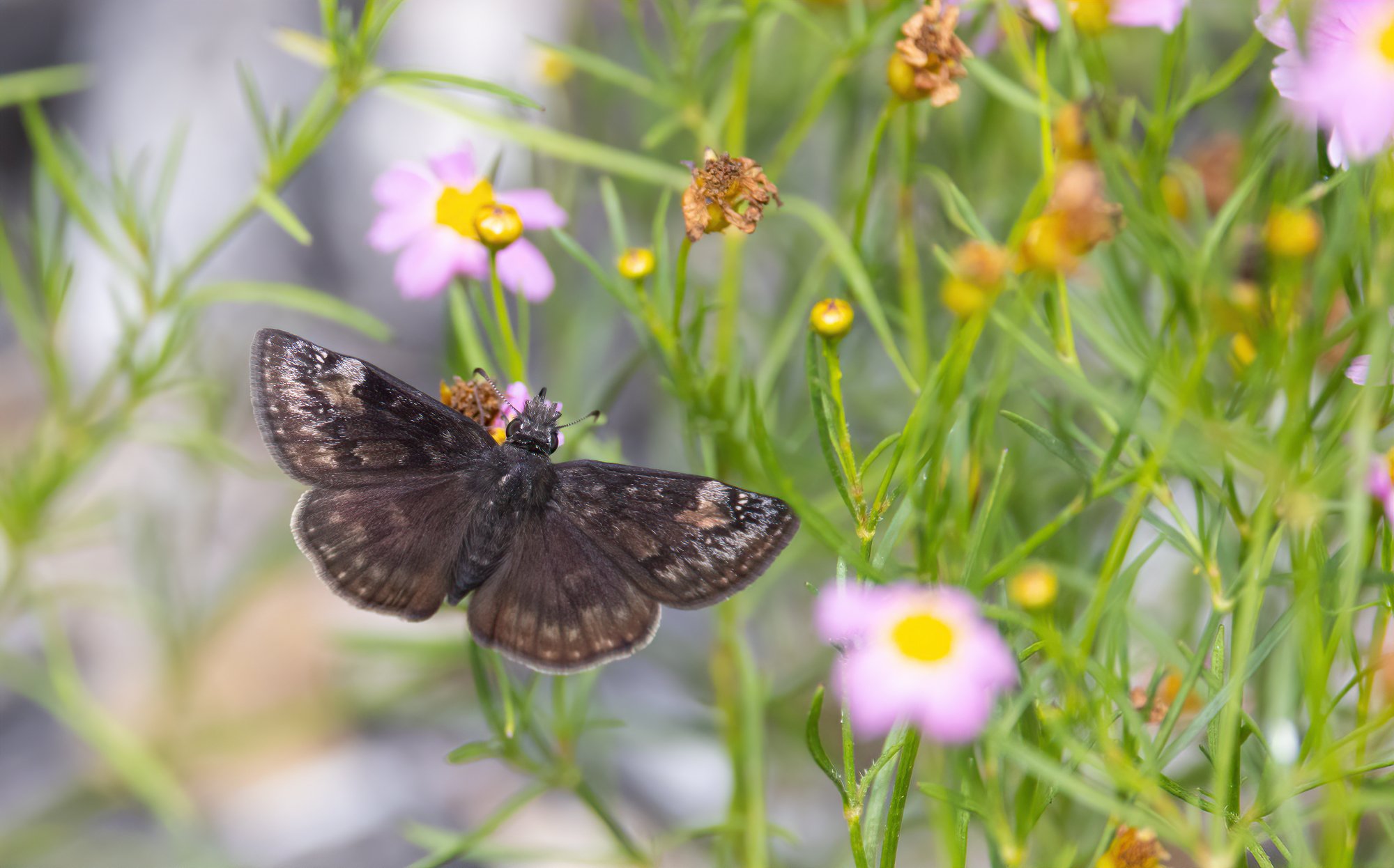
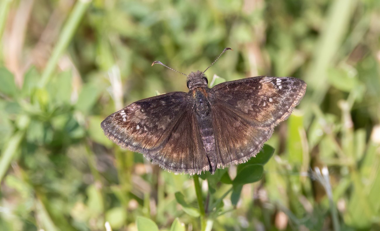
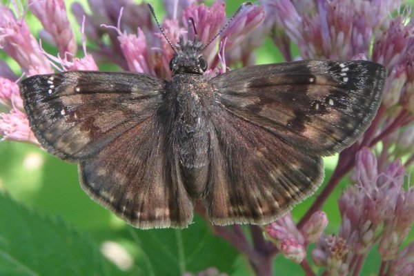
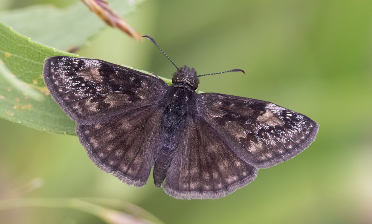
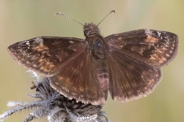
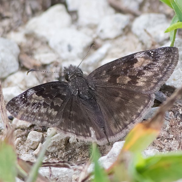
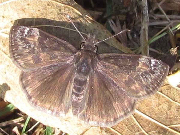
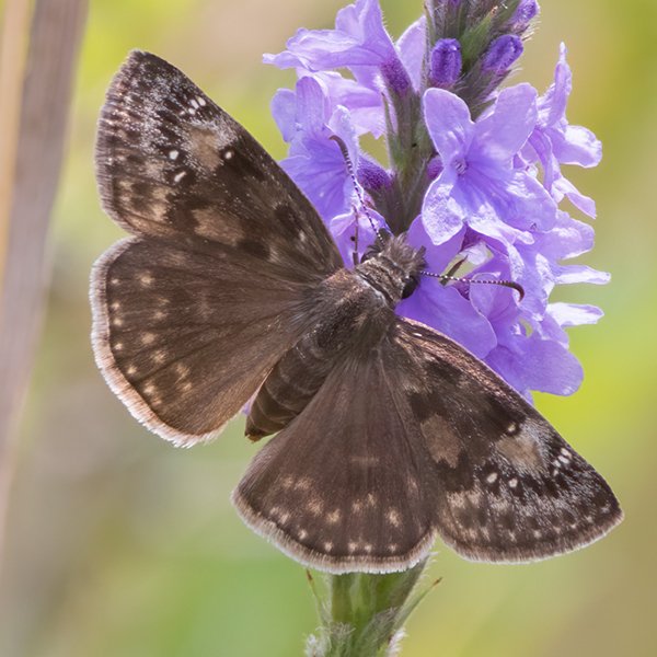
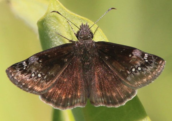
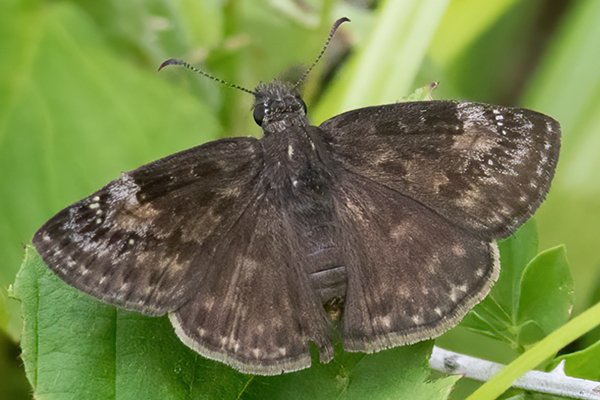
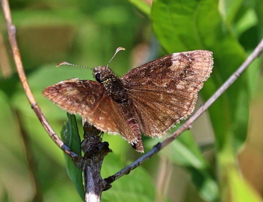
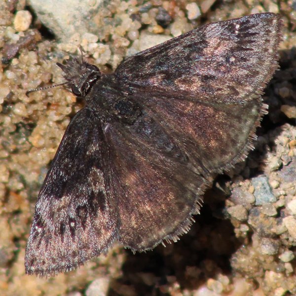
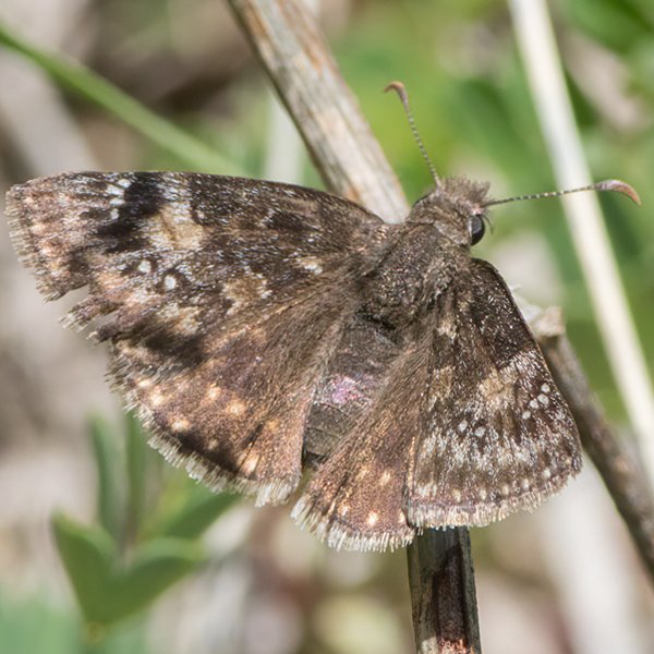
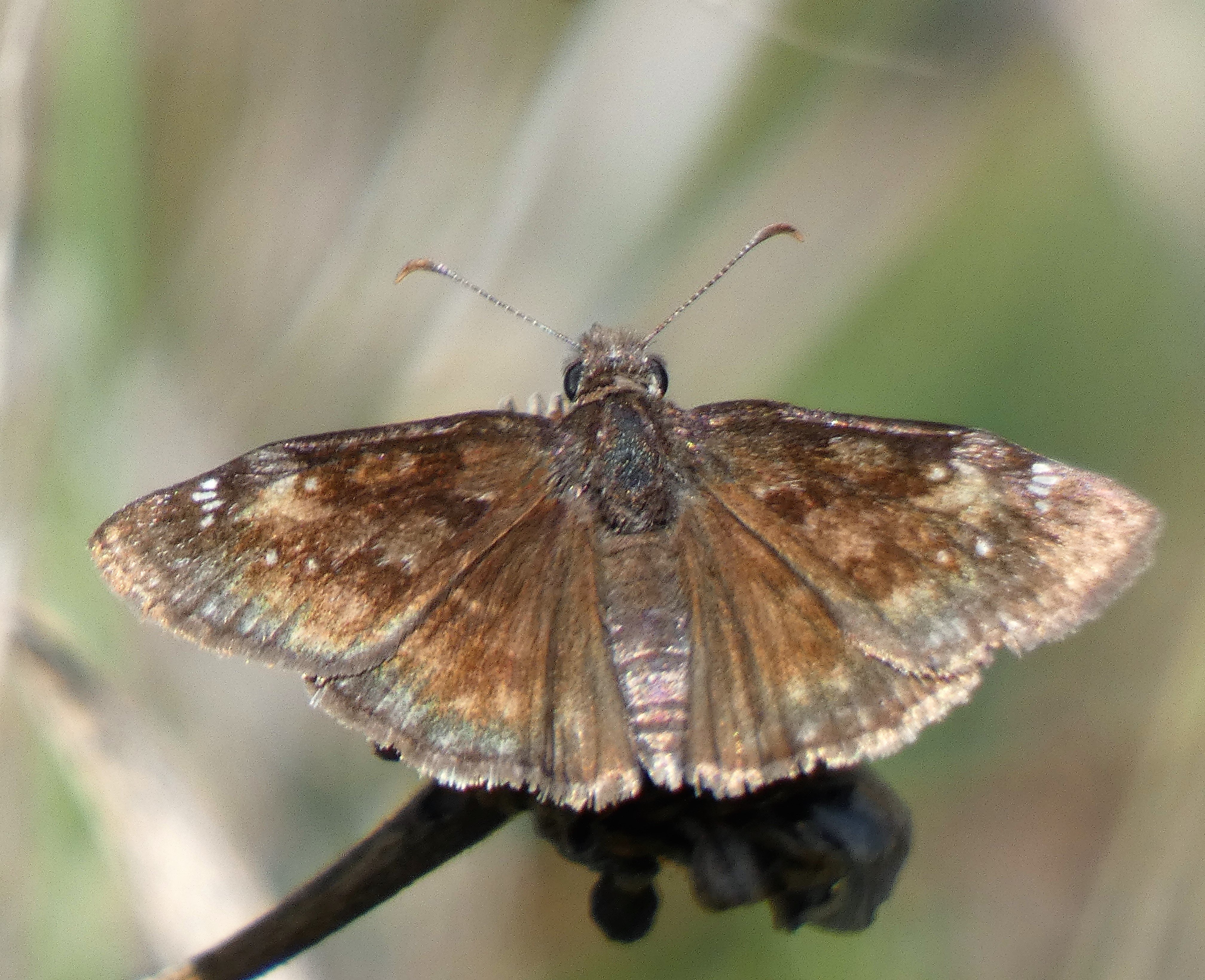
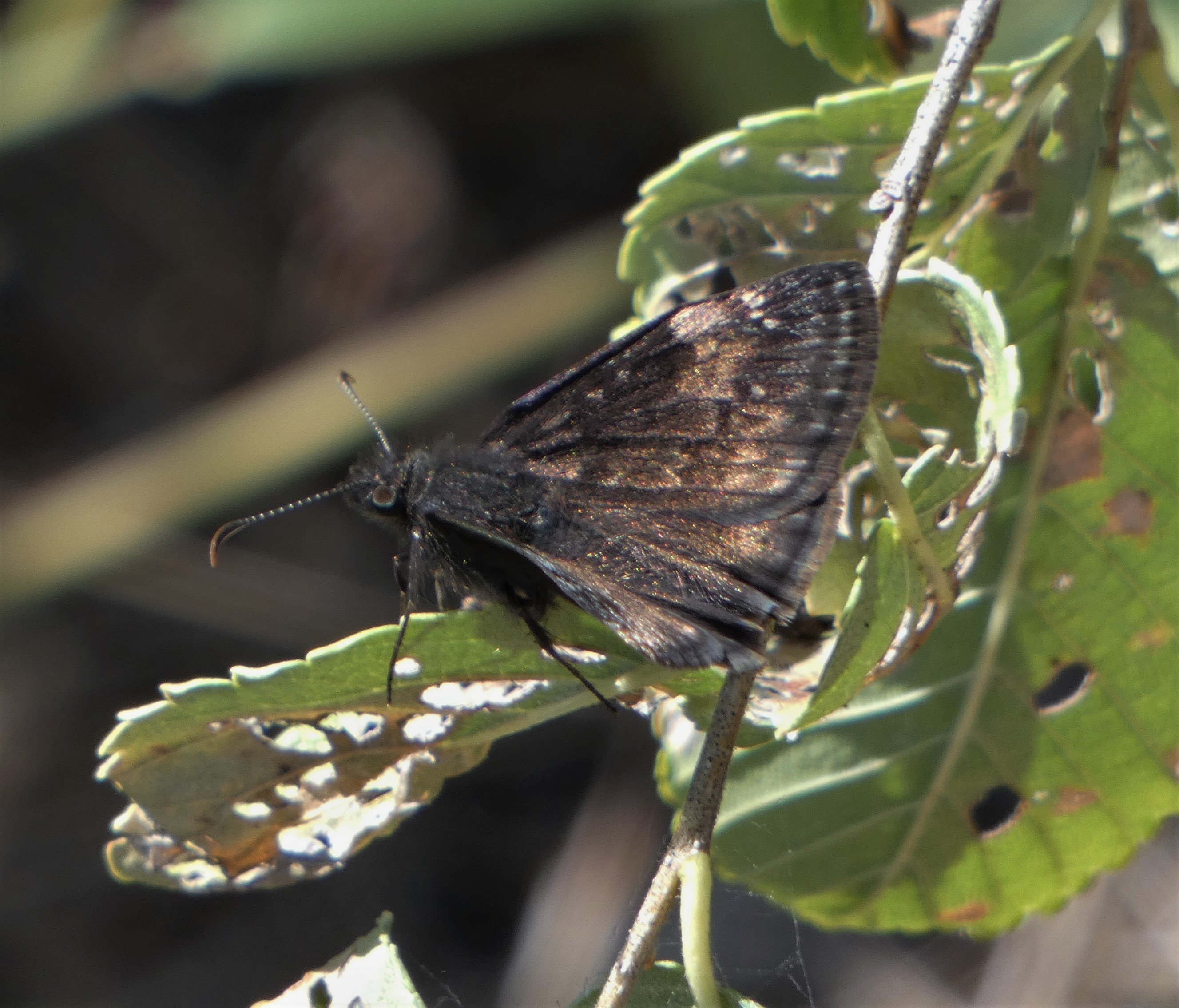
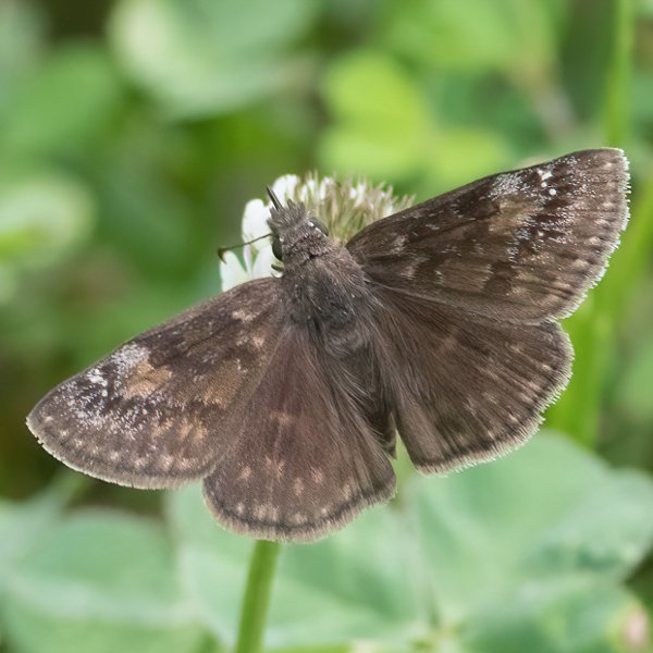
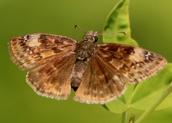
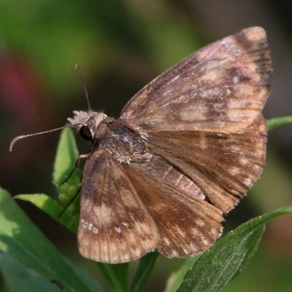
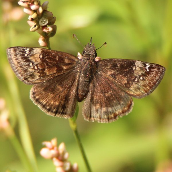
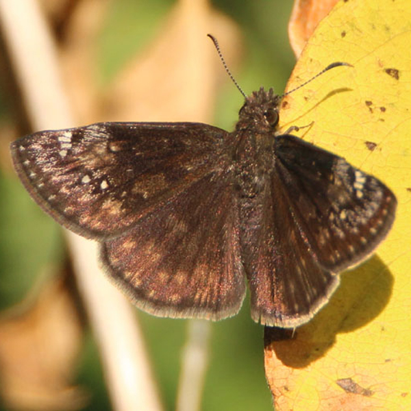
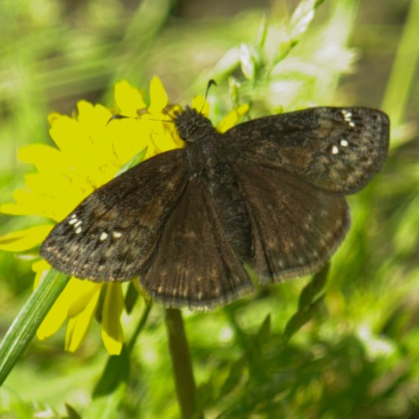
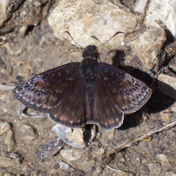
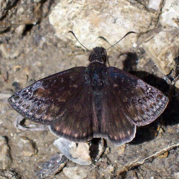
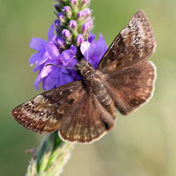
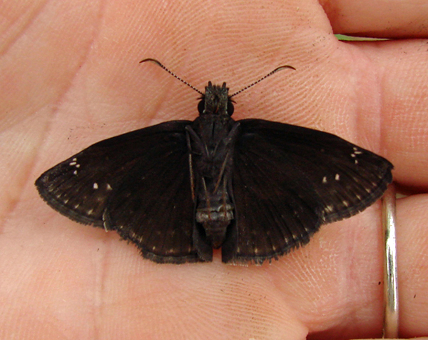
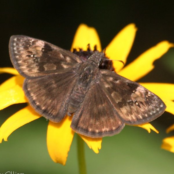
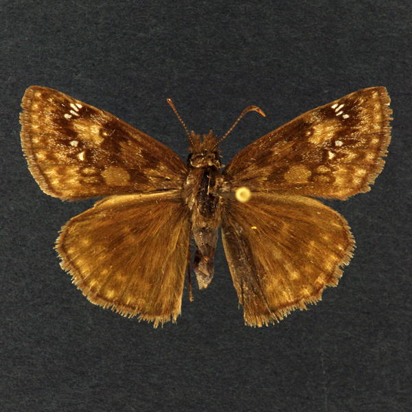
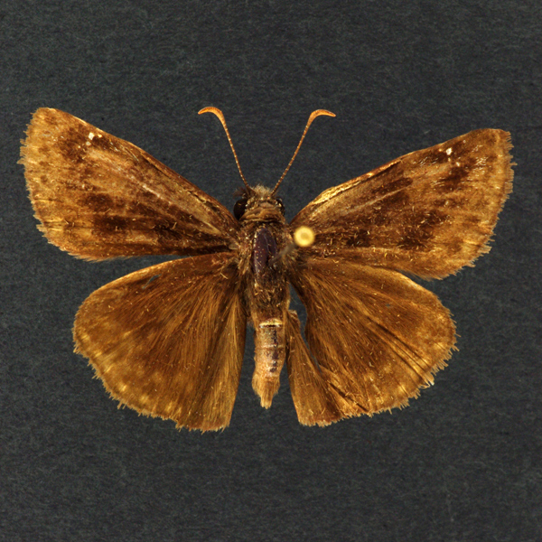
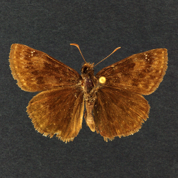
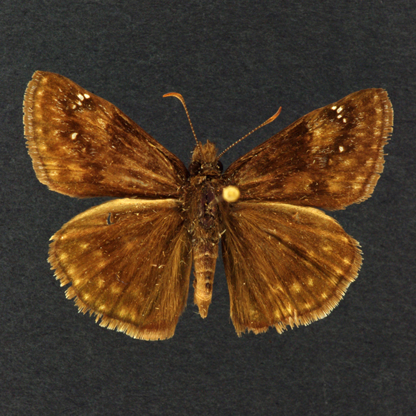
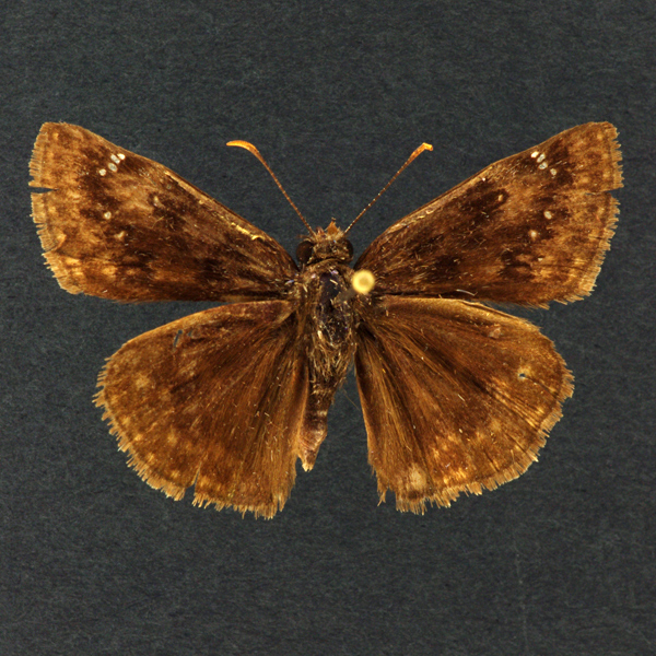
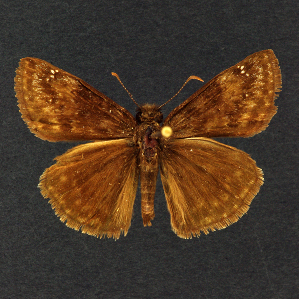
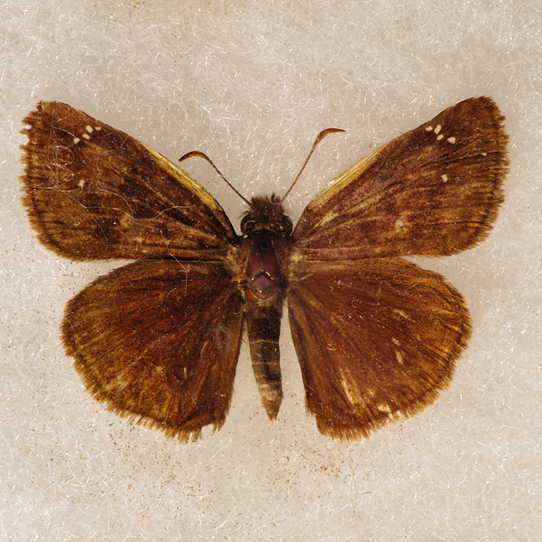
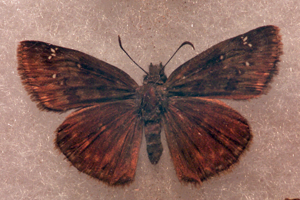
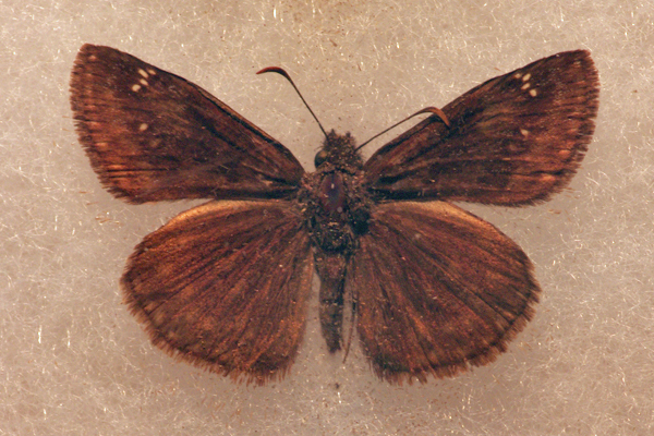
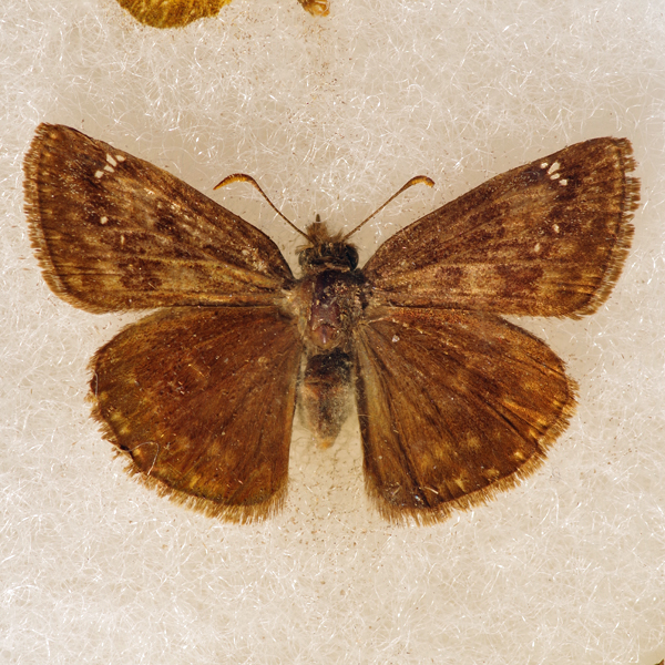
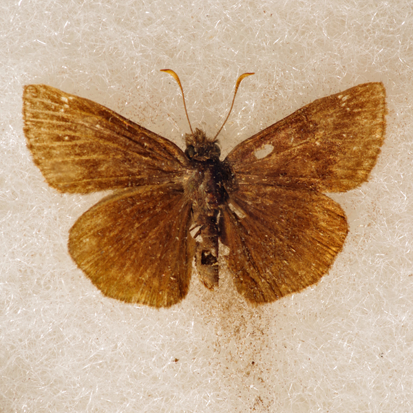
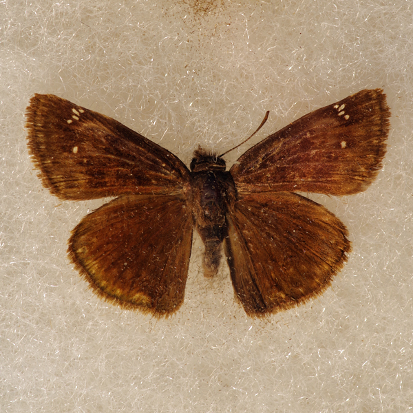
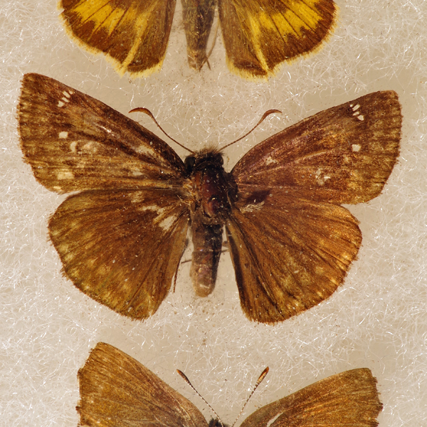
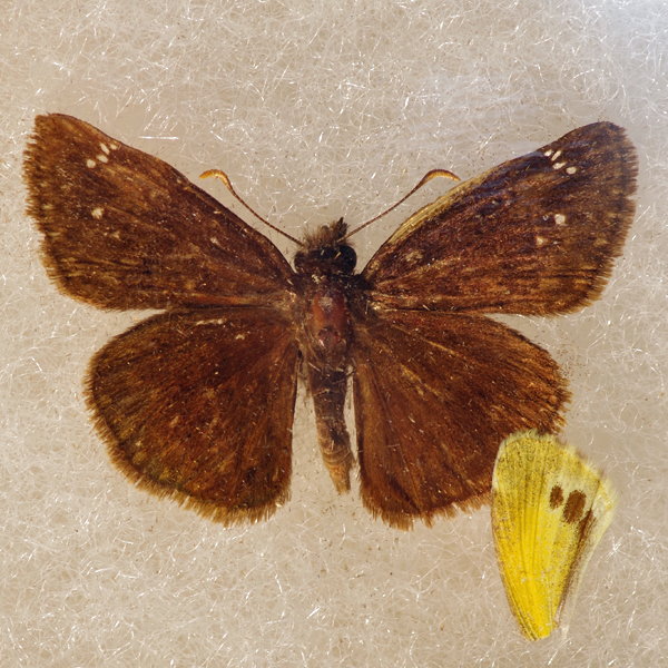
Distinguishing features: This species is very similar to the Columbine Duskywing, being on average larger and darker in color. It often possesses a lighter brown patch just proximal to the row of upper forewing clear spots. However, the only consistent characteristics distinguishing these species are their larval host plant choices.
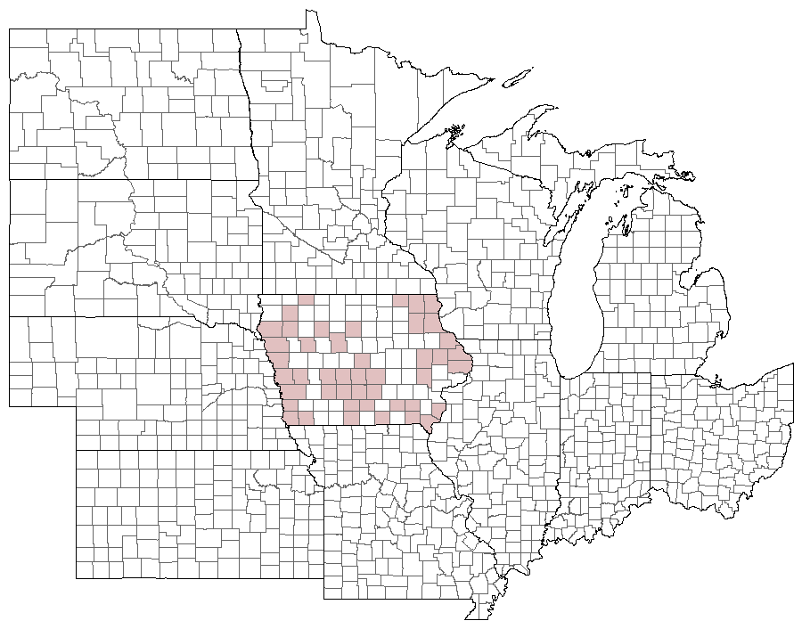
Distribution and habitat: Until the mid-1980's this species was very rare and limited in Iowa to dry prairies supporting large colonies of Wild Indigo (Baptisia spp.). Most verified colonies were restricted in the west to the Loess Hills and in the northeast to limestone and sandstone glades. Since this time, however, a race originating in Pennsylvania that eats Crown Vetch (Coronilla varia) has rapidly moved through Iowa along roadside ditches where this plant has been planted. It is now know from scattered sites across the entire state.
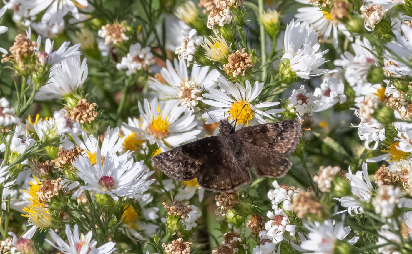
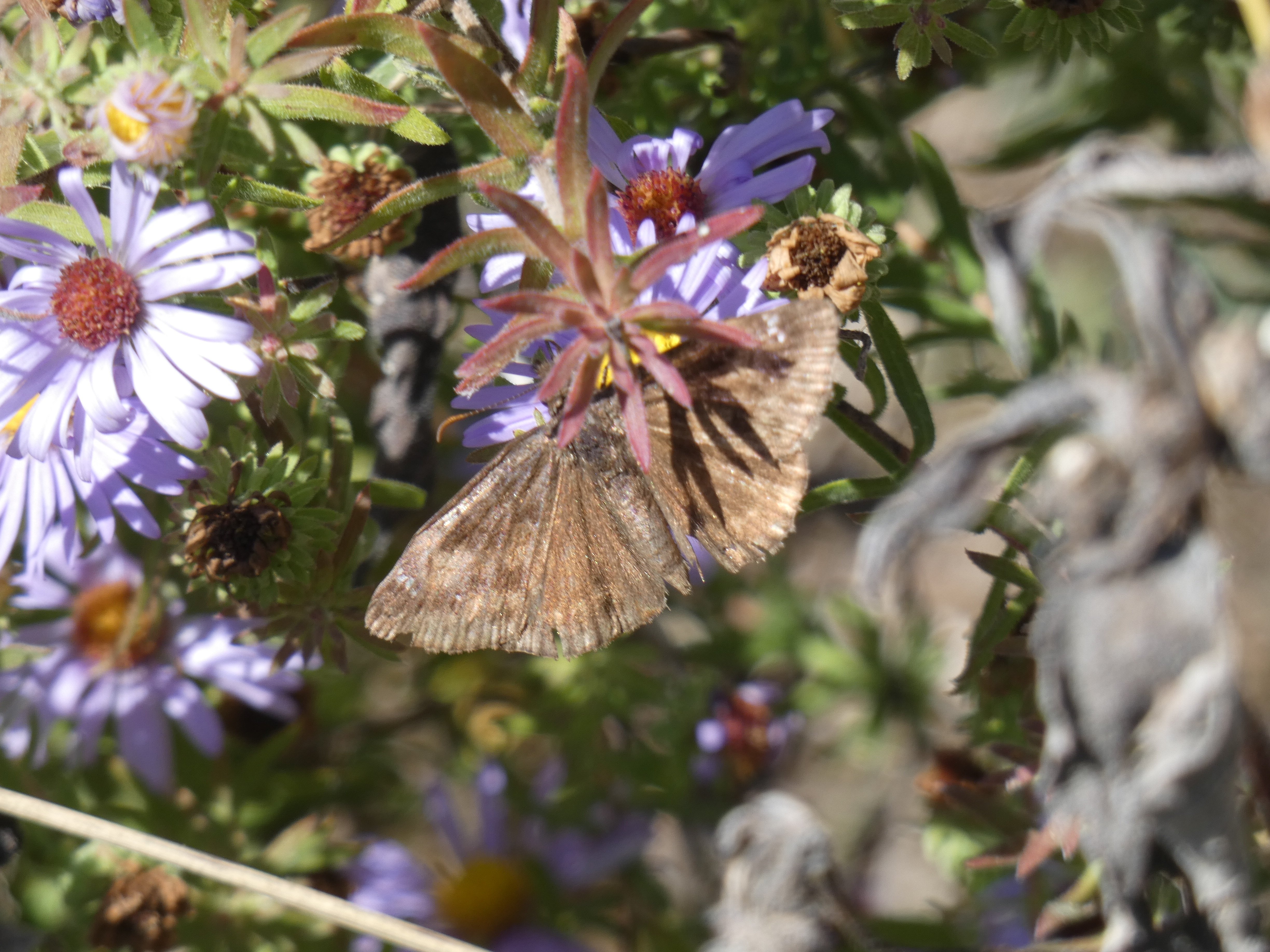
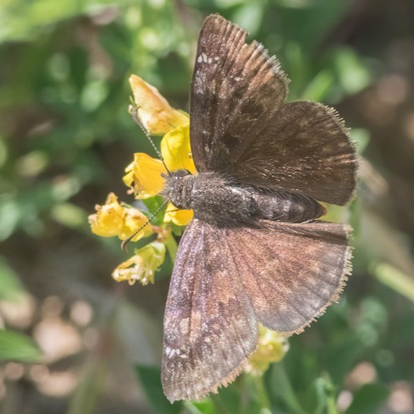
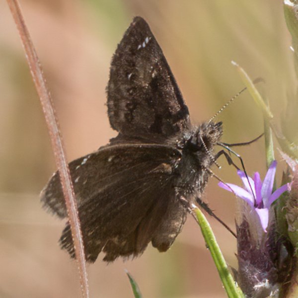
Natural History: Depending upon the population, Wild Indigo (especially the Cream Wild Indigo, Baptisia leucophaea) or Crown Vetch (Coronilla varia) is used as larval hosts.


| Record # | Date | Locale | State | Lat/Lon | Collected By | Count |
|---|---|---|---|---|---|---|
| 347234 | 2023-10-21 | Roberts Creek Park | Iowa | 41.42076 -93.052121 | Jay Gilliam | 2 |
 346327 346327
|
2023-10-08 | Lake Rathbun - Bridgeview | Iowa | 40.878864 -93.022393 | Jay Gilliam | 5 |
| 347223 | 2023-10-08 | Lake Rathbun - Rolling Cove Park | Iowa | 40.848458 -92.978644 | Jay Gilliam | 3 |
 346318 346318
|
2023-10-07 | Roberts Creek Park | Iowa | 41.42076 -93.052121 | Jay Gilliam | 7 |
 341603 341603
|
2023-10-02 | Terry Trueblood Recreation Area | Iowa | 41.62629 -91.532524 | Mark Madsen | 5 |
 346309 346309
|
2023-10-01 | Slip Bluff County Park | Iowa | 40.652884 -93.847544 | Jay Gilliam | 24 |
 346296 346296
|
2023-09-30 | Elk Rock State Park | Iowa | 41.40032 -93.060454 | Jay Gilliam | 9 |
 346298 346298
|
2023-09-30 | Red Rock Reservoir- Elk Rock Archery Range | Iowa | 41.407931 -93.108048 | Jay Gilliam | 2 |
 346299 346299
|
2023-09-30 | Red Rock Reservoir- Hwy 14 & G28 | Iowa | 41.434442 -93.10052 | Jay Gilliam | 2 |
 346276 346276
|
2023-09-23 | Elk Rock State Park | Iowa | 41.40032 -93.060454 | Jay Gilliam | 16 |
| 347122 | 2023-09-23 | Roberts Creek Park | Iowa | 41.42076 -93.052121 | Jay Gilliam | 7 |
 346370 346370
|
2023-09-10 | Saylorville Visitor Center | Iowa | 41.710399 -93.67038 | Jay Gilliam | 1 |
 346195 346195
|
2023-08-20 | Slip Bluff County Park | Iowa | 40.652884 -93.847544 | Jay Gilliam | 5 |
 346190 346190
|
2023-08-19 | Roberts Creek Park | Iowa | 41.42076 -93.052121 | Jay Gilliam | 27 |
| 347022 | 2023-08-19 | Elk Rock State Park | Iowa | 41.40032 -93.060454 | Jay Gilliam | 3 |
| 349979 | 2023-08-18 | MacBride Nature Recreation Area | IA | 41.786242 -91.566399 | Chris Edwards | 1 |
 347829 347829
|
2023-08-12 | Saylorville Visitor Center | Iowa | 41.707308266667 -93.671161271667 | Mark Brown | 1 |
| 346951 | 2023-08-05 | Folsom Point Preserve | Iowa | 41.154432 -95.799393 | Jay Gilliam | 2 |
 346336 346336
|
2023-07-09 | Rolling Thunder Prairie State Preserve | Iowa | 41.204306 -93.656457 | Jay Gilliam | 1 |
 346253 346253
|
2023-07-01 | Deer Creek Wildlife Management Area | Iowa | 42.718031 -96.511437 | Jay Gilliam | 3 |
 336385 336385
|
2023-06-27 | Terry Trueblood Recreation Area | Iowa | 41.627269 -91.530563 | Mark Madsen | 1 |
| 318717 | 2022-10-08 | Roberts Creek Park | Iowa | 41.42076 -93.052121 | Jay Gilliam | 1 |
 318665 318665
|
2022-10-01 | Roberts Creek Park | Iowa | 41.42076 -93.052121 | Jay Gilliam | 4 |
| 318636 | 2022-09-17 | Roberts Creek Park | Iowa | 41.42076 -93.052121 | Jay Gilliam | 2 |
| 318459 | 2022-08-27 | Loess Hills Scenic Overlook | Iowa | 41.905198 -95.945582 | Jay Gilliam | 2 |
| 318474 | 2022-08-27 | Folsom Point Preserve | Iowa | 41.154432 -95.799393 | Jay Gilliam | 2 |
| 318454 | 2022-08-21 | Sylvan Runkel State Preserve | Iowa | 42.104116 -95.973382 | Jay Gilliam | 2 |
| 318456 | 2022-08-21 | Loess Hills Scenic Overlook | Iowa | 41.905198 -95.945582 | Jay Gilliam | 5 |
 318433 318433
|
2022-08-20 | Slip Bluff County Park | Iowa | 40.652884 -93.847544 | Jay Gilliam | 11 |
| 316762 | 2022-08-16 | Lowe Park | Iowa | 42.0677 -91.602248 | Frank Olsen | 1 |
| 327827 | 2022-08-16 | F. W. Kent Park | Iowa | 41.726926 -91.737745 | IBSN | 1 |
 315920 315920
|
2022-08-14 | Willow Creek/Kiwanis Park | Iowa | 41.646916 -91.569958 | Peter Hansen | 1 |
| 318406 | 2022-08-14 | Slip Bluff County Park | Iowa | 40.652884 -93.847544 | Jay Gilliam | 16 |
| 318370 | 2022-08-07 | Elk Rock State Park | Iowa | 41.40032 -93.060454 | Jay Gilliam | 13 |
 318294 318294
|
2022-07-31 | Folsom Point Preserve | Iowa | 41.154432 -95.799393 | Jay Gilliam | 1 |
| 318188 | 2022-07-09 | Driftless Area Wetlands Center, Marquette | Iowa | 43.044531 -91.190869 | Jay Gilliam | 1 |
 320110 320110
|
2022-07-09 | Yellow River State Forest | Iowa | 43.171905 -91.245009 | Mark Brown | 1 |
| 331390 | 2022-07-09 | Driftless Area Wetlands Center, Marquette | Iowa | 43.044637 -91.190454 | Chris Edwards | 5 |
| 331444 | 2022-07-09 | Yellow River State Forest | Iowa | 43.166015 -91.233583 | Chris Edwards | 1 |
 318171 318171
|
2022-07-03 | Slip Bluff County Park | Iowa | 40.652884 -93.847544 | Jay Gilliam | 5 |
| 327826 | 2022-07-03 | Big Creek State Park | Iowa | 41.801614 -93.753022 | IBSN | 4 |
| 327828 | 2022-06-27 | Neal Smith National Wildlife Refuge | Iowa | 41.558683 -93.280422 | IBSN | 1 |
 317947 317947
|
2022-06-18 | Folsom Point Preserve | Iowa | 41.154432 -95.799393 | Jay Gilliam | 1 |
| 317968 | 2022-06-18 | Slip Bluff County Park | Iowa | 40.652884 -93.847544 | Jay Gilliam | 2 |
| 331267 | 2022-06-18 | Shimek State Forest, Croton Unit East | Iowa | 40.545896 -91.616881 | Chris Edwards | 2 |
 309612 309612
|
2022-06-01 | Hickory Hill Park | Iowa | 41.674081 -91.507939 | Mark Madsen | 1 |
 309587 309587
|
2022-05-31 | Roberts Creek Park | Iowa | 41.424665 -93.060098 | Marla Mertz | 1 |
 317776 317776
|
2022-05-27 | Folsom Point Preserve | Iowa | 41.154432 -95.799393 | Jay Gilliam | 1 |
 296849 296849
|
2021-10-26 | Terry Trueblood Recreation Area | Iowa | 41.626664 -91.529921 | Mark Madsen | 1 |
 296165 296165
|
2021-10-17 | Terry Trueblood Recreation Area | Iowa | 41.627172 -91.531112 | Mark Madsen | 1 |
| 301160 | 2021-10-09 | Big Wall Lake Wildlife Management Area | Iowa | 42.626904 -93.651943 | Jay Gilliam | 4 |
 298080 298080
|
2021-10-03 | Slip Bluff County Park | Iowa | 40.65307194 -93.84647182 | Mark Brown | 1 |
 299007 299007
|
2021-10-03 | Slip Bluff County Park | Iowa | 40.653043 -93.843192 | Mark Brown | 1 |
 301153 301153
|
2021-10-02 | Slip Bluff County Park | Iowa | 40.652884 -93.847544 | Jay Gilliam | 1 |
 301117 301117
|
2021-09-25 | Cordova Park | Iowa | 41.42552 -93.089529 | Jay Gilliam | 3 |
 295937 295937
|
2021-09-24 | Terry Trueblood Recreation Area | Iowa | 41.62675 -91.531826 | Mark Madsen | 1 |
| 301077 | 2021-09-12 | Cordova Park | Iowa | 41.42552 -93.089529 | Jay Gilliam | 1 |
 301011 301011
|
2021-08-22 | Slip Bluff County Park | Iowa | 40.652884 -93.847544 | Jay Gilliam | 1 |
| 304266 | 2021-08-22 | Jefferson County Park | Iowa | 40.989906 -91.990814 | IBSN | 1 |
 296686 296686
|
2021-08-15 | Middle River Park | Iowa | 41.3175083 -94.00387136 | Mark Brown | 1 |
| 300895 | 2021-08-08 | Red Rock Reservoir- Hwy 14 & G28 | Iowa | 41.434442 -93.10052 | Jay Gilliam | 12 |
 300907 300907
|
2021-08-08 | Middle River Park | Iowa | 41.317638 -94.004713 | Jay Gilliam | 1 |
| 304270 | 2021-08-08 | Big Creek State Park | Iowa | 41.804681 -93.733121 | IBSN | 1 |
 300889 300889
|
2021-08-07 | Slip Bluff County Park | Iowa | 40.652884 -93.847544 | Jay Gilliam | 14 |
| 304269 | 2021-08-04 | Red Feather Prairie | Iowa | 41.7205866 -93.669776 | IBSN | 1 |
| 296884 | 2021-07-17 | Driftless Area Wetlands Center, Marquette | Iowa | 43.044637 -91.190454 | Frank Olsen | 1 |
| 296890 | 2021-07-17 | Effigy Mounds National Monument | Iowa | 43.100641 -91.183746 | Frank Olsen | 1 |
 297950 297950
|
2021-07-17 | Effigy Mounds National Monument | Iowa | 43.089077 -91.186162 | Mark Brown | 1 |
| 308245 | 2021-07-17 | Driftless Area Wetlands Center, Marquette | Iowa | 43.044637 -91.190454 | Chris Edwards | 1 |
| 308260 | 2021-07-17 | Effigy Mounds National Monument | Iowa | 43.100641 -91.183746 | Chris Edwards | 2 |
| 296871 | 2021-07-13 | Clear Creek Fen | Iowa | 43.455306 -91.42388 | Frank Olsen | 1 |
| 297646 | 2021-07-02 | Rock Island Botanical State Preserve | Iowa | 42.02732 -91.72723 | Frank Olsen | 1 |
| 304268 | 2021-07-01 | Red Feather Prairie | Iowa | 41.7205866 -93.669776 | IBSN | 24 |
| 300602 | 2021-06-26 | Red Rock Reservoir- Hwy 14 & G28 | Iowa | 41.434442 -93.10052 | Jay Gilliam | 1 |
| 300607 | 2021-06-26 | Cordova Park | Iowa | 41.42552 -93.089529 | Jay Gilliam | 1 |
| 304267 | 2021-06-23 | Red Feather Prairie | Iowa | 41.7205866 -93.669776 | IBSN | 3 |
| 307986 | 2021-06-19 | Lee County | Iowa | 0 0 | Chris Edwards | 1 |
| 308028 | 2021-06-19 | Shimek State Forest, Donnellson Unit | Iowa | 40.643603 -91.67741 | Chris Edwards | 2 |
 275176 275176
|
2020-09-05 | Sylvan Runkel State Preserve | Iowa | 42.104116 -95.973382 | Jay Gilliam | 1 |
| 273794 | 2020-09-02 | Pohlman Prairie | Iowa | 42.5600035 -90.748624 | Frank Olsen | 1 |
| 280967 | 2020-08-30 | Waubonsie State Park | Iowa | 40.677029 -95.691183 | Chris Edwards | 1 |
| 280965 | 2020-08-29 | Hitchcock Nature Center | Iowa | 41.414366 -95.856707 | Chris Edwards | 1 |
| 280966 | 2020-08-29 | Sylvan Runkel State Preserve | Iowa | 42.104905 -95.975953 | Chris Edwards | 3 |
| 280964 | 2020-08-23 | Rand Park, Keokuk | Iowa | 40.410932 -91.381383 | Chris Edwards | 2 |
| 284386 | 2020-08-20 | Red Feather Prairie | Iowa | 41.723712 -93.671758 | IBSN | 28 |
 269342 269342
|
2020-08-14 | Willow Creek/Kiwanis Park | Iowa | 41.644661 -91.568943 | Peter Hansen | 1 |
| 284385 | 2020-07-22 | Red Feather Prairie | Iowa | 41.723712 -93.671758 | IBSN | 1 |
| 354443 | 2020-07-08 | Decorah Community Prairie | Iowa | 43.3015 -91.8025 | Kayla Gibson | 1 |
| 354444 | 2020-07-08 | Decorah Community Prairie | Iowa | 43.3015 -91.8025 | Kayla Gibson | 1 |
 275551 275551
|
2019-09-16 | Slip Bluff County Park | Iowa | 40.652884 -93.847544 | Jay Gilliam | 1 |
| 241036 | 2019-09-05 | Pohlman Prairie | Iowa | 42.560363 -90.749433 | Frank Olsen | 6 |
| 241045 | 2019-09-05 | Sunnycrest Prairie, Dubuque | Iowa | 42.531892 -90.656191 | Frank Olsen | 1 |
| 254966 | 2019-09-05 | Red Feather Prairie | Iowa | 41.723743 -93.671574 | IBSN | 6 |
 238433 238433
|
2019-09-01 | Saylorville Visitor Center | Iowa | 41.707482 -93.671472 | Mark Brown | 1 |
| 240985 | 2019-08-28 | Turin Loess Hills State Preserve | Iowa | 42.0455 -95.965 | Frank Olsen | 3 |
| 240917 | 2019-08-24 | Sunnycrest Prairie, Dubuque | Iowa | 42.531892 -90.656191 | Frank Olsen | 2 |
 275500 275500
|
2019-08-16 | Saylorville Visitor Center | Iowa | 41.710399 -93.67038 | Jay Gilliam | 1 |
| 254965 | 2019-08-13 | Red Feather Prairie | Iowa | 41.723743 -93.671574 | IBSN | 16 |
| 254964 | 2019-07-24 | Red Feather Prairie | Iowa | 41.723743 -93.671574 | IBSN | 1 |
 233908 233908
|
2019-07-04 | Red Feather Prairie | Iowa | 41.721627 -93.668778 | Chuck Hall | 1 |
 235102 235102
|
2019-07-04 | Red Feather Prairie | Iowa | 41.72162792 -93.66877867 | Chuck Hall | 1 |
| 240329 | 2019-05-04 | Shimek State Forest, Donnellson Unit | Iowa | 40.649586 -91.68705 | Frank Olsen | 5 |
| 224087 | 2018-09-11 | Turin Loess Hills State Preserve | Iowa | 42.0455 -95.965 | Frank Olsen | 2 |
| 223999 | 2018-08-30 | Pohlman Prairie | Iowa | 42.5600035 -90.748624 | Frank Olsen | 6 |
 225554 225554
|
2018-07-29 | Red Feather Prairie | Iowa | 41.7206566 -93.6692402 | Mark Brown | 1 |
| 254963 | 2018-07-02 | Red Feather Prairie | Iowa | 41.723743 -93.671574 | IBSN | 13 |
| 202306 | 2017-08-11 | Decatur County, Iowa | Iowa | Location Protected | Sibylla Brown | 1 |
| 199340 | 2017-08-08 | Heron Bend Conservation Area | Iowa | 40.5711 -91.4215 | Frank Olsen | 1 |
 202612 202612
|
2017-07-30 | Slip Bluff County Park | Iowa | 40.65255 -93.84534 | Mark Brown | 1 |
| 202305 | 2017-07-14 | Decatur County, Iowa | Iowa | Location Protected | Sibylla Brown | 1 |
| 202863 | 2017-07-08 | Driftless Area Wetlands Center, Marquette | Iowa | 43.044637 -91.190454 | Chris Edwards | 1 |
| 254962 | 2017-07-07 | Red Feather Prairie | Iowa | 41.723743 -93.671574 | IBSN | 1 |
| 254961 | 2017-06-27 | Red Feather Prairie | Iowa | 41.723743 -93.671574 | IBSN | 1 |
| 181063 | 2016-09-20 | Pohlman Prairie | Iowa | 42.5600035 -90.748624 | Frank Olsen | 3 |
| 184312 | 2016-09-05 | Pohlman Prairie | Iowa | 42.560363 -90.749433 | Chris Edwards | 10 |
| 180805 | 2016-09-01 | Loess Hills State Forest, Little Sioux Unit | Iowa | 41.814122 -95.962741 | Frank Olsen | 5 |
| 188793 | 2016-09-01 | Red Feather Prairie | Iowa | 41.7205866 -93.669776 | IBSN | 6 |
| 180786 | 2016-08-31 | Turin Loess Hills State Preserve | Iowa | 42.0455 -95.965 | Frank Olsen | 4 |
 181995 181995
|
2016-08-13 | Folsom Point Preserve | Iowa | 41.16139 -95.795 | Mark Brown | 1 |
| 190619 | 2016-08-06 | Big Creek State Park | Iowa | 41.801614 -93.753022 | IBSN | 1 |
| 188772 | 2016-08-05 | Red Feather Prairie | Iowa | 41.7205866 -93.669776 | IBSN | 6 |
| 189870 | 2016-08-05 | Jester Park | Iowa | 41.7894 -93.7824 | IBSN | 1 |
| 189855 | 2016-07-28 | Jester Park | Iowa | 41.7894 -93.7824 | IBSN | 1 |
| 184014 | 2016-07-25 | Driftless Area Wetlands Center, Marquette | Iowa | 43.044637 -91.190454 | Chris Edwards | 1 |
| 188751 | 2016-07-08 | Red Feather Prairie | Iowa | 41.7205866 -93.669776 | IBSN | 2 |
| 188737 | 2016-06-28 | Red Feather Prairie | Iowa | 41.7205866 -93.669776 | IBSN | 2 |
| 188726 | 2016-06-21 | Red Feather Prairie | Iowa | 41.7205866 -93.669776 | IBSN | 1 |
 170000 170000
|
2016-06-18 | Decatur County, Iowa | Iowa | Location Protected | Jim Durbin | 1 |
| 182129 | 2016-06-18 | Decatur County, Iowa | Iowa | Location Protected | Sibylla Brown | 1 |
 182939 182939
|
2016-05-07 | Dunning's Spring Park | Iowa | 43.31167 -91.78917 | MJ Hatfield | 1 |
 137692 137692
|
2015-10-19 | Burlington | Iowa | 40.792831 -91.096827 | David Berry | 1 |
| 131376 | 2015-09-03 | Turin Loess Hills State Preserve | Iowa | 42.0455 -95.965 | Frank Olsen | 5 |
| 131095 | 2015-09-02 | Loess Hills State Forest, Little Sioux Unit | Iowa | 41.802653 -95.981814 | Frank Olsen | 4 |
| 131120 | 2015-09-02 | Murray Hill Scenic Overlook | Iowa | 41.836756 -96.000347 | Frank Olsen | 3 |
| 130970 | 2015-09-01 | Folsom Point Preserve | Iowa | 41.16139 -95.795 | Frank Olsen | 8 |
| 131383 | 2015-09-01 | Vincent Bluff State Preserve | Iowa | 41.241457 -95.834931 | Frank Olsen | 3 |
| 131397 | 2015-08-31 | Waubonsie State Park | Iowa | 40.676 -95.689 | Frank Olsen | 1 |
| 359306 | 2015-08-31 | Zoll's Mountain Hill Prairie | Iowa | 43.439333 -91.3315 | Kirk J. Larsen | 1 |
| 140940 | 2015-08-26 | Red Feather Prairie | Iowa | 41.724028 -93.671574 | IBSN | 4 |
| 356323 | 2015-08-26 | Allamakee County, Iowa | Iowa | Location Protected | Kirk J. Larsen | 1 |
| 140924 | 2015-08-21 | Red Feather Prairie | Iowa | 41.724028 -93.671574 | IBSN | 3 |
| 140912 | 2015-08-11 | Red Feather Prairie | Iowa | 41.724028 -93.671574 | IBSN | 1 |
| 355350 | 2015-07-28 | Spilde Woods | Iowa | 43.317783 -91.812417 | Kirk J. Larsen | 1 |
| 131344 | 2015-07-22 | Mile Long Prairie | Iowa | 43.40655 -91.550008 | Frank Olsen | 15 |
| 131448 | 2015-07-22 | Zoll's Mountain Hill Prairie | Iowa | 43.439626 -91.331165 | Frank Olsen | 14 |
| 130938 | 2015-07-21 | Black Hawk Point Wildlife Management Area | Iowa | 43.4602778 -91.2980555 | Frank Olsen | 9 |
| 131041 | 2015-07-21 | Allamakee County, Iowa | Iowa | Location Protected | Frank Olsen | 6 |
| 131143 | 2015-07-21 | Whispering Pines Hill Prairie | Iowa | 43.427166 -91.287898 | Frank Olsen | 7 |
| 355351 | 2015-07-21 | Spilde Woods | Iowa | 43.317783 -91.812417 | Emma Stivers | 1 |
| 136347 | 2015-07-12 | Decatur County, Iowa | Iowa | Location Protected | Sibylla Brown | 1 |
| 183552 | 2015-07-12 | Driftless Area Wetlands Center, Marquette | Iowa | 43.044637 -91.190454 | Chris Edwards | 1 |
| 183566 | 2015-07-12 | Effigy Mounds National Monument | Iowa | 43.100641 -91.183746 | Chris Edwards | 1 |
| 131330 | 2015-07-10 | Mile Long Prairie | Iowa | 43.40655 -91.550008 | Frank Olsen | 1 |
| 131442 | 2015-07-10 | Zoll's Mountain Hill Prairie | Iowa | 43.439626 -91.331165 | Frank Olsen | 5 |
| 130932 | 2015-07-09 | Black Hawk Point Wildlife Management Area | Iowa | 43.4602778 -91.2980555 | Frank Olsen | 2 |
| 131033 | 2015-07-09 | Allamakee County, Iowa | Iowa | Location Protected | Frank Olsen | 5 |
| 131132 | 2015-07-09 | Whispering Pines Hill Prairie | Iowa | 43.427166 -91.287898 | Frank Olsen | 3 |
| 248158 | 2015-07-09 | Allamakee County, Iowa | Iowa | Location Protected | Frank Olsen | 5 |
| 352859 | 2015-07-09 | Anderson Prairie, Decorah | Iowa | 43.315833 -91.800278 | Kirk J. Larsen | 1 |
| 120370 | 2014-09-16 | Timberhill | Iowa | 40.715921 -93.651635 | Sibylla Brown | 1 |
| 136346 | 2014-09-16 | Decatur County, Iowa | Iowa | Location Protected | Sibylla Brown | 1 |
| 109694 | 2014-09-02 | Loess Hills State Forest, Little Sioux Unit | Iowa | 41.802653 -95.981814 | Frank Olsen | 1 |
| 109753 | 2014-09-02 | Murray Hill Scenic Overlook | Iowa | 41.836765 -96.000347 | Frank Olsen | 5 |
| 142129 | 2014-09-02 | Reiman Gardens Area, Ames | Iowa | 42.01102 -93.638089 | IBSN | 1 |
| 110041 | 2014-09-01 | Turin Loess Hills State Preserve | Iowa | 42.044872 -95.964183 | Frank Olsen | 2 |
| 248178 | 2014-08-30 | Knapp Prairie | Iowa | 42.664997 -96.452914 | Frank Olsen | 1 |
| 142106 | 2014-08-18 | Reiman Gardens Area, Ames | Iowa | 42.01102 -93.638089 | IBSN | 1 |
| 109678 | 2014-05-06 | Lacey-Keosauqua State Park | Iowa | 40.7125 -91.994444 | Frank Olsen | 2 |
| 136345 | 2013-09-13 | Decatur County, Iowa | Iowa | Location Protected | Sibylla Brown | 1 |
| 54992 | 2013-09-04 | Turin Loess Hills State Preserve | Iowa | 42.0455 -95.965 | Frank Olsen | 5 |
| 54996 | 2013-09-03 | Vincent Bluff State Preserve | Iowa | 41.241457 -95.834931 | Frank Olsen | 1 |
| 136344 | 2013-08-24 | Decatur County, Iowa | Iowa | Location Protected | Sibylla Brown | 1 |
| 6798 | 2013-08-18 | Decatur County, Iowa | Iowa | Location Protected | Aaron Brees | 1 |
| 6797 | 2013-08-11 | Slip Bluff County Park | Iowa | 40.65255 -93.84534 | Aaron Brees | 1 |
| 359029 | 2013-08-06 | Weymiller Hill Prairie | Iowa | 43.4535 -91.303 | Kirk J. Larsen | 1 |
| 358564 | 2013-07-31 | Mile Long Prairie | Iowa | 43.406167 -91.550667 | Sharon Heyer | 1 |
| 356324 | 2013-07-23 | Allamakee County, Iowa | Iowa | Location Protected | Kirk J. Larsen | 1 |
| 358070 | 2013-07-10 | Potter's Prairie | Iowa | 43.4825 -91.412333 | Kirk J. Larsen | 1 |
| 8389 | 2012-09-09 | Waubonsie State Park | Iowa | 40.676 -95.689 | Tom Jantscher | 1 |
| 2956 | 2012-09-08 | Sylvan Runkel State Preserve | Iowa | 42.1052673 -95.982474 | BAMONA | 1 |
| 8405 | 2012-09-08 | Sylvan Runkel State Preserve | Iowa | 42.1052778 -95.9825 | Tom Jantscher | 1 |
| 54929 | 2012-08-24 | Catfish Creek State Preserve | Iowa | 42.4679 -90.6553 | Frank Olsen | 1 |
| 358923 | 2012-08-14 | US-52 Project | Iowa | 43.3122 -91.814625 | Kirk J. Larsen | 1 |
| 54928 | 2012-07-20 | Catfish Creek State Preserve | Iowa | 42.4679 -90.6553 | Frank Olsen | 1 |
| 54968 | 2012-07-10 | Pohlman Prairie | Iowa | 42.561448 -90.745365 | Frank Olsen | 1 |
| 106998 | 2012-07-10 | Dubuque County | Iowa | 42.47609 -90.822022 | Frank Olsen | 1 |
| 8385 | 2012-07-07 | Yellow River State Forest | Iowa | 43.1755556 -91.2391667 | Tom Jantscher | 1 |
| 8386 | 2012-07-07 | Yellow River State Forest | Iowa | 43.1763889 -91.2530556 | Tom Jantscher | 1 |
| 8387 | 2012-07-07 | Yellow River State Forest | Iowa | 43.175 -91.2230556 | Tom Jantscher | 1 |
| 114611 | 2012-07-07 | Yellow River State Forest | Iowa | 43.170603 -91.240395 | Chris Edwards | 10 |
| 54967 | 2012-06-22 | Pohlman Prairie | Iowa | 42.561448 -90.745365 | Frank Olsen | 1 |
 188386 188386
|
2012-04-14 | Shimek State Forest, Croton Unit East | Iowa | 40.5686111 -91.6038889 | Jim Durbin | 1 |
 188390 188390
|
2012-04-14 | Shimek State Forest, Croton Unit East | Iowa | 40.5686111 -91.6038889 | Jim Durbin | 1 |
| 6793 | 2011-09-25 | Sylvan Runkel State Preserve | Iowa | 42.112473 -95.977253 | Aaron Brees | 1 |
| 6803 | 2011-08-21 | Polk City Wildlife Area | Iowa | 41.77041 -93.733437 | Aaron Brees | 12 |
| 248151 | 2011-08-17 | Hitaga Sand Ridge Prairie Preserve | Iowa | 42.25088 -91.632179 | Frank Olsen | 1 |
 25886 25886
|
2011-08-08 | Des Moines-x | Iowa | 41.59 -93.62611 | Leland Searles | 1 |
| 2963 | 2011-08-05 | Pioneer Ridge Nature Area | Iowa | 40.9034581 -92.408452 | BAMONA | 1 |
| 6791 | 2011-07-31 | Stephens State Forest - Thousand Acre Unit, Lucas County | Iowa | 41.103003 -93.101751 | Aaron Brees | 1 |
| 6800 | 2011-07-24 | Folsom Point Preserve | Iowa | 41.153044 -95.796881 | Aaron Brees | 4 |
| 6802 | 2011-07-24 | Sylvan Runkel State Preserve | Iowa | 42.105 -95.98233 | Aaron Brees | 3 |
| 114608 | 2011-07-17 | Effigy Mounds National Monument | Iowa | 43.100641 -91.183746 | Chris Edwards | 2 |
| 114610 | 2011-07-17 | Yellow River State Forest | Iowa | 43.170603 -91.240395 | Chris Edwards | 4 |
 207906 207906
|
2011-07-10 | Coyote Canyon | Iowa | 41.1213 -93.8614 | Aaron Brees | 1 |
 207907 207907
|
2011-07-10 | Coyote Canyon | Iowa | 41.1213 -93.8614 | Aaron Brees | 2 |
| 54958 | 2011-07-09 | Mile Long Prairie | Iowa | 43.40662 -91.56523 | Frank Olsen | 1 |
| 6796 | 2011-06-26 | Slip Bluff County Park | Iowa | 40.65255 -93.84534 | Aaron Brees | 1 |
| 6792 | 2011-05-08 | Folsom Point Preserve | Iowa | 41.153044 -95.796881 | Aaron Brees | 1 |
 207912 207912
|
2011-05-08 | Hitchcock Nature Center | Iowa | 41.416 -95.8495 | Aaron Brees | 2 |
| 6799 | 2010-09-12 | Murray Hill Scenic Overlook | Iowa | 41.836756 -96.000347 | Aaron Brees | 1 |
| 6801 | 2010-09-04 | Folsom Point Preserve | Iowa | 41.153044 -95.796881 | Aaron Brees | 2 |
| 6790 | 2010-07-25 | Slip Bluff County Park | Iowa | 40.65255 -93.84534 | Aaron Brees | 2 |
| 114613 | 2010-07-17 | Big Prairie | Iowa | 43.268358 -91.370554 | Chris Edwards | 2 |
| 54938 | 2010-07-03 | Hitchcock Nature Center | Iowa | 41.41733 -95.85388 | Frank Olsen | 1 |
 207909 207909
|
2010-04-21 | Water Works Park, Des Moines | Iowa | 41.568746 -93.647354 | Aaron Brees | 1 |
 207910 207910
|
2010-04-21 | Water Works Park, Des Moines | Iowa | 41.568746 -93.647354 | Aaron Brees | 1 |
| 6805 | 2009-09-19 | Polk County, Iowa | Iowa | Location Protected | Aaron Brees | 2 |
| 6804 | 2009-09-11 | Polk County, Iowa | Iowa | Location Protected | Aaron Brees | 1 |
| 6794 | 2009-08-30 | Polk County, Iowa | Iowa | Location Protected | Aaron Brees | 1 |
 207911 207911
|
2009-08-30 | Polk City Wildlife Area | Iowa | 41.77041 -93.733437 | Aaron Brees | 1 |
| 140438 | 2009-08-24 | Kuehn Connservation Area | Iowa | 41.562436 -94.129103 | IBSN | 1 |
| 140387 | 2009-06-05 | Kuehn Connservation Area | Iowa | 41.562436 -94.129103 | IBSN | 1 |
 144113 144113
|
2009-05-24 | Webster County | Iowa | 42.39853 -94.152593 | Mark Brown | 1 |
 266217 266217
|
2009-05-08 | Lacey-Keosauqua State Park | Iowa | 40.71523215 -91.99018841 | Jim Durbin | 1 |
| 141513 | 2008-09-09 | Reiman Gardens Area, Ames | Iowa | 42.01102 -93.638089 | Nathan Brockman | 1 |
| 54991 | 2008-08-24 | Sylvan Runkel State Preserve | Iowa | 42.105 -95.98233 | Frank Olsen | 1 |
| 54993 | 2008-08-24 | Turin Loess Hills State Preserve | Iowa | 42.0455 -95.965 | Frank Olsen | 9 |
| 54931 | 2008-07-19 | Dinesen Prairie State Preserve | Iowa | 41.70877 -95.280825 | Frank Olsen | 3 |
| 54973 | 2008-07-19 | Sheeder Prairie State Preserve | Iowa | 41.689003 -94.587724 | Frank Olsen | 2 |
| 54930 | 2008-07-08 | Dinesen Prairie State Preserve | Iowa | 41.70877 -95.280825 | Frank Olsen | 1 |
| 54921 | 2008-07-07 | Blue Flag Marsh | Iowa | 41.441 -93.75533 | Dennis Schlicht | 1 |
| 141429 | 2008-06-06 | Reiman Gardens Area, Ames | Iowa | 42.01102 -93.638089 | Nathan Brockman | 1 |
| 141428 | 2008-05-30 | Reiman Gardens Area, Ames | Iowa | 42.01102 -93.638089 | Nathan Brockman | 1 |
 138483 138483
|
2008-05-14 | Decatur County | Iowa | 40.814648 -93.824821 | Aaron Brees | 1 |
 207908 207908
|
2008-05-14 | Slip Bluff County Park | Iowa | 40.65255 -93.84534 | Aaron Brees | 1 |
| 141358 | 2007-09-07 | Reiman Gardens Area, Ames | Iowa | 42.01102 -93.638089 | Nathan Brockman | 1 |
| 141323 | 2007-08-16 | Reiman Gardens Area, Ames | Iowa | 42.01102 -93.638089 | Nathan Brockman | 6 |
| 141309 | 2007-08-15 | Reiman Gardens Area, Ames | Iowa | 42.01102 -93.638089 | IBSN | 10 |
 138530 138530
|
2007-07-29 | Vincent Bluff State Preserve | Iowa | 41.240317 -95.835483 | Brian Peterson | 1 |
| 139017 | 2007-07-15 | Richard W Pohl Memorial Preserve, Ames | Iowa | 42.038 -93.6366 | IBSN | 1 |
| 114606 | 2007-07-14 | Sugar Bottom Recreational Area | Iowa | 41.761676 -91.554925 | Chris Edwards | 1 |
| 114612 | 2007-07-07 | Big Prairie | Iowa | 43.268358 -91.370554 | Chris Edwards | 1 |
| 54936 | 2007-06-28 | Hayden Prairie State Wildlife Management Area | Iowa | 43.44055 -92.38058 | Frank Olsen | 1 |
| 54926 | 2006-09-06 | Blue Flag Marsh | Iowa | 41.441 -93.75533 | Frank Olsen | 1 |
| 54923 | 2006-08-27 | Blue Flag Marsh | Iowa | 41.441 -93.75533 | Frank Olsen | 2 |
 275474 275474
|
2006-08-20 | Saylorville Visitor Center | Iowa | 41.710399 -93.67038 | Jay Gilliam | 1 |
| 54922 | 2006-08-16 | Blue Flag Marsh | Iowa | 41.441 -93.75533 | Frank Olsen | 10 |
| 107008 | 2006-08-16 | Brush Creek Wetland | Iowa | 41.51367 -93.12767 | Frank Olsen | 1 |
| 2948 | 2006-08-13 | Bickelhaupt Arboretum | Iowa | 41.8400572 -90.219962 | BAMONA | 1 |
 138382 138382
|
2006-08-13 | 2505 Tullamore Lane, Ames | Iowa | 42.088653 -93.578813 | MJ Hatfield | 1 |
| 275463 | 2006-08-12 | Saylorville Visitor Center | Iowa | 41.710399 -93.67038 | Jay Gilliam | 1 |
| 54924 | 2006-08-07 | Blue Flag Marsh | Iowa | 41.441 -93.75533 | Frank Olsen | 9 |
 275448 275448
|
2006-08-06 | Blue Flag Marsh | Iowa | 41.445607 -93.7579 | Jay Gilliam | 1 |
| 54957 | 2006-07-22 | Medora Prairie | Iowa | 41.209512 -93.627408 | Frank Olsen | 1 |
| 54925 | 2006-05-26 | Blue Flag Marsh | Iowa | 41.441 -93.75533 | Frank Olsen | 1 |
 25885 25885
|
2006-05-01 | Shimek State Forest, Donnellson Unit | Iowa | 40.64833 -91.68057 | Jim Durbin | 1 |
| 55000 | 2005-09-12 | Waubonsie State Park | Iowa | 40.676 -95.689 | Frank Olsen | 1 |
| 54999 | 2005-09-11 | Waubonsie State Park | Iowa | 40.676 -95.689 | Frank Olsen | 1 |
| 134982 | 2005-08-27 | Ada Hayden Heritage Park | Iowa | 42.06694 -93.62944 | Tom Jantscher | 2 |
 25884 25884
|
2005-08-21 | Harper's Ferry Levee | Iowa | 43.23257 -91.12287 | Jim Durbin | 1 |
| 114604 | 2005-08-14 | Pinchey Bottoms | Iowa | 41.459174 -93.272169 | Chris Edwards | 6 |
| 114609 | 2005-07-23 | Yellow River State Forest | Iowa | 43.170603 -91.240395 | Chris Edwards | 10 |
| 54954 | 2005-07-16 | Kuehn Connservation Area | Iowa | 41.562794 -94.12889 | Keith Summerville | 1 |
| 114598 | 2004-08-15 | Rand Park, Keokuk | Iowa | 40.410932 -91.381383 | Chris Edwards | 1 |
| 114599 | 2004-08-15 | Heron Bend Conservation Area | Iowa | 40.572222 -91.424444 | Chris Edwards | 1 |
| 114601 | 2004-08-15 | Near Sandusky | Iowa | 40.474533 -91.3885 | Chris Edwards | 1 |
| 114602 | 2004-08-15 | Near Sandusky | Iowa | 40.474533 -91.3885 | Chris Edwards | 1 |
| 54955 | 2004-07-21 | Kuehn Connservation Area | Iowa | 41.562794 -94.12889 | Keith Summerville | 1 |
| 107005 | 2004-07-12 | Anderson Prairie, Decorah | Iowa | 43.31556 -91.80167 | Kirk Larsen | 1 |
| 114597 | 2004-06-26 | Rand Park, Keokuk | Iowa | 40.410932 -91.381383 | Chris Edwards | 1 |
| 353871 | 2003-07-01 | Cement Ridge Fire Lookout | Wyoming | 44.354583 -104.07595 | Hannah Muller | 1 |
| 114603 | 2003-06-30 | Shimek State Forest Count Circle | Iowa | 40.588416 -91.686616 | Chris Edwards | 3 |
 137189 137189
|
2003-05-03 | Ames, Paul | Iowa | 42.016928 -93.615791 | Paul Martsching | 1 |
| 114607 | 2002-08-24 | Lake MacBride State Park | Iowa | 41.800146 -91.555669 | Chris Edwards | 1 |
| 144545 | 2002-08-21 | Hitchcock Nature Center | Iowa | 41.41666 -95.8614 | Doug Veal | 1 |
| 54927 | 2002-08-13 | Five Ridge Prairie State Preserve | Iowa | 42.6496 -96.5032 | Dennis Schlicht | 1 |
| 246619 | 2002-08-13 | Broken Kettle Grasslands Preserve | Iowa | 42.697245 -96.575627 | Dennis Schlicht | 2 |
| 114600 | 2002-08-11 | Near Sandusky | Iowa | 40.474533 -91.3885 | Chris Edwards | 1 |
| 54971 | 2002-08-09 | Rock Island Botanical State Preserve | Iowa | 42.02732 -91.72723 | Frank Olsen | 1 |
| 144532 | 2002-08-09 | Rock Island Botanical State Preserve | Iowa | 42.026205 -91.726516 | Frank Olsen | 1 |
| 54972 | 2002-07-12 | Rolling Thunder Prairie State Preserve | Iowa | 41.2042 -93.656 | Frank Olsen | 1 |
| 144578 | 2002-07-12 | Rolling Thunder Prairie State Preserve | Iowa | 41.2042 -93.656 | Frank Olsen | 1 |
| 54941 | 2001-09-11 | Honey Creek State Park | Iowa | 40.86526 -92.94011 | Frank Olsen | 1 |
| 54940 | 2001-09-10 | Honey Creek State Park | Iowa | 40.86526 -92.94011 | Frank Olsen | 1 |
| 54942 | 2001-08-28 | Honey Creek State Park | Iowa | 40.86526 -92.94011 | Frank Olsen | 4 |
| 54939 | 2001-08-14 | Honey Creek State Park | Iowa | 40.86526 -92.94011 | Dennis Schlicht | 4 |
| 114596 | 2001-08-05 | Rand Park, Keokuk | Iowa | 40.410932 -91.381383 | Chris Edwards | 1 |
| 114605 | 2001-07-19 | F. W. Kent Park | Iowa | 41.72916 -91.727161 | Chris Edwards | 1 |
| 25882 | 2001-05-21 | Hawkeye Willdlife Management Area | Iowa | 41.779383 -91.714853 | Jim Durbin | 1 |
 137194 137194
|
2000-08-26 | Ames, Paul | Iowa | 42.016928 -93.615791 | Paul Martsching | 1 |
 137192 137192
|
2000-08-13 | Ames, Paul | Iowa | 42.016928 -93.615791 | Paul Martsching | 1 |
 137193 137193
|
2000-08-13 | Ames, Paul | Iowa | 42.016928 -93.615791 | Paul Martsching | 1 |
 25883 25883
|
2000-07-17 | Shimek State Forest, Croton Unit East | Iowa | 40.54693 -91.61435 | Jim Durbin | 1 |
 137190 137190
|
2000-07-15 | Ames, Paul | Iowa | 42.016928 -93.615791 | Paul Martsching | 1 |
 137191 137191
|
2000-07-15 | Ames, Paul | Iowa | 42.016928 -93.615791 | Paul Martsching | 1 |
 137188 137188
|
1996-09-02 | Ames, Paul | Iowa | 42.02064 -93.623952 | Paul Martsching | 1 |
| 106999 | 1994-06-14 | Pocahontas County | Iowa | 42.74456 -94.683864 | Ron Harms | 1 |
| 107000 | 1994-06-14 | Pocahontas County | Iowa | 42.74456 -94.683864 | Ron Harms | 1 |
| 54959 | 1992-09-05 | Millard Preserve | Iowa | 42.227954 -91.5335 | Frank Olsen | 1 |
 144448 144448
|
1992-09-05 | Millard Preserve | Iowa | 42.227871 -91.532398 | Frank Olsen | 1 |
| 54965 | 1991-08-31 | Onawa | Iowa | 42.0274 -96.0967 | Tim Orwig | 1 |
| 54987 | 1991-08-30 | Wanatee County Park | Iowa | 42.00994 -91.57749 | Frank Olsen | 1 |
| 54986 | 1991-08-25 | Wanatee County Park | Iowa | 42.00994 -91.57749 | Frank Olsen | 5 |
| 54980 | 1991-08-18 | Wanatee County Park | Iowa | 42.00994 -91.57749 | Frank Olsen | 1 |
| 54981 | 1991-08-10 | Wanatee County Park | Iowa | 42.00994 -91.57749 | Frank Olsen | 2 |
| 54984 | 1991-08-03 | Wanatee County Park | Iowa | 42.00994 -91.57749 | Frank Olsen | 2 |
| 54985 | 1991-07-27 | Wanatee County Park | Iowa | 42.00994 -91.57749 | Frank Olsen | 1 |
 144380 144380
|
1991-07-27 | Wanatee County Park | Iowa | 42.00994 -91.57749 | Frank Olsen | 4 |
| 106994 | 1991-07-06 | Monona County | Iowa | 42.050426 -95.953652 | Tim Orwig | 2 |
 144373 144373
|
1991-06-29 | Wanatee County Park | Iowa | 42.00994 -91.57749 | Frank Olsen | 1 |
| 54983 | 1991-06-23 | Wanatee County Park | Iowa | 42.00994 -91.57749 | Frank Olsen | 1 |
| 144367 | 1991-06-23 | Wanatee County Park | Iowa | 42.00994 -91.57749 | Frank Olsen | 2 |
| 54982 | 1991-05-11 | Wanatee County Park | Iowa | 42.00994 -91.57749 | Frank Olsen | 1 |
| 144349 | 1991-05-11 | Wanatee County Park | Iowa | 42.00994 -91.57749 | Frank Olsen | 2 |
| 124850 | 1990-08-31 | Wanatee County Park | Iowa | 42.00994 -91.57749 | Frank Olsen | 1 |
 144332 144332
|
1990-08-31 | Wanatee County Park | Iowa | 42.00994 -91.57749 | Frank Olsen | 1 |
 144324 144324
|
1990-08-05 | Wanatee County Park | Iowa | 42.00994 -91.57749 | Frank Olsen | 1 |
| 54970 | 1990-07-14 | Rock Island Botanical State Preserve | Iowa | 42.02732 -91.72723 | Frank Olsen | 1 |
 144317 144317
|
1990-07-14 | Rock Island Botanical State Preserve | Iowa | 42.026205 -91.726516 | Frank Olsen | 1 |
| 107011 | 1989-10-01 | Huser's Prairie | Iowa | 42.650399 -96.468816 | Tim Orwig | 1 |
| 107014 | 1989-10-01 | Huser's Prairie | Iowa | 42.650399 -96.468816 | Tim Orwig | 1 |
| 124687 | 1989-09-24 | Wanatee County Park | Iowa | 42.00994 -91.57749 | Frank Olsen | 1 |
 144300 144300
|
1989-09-24 | Wanatee County Park | Iowa | 42.00994 -91.57749 | Frank Olsen | 1 |
| 54969 | 1989-09-01 | Rock Island Botanical State Preserve | Iowa | 42.02732 -91.72723 | Frank Olsen | 1 |
| 124612 | 1989-09-01 | Rock Island Botanical State Preserve | Iowa | 42.02732 -91.72723 | Frank Olsen | 1 |
 144292 144292
|
1989-09-01 | Rock Island Botanical State Preserve | Iowa | 42.026205 -91.726516 | Frank Olsen | 1 |
| 54951 | 1989-08-19 | Kalsow Prairie State Preserve | Iowa | 42.5734 -94.5677 | Ron Harms | 1 |
| 54953 | 1989-08-19 | Kalsow Prairie State Preserve | Iowa | 42.5734 -94.5677 | Ron Harms | 1 |
| 54956 | 1989-08-16 | Manikowski Prairie State Preserve | Iowa | 41.972843 -90.375383 | Tim Orwig | 1 |
| 54950 | 1989-06-23 | Kalsow Prairie State Preserve | Iowa | 42.5734 -94.5677 | Ron Harms | 1 |
| 54952 | 1989-06-23 | Kalsow Prairie State Preserve | Iowa | 42.5734 -94.5677 | Ron Harms | 1 |
| 54997 | 1989-06-09 | War Eagle Park | Iowa | 42.49332 -96.4508 | Tim Orwig | 1 |
| 106993 | 1989-05-07 | Murray Hill Scenic Overlook | Iowa | 41.837431 -96.0008 | Tim Orwig | 1 |
| 54998 | 1989-04-25 | War Eagle Park | Iowa | 42.49332 -96.4508 | Tim Orwig | 1 |
| 107009 | 1988-09-10 | Huser's Prairie | Iowa | 42.650399 -96.468816 | Tim Orwig | 1 |
| 107010 | 1988-09-10 | Huser's Prairie | Iowa | 42.650399 -96.468816 | Tim Orwig | 1 |
| 107012 | 1988-09-10 | Huser's Prairie | Iowa | 42.650399 -96.468816 | Tim Orwig | 1 |
| 107013 | 1988-09-10 | Huser's Prairie | Iowa | 42.650399 -96.468816 | Tim Orwig | 1 |
| 357897 | 1988-08-26 | Mount Hosmer Park | Iowa | 43.363887 -91.221697 | John G. Nehnevaj | 1 |
| 54948 | 1988-07-27 | Bellevue State Park | Iowa | 42.2477731 -90.429015 | Dennis Schlicht | 1 |
| 54961 | 1988-06-29 | Mount Hosmer Park | Iowa | 43.36597 -91.22188 | J. Nehuevaj | 1 |
| 357898 | 1988-06-29 | Mount Hosmer Park | Iowa | 43.363887 -91.221697 | John G. Nehnevaj | 1 |
| 106996 | 1988-06-26 | Anthony Pope Prairie | Iowa | 42.438477 -96.23305 | Tim Orwig | 1 |
| 106997 | 1988-06-26 | Anthony Pope Prairie | Iowa | 42.438477 -96.23305 | Tim Orwig | 1 |
| 54976 | 1988-05-09 | Sioux City State Prairie Preserve | Iowa | 42.5241 -96.4362 | Tim Orwig | 1 |
| 54978 | 1988-05-09 | Sioux City State Prairie Preserve | Iowa | 42.5241 -96.4362 | Tim Orwig | 1 |
| 54988 | 1988-05-02 | Stone State Park | Iowa | 42.55333 -96.46194 | Tim Orwig | 1 |
| 54989 | 1988-05-02 | Stone State Park | Iowa | 42.55333 -96.46194 | Tim Orwig | 1 |
| 54990 | 1988-05-02 | Stone State Park | Iowa | 42.55333 -96.46194 | Tim Orwig | 1 |
| 54975 | 1988-04-30 | Sioux City State Prairie Preserve | Iowa | 42.5241 -96.4362 | Tim Orwig | 1 |
| 54977 | 1988-04-30 | Sioux City State Prairie Preserve | Iowa | 42.5241 -96.4362 | Tim Orwig | 1 |
| 54946 | 1987-09-07 | Black Hawk Point Wildlife Management Area | Iowa | 43.45604 -91.30837 | J. Nehuevaj | 1 |
| 356317 | 1987-09-07 | Allamakee County, Iowa | Iowa | Location Protected | John G. Nehnevaj | 1 |
| 54962 | 1987-09-02 | Mount Hosmer Park | Iowa | 43.36597 -91.22188 | J. Nehuevaj | 1 |
| 55002 | 1987-09-02 | Waukon | Iowa | 43.2693 -91.47524 | J. Nehuevaj | 1 |
| 357896 | 1987-09-02 | Mount Hosmer Park | Iowa | 43.363887 -91.221697 | John G. Nehnevaj | 1 |
| 55001 | 1987-09-01 | Waukon | Iowa | 43.2693 -91.47524 | J. Nehuevaj | 1 |
| 359005 | 1987-09-01 | Waukon | Iowa | 43.267839 -91.477748 | John G. Nehnevaj | 1 |
| 54935 | 1987-08-23 | Hanover Township | Iowa | 43.37643 -91.54023 | J. Nehuevaj | 1 |
| 358466 | 1987-08-23 | Riverside Drive | Iowa | 43.427167 -91.52 | John G. Nehnevaj | 1 |
| 54995 | 1987-08-22 | Clear Creek Fen | Iowa | 43.455306 -91.42388 | J. Nehuevaj | 1 |
| 358081 | 1987-08-22 | Potter's Prairie | Iowa | 43.4825 -91.412333 | John G. Nehnevaj | 1 |
| 54945 | 1987-08-16 | Black Hawk Point Wildlife Management Area | Iowa | 43.45604 -91.30837 | J. Nehuevaj | 1 |
| 356387 | 1987-08-16 | Black Hawk Point Wildlife Management Area | Iowa | 43.469016 -91.30228 | John G. Nehnevaj | 1 |
| 356388 | 1987-08-16 | Black Hawk Point Wildlife Management Area | Iowa | 43.469016 -91.30228 | John G. Nehnevaj | 1 |
| 54994 | 1987-08-15 | Clear Creek Fen | Iowa | 43.455306 -91.42388 | J. Nehuevaj | 1 |
| 358080 | 1987-08-15 | Potter's Prairie | Iowa | 43.4825 -91.412333 | John G. Nehnevaj | 1 |
| 54963 | 1987-07-14 | New Albin | Iowa | 43.49679 -91.28762 | Dennis Schlicht | 1 |
| 107001 | 1987-07-14 | Wadena | Iowa | 42.837952 -91.656827 | Jeff Nekola | 1 |
| 107007 | 1987-07-14 | Weymiller Prairie | Iowa | 43.42359 -91.384274 | Jeff Nekola | 1 |
| 106995 | 1987-07-12 | Mallard Marsh | Iowa | 42.119996 -91.162116 | Jeff Nekola | 1 |
| 54932 | 1987-07-10 | French Creek Wildlife Management Area | Iowa | 43.39075 -91.412 | J. Nehuevaj | 1 |
| 358848 | 1987-07-10 | Sunflower Drive Hill Prairie | Iowa | 43.387 -91.456 | John G. Nehnevaj | 1 |
| 358849 | 1987-07-10 | Sunflower Drive Hill Prairie | Iowa | 43.387 -91.456 | John G. Nehnevaj | 1 |
| 54934 | 1987-07-08 | Hanover Township | Iowa | 43.37643 -91.54023 | J. Nehuevaj | 1 |
| 358580 | 1987-07-08 | Mile Long Prairie | Iowa | 43.4065 -91.563833 | John G. Nehnevaj | 1 |
| 358581 | 1987-07-08 | Mile Long Prairie | Iowa | 43.4065 -91.563833 | John G. Nehnevaj | 1 |
| 54944 | 1987-07-07 | Black Hawk Point Wildlife Management Area | Iowa | 43.45604 -91.30837 | J. Nehuevaj | 1 |
| 107002 | 1987-07-07 | Big Prairie | Iowa | 43.268358 -91.370554 | Jeff Nekola | 1 |
| 107003 | 1987-07-07 | Big Prairie | Iowa | 43.268358 -91.370554 | Jeff Nekola | 1 |
| 107004 | 1987-07-07 | Merlin Moe Park | Iowa | 43.285249 -91.650844 | Jeff Nekola | 1 |
| 359012 | 1987-07-07 | Weymiller Hill Prairie | Iowa | 43.453733 -91.303181 | John G. Nehnevaj | 1 |
| 55005 | 1987-07-06 | Winneshiek County | Iowa | 43.23626 -91.90993 | Jeff Nekola | 1 |
| 54947 | 1987-06-30 | Pool Slough Wildlife Management Area | Iowa | 43.495821 -91.282811 | J. Nehuevaj | 1 |
| 353923 | 1987-06-30 | Chimney Rock | Iowa | 43.4675 -91.325 | John G. Nehnevaj | 1 |
| 55003 | 1987-06-29 | Winneshiek County | Iowa | 43.23626 -91.90993 | Jeff Nekola | 1 |
| 55004 | 1987-06-29 | Winneshiek County | Iowa | 43.23626 -91.90993 | Jeff Nekola | 1 |
| 54943 | 1987-06-28 | Black Hawk Point Wildlife Management Area | Iowa | 43.45604 -91.30837 | J. Nehuevaj | 1 |
| 357876 | 1987-06-28 | Armund Bartz Prairie | Iowa | 43.430585 -91.310976 | John G. Nehnevaj | 1 |
| 357877 | 1987-06-28 | Armund Bartz Prairie | Iowa | 43.430585 -91.310976 | John G. Nehnevaj | 1 |
| 357878 | 1987-06-28 | Armund Bartz Prairie | Iowa | 43.430585 -91.310976 | John G. Nehnevaj | 1 |
| 54933 | 1987-06-25 | Hanover Township | Iowa | 43.37643 -91.54023 | J. Nehuevaj | 1 |
| 358464 | 1987-06-25 | Riverside Drive | Iowa | 43.427167 -91.52 | John G. Nehnevaj | 1 |
| 358465 | 1987-06-25 | Riverside Drive | Iowa | 43.427167 -91.52 | John G. Nehnevaj | 1 |
| 358454 | 1987-06-24 | Red Oak Prairie | Iowa | 43.236675 -91.119145 | Kirk J. Larsen | 1 |
| 54974 | 1987-05-09 | Sioux City State Prairie Preserve | Iowa | 42.5241 -96.4362 | Tim Orwig | 1 |
| 54979 | 1987-05-09 | Sioux City State Prairie Preserve | Iowa | 42.5241 -96.4362 | Tim Orwig | 1 |
| 107006 | 1987-04-26 | Weymiller Prairie | Iowa | 43.42359 -91.384274 | Jeff Nekola | 1 |
| 54960 | 1986-07-22 | Motor Mill Historic Site | Iowa | 42.807232 -91.351298 | Jeff Nekola | 1 |
| 54949 | 1986-06-21 | Kalsow Prairie State Preserve | Iowa | 42.5734 -94.5677 | Dennis Schlicht | 1 |
| 54966 | 1977-09-01 | Pinicon Ridge Park | Iowa | 42.21188 -91.54753 | Dennis Schlicht | 1 |
| 2942 | 1950-08-20 | Adair County | Iowa | 41.274178 -94.479983 | USGS - NPWRC | 1 |
| 2943 | 1950-08-20 | Allamakee County | Iowa | 43.243076 -91.443466 | USGS - NPWRC | 1 |
| 2944 | 1950-08-20 | Appanoose County | Iowa | 40.680611 -92.857712 | USGS - NPWRC | 1 |
| 2945 | 1950-08-20 | Cherokee County | Iowa | 42.802776 -95.645798 | USGS - NPWRC | 1 |
| 2946 | 1950-08-20 | Clayton County | Iowa | 42.77853 -91.289101 | USGS - NPWRC | 1 |
| 2947 | 1950-08-20 | Clinton County | Iowa | 41.878563 -90.563606 | USGS - NPWRC | 1 |
| 2949 | 1950-08-20 | Dickinson County | Iowa | 43.404938 -95.184921 | USGS - NPWRC | 1 |
| 2950 | 1950-08-20 | Fayette County | Iowa | 42.925819 -91.909927 | USGS - NPWRC | 1 |
| 2951 | 1950-08-20 | Jackson County | Iowa | 42.156071 -90.52578 | USGS - NPWRC | 1 |
| 2952 | 1950-08-20 | Linn County | Iowa | 42.027289 -91.67275 | USGS - NPWRC | 1 |
| 2953 | 1950-08-20 | Madison County | Iowa | 41.292236 -93.987846 | USGS - NPWRC | 1 |
| 2954 | 1950-08-20 | Marion County | Iowa | 41.317383 -93.177963 | USGS - NPWRC | 1 |
| 2955 | 1950-08-20 | Monona County | Iowa | 42.001595 -95.983261 | USGS - NPWRC | 1 |
| 2957 | 1950-08-20 | Page County | Iowa | 40.763512 -95.143204 | USGS - NPWRC | 1 |
| 2958 | 1950-08-20 | Page County | Iowa | 40.763512 -95.143204 | USGS - NPWRC | 1 |
| 2959 | 1950-08-20 | Plymouth County | Iowa | 42.776665 -96.152695 | USGS - NPWRC | 1 |
| 2960 | 1950-08-20 | Pocahontas County | Iowa | 42.691803 -94.645035 | USGS - NPWRC | 1 |
| 2961 | 1950-08-20 | Sac County | Iowa | 42.357353 -95.143204 | USGS - NPWRC | 1 |
| 2962 | 1950-08-20 | Story County | Iowa | 42.104046 -93.500343 | USGS - NPWRC | 1 |
| 2964 | 1950-08-20 | Webster County | Iowa | 42.397495 -94.151375 | USGS - NPWRC | 1 |
| 2965 | 1950-08-20 | Winneshiek County | Iowa | 43.236259 -91.909927 | USGS - NPWRC | 1 |
| 2966 | 1950-08-20 | Woodbury County | Iowa | 42.316616 -95.983261 | USGS - NPWRC | 1 |
| 54964 | 1950-08-20 | O'Brien County | Iowa | 43.1131 -95.6458 | Tim Orwig | 1 |
| 106992 | 1930-08-30 | Murray Hill Scenic Overlook | Iowa | 41.837431 -96.0008 | Tim Orwig | 1 |