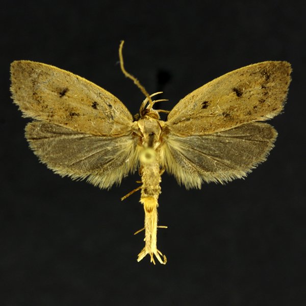
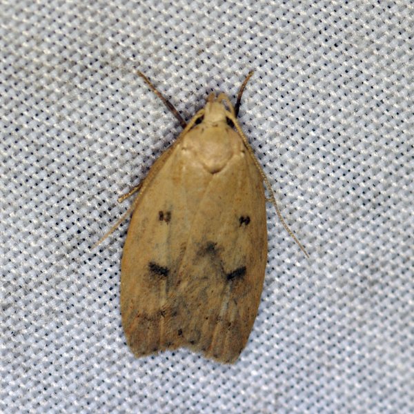
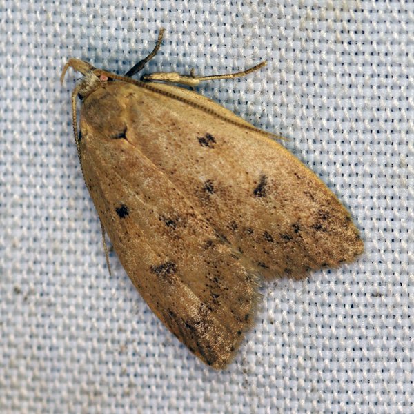
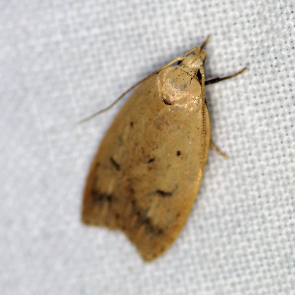
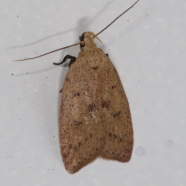
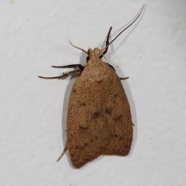
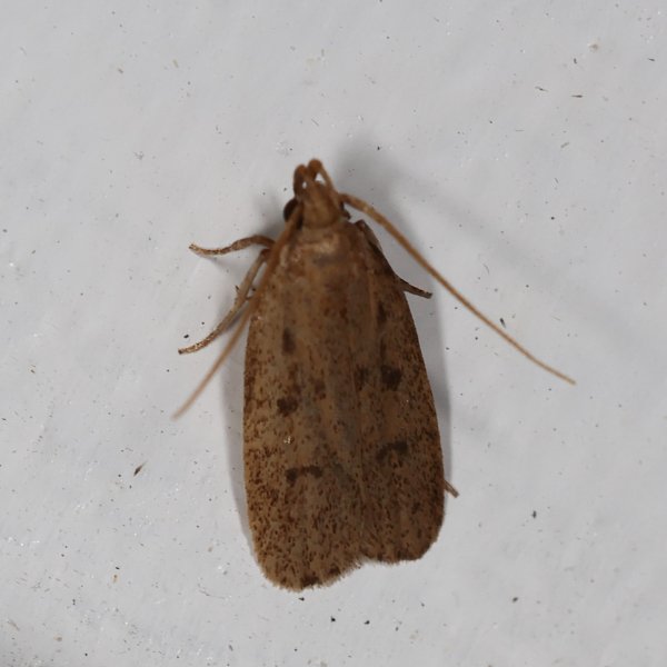
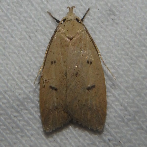
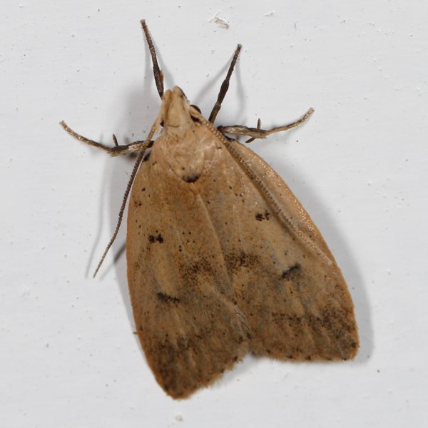
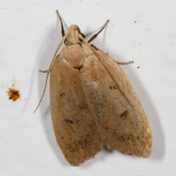
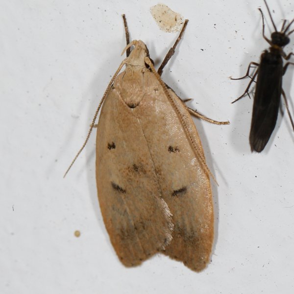
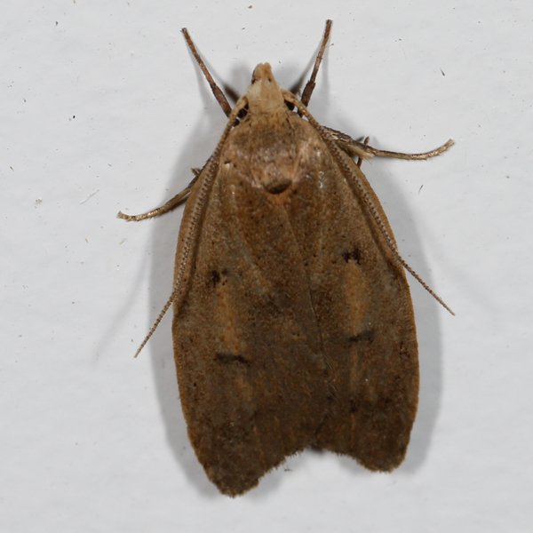
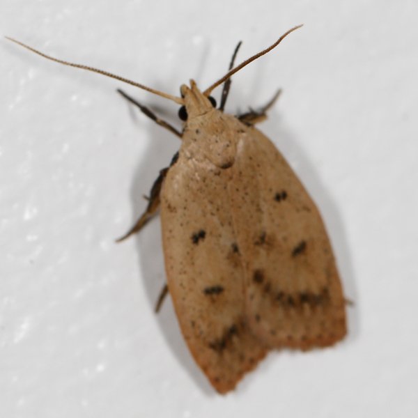
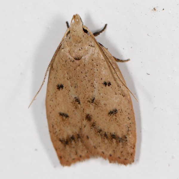
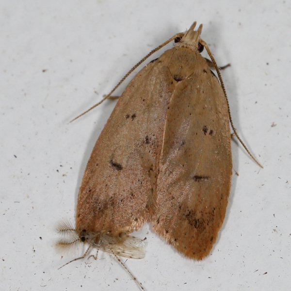
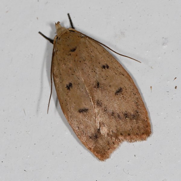
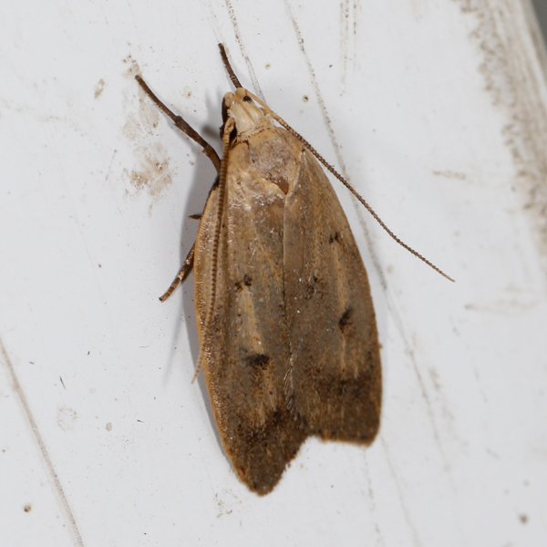
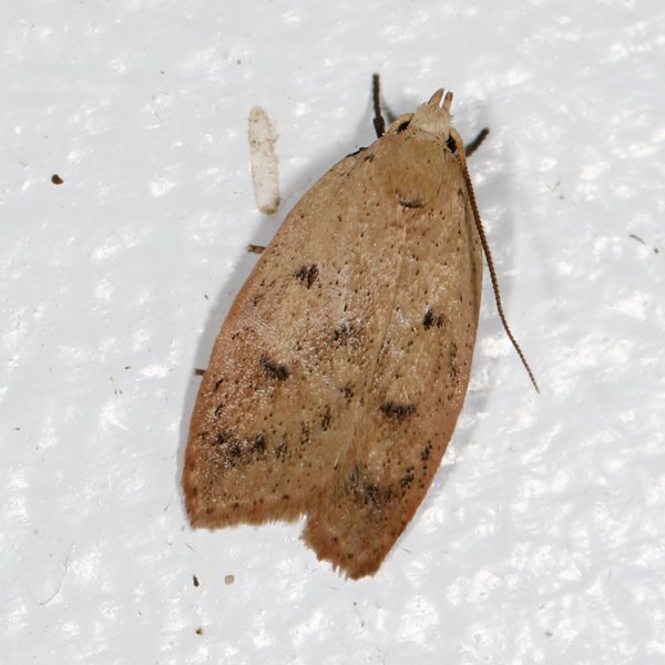
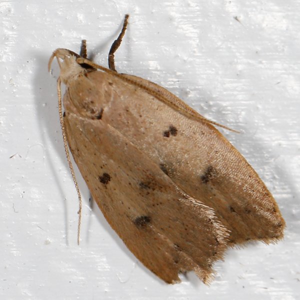
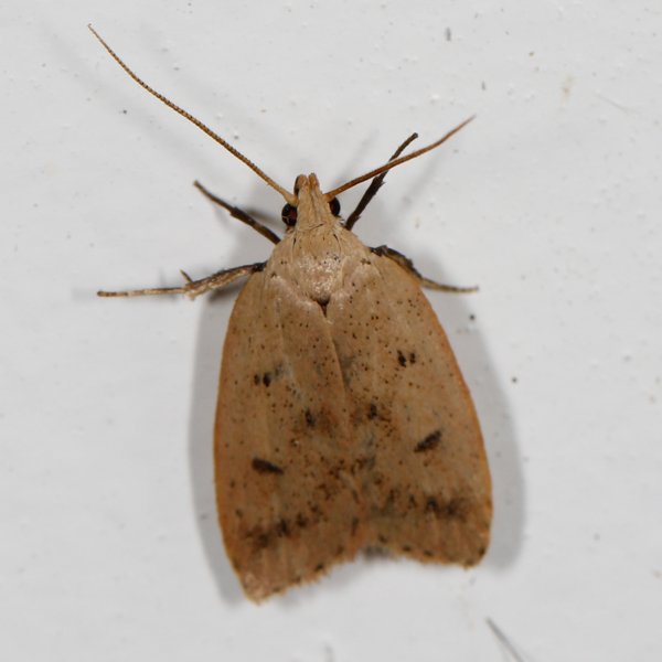
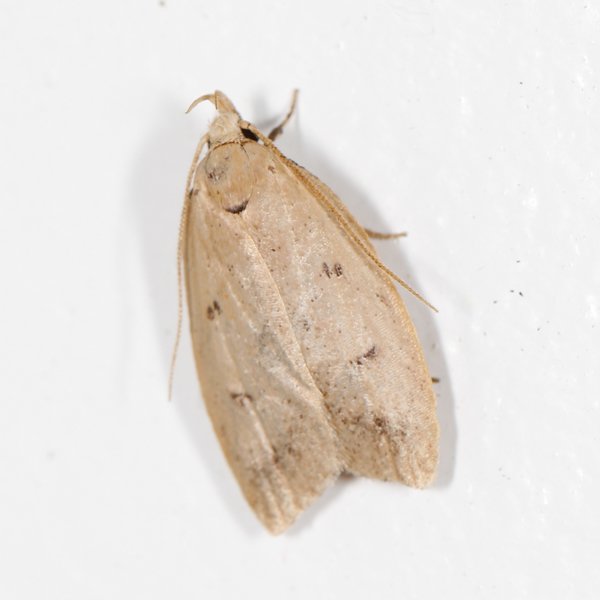
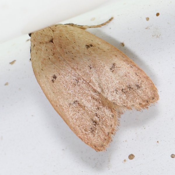
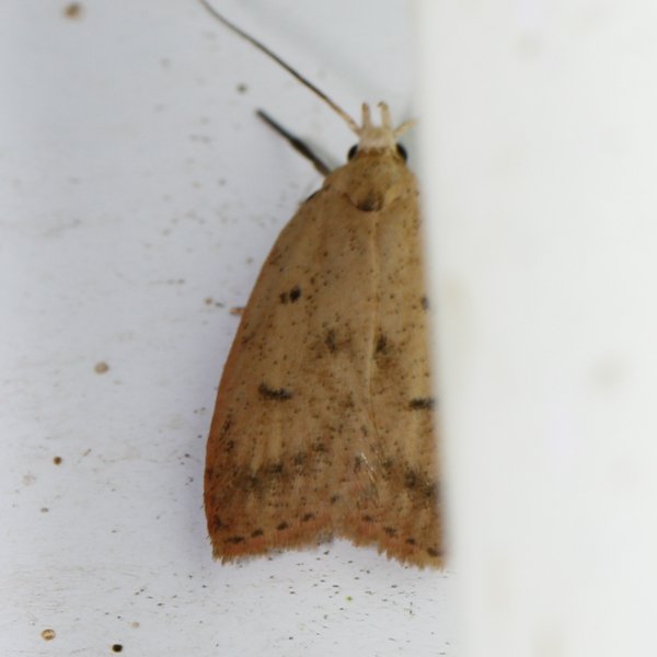
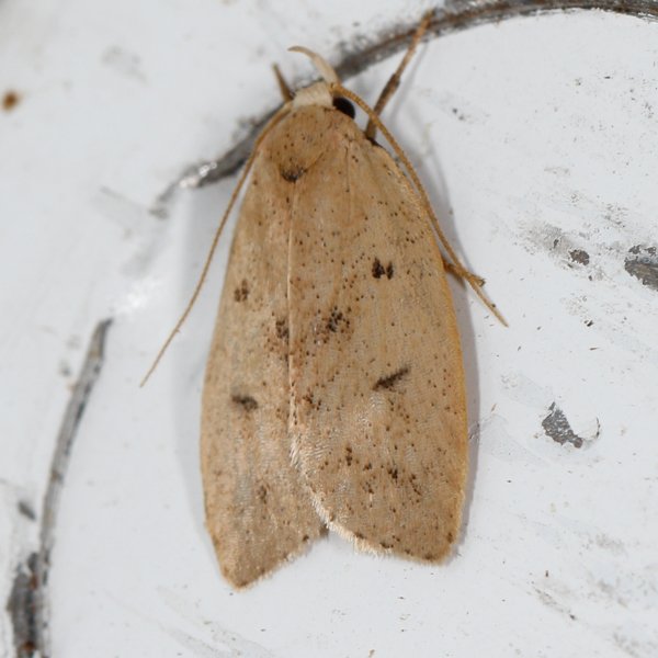
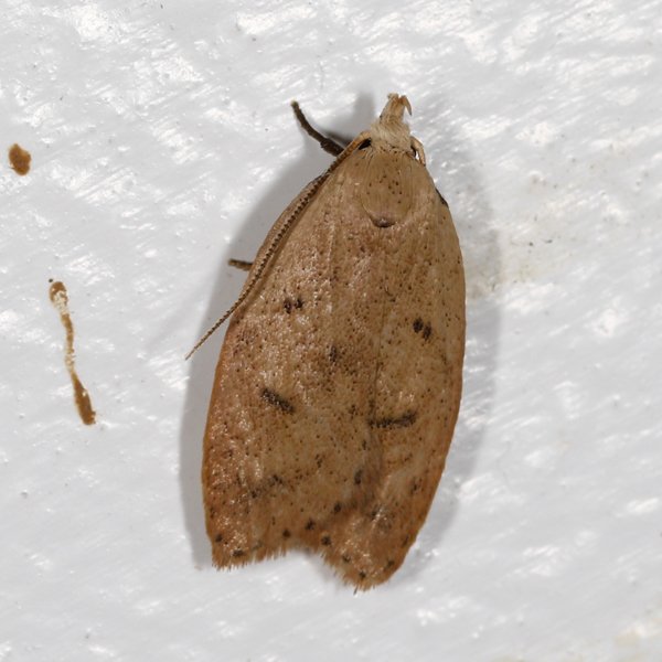
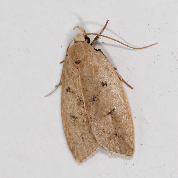
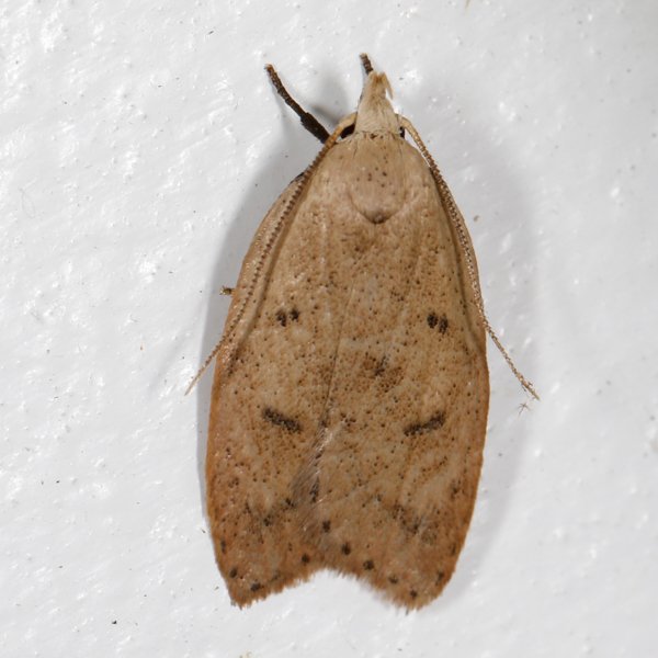
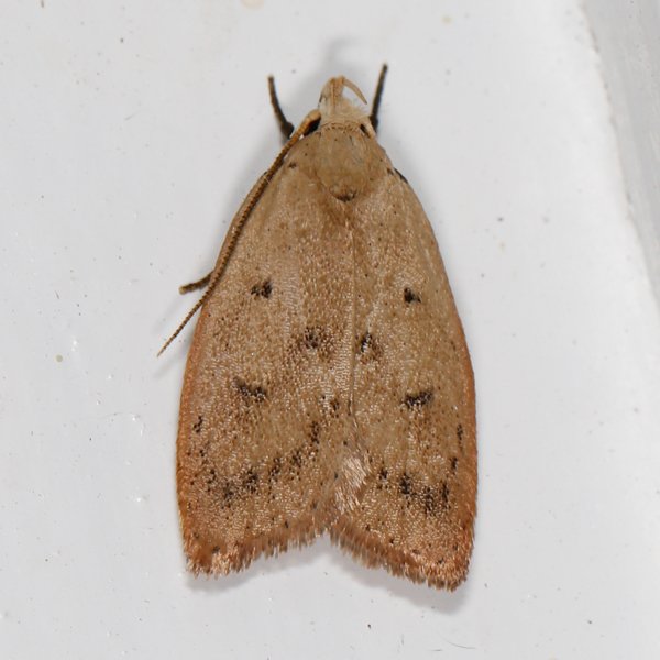
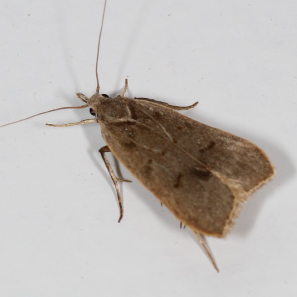
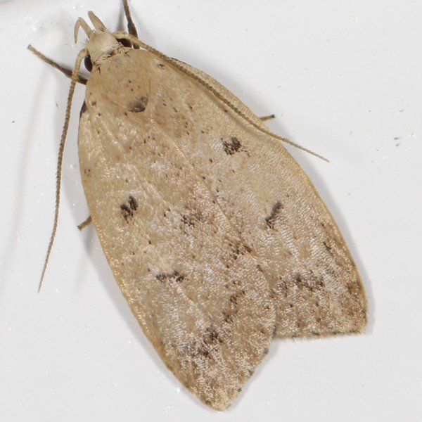
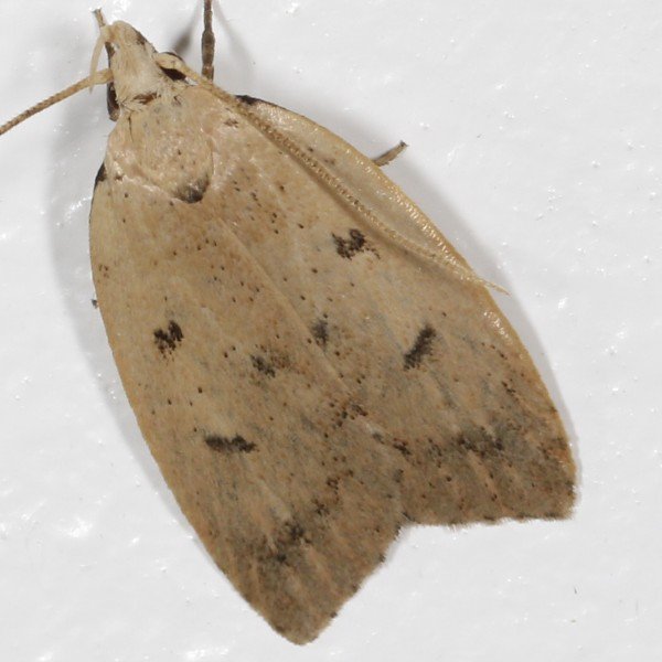
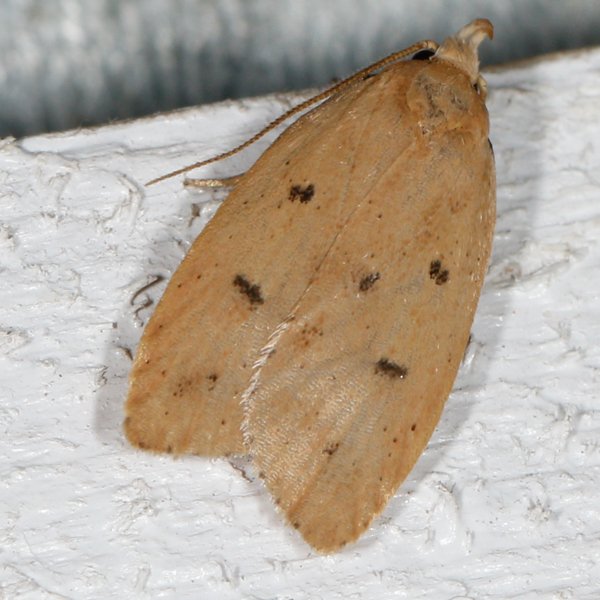
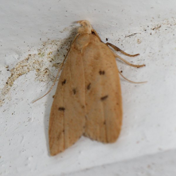
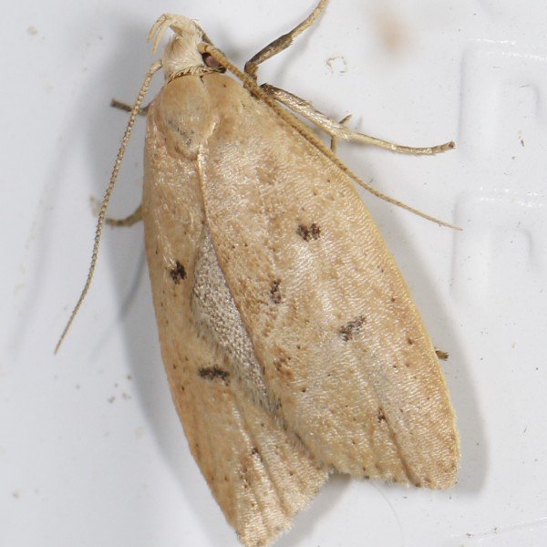
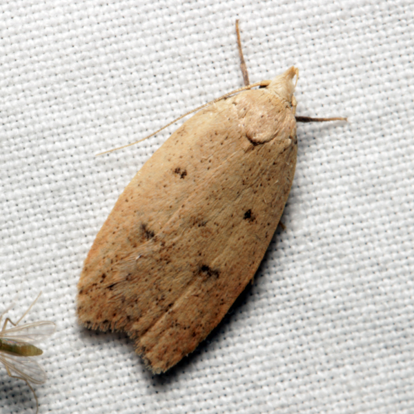
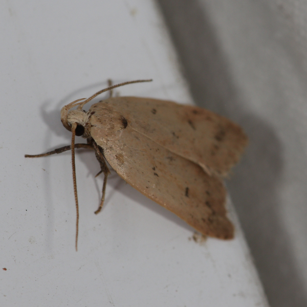
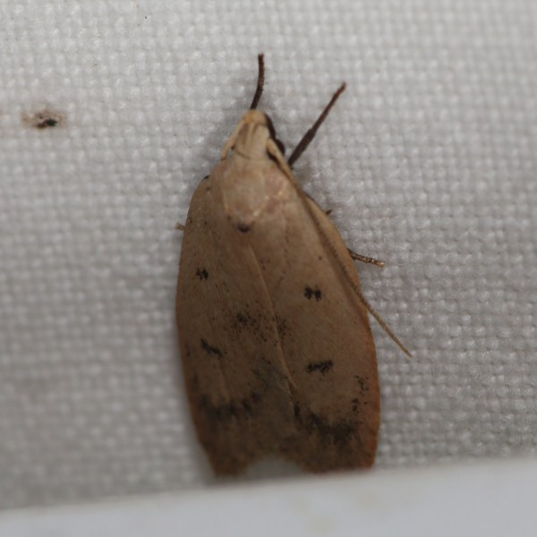
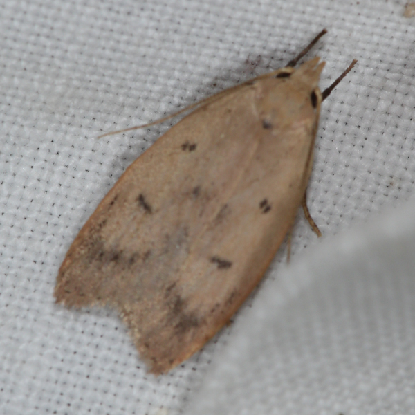
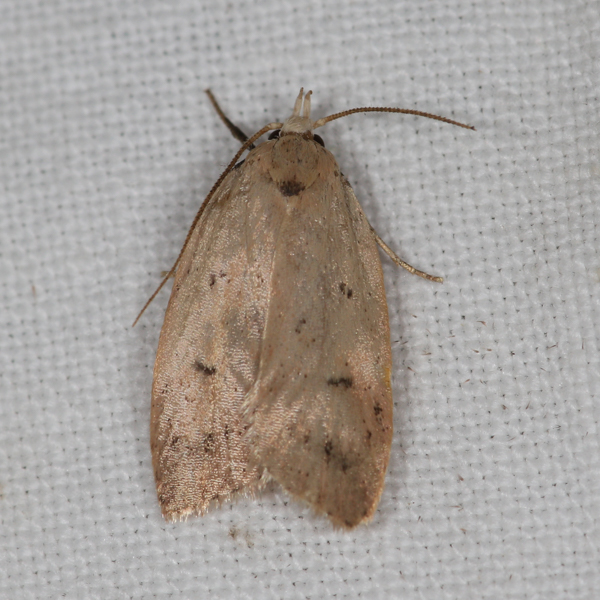
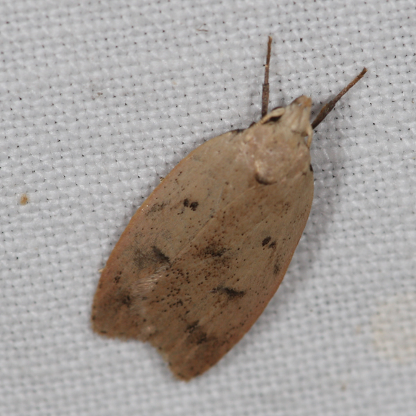
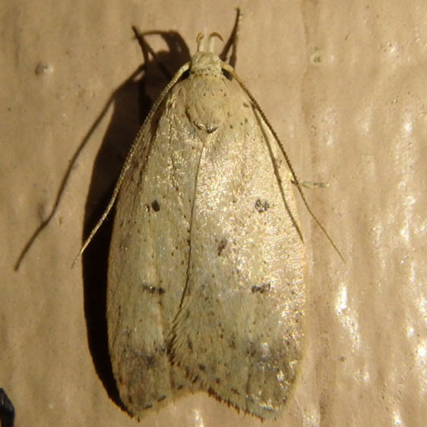
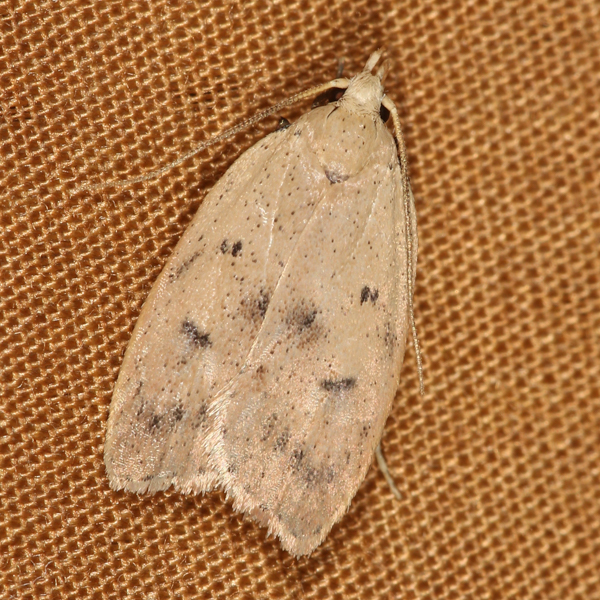
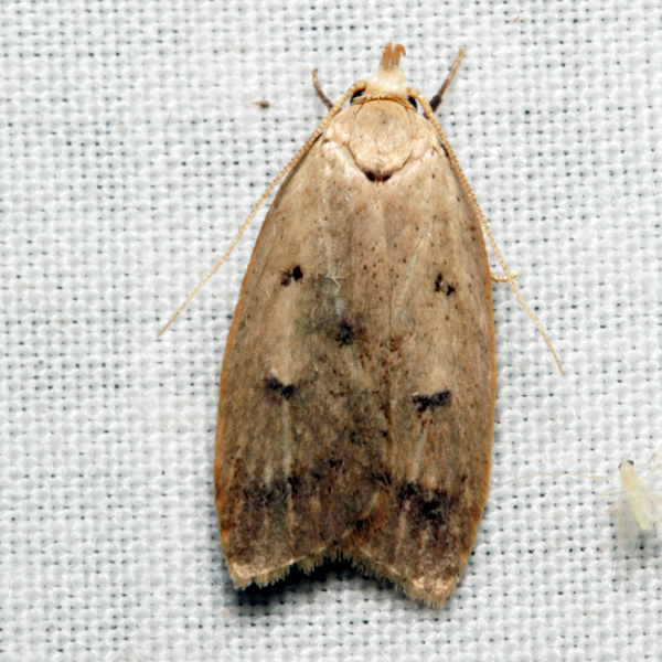
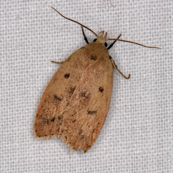
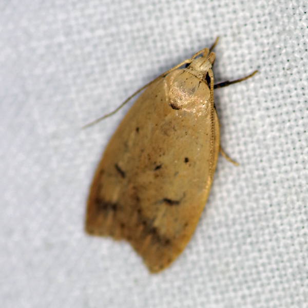
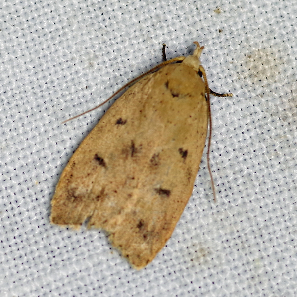
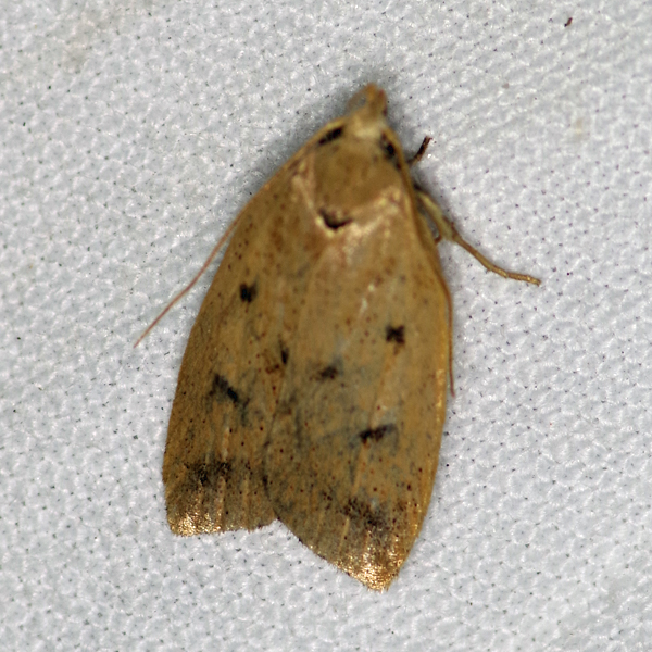
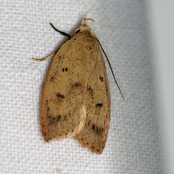
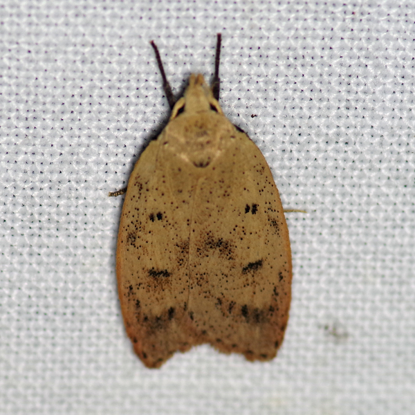
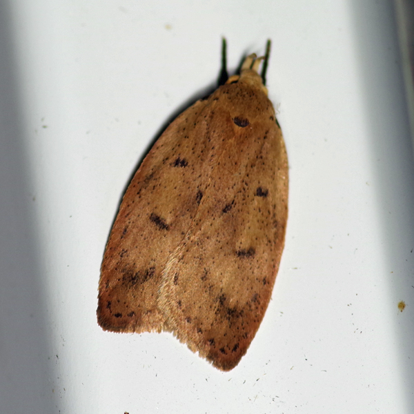
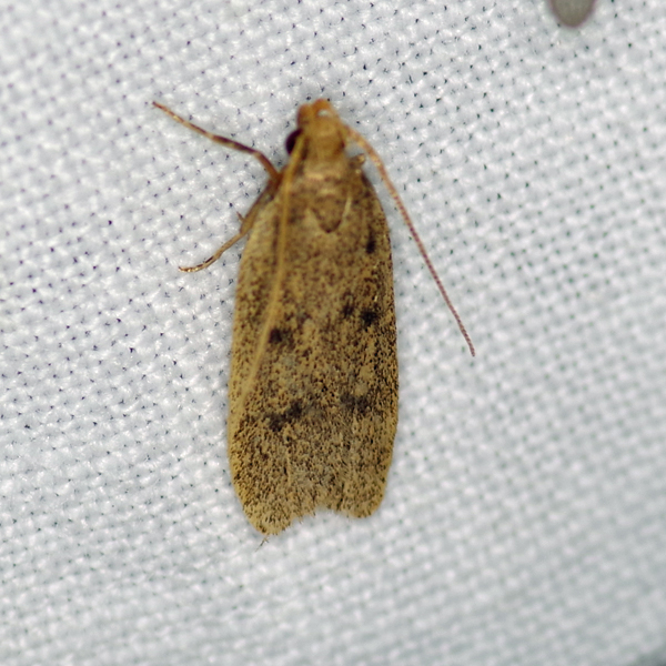
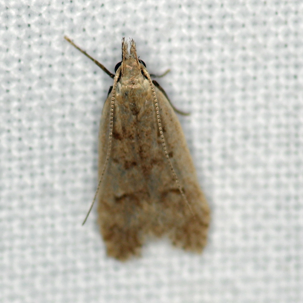
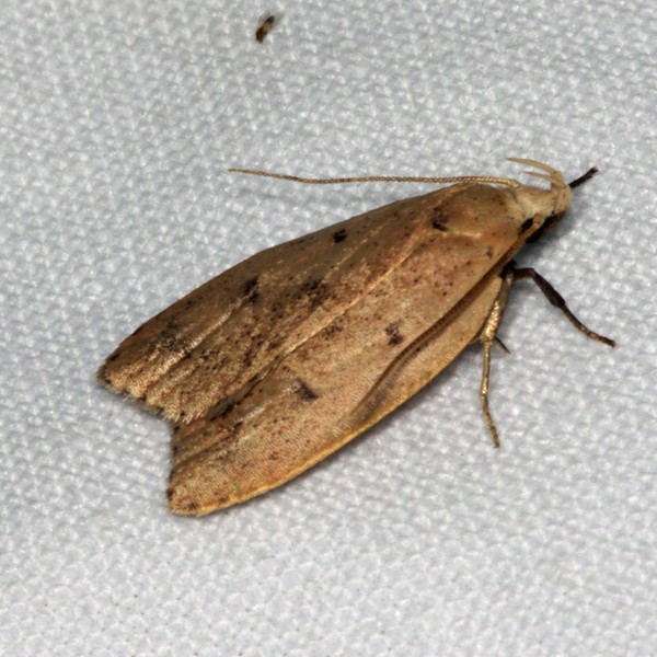
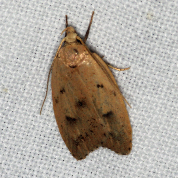
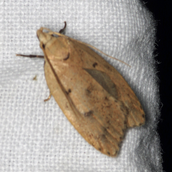
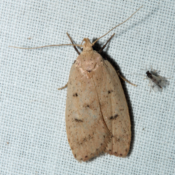
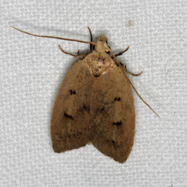
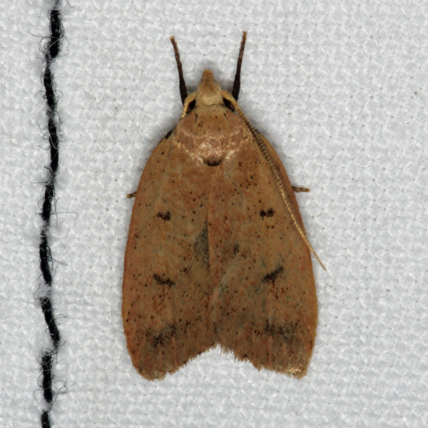
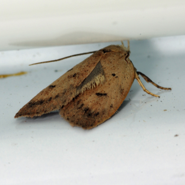
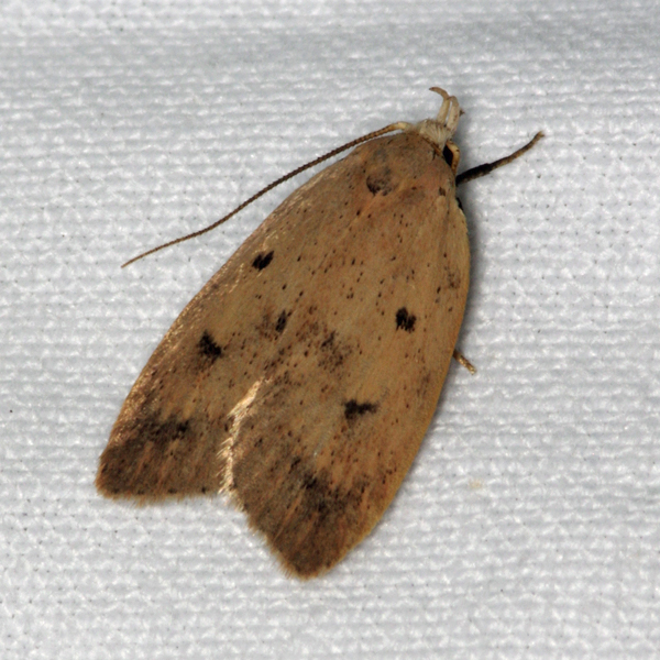
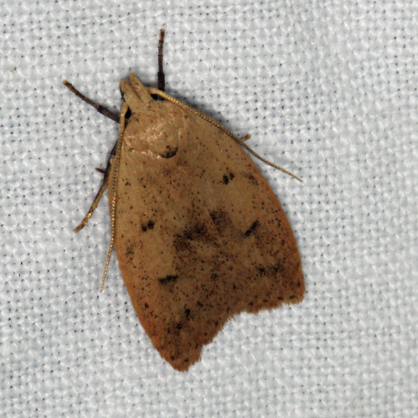
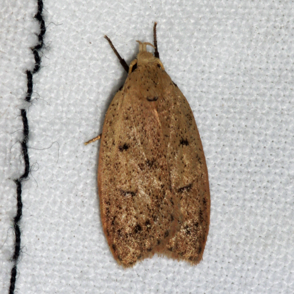
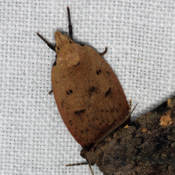
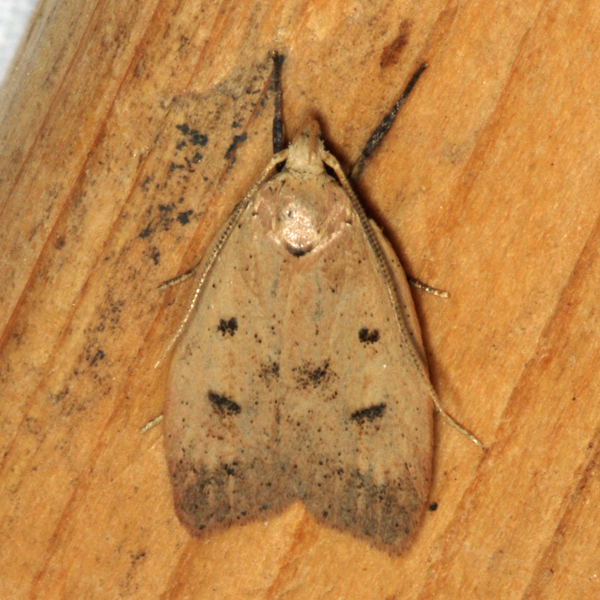
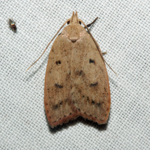
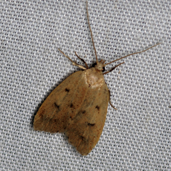
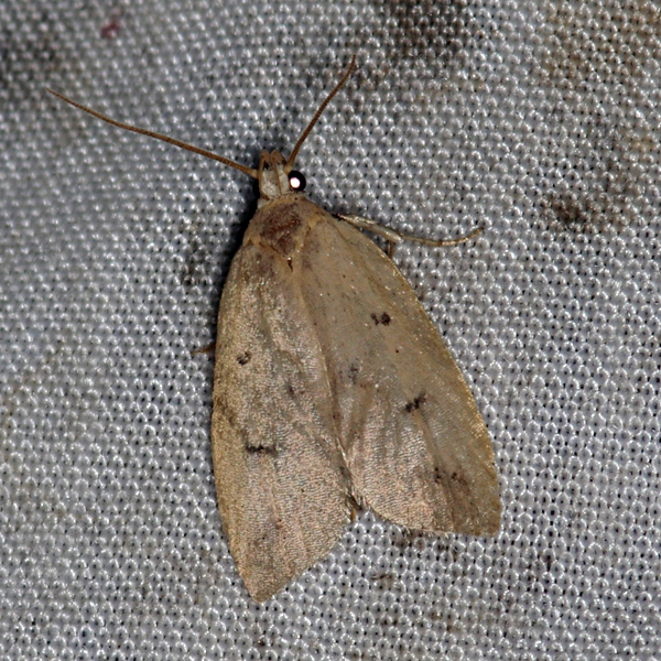
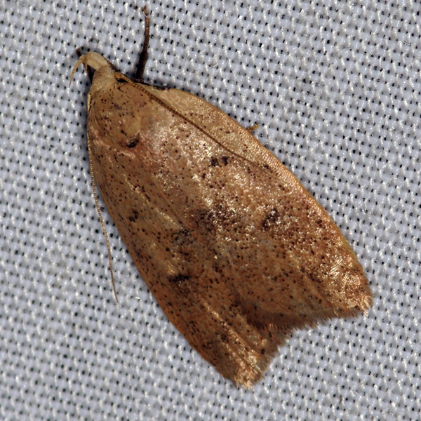
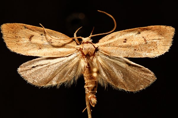
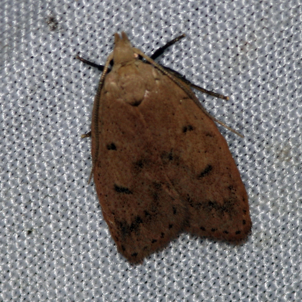
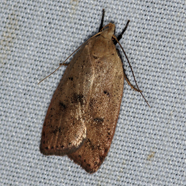
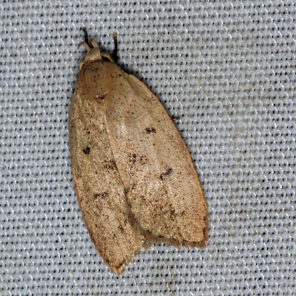
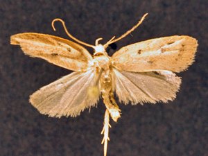
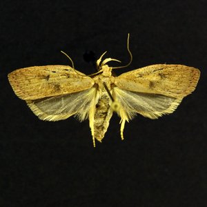
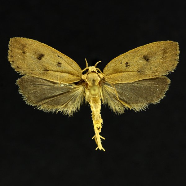
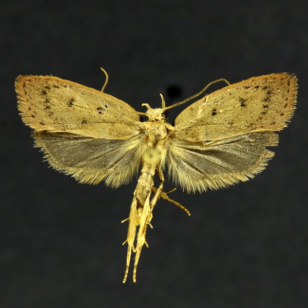
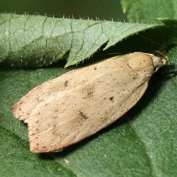
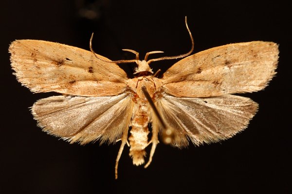
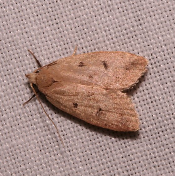
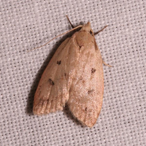
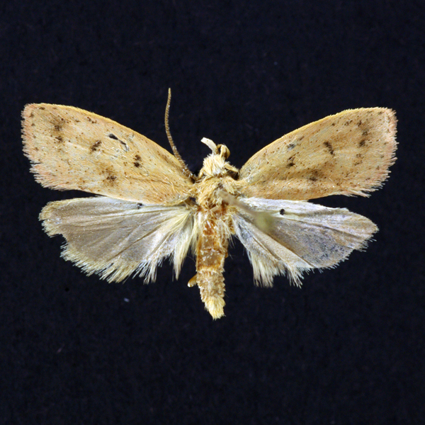
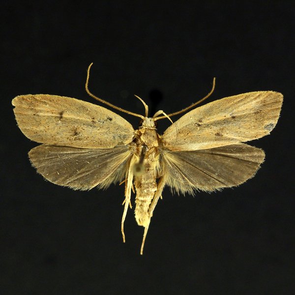
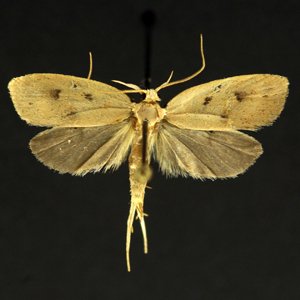
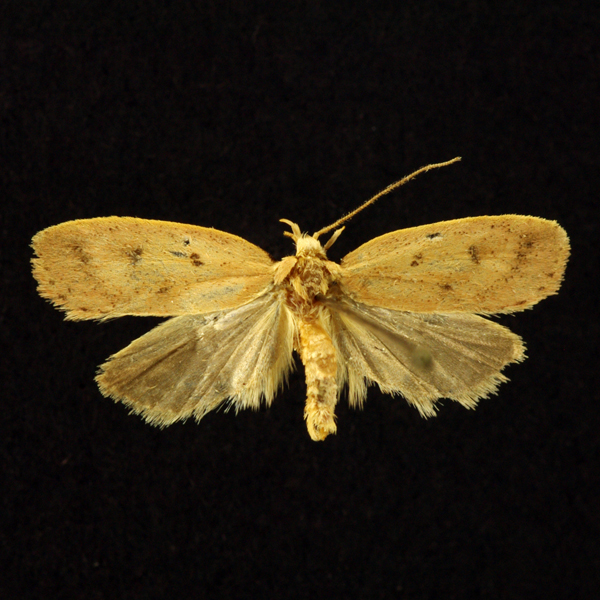
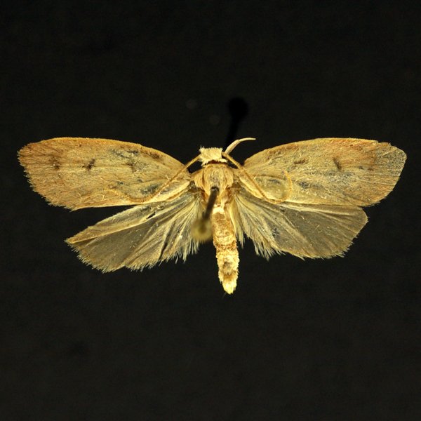
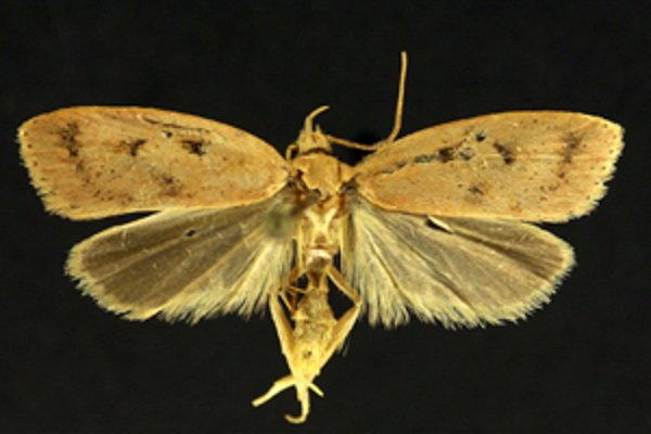
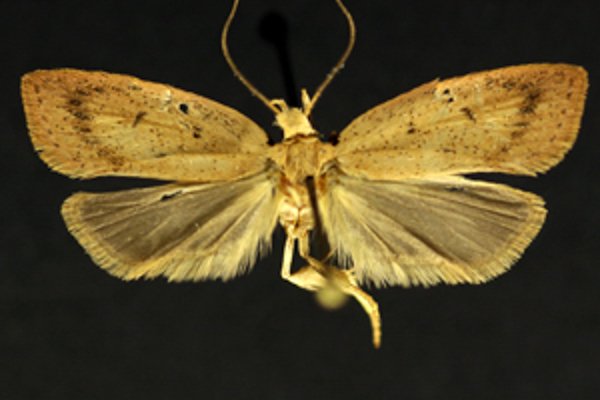
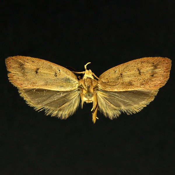
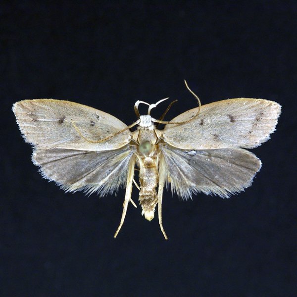
Gold-striped Leaftier Moth (Machimia tentoriferella), Clemens, 1860 - 951.000000 - 59a0257
Identification: Forewing yellowish gray to grayish brown. Note two sharp blackish dots in am. and reniform positions that form a triangle with more diffuse spot on inner margin. Diffuse pm. line usually present. Hindwing pale grayish brown.
Wing Span: 20 -26 mm.
Life History: Larva (Gold-striped Leaftier) rolls or ties leaves of food plant together.
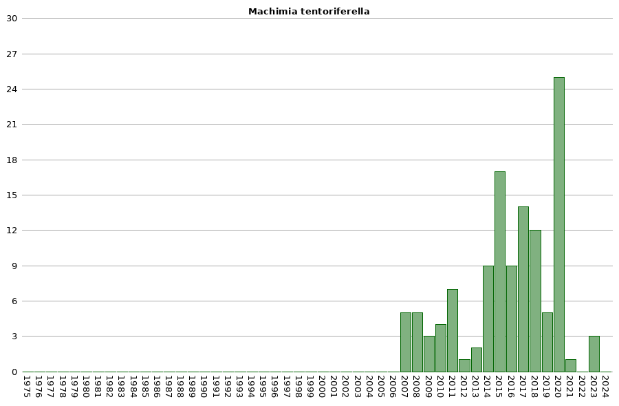
Flight: June - July.
Caterpillar Hosts: Ash, elms, maples, oaks, and many other trees.
Adult Food:
Habitat:
Range: Nova Scotia to Virginia, west to Iowa and Mississippi.
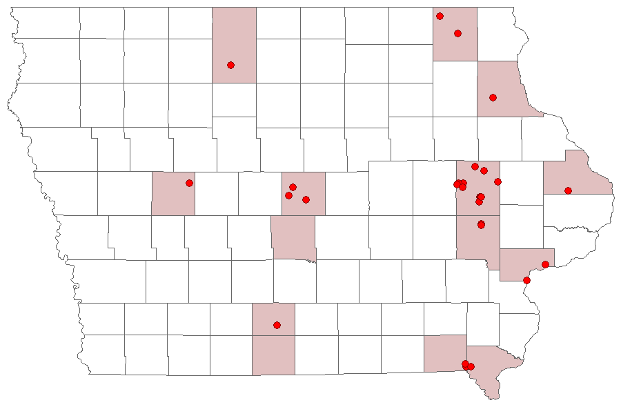
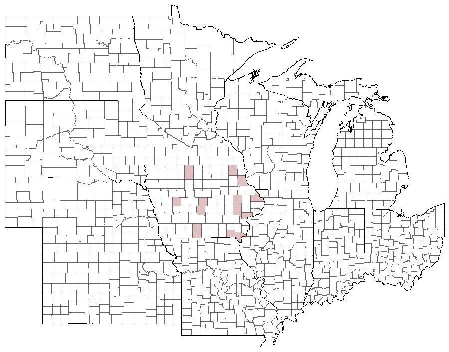

Photos


Records
| Record # | Date | Locale | State | Lat/Lon | Collected By | Count |
|---|---|---|---|---|---|---|
 341492 341492
|
2023-09-08 | Pinicon Ridge Park | Iowa | 42.21893755 -91.53818983 | Jim Durbin | 1 |
 341503 341503
|
2023-09-08 | Pinicon Ridge Park | Iowa | 42.21893755 -91.53818983 | Jim Durbin | 1 |
 338117 338117
|
2023-07-18 | Big Sand Mound Prairie Preserve, Muscatine County | Iowa | 41.34026787 -91.08103262 | Jim Durbin | 1 |
 296193 296193
|
2021-09-06 | Johnson County, Iowa | Iowa | Location Protected | Mark Brown | 1 |
 272233 272233
|
2020-09-24 | Shimek State Forest, Donnellson Unit | Iowa | 40.6445938 -91.67428614 | Jim Durbin | 1 |
 272256 272256
|
2020-09-24 | Shimek State Forest, Donnellson Unit | Iowa | 40.6445938 -91.67428614 | Jim Durbin | 1 |
 272271 272271
|
2020-09-24 | Shimek State Forest, Donnellson Unit | Iowa | 40.6445938 -91.67428614 | Jim Durbin | 1 |
 272272 272272
|
2020-09-24 | Shimek State Forest, Donnellson Unit | Iowa | 40.6445938 -91.67428614 | Jim Durbin | 1 |
 272068 272068
|
2020-09-22 | Shimek State Forest, Farmington Unit | Iowa | 40.66548334 -91.73626721 | Jim Durbin | 1 |
 272069 272069
|
2020-09-22 | Shimek State Forest, Farmington Unit | Iowa | 40.66548334 -91.73626721 | Jim Durbin | 1 |
 272074 272074
|
2020-09-22 | Shimek State Forest, Farmington Unit | Iowa | 40.66548334 -91.73626721 | Jim Durbin | 1 |
 272086 272086
|
2020-09-22 | Shimek State Forest, Farmington Unit | Iowa | 40.66548334 -91.73626721 | Jim Durbin | 1 |
 272127 272127
|
2020-09-22 | Shimek State Forest, Farmington Unit | Iowa | 40.66548334 -91.73626721 | Jim Durbin | 1 |
 272132 272132
|
2020-09-22 | Shimek State Forest, Farmington Unit | Iowa | 40.66548334 -91.73626721 | Jim Durbin | 1 |
 272034 272034
|
2020-09-16 | Hitaga Sand Ridge Prairie Preserve | Iowa | 42.25083834 -91.63212487 | Jim Durbin | 1 |
 272037 272037
|
2020-09-16 | Hitaga Sand Ridge Prairie Preserve | Iowa | 42.25083834 -91.63212487 | Jim Durbin | 1 |
 271436 271436
|
2020-09-14 | Wickiup Hill Outdoor Learning Area | Iowa | 42.08735192 -91.76707176 | Jim Durbin | 1 |
 271520 271520
|
2020-09-14 | Wickiup Hill Outdoor Learning Area | Iowa | 42.08735192 -91.76707176 | Jim Durbin | 1 |
 271549 271549
|
2020-09-14 | Wickiup Hill Outdoor Learning Area | Iowa | 42.08735192 -91.76707176 | Jim Durbin | 1 |
 282353 282353
|
2020-09-06 | Johnson County, Iowa | Iowa | Location Protected | Mark Brown | 1 |
 271316 271316
|
2020-09-05 | Hertz Family Woods and Nature Preserve | Iowa | 41.98899391 -93.44316226 | Jim Durbin | 1 |
 271357 271357
|
2020-09-05 | Hertz Family Woods and Nature Preserve | Iowa | 41.98899391 -93.44316226 | Jim Durbin | 1 |
 270984 270984
|
2020-09-02 | Matsell Bridge Natural Area | Iowa | 42.13215415 -91.38528784 | Jim Durbin | 1 |
 271036 271036
|
2020-09-02 | Matsell Bridge Natural Area | Iowa | 42.13215415 -91.38528784 | Jim Durbin | 1 |
 271038 271038
|
2020-09-02 | Matsell Bridge Natural Area | Iowa | 42.13215415 -91.38528784 | Jim Durbin | 1 |
 271058 271058
|
2020-09-02 | Matsell Bridge Natural Area | Iowa | 42.13215415 -91.38528784 | Jim Durbin | 1 |
 271075 271075
|
2020-09-02 | Matsell Bridge Natural Area | Iowa | 42.13215415 -91.38528784 | Jim Durbin | 1 |
 270851 270851
|
2020-08-29 | Hitaga Sand Ridge Prairie Preserve | Iowa | 42.25085584 -91.63207192 | Jim Durbin | 1 |
 266904 266904
|
2020-06-12 | Hitaga Sand Ridge Prairie Preserve | Iowa | 42.2508675 -91.63209427 | Jim Durbin | 1 |
 238032 238032
|
2019-09-05 | Wickiup Hill Outdoor Learning Area | Iowa | 42.087352 -91.767107 | Jim Durbin | 1 |
 238065 238065
|
2019-09-05 | Wickiup Hill Outdoor Learning Area | Iowa | 42.087352 -91.767107 | Jim Durbin | 1 |
 238139 238139
|
2019-09-05 | Wickiup Hill Outdoor Learning Area | Iowa | 42.087352 -91.767107 | Jim Durbin | 1 |
 238181 238181
|
2019-09-05 | Wickiup Hill Outdoor Learning Area | Iowa | 42.087352 -91.767107 | Jim Durbin | 1 |
 238182 238182
|
2019-09-05 | Wickiup Hill Outdoor Learning Area | Iowa | 42.087352 -91.767107 | Jim Durbin | 1 |
 221845 221845
|
2018-09-15 | 100 Acre Wood-x | Iowa | 0 0 | MJ Hatfield | 1 |
 220150 220150
|
2018-09-11 | Hitaga Sand Ridge Prairie Preserve | Iowa | 42.25095 -91.63209 | Jim Durbin | 1 |
 220176 220176
|
2018-09-11 | Hitaga Sand Ridge Prairie Preserve | Iowa | 42.25095 -91.63209 | Jim Durbin | 1 |
 220187 220187
|
2018-09-11 | Hitaga Sand Ridge Prairie Preserve | Iowa | 42.25095 -91.63209 | Jim Durbin | 1 |
 220188 220188
|
2018-09-11 | Hitaga Sand Ridge Prairie Preserve | Iowa | 42.25095 -91.63209 | Jim Durbin | 1 |
 220199 220199
|
2018-09-11 | Hitaga Sand Ridge Prairie Preserve | Iowa | 42.25095 -91.63209 | Jim Durbin | 1 |
 220308 220308
|
2018-09-11 | Hitaga Sand Ridge Prairie Preserve | Iowa | 42.25095 -91.63209 | Jim Durbin | 1 |
| 223189 | 2018-09-11 | MacBride Nature Recreation Area | Iowa | 41.786729 -91.568057 | Mark Brown | 1 |
 227602 227602
|
2018-09-11 | MacBride Nature Recreation Area | Iowa | 41.786729 -91.568057 | Mark Brown | 1 |
 219696 219696
|
2018-09-08 | Wickiup Hill Outdoor Learning Area | Iowa | 42.087352 -91.767107 | Jim Durbin | 1 |
 219711 219711
|
2018-09-08 | Wickiup Hill Outdoor Learning Area | Iowa | 42.087352 -91.767107 | Jim Durbin | 1 |
 221512 221512
|
2018-09-02 | 100 Acre Wood-x | Iowa | 0 0 | MJ Hatfield | 1 |
| 196331 | 2017-09-14 | Hitaga Sand Ridge Prairie Preserve | Iowa | 42.250957 -91.632098 | Jim Durbin | 1 |
| 196343 | 2017-09-14 | Hitaga Sand Ridge Prairie Preserve | Iowa | 42.250957 -91.632098 | Jim Durbin | 1 |
| 196344 | 2017-09-14 | Hitaga Sand Ridge Prairie Preserve | Iowa | 42.250957 -91.632098 | Jim Durbin | 1 |
| 196368 | 2017-09-14 | Hitaga Sand Ridge Prairie Preserve | Iowa | 42.250957 -91.632098 | Jim Durbin | 1 |
| 196376 | 2017-09-14 | Hitaga Sand Ridge Prairie Preserve | Iowa | 42.250957 -91.632098 | Jim Durbin | 1 |
| 196377 | 2017-09-14 | Hitaga Sand Ridge Prairie Preserve | Iowa | 42.250957 -91.632098 | Jim Durbin | 1 |
| 196423 | 2017-09-14 | Hitaga Sand Ridge Prairie Preserve | Iowa | 42.250957 -91.632098 | Jim Durbin | 1 |
| 196448 | 2017-09-14 | Hitaga Sand Ridge Prairie Preserve | Iowa | 42.250957 -91.632098 | Jim Durbin | 1 |
| 196452 | 2017-09-14 | Hitaga Sand Ridge Prairie Preserve | Iowa | 42.250957 -91.632098 | Jim Durbin | 1 |
| 196464 | 2017-09-14 | Hitaga Sand Ridge Prairie Preserve | Iowa | 42.250957 -91.632098 | Jim Durbin | 1 |
 208244 208244
|
2017-09-13 | 100 Acre Wood-x | Iowa | 0 0 | MJ Hatfield | 1 |
 202663 202663
|
2017-09-09 | Lake MacBride State Park | Iowa | 41.7939 -91.56601 | Mark Brown | 1 |
| 199237 | 2017-09-03 | Ambrose A. Call State Park | Iowa | 43.0517 -94.2498 | Matt Kenne | 1 |
 196198 196198
|
2017-08-30 | Hitaga Sand Ridge Prairie Preserve | Iowa | 42.250957 -91.632098 | Jim Durbin | 1 |
 176765 176765
|
2016-09-17 | Hitaga Sand Ridge Prairie Preserve | Iowa | 42.250957 -91.632098 | Jim Durbin | 1 |
 176363 176363
|
2016-09-11 | Hitaga Sand Ridge Prairie Preserve | Iowa | 42.250957 -91.632098 | Jim Durbin | 1 |
 176314 176314
|
2016-09-05 | Hitaga Sand Ridge Prairie Preserve | Iowa | 42.250957 -91.632098 | Jim Durbin | 1 |
 176040 176040
|
2016-08-31 | Wanatee County Park | Iowa | 42.010091 -91.566619 | Jim Durbin | 1 |
 176052 176052
|
2016-08-31 | Wanatee County Park | Iowa | 42.010091 -91.566619 | Jim Durbin | 1 |
 176053 176053
|
2016-08-31 | Wanatee County Park | Iowa | 42.010091 -91.566619 | Jim Durbin | 1 |
 170681 170681
|
2016-06-21 | Decatur County, Iowa | Iowa | Location Protected | Jim Durbin | 1 |
 171860 171860
|
2016-06-18 | Decatur County, Iowa | Iowa | Location Protected | Jim Durbin | 1 |
| 184358 | 2016-06-18 | Decatur County, Iowa | Iowa | Location Protected | Jim Durbin | 1 |
 130610 130610
|
2015-09-15 | Indian Creek Nature Center | Iowa | 41.968932 -91.586884 | Jim Durbin | 1 |
 130666 130666
|
2015-09-15 | Indian Creek Nature Center | Iowa | 41.968932 -91.586884 | Jim Durbin | 1 |
 130667 130667
|
2015-09-15 | Indian Creek Nature Center | Iowa | 41.968932 -91.586884 | Jim Durbin | 1 |
 147971 147971
|
2015-09-14 | 100 Acre Wood-x | Iowa | 0 0 | MJ Hatfield | 1 |
 130508 130508
|
2015-09-11 | Prairie Creek Recreation Area | Iowa | 42.061802 -90.63811 | Jim Durbin | 1 |
 130511 130511
|
2015-09-11 | Prairie Creek Recreation Area | Iowa | 42.061802 -90.63811 | Jim Durbin | 1 |
 130378 130378
|
2015-09-07 | Wanatee County Park | Iowa | 42.01026 -91.57381 | Jim Durbin | 1 |
 130380 130380
|
2015-09-07 | Wanatee County Park | Iowa | 42.01026 -91.57381 | Jim Durbin | 1 |
 130431 130431
|
2015-09-07 | Wanatee County Park | Iowa | 42.01026 -91.57381 | Jim Durbin | 1 |
 130432 130432
|
2015-09-07 | Wanatee County Park | Iowa | 42.01026 -91.57381 | Jim Durbin | 1 |
 130468 130468
|
2015-09-07 | Wanatee County Park | Iowa | 42.01026 -91.57381 | Jim Durbin | 1 |
 130032 130032
|
2015-09-03 | Matsell Bridge Natural Area | Iowa | 42.131959 -91.388307 | Jim Durbin | 1 |
 130115 130115
|
2015-09-03 | Matsell Bridge Natural Area | Iowa | 42.131959 -91.388307 | Jim Durbin | 1 |
 130124 130124
|
2015-09-03 | Matsell Bridge Natural Area | Iowa | 42.131959 -91.388307 | Jim Durbin | 1 |
| 148097 | 2015-09-03 | Plymouth Rock-x | Iowa | 0 0 | MJ Hatfield | 1 |
 129836 129836
|
2015-09-01 | Indian Creek Nature Center | Iowa | 41.968932 -91.586884 | Jim Durbin | 1 |
 147866 147866
|
2015-08-30 | 100 Acre Wood-x | Iowa | 0 0 | MJ Hatfield | 1 |
 65477 65477
|
2014-09-19 | Pleasant Creek State Recreation Area, Linn County | Iowa | 42.110327 -91.822988 | Jim Durbin | 1 |
 65490 65490
|
2014-09-19 | Pleasant Creek State Recreation Area, Linn County | Iowa | 42.110327 -91.822988 | Jim Durbin | 1 |
 65566 65566
|
2014-09-19 | Pleasant Creek State Recreation Area, Linn County | Iowa | 42.110327 -91.822988 | Jim Durbin | 1 |
 109095 109095
|
2014-09-18 | Pleasant Creek State Recreation Area, Linn County | Iowa | 42.110327 -91.822988 | Frank Olsen | 1 |
 65265 65265
|
2014-09-07 | Pleasant Creek State Recreation Area, Linn County | Iowa | 42.110327 -91.822988 | Jim Durbin | 1 |
 65287 65287
|
2014-09-07 | Pleasant Creek State Recreation Area, Linn County | Iowa | 42.110327 -91.822988 | Jim Durbin | 1 |
 65292 65292
|
2014-09-07 | Pleasant Creek State Recreation Area, Linn County | Iowa | 42.110327 -91.822988 | Jim Durbin | 1 |
 65293 65293
|
2014-09-07 | Pleasant Creek State Recreation Area, Linn County | Iowa | 42.110327 -91.822988 | Jim Durbin | 1 |
 65304 65304
|
2014-09-07 | Pleasant Creek State Recreation Area, Linn County | Iowa | 42.110327 -91.822988 | Jim Durbin | 1 |
 35135 35135
|
2013-10-01 | Wickiup Hill Outdoor Learning Area | Iowa | 42.08398 -91.7651 | Frank Olsen | 1 |
| 110487 | 2013-09-11 | Polk County, Iowa | Iowa | Location Protected | Aaron Brees | 1 |
 35134 35134
|
2012-10-03 | Shimek State Forest, Farmington Unit | Iowa | 40.64802 -91.7254 | Frank Olsen | 1 |
 35133 35133
|
2011-09-27 | Red Fern Timber | Iowa | 40.98317 -93.75317 | Frank Olsen | 1 |
 35132 35132
|
2011-09-19 | Twin Springs Park, Decorah, Trout | Iowa | 43.29639 -91.81667 | Frank Olsen | 1 |
 35128 35128
|
2011-09-11 | Wanatee County Park | Iowa | 42.0094 -91.56623 | Jim Durbin | 1 |
| 35129 | 2011-09-11 | Wanatee County Park | Iowa | 42.0094 -91.56623 | Jim Durbin | 1 |
 35130 35130
|
2011-09-11 | Wanatee County Park | Iowa | 42.0094 -91.56623 | Jim Durbin | 1 |
 35127 35127
|
2011-09-02 | Wanatee County Park | Iowa | 42.0094 -91.56623 | Jim Durbin | 1 |
 35126 35126
|
2011-08-26 | 100 Acre Wood-x | Iowa | 43.431848 -92.009353 | Jim Durbin | 1 |
 128957 128957
|
2010-09-09 | Dickson Timber County Park | Iowa | 42.117173 -94.690157 | Eileen Miller | 1 |
 35124 35124
|
2010-08-31 | Osborne Outdoor Education Center Park | Iowa | 42.79303 -91.4432 | Frank Olsen | 1 |
 35125 35125
|
2010-08-30 | 100 Acre Wood-x | Iowa | 0 0 | MJ Hatfield | 1 |
 35131 35131
|
2010-08-20 | 100 Acre Wood-x | Iowa | 0 0 | MJ Hatfield | 1 |
| 168220 | 2009-09-12 | Ames, Paul | Iowa | 42.02064 -93.62395 | Paul Martsching | 1 |
 133288 133288
|
2009-08-28 | Ames, Paul | Iowa | 42.02064 -93.623952 | Paul Martsching | 1 |
 35123 35123
|
2009-06-15 | 2505 Tullamore Lane, Ames | Iowa | 42.088653 -93.578813 | MJ Hatfield | 1 |
 35121 35121
|
2008-10-11 | Wildcat Den State Park | Iowa | 41.4705 -90.88228 | Frank Olsen | 1 |
 35120 35120
|
2008-09-25 | Behren's Pond Woodland State Preserve | Iowa | 42.118214 -91.754324 | Jim Durbin | 1 |
 35122 35122
|
2008-09-19 | Pleasant Creek State Recreation Area, Linn County | Iowa | 42.11952 -91.81215 | Frank Olsen | 1 |
 133289 133289
|
2008-09-13 | Ames, Paul | Iowa | 42.02064 -93.623952 | Paul Martsching | 1 |
| 168219 | 2008-08-25 | Ames, Paul | Iowa | 42.02064 -93.62395 | Paul Martsching | 1 |
 35119 35119
|
2007-10-16 | Leon's Farm, Ohio County | Kentucky | 37.42033 -86.77023 | Jim Durbin | 1 |
 235 235
|
2007-09-21 | Shimek State Forest, Farmington Unit | Iowa | 40.64802 -91.7254 | Frank Olsen | 1 |
 234 234
|
2007-08-27 | Wanatee County Park | Iowa | 42.00994 -91.57749 | Frank Olsen | 1 |
 35117 35117
|
2007-08-25 | Wanatee County Park | Iowa | 42.0094 -91.56623 | Jim Durbin | 1 |
 35118 35118
|
2007-08-25 | Wanatee County Park | Iowa | 42.0094 -91.56623 | Jim Durbin | 1 |