Wing span:
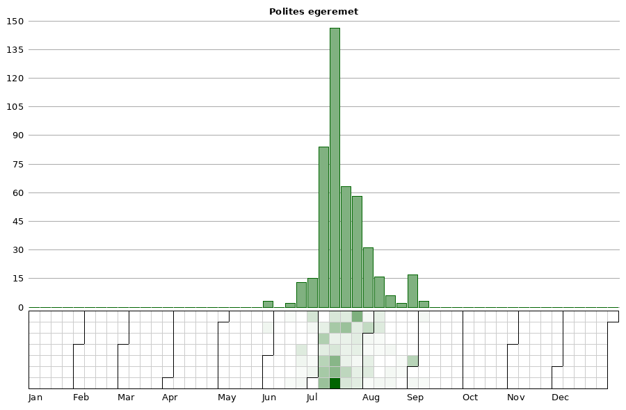
Flight time:Adults generally fly from the end of June to the first of August.
Status: Infrequent breeding resident.
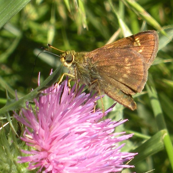
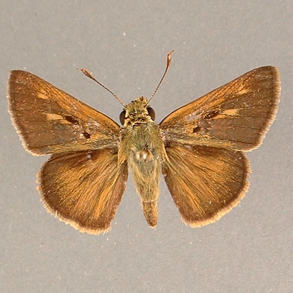
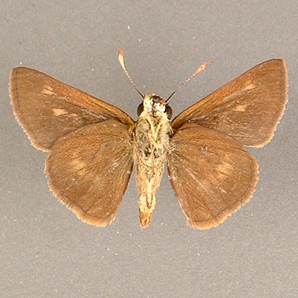
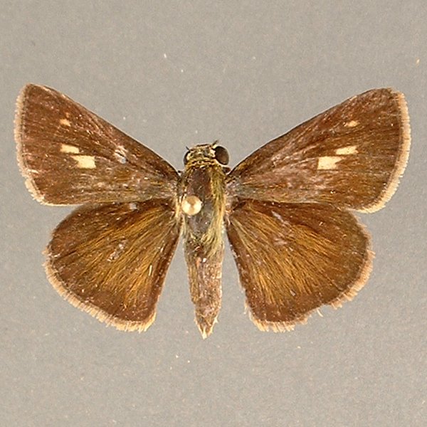
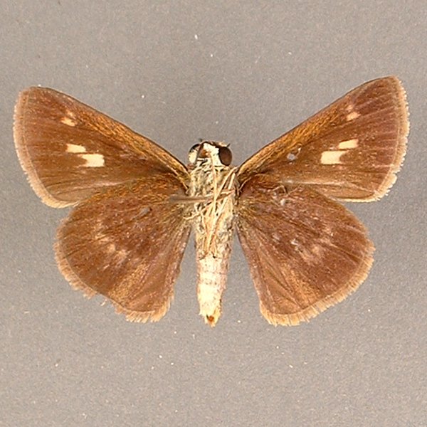
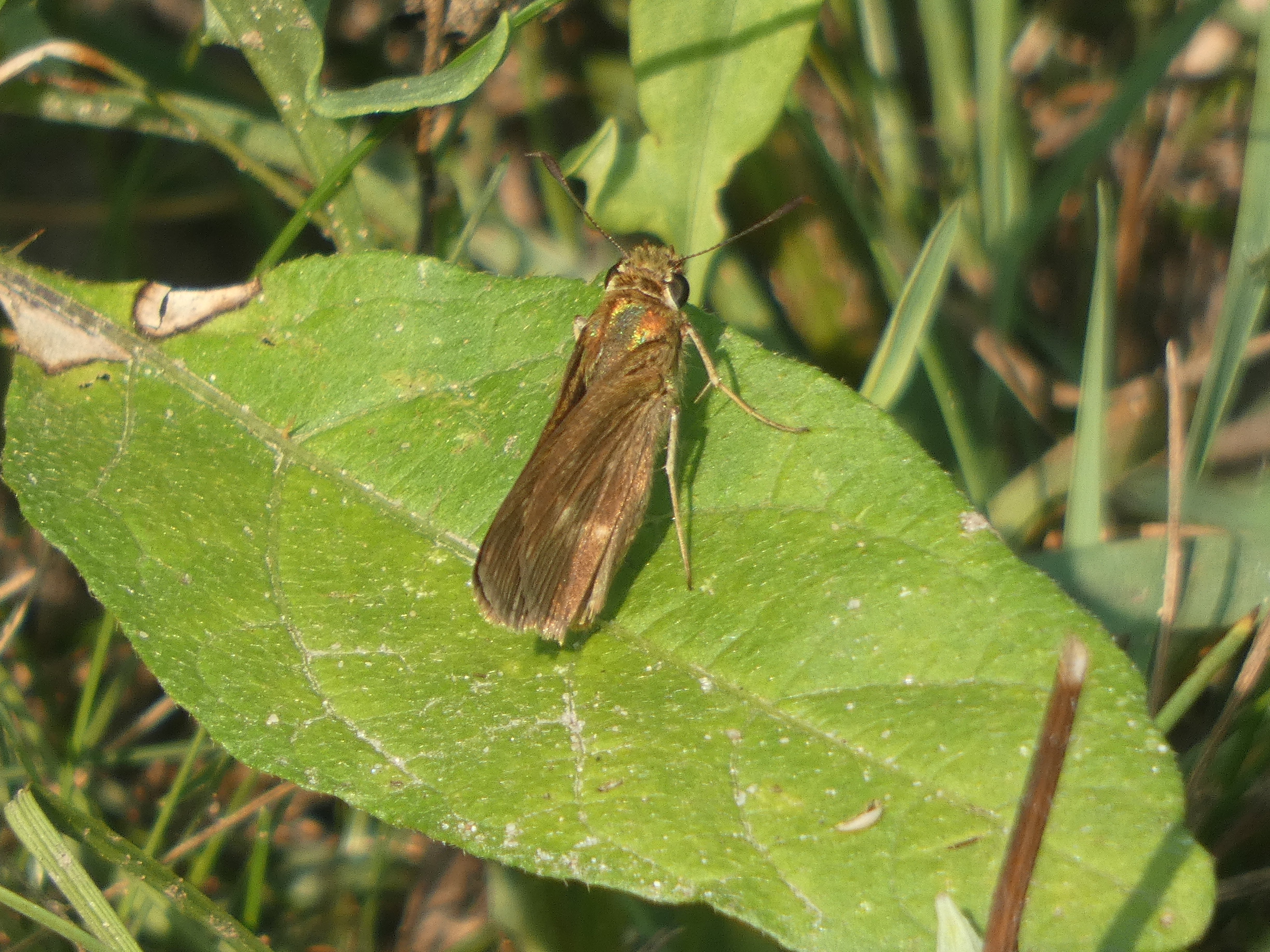
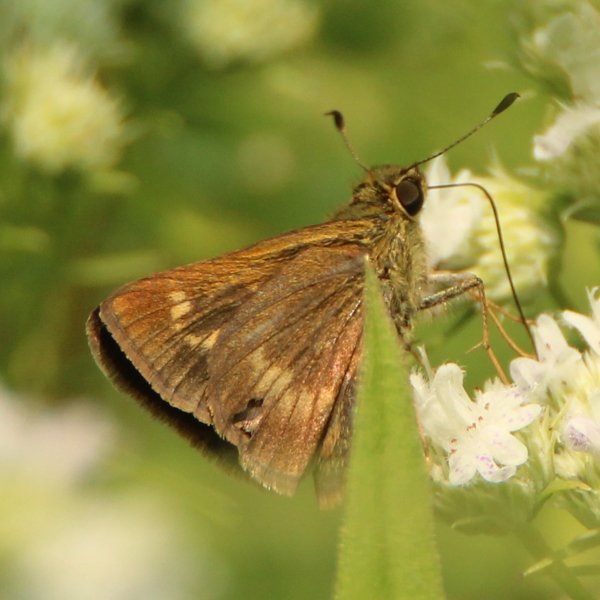
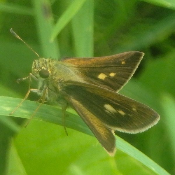
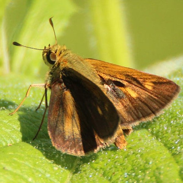
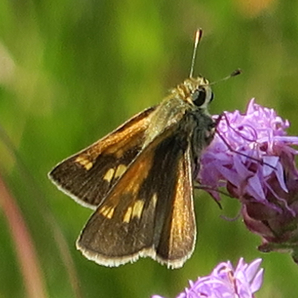
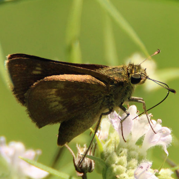
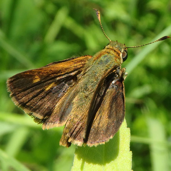
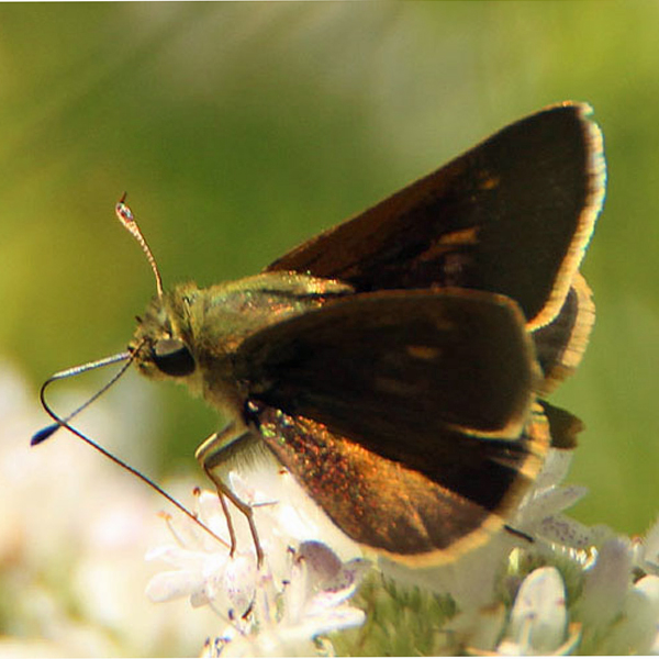
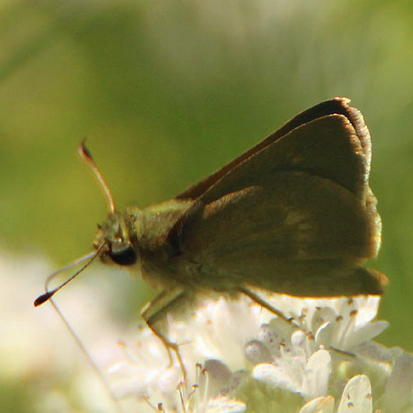
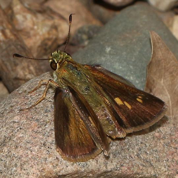
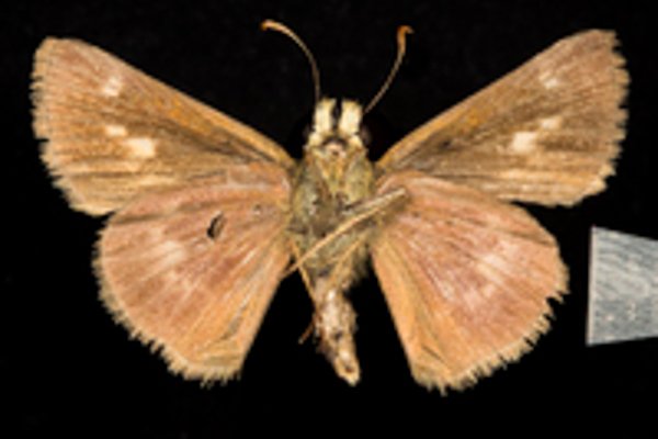
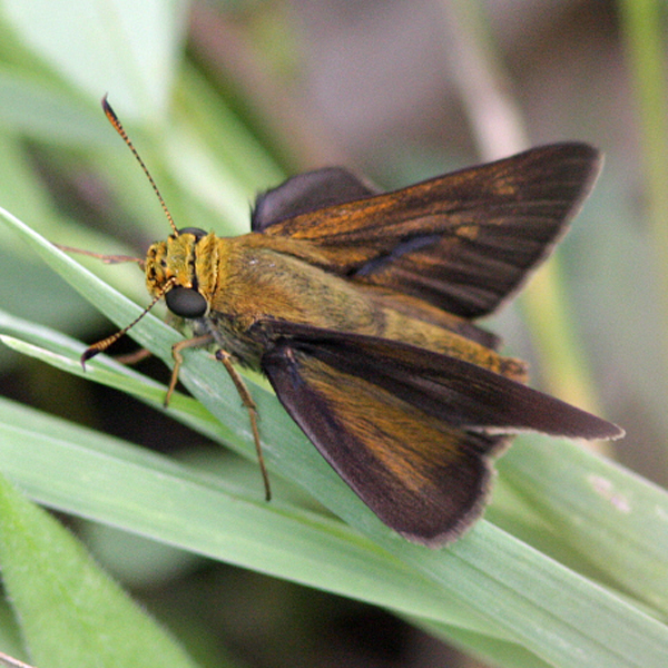
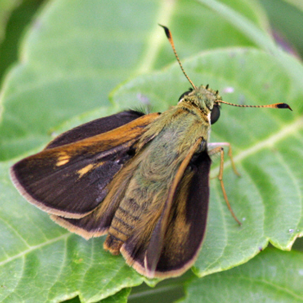
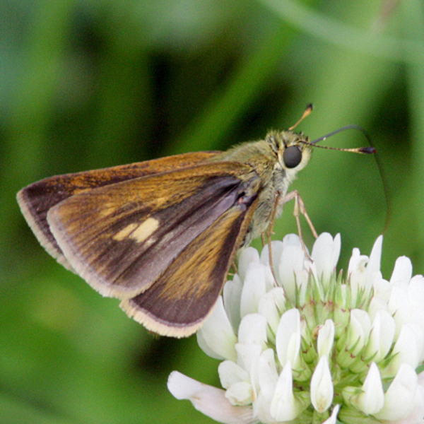
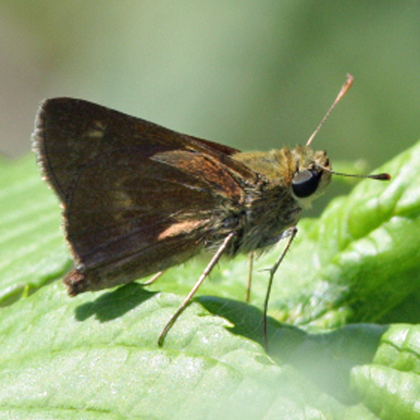
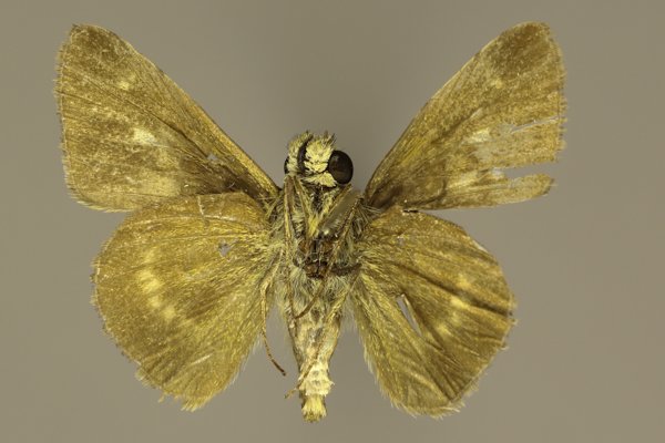
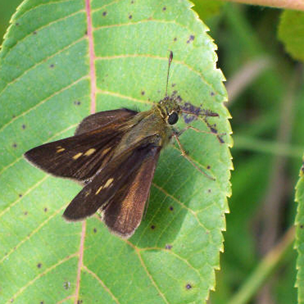
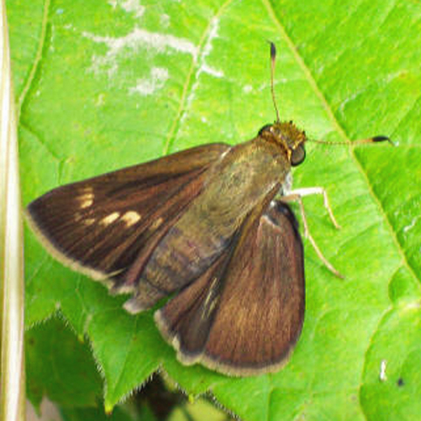
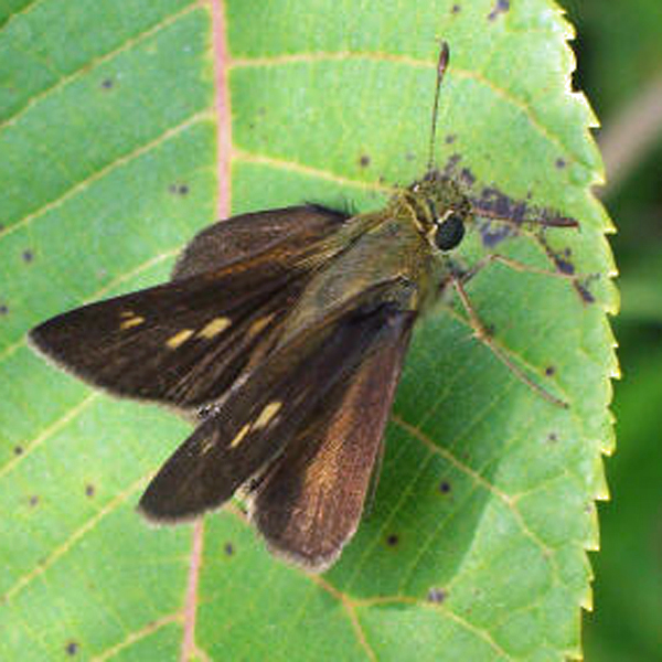
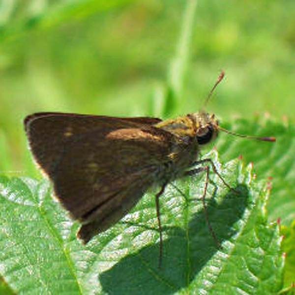
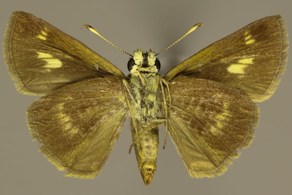
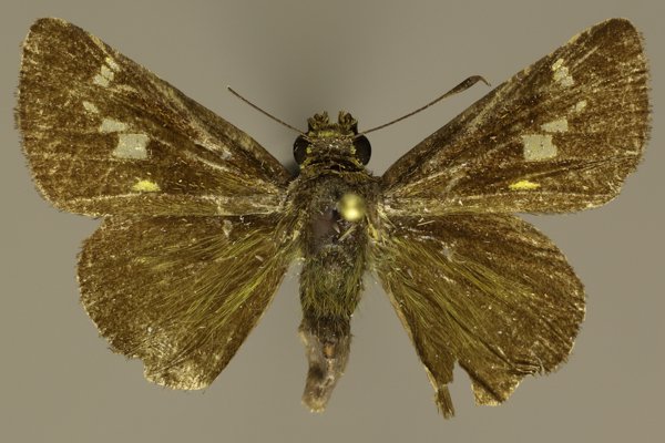
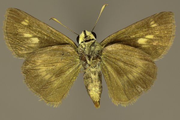
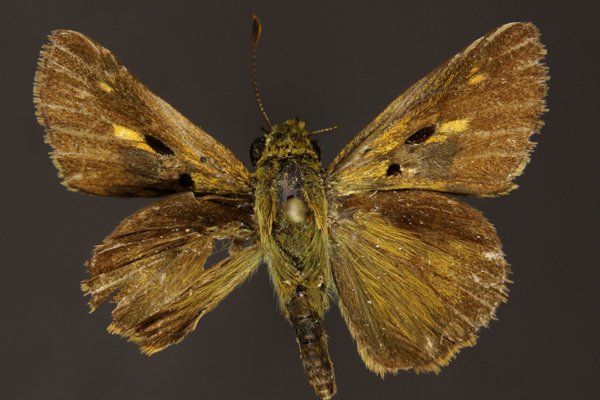
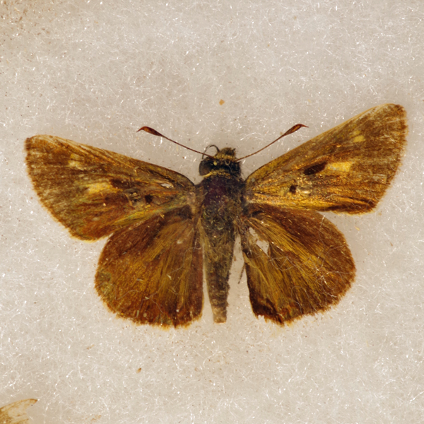
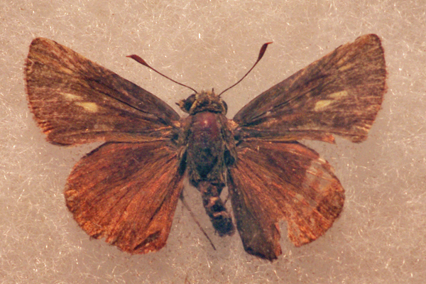
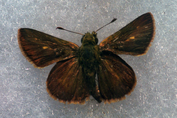
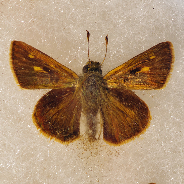
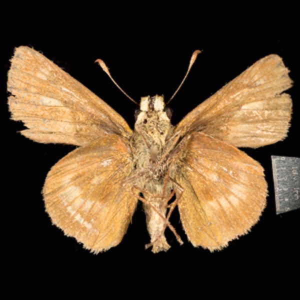
Distinguishing features: Males may be easily distinguished by their double stigma on the upper forewing. Females are very similar to female Euphyes ruricola and Pompeius verna, but may be distinguished by having orange spots on both the upper and lower wing surfaces.
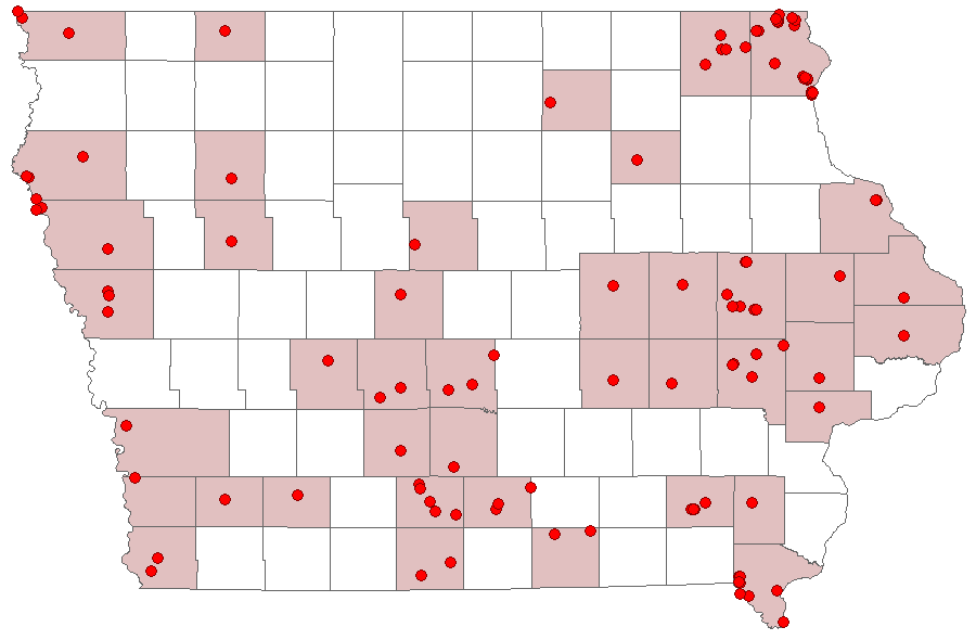
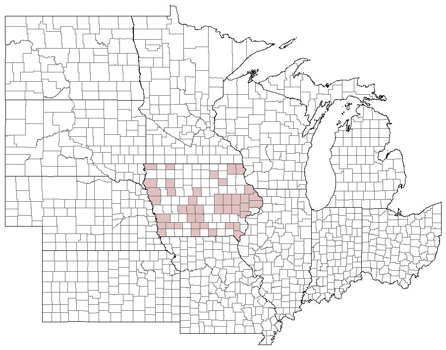
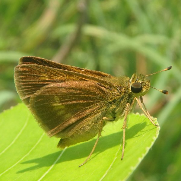
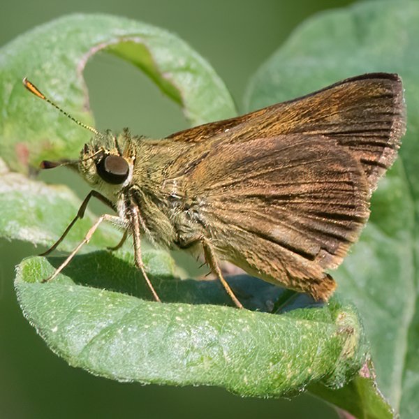
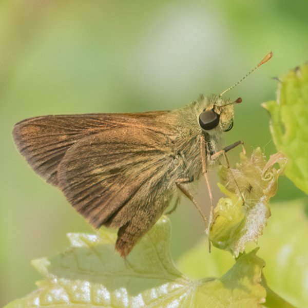
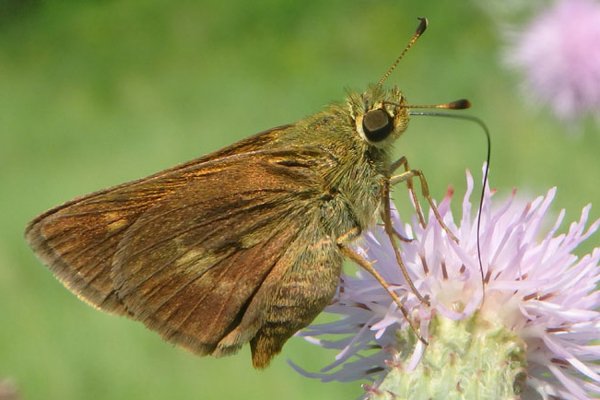
Distribution and habitat: Scattered records for this species occur throughout most of the state, although it has yet to be seen in the north-central counties. It occurs in a wide variety of habitats, ranging from fens and xeric prairie to forests. It is perhaps most often encountered in open areas adjacent to woodlands.
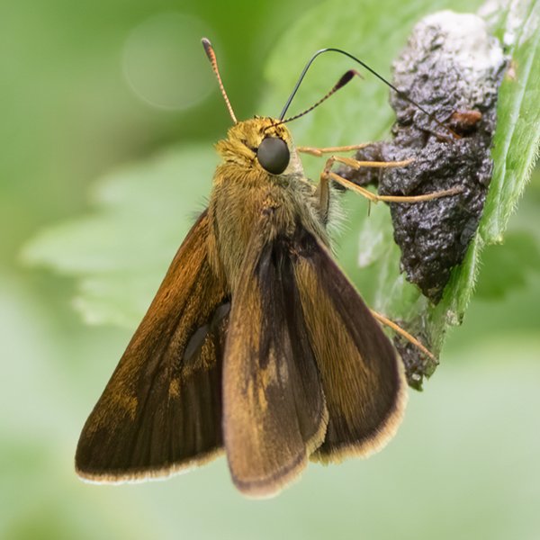
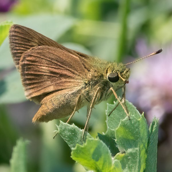
Natural History: While various grasses, including Panic Grass, have been listed as larval hosts in other states, the favored food plants have not been identified in Iowa. Given the wide range of habitats in which it has been found, it likely consumes a number of species.

| Record # | Date | Locale | State | Lat/Lon | Collected By | Count |
|---|---|---|---|---|---|---|
| 346952 | 2023-08-05 | Folsom Point Preserve | Iowa | 41.154432 -95.799393 | Jay Gilliam | 1 |
 345220 345220
|
2023-07-15 | Effigy Mounds National Monument | Iowa | 43.09084524 -91.18704508 | Mark Brown | 1 |
 347300 347300
|
2023-07-15 | Yellow River State Forest | Iowa | 43.17083738 -91.23674128 | Mark Brown | 1 |
| 349758 | 2023-07-15 | Effigy Mounds National Monument | IA | 43.100641 -91.183746 | Chris Edwards | 12 |
| 350290 | 2023-06-25 | Turkey Run Wildlife Area, Lee County | IA | 40.558402 -91.679173 | Chris Edwards | 1 |
| 346500 | 2023-06-11 | Chichaqua Bottoms- Clingan Grassland Unit | Iowa | 41.777616 -93.355846 | Jay Gilliam | 1 |
 318281 318281
|
2022-07-24 | Coyote Canyon Wildlife Area | Iowa | 41.099428 -93.858554 | Jay Gilliam | 1 |
| 331521 | 2022-07-23 | F. W. Kent Park | Iowa | 41.72916 -91.727161 | Chris Edwards | 3 |
| 330961 | 2022-07-16 | Jefferson County Park | Iowa | 40.989906 -91.990814 | IBSN | 1 |
| 318183 | 2022-07-09 | Effigy Mounds National Monument | Iowa | 43.101383 -91.187278 | Jay Gilliam | 1 |
| 331409 | 2022-07-09 | Effigy Mounds National Monument | Iowa | 43.100641 -91.183746 | Chris Edwards | 3 |
| 330960 | 2022-06-29 | Jefferson County Park | Iowa | 40.989906 -91.990814 | IBSN | 1 |
 318023 318023
|
2022-06-25 | Bell's Mill Park | Iowa | 42.339865 -93.891048 | Jay Gilliam | 1 |
| 330959 | 2022-06-21 | Cedar View Trail | Iowa | 40.99102 -92.005082 | IBSN | 1 |
 292195 292195
|
2021-08-01 | Ciha Fen Wildlife Preserve | Iowa | 41.829388 -91.381469 | Mark Madsen | 1 |
 295290 295290
|
2021-07-17 | Effigy Mounds National Monument | Iowa | 43.08725518 -91.18881336 | Mark Brown | 1 |
| 308261 | 2021-07-17 | Effigy Mounds National Monument | Iowa | 43.100641 -91.183746 | Chris Edwards | 2 |
 300740 300740
|
2021-07-16 | Slip Bluff County Park | Iowa | 40.652884 -93.847544 | Jay Gilliam | 1 |
| 306999 | 2021-07-10 | Jefferson County Park | Iowa | 40.989906 -91.990814 | IBSN | 1 |
 300667 300667
|
2021-07-03 | Clear Creek Fen | Iowa | 43.452358 -91.424706 | Jay Gilliam | 1 |
| 273909 | 2020-08-30 | Rand Park, Keokuk | Iowa | 40.4105556 -91.3811111 | Frank Olsen | 3 |
| 274114 | 2020-08-30 | Shimek State Forest, Croton Unit East | Iowa | 40.545472 -91.616246 | Frank Olsen | 2 |
| 274276 | 2020-08-30 | Shimek State Forest, Lick Creek Unit | Iowa | 40.618388 -91.680338 | Frank Olsen | 2 |
| 274443 | 2020-08-30 | Turkey Run Wildlife Area, Lee County | Iowa | 40.556414 -91.678161 | Frank Olsen | 8 |
| 273341 | 2020-08-01 | Heron Bend Conservation Area | Iowa | 40.5722222 -91.4244444 | Frank Olsen | 1 |
| 273983 | 2020-07-30 | Rock Island Botanical State Preserve | Iowa | 42.02732 -91.72723 | Frank Olsen | 1 |
| 286765 | 2020-07-22 | Cedar View Trail | Iowa | 40.990996 -92.004793 | IBSN | 1 |
| 286764 | 2020-07-13 | Jefferson County Park | Iowa | 40.990015 -91.986398 | IBSN | 3 |
 269495 269495
|
2020-07-12 | Effigy Mounds National Monument | Iowa | 43.100641 -91.183746 | Mark Brown | 1 |
| 273287 | 2020-07-12 | Effigy Mounds National Monument | Iowa | 43.100641 -91.183746 | Frank Olsen | 2 |
| 282091 | 2020-07-12 | Effigy Mounds National Monument | Iowa | 43.100641 -91.183746 | Chris Edwards | 6 |
| 282092 | 2020-07-12 | Yellow River State Forest | Iowa | 43.170603 -91.240395 | Chris Edwards | 1 |
| 286763 | 2020-07-12 | Cedar View Trail | Iowa | 40.990996 -92.004793 | IBSN | 1 |
| 274085 | 2020-07-10 | Shimek State Forest, Croton Unit East | Iowa | 40.545472 -91.616246 | Frank Olsen | 2 |
 279229 279229
|
2020-07-03 | Clear Creek Wildlife Management Area | Iowa | 43.449515 -91.42018 | Mark Brown | 1 |
 279239 279239
|
2020-07-03 | Clear Creek Wildlife Management Area | Iowa | 43.456031 -91.417896 | Mark Brown | 1 |
| 274663 | 2020-06-25 | Yellow River State Forest | Iowa | 43.176543 -91.249729 | Frank Olsen | 1 |
| 274073 | 2020-06-16 | Shimek State Forest, Croton Unit East | Iowa | 40.545472 -91.616246 | Frank Olsen | 1 |
| 263789 | 2019-08-12 | Cedar View Trail | Iowa | 40.990459 -92.005459 | IBSN | 2 |
| 263791 | 2019-08-03 | Jefferson County Park | Iowa | 40.989906 -91.990814 | IBSN | 1 |
| 263790 | 2019-07-29 | Jefferson County Park | Iowa | 40.989906 -91.990814 | IBSN | 1 |
| 240611 | 2019-07-21 | Wickiup Hill Outdoor Learning Area | Iowa | 42.08398 -91.7651 | Frank Olsen | 2 |
 247150 247150
|
2019-07-13 | Effigy Mounds National Monument | Iowa | 43.100641 -91.183746 | Mark Brown | 1 |
| 248811 | 2019-07-13 | Effigy Mounds National Monument | Iowa | 43.100641 -91.183746 | Chris Edwards | 6 |
| 240555 | 2019-07-06 | Pohlman Prairie | Iowa | 42.560363 -90.749433 | Frank Olsen | 8 |
| 240569 | 2019-07-06 | Hamilton and Tapken Prairie Preserve | Iowa | 42.1775 -90.9975 | Frank Olsen | 4 |
 225226 225226
|
2018-07-23 | Decatur County, Iowa | Iowa | Location Protected | Sibylla Brown | 1 |
| 263788 | 2018-07-14 | Cedar View Trail | Iowa | 40.990459 -92.005459 | IBSN | 1 |
 225470 225470
|
2018-07-07 | Effigy Mounds National Monument | Iowa | 43.100641 -91.183746 | Mark Brown | 1 |
 225471 225471
|
2018-07-07 | Effigy Mounds National Monument | Iowa | 43.100641 -91.183746 | Mark Brown | 1 |
| 228688 | 2018-07-07 | Effigy Mounds National Monument | Iowa | 43.100641 -91.183746 | Chris Edwards | 6 |
| 202212 | 2017-09-09 | Decatur County, Iowa | Iowa | Location Protected | Sibylla Brown | 1 |
| 199663 | 2017-08-07 | Rock Island Botanical State Preserve | Iowa | 42.0258 -91.72638 | Frank Olsen | 1 |
| 202211 | 2017-08-01 | Decatur County, Iowa | Iowa | Location Protected | Sibylla Brown | 1 |
| 202210 | 2017-07-30 | Decatur County, Iowa | Iowa | Location Protected | Sibylla Brown | 1 |
| 202209 | 2017-07-21 | Decatur County, Iowa | Iowa | Location Protected | Sibylla Brown | 1 |
| 203222 | 2017-07-08 | Effigy Mounds National Monument | Iowa | 43.100641 -91.183746 | Chris Edwards | 6 |
| 203223 | 2017-07-08 | Yellow River State Forest | Iowa | 43.170603 -91.240395 | Chris Edwards | 1 |
| 182147 | 2016-09-02 | Decatur County, Iowa | Iowa | Location Protected | Sibylla Brown | 1 |
 181733 181733
|
2016-07-16 | F. W. Kent Park | Iowa | 41.7352778 -91.7225 | Mark Brown | 1 |
 181817 181817
|
2016-07-16 | F. W. Kent Park | Iowa | 41.7352778 -91.7225 | Mark Brown | 1 |
| 183908 | 2016-07-16 | F. W. Kent Park | Iowa | 41.72916 -91.727161 | Chris Edwards | 1 |
| 180497 | 2016-07-14 | Rock Island Botanical State Preserve | Iowa | 42.0263889 -91.7269444 | Frank Olsen | 2 |
| 180477 | 2016-07-09 | Hamilton Prairie, Jackson County | Iowa | 42.07133 -90.559 | Frank Olsen | 4 |
| 131424 | 2015-07-29 | Wickiup Hill Outdoor Learning Area | Iowa | 42.08398 -91.7651 | Frank Olsen | 3 |
| 356402 | 2015-07-28 | Winneshiek County | Iowa | 43.236259 -91.909927 | Emma Stivers | 1 |
| 130921 | 2015-07-22 | Armund Bartz Prairie | Iowa | 43.429728 -91.310705 | Frank Olsen | 2 |
| 131346 | 2015-07-22 | Mile Long Prairie | Iowa | 43.40655 -91.550008 | Frank Olsen | 1 |
| 131210 | 2015-07-19 | Rock Island Botanical State Preserve | Iowa | 42.0263889 -91.7269444 | Frank Olsen | 1 |
| 183567 | 2015-07-12 | Effigy Mounds National Monument | Iowa | 43.100641 -91.183746 | Chris Edwards | 5 |
| 183604 | 2015-07-12 | Yellow River State Forest | Iowa | 43.170603 -91.240395 | Chris Edwards | 2 |
| 130916 | 2015-07-10 | Armund Bartz Prairie | Iowa | 43.429728 -91.310705 | Frank Olsen | 1 |
| 131332 | 2015-07-10 | Mile Long Prairie | Iowa | 43.40655 -91.550008 | Frank Olsen | 1 |
| 130933 | 2015-07-09 | Black Hawk Point Wildlife Management Area | Iowa | 43.4602778 -91.2980555 | Frank Olsen | 1 |
| 353312 | 2015-07-09 | Anderson Prairie, Decorah | Iowa | 43.315099 -91.800701 | Kirk J. Larsen | 1 |
| 136381 | 2015-07-05 | Decatur County, Iowa | Iowa | Location Protected | Sibylla Brown | 1 |
| 136380 | 2015-07-04 | Decatur County, Iowa | Iowa | Location Protected | Sibylla Brown | 1 |
| 183513 | 2015-06-21 | Shimek State Forest, Croton Unit East | Iowa | 40.545896 -91.616881 | Chris Edwards | 5 |
| 248396 | 2015-05-29 | Wickiup Hill Outdoor Learning Area | Iowa | 42.08398 -91.7651 | Frank Olsen | 3 |
| 120411 | 2014-08-04 | Timberhill | Iowa | 40.715921 -93.651635 | Sibylla Brown | 1 |
 138372 138372
|
2014-07-26 | Des Moines-x | Iowa | 41.601432 -93.663846 | Leland Searles | 1 |
| 109796 | 2014-07-24 | Rock Island Botanical State Preserve | Iowa | 42.0263889 -91.7269444 | Frank Olsen | 1 |
| 68459 | 2014-07-19 | Wickiup Hill Outdoor Learning Area | Iowa | 42.0883333 -91.7652778 | Tom Jantscher | 1 |
| 68346 | 2014-07-13 | Effigy Mounds National Monument | Iowa | 43.100641 -91.183746 | Tom Jantscher | 1 |
| 68421 | 2014-07-13 | Yellow River State Forest | Iowa | 43.16861111 -91.22 | Tom Jantscher | 1 |
| 120159 | 2014-07-13 | Effigy Mounds National Monument | Iowa | 43.100641 -91.183746 | Chris Edwards | 5 |
| 120162 | 2014-07-13 | Yellow River State Forest | Iowa | 43.170603 -91.240395 | Chris Edwards | 1 |
| 67787 | 2014-07-06 | Stephens State Forest - Thousand Acre Unit, Lucas County | Iowa | 41.102957 -93.104058 | Aaron Brees | 1 |
| 120145 | 2014-07-03 | Shimek State Forest, Croton Unit East | Iowa | 40.545896 -91.616881 | Chris Edwards | 3 |
| 7569 | 2014-06-25 | Sylvan Runkel State Preserve | Iowa | 42.105 -95.98233 | Aaron Brees | 1 |
| 64361 | 2013-09-03 | Hitchcock Nature Center | Iowa | 41.41733 -95.85388 | Frank Olsen | 1 |
| 64397 | 2013-09-02 | Waubonsie State Park | Iowa | 40.676 -95.689 | Frank Olsen | 2 |
| 7567 | 2013-08-18 | Decatur County, Iowa | Iowa | Location Protected | Aaron Brees | 1 |
| 64371 | 2013-08-03 | Red Fern Timber | Iowa | 40.98317 -93.75317 | Frank Olsen | 1 |
| 64388 | 2013-07-25 | Rock Island Botanical State Preserve | Iowa | 42.02732 -91.72723 | Frank Olsen | 1 |
| 353541 | 2013-07-23 | Black Hawk Point Wildlife Management Area | Iowa | 43.45949 -91.29776 | Nicole Powers | 1 |
| 358597 | 2013-07-23 | Mile Long Prairie | Iowa | 43.4065 -91.563833 | Kirk J. Larsen | 1 |
 358573 358573
|
2013-07-20 | Mile Long Prairie | Iowa | 43.406167 -91.550667 | Kirk J. Larsen | 1 |
| 120158 | 2013-07-15 | Effigy Mounds National Monument | Iowa | 43.100641 -91.183746 | Chris Edwards | 1 |
| 353937 | 2013-07-15 | Chimney Rock Prairie | Iowa | 43.4675 -91.325 | Nicole Powers | 1 |
| 353938 | 2013-07-15 | Chimney Rock Prairie | Iowa | 43.4675 -91.325 | Sharon Heyer | 1 |
 10423 10423
|
2013-07-04 | Five Ridge Prairie State Preserve | Iowa | 42.6780556 -96.52 | Tom Jantscher | 1 |
| 10421 | 2013-06-22 | Shimek State Forest, Croton Unit East | Iowa | 40.5425 -91.6144444 | Tom Jantscher | 1 |
| 120144 | 2013-06-22 | Shimek State Forest, Croton Unit East | Iowa | 40.545896 -91.616881 | Chris Edwards | 2 |
| 120148 | 2012-07-15 | MacBride Nature Recreation Area | Iowa | 41.786242 -91.566399 | Chris Edwards | 1 |
| 64389 | 2012-07-14 | Rock Island Botanical State Preserve | Iowa | 42.02732 -91.72723 | Frank Olsen | 1 |
| 10418 | 2012-07-07 | Effigy Mounds National Monument | Iowa | 43.100641 -91.183746 | Tom Jantscher | 1 |
| 10420 | 2012-07-07 | Yellow River State Forest | Iowa | 43.1619444 -91.2186111 | Tom Jantscher | 1 |
| 120157 | 2012-07-07 | Effigy Mounds National Monument | Iowa | 43.100641 -91.183746 | Chris Edwards | 12 |
| 120161 | 2012-07-07 | Yellow River State Forest | Iowa | 43.170603 -91.240395 | Chris Edwards | 1 |
| 7563 | 2012-07-04 | Five Ridge Prairie State Preserve | Iowa | 42.67867 -96.53473 | Aaron Brees | 1 |
| 64370 | 2012-06-22 | Pohlman Prairie | Iowa | 42.561448 -90.745365 | Frank Olsen | 1 |
| 6399 | 2011-08-03 | Appanoose County | Iowa | 40.88266 -92.699139 | BAMONA | 1 |
| 7561 | 2011-07-31 | Stephens State Forest - Woodburn Unit | Iowa | 40.965696 -93.6083756 | Aaron Brees | 8 |
| 7568 | 2011-07-31 | Stephens State Forest - Thousand Acre Unit, Lucas County | Iowa | 41.103003 -93.101751 | Aaron Brees | 2 |
| 7562 | 2011-07-24 | Folsom Point Preserve | Iowa | 41.153044 -95.796881 | Aaron Brees | 4 |
| 142541 | 2011-07-23 | Rochester Cemetery | Iowa | 41.664504 -91.137696 | IBSN | 1 |
| 120156 | 2011-07-17 | Effigy Mounds National Monument | Iowa | 43.100641 -91.183746 | Chris Edwards | 10 |
| 120163 | 2011-07-17 | Yellow River State Forest | Iowa | 43.170603 -91.240395 | Chris Edwards | 3 |
| 7565 | 2011-07-10 | Coyote Canyon | Iowa | 41.1213 -93.8614 | Aaron Brees | 4 |
| 120143 | 2011-07-04 | Shimek State Forest, Croton Unit East | Iowa | 40.545896 -91.616881 | Chris Edwards | 2 |
| 120149 | 2011-07-04 | Shimek State Forest, Donnellson Unit | Iowa | 40.643603 -91.67741 | Chris Edwards | 2 |
 208377 208377
|
2011-06-26 | Slip Bluff County Park | Iowa | 40.65255 -93.84534 | Aaron Brees | 1 |
 208378 208378
|
2011-06-25 | Five Ridge Prairie State Preserve | Iowa | 42.67867 -96.53473 | Aaron Brees | 2 |
 208379 208379
|
2011-06-25 | Five Ridge Prairie State Preserve | Iowa | 42.67867 -96.53473 | Aaron Brees | 1 |
 208380 208380
|
2011-06-25 | Five Ridge Prairie State Preserve | Iowa | 42.67867 -96.53473 | Aaron Brees | 1 |
 208381 208381
|
2011-06-25 | Five Ridge Prairie State Preserve | Iowa | 42.67867 -96.53473 | Aaron Brees | 1 |
| 64374 | 2010-08-18 | Rock Island Botanical State Preserve | Iowa | 42.02732 -91.72723 | Frank Olsen | 1 |
| 7564 | 2010-08-08 | Coyote Canyon | Iowa | 41.1213 -93.8614 | Aaron Brees | 1 |
| 64378 | 2010-08-03 | Rock Island Botanical State Preserve | Iowa | 42.02732 -91.72723 | Frank Olsen | 2 |
 208384 208384
|
2010-07-25 | Slip Bluff County Park | Iowa | 40.65255 -93.84534 | Aaron Brees | 4 |
| 64387 | 2010-07-17 | Rock Island Botanical State Preserve | Iowa | 42.02732 -91.72723 | Frank Olsen | 1 |
| 120155 | 2010-07-17 | Effigy Mounds National Monument | Iowa | 43.100641 -91.183746 | Chris Edwards | 1 |
| 120160 | 2010-07-17 | Yellow River State Forest | Iowa | 43.170603 -91.240395 | Chris Edwards | 1 |
| 10422 | 2010-07-10 | Shimek State Forest, Donnellson Unit | Iowa | 40.6463889 -91.6863889 | Tom Jantscher | 1 |
| 64366 | 2010-06-30 | Indiangrass Hills | Iowa | 41.63778 -92.14389 | 1 | |
| 64379 | 2009-07-31 | Rock Island Botanical State Preserve | Iowa | 42.02732 -91.72723 | Frank Olsen | 2 |
| 64364 | 2009-07-29 | Indiangrass Hills | Iowa | 41.63778 -92.14389 | Frank Olsen | 2 |
| 64365 | 2009-07-20 | Indiangrass Hills | Iowa | 41.63778 -92.14389 | Frank Olsen | 2 |
| 120154 | 2009-07-03 | Effigy Mounds National Monument | Iowa | 43.100641 -91.183746 | Chris Edwards | 1 |
 302331 302331
|
2008-08-15 | Wanatee County Park | Iowa | 42.010214 -91.566569 | Jim Durbin | 1 |
 138478 138478
|
2008-08-06 | Clarke County | Iowa | 41.02903 -93.78516 | Aaron Brees | 1 |
 208382 208382
|
2008-08-06 | Coyote Canyon | Iowa | 41.1213 -93.8614 | Aaron Brees | 1 |
 208383 208383
|
2008-08-06 | Coyote Canyon | Iowa | 41.1213 -93.8614 | Aaron Brees | 1 |
 208385 208385
|
2008-08-06 | Coyote Canyon | Iowa | 41.1213 -93.8614 | Aaron Brees | 1 |
| 120153 | 2008-07-13 | Effigy Mounds National Monument | Iowa | 43.100641 -91.183746 | Chris Edwards | 19 |
| 120147 | 2007-07-14 | MacBride Nature Recreation Area | Iowa | 41.786242 -91.566399 | Chris Edwards | 2 |
| 120152 | 2007-07-07 | Effigy Mounds National Monument | Iowa | 43.100641 -91.183746 | Chris Edwards | 11 |
| 64373 | 2007-07-06 | Rock Island Botanical State Preserve | Iowa | 42.02732 -91.72723 | Frank Olsen | 1 |
 48704 48704
|
2006-07-22 | Shimek State Forest, Croton Unit East | Iowa | 40.54693 -91.61435 | Jim Durbin | 1 |
 48705 48705
|
2006-07-22 | Shimek State Forest, Croton Unit East | Iowa | 40.54693 -91.61435 | Jim Durbin | 1 |
 48706 48706
|
2006-07-22 | Shimek State Forest, Croton Unit East | Iowa | 40.54693 -91.61435 | Jim Durbin | 1 |
| 64369 | 2006-07-22 | Medora Prairie | Iowa | 41.209512 -93.627408 | Frank Olsen | 1 |
| 64358 | 2006-07-10 | Rockford Fossil & Prairie Park Preserve | Iowa | 43.04778 -92.97113 | Frank Olsen | 1 |
| 120151 | 2006-07-04 | Effigy Mounds National Monument | Iowa | 43.100641 -91.183746 | Chris Edwards | 6 |
 48703 48703
|
2005-08-06 | Shimek State Forest, Lick Creek Unit | Iowa | 40.612832 -91.676971 | Jim Durbin | 1 |
| 64367 | 2005-07-30 | Kuehn Connservation Area | Iowa | 41.562794 -94.12889 | Keith Summerville | 1 |
 287018 287018
|
2004-08-15 | Leon's Farm, Ohio County | Kentucky | 37.42033 -86.77023 | Jim Durbin | 1 |
| 48702 | 2004-07-04 | Leon's Farm, Ohio County | Kentucky | 37.42033 -86.77023 | Jim Durbin | 1 |
| 120150 | 2004-07-04 | Effigy Mounds National Monument | Iowa | 43.100641 -91.183746 | Chris Edwards | 3 |
| 271868 | 2002-08-25 | Rock Island Botanical State Preserve | Iowa | 42.02732 -91.72723 | Dennis Schlicht | 1 |
| 64386 | 2002-08-09 | Rock Island Botanical State Preserve | Iowa | 42.02732 -91.72723 | Frank Olsen | 1 |
| 271833 | 2002-08-06 | Rock Island Botanical State Preserve | Iowa | 42.02732 -91.72723 | Dennis Schlicht | 4 |
| 64384 | 2002-07-23 | Rock Island Botanical State Preserve | Iowa | 42.02732 -91.72723 | Frank Olsen | 8 |
| 271819 | 2002-07-23 | Rock Island Botanical State Preserve | Iowa | 42.02732 -91.72723 | Dennis Schlicht | 12 |
| 64362 | 2002-07-15 | Honey Creek State Park | Iowa | 40.86526 -92.94011 | Dennis Schlicht | 3 |
| 64382 | 2002-07-15 | Rock Island Botanical State Preserve | Iowa | 42.02732 -91.72723 | Frank Olsen | 6 |
| 64372 | 2002-07-12 | Rock Island Botanical State Preserve | Iowa | 42.02732 -91.72723 | Dennis Schlicht | 1 |
| 144591 | 2001-07-26 | Seed Saver Exchange | Iowa | 43.384089 -91.808608 | Frank Olsen | 4 |
| 144513 | 2000-08-18 | Rock Island Botanical State Preserve | Iowa | 42.026205 -91.726516 | Frank Olsen | 2 |
| 144508 | 2000-08-06 | Wickiup Hill Outdoor Learning Area | Iowa | 42.08398 -91.7651 | Frank Olsen | 1 |
| 64381 | 2000-08-03 | Rock Island Botanical State Preserve | Iowa | 42.02732 -91.72723 | Frank Olsen | 1 |
| 144506 | 2000-08-03 | Rock Island Botanical State Preserve | Iowa | 42.026205 -91.726516 | Frank Olsen | 1 |
| 144507 | 2000-08-03 | Rock Island Botanical State Preserve | Iowa | 42.026205 -91.726516 | Frank Olsen | 4 |
| 64380 | 2000-07-27 | Rock Island Botanical State Preserve | Iowa | 42.02732 -91.72723 | Frank Olsen | 1 |
| 144504 | 2000-07-27 | Rock Island Botanical State Preserve | Iowa | 42.026205 -91.726516 | Frank Olsen | 3 |
| 120146 | 2000-07-21 | Rochester Cemetery | Iowa | 41.664973 -91.13914 | Chris Edwards | 1 |
| 64383 | 2000-07-20 | Rock Island Botanical State Preserve | Iowa | 42.02732 -91.72723 | Frank Olsen | 1 |
| 144498 | 2000-07-20 | Rock Island Botanical State Preserve | Iowa | 42.026205 -91.726516 | Frank Olsen | 1 |
| 144500 | 2000-07-20 | Rock Island Botanical State Preserve | Iowa | 42.026205 -91.726516 | Frank Olsen | 1 |
| 144501 | 2000-07-20 | Rock Island Botanical State Preserve | Iowa | 42.026205 -91.726516 | Frank Olsen | 8 |
| 64376 | 2000-07-15 | Rock Island Botanical State Preserve | Iowa | 42.02732 -91.72723 | Frank Olsen | 1 |
| 144493 | 2000-07-15 | Rock Island Botanical State Preserve | Iowa | 42.026205 -91.726516 | Frank Olsen | 1 |
| 144496 | 2000-07-15 | Rock Island Botanical State Preserve | Iowa | 42.026205 -91.726516 | Frank Olsen | 2 |
| 64399 | 1998-07-09 | Winneshiek County | Iowa | 43.23626 -91.90993 | 1 | |
| 354300 | 1998-07-09 | Coon Creek Wildlife Management Area | Iowa | 43.322222 -91.643056 | Jennifer Bovee | 1 |
| 64398 | 1998-06-30 | Winneshiek County | Iowa | 43.23626 -91.90993 | Kirk Larsen | 1 |
| 358961 | 1998-06-30 | Barbara Barnhart Van Peenen Memorial Park | Iowa | 43.315833 -91.774167 | Kirk J. Larsen | 1 |
| 108044 | 1994-06-25 | Riverside Bluff | Iowa | 42.512814 -96.471741 | Tim Orwig | 1 |
| 64390 | 1993-07-10 | Sioux City State Prairie Preserve | Iowa | 42.5241 -96.4362 | Tim Orwig | 1 |
| 64391 | 1993-07-10 | Sioux City State Prairie Preserve | Iowa | 42.5241 -96.4362 | Tim Orwig | 1 |
| 108042 | 1993-07-10 | Riverside Bluff | Iowa | 42.512529 -96.471097 | Tim Orwig | 3 |
| 108043 | 1993-07-10 | Riverside Bluff | Iowa | 42.512357 -96.471569 | Tim Orwig | 1 |
| 64360 | 1992-07-18 | Hitaga Sand Ridge Prairie Preserve | Iowa | 42.25233 -91.63633 | Frank Olsen | 1 |
 144427 144427
|
1992-07-18 | Hitaga Sand Ridge Prairie Preserve | Iowa | 42.24944 -91.63056 | Frank Olsen | 1 |
| 64356 | 1991-08-24 | Blood Run Preserve | Iowa | 43.468461 -96.568663 | Tim Orwig | 1 |
| 64394 | 1991-07-27 | Wanatee County Park | Iowa | 42.00994 -91.57749 | Frank Olsen | 1 |
 144378 144378
|
1991-07-27 | Wanatee County Park | Iowa | 42.00994 -91.57749 | Frank Olsen | 1 |
| 64393 | 1991-07-20 | Sioux City State Prairie Preserve | Iowa | 42.5241 -96.4362 | Tim Orwig | 1 |
| 64368 | 1991-07-06 | Loess Hills Wildlife Management Area | Iowa | 42.08 -95.9765 | Tim Orwig | 1 |
 144369 144369
|
1991-06-24 | Rock Island Botanical State Preserve | Iowa | 42.026205 -91.726516 | Frank Olsen | 2 |
| 64392 | 1990-08-07 | Sioux City State Prairie Preserve | Iowa | 42.5241 -96.4362 | Tim Orwig | 1 |
| 64385 | 1990-07-04 | Rock Island Botanical State Preserve | Iowa | 42.02732 -91.72723 | Frank Olsen | 1 |
| 108045 | 1990-07-04 | Mount Talbot State Preserve | Iowa | 42.564983 -96.471585 | Tim Orwig | 1 |
 144312 144312
|
1990-07-04 | Rock Island Botanical State Preserve | Iowa | 42.026205 -91.726516 | Frank Olsen | 1 |
| 108041 | 1987-07-25 | Chariton | Iowa | 41.02054 -93.326534 | Tim Orwig | 1 |
| 64396 | 1987-07-18 | Clear Creek Fen | Iowa | 43.455306 -91.42388 | John G. Nehnevaj | 1 |
| 358907 | 1987-07-18 | Union City Township: Large Hillside Prairie | Iowa | 43.462847 -91.433565 | John G. Nehnevaj | 1 |
| 358908 | 1987-07-18 | Union City Township: Large Hillside Prairie | Iowa | 43.462847 -91.433565 | John G. Nehnevaj | 1 |
 358909 358909
|
1987-07-18 | Union City Township: Large Hillside Prairie | Iowa | 43.462847 -91.433565 | John G. Nehnevaj | 1 |
| 64395 | 1987-07-11 | Clear Creek Fen | Iowa | 43.455306 -91.42388 | John G. Nehnevaj | 1 |
| 358106 | 1987-07-11 | Potter's Prairie | Iowa | 43.4825 -91.412333 | John G. Nehnevaj | 1 |
| 64359 | 1987-06-21 | Gitchie Manitou State Preserve | Iowa | 43.4997 -96.5983 | Tim Orwig | 1 |
| 6397 | 1950-07-15 | Adams County | Iowa | 41.065208 -94.686378 | USGS - NPWRC | 1 |
| 6398 | 1950-07-15 | Allamakee County | Iowa | 43.243076 -91.443466 | USGS - NPWRC | 1 |
| 6400 | 1950-07-15 | Benton County | Iowa | 42.138725 -92.066521 | USGS - NPWRC | 1 |
| 6401 | 1950-07-15 | Boone County | Iowa | 42.088177 -93.987846 | USGS - NPWRC | 1 |
| 6402 | 1950-07-15 | Bremer County | Iowa | 42.761082 -92.381363 | USGS - NPWRC | 1 |
| 6403 | 1950-07-15 | Buena Vista County | Iowa | 42.670544 -95.143204 | USGS - NPWRC | 1 |
| 6404 | 1950-07-15 | Clinton County | Iowa | 41.878563 -90.563606 | USGS - NPWRC | 1 |
| 6405 | 1950-07-15 | Dallas County | Iowa | 41.612003 -93.987846 | USGS - NPWRC | 1 |
| 6406 | 1950-07-15 | Dickinson County | Iowa | 43.404938 -95.184921 | USGS - NPWRC | 1 |
| 6407 | 1950-07-15 | Sidney | Iowa | 40.74004 -95.645798 | USGS - NPWRC | 1 |
| 6408 | 1950-07-15 | Guthrie County | Iowa | 41.75309 -94.479973 | USGS - NPWRC | 1 |
| 6409 | 1950-07-15 | Henry County | Iowa | 41.028358 -91.598396 | USGS - NPWRC | 1 |
| 6410 | 1950-07-15 | Jefferson County | Iowa | 41.023636 -91.909927 | USGS - NPWRC | 1 |
| 6411 | 1950-07-15 | Johnson County | Iowa | 41.669899 -91.598396 | USGS - NPWRC | 1 |
| 6412 | 1950-07-15 | Linn County | Iowa | 42.027289 -91.67275 | USGS - NPWRC | 1 |
| 6413 | 1950-07-15 | Lucas County | Iowa | 40.991203 -93.33889 | USGS - NPWRC | 1 |
| 6414 | 1950-07-15 | Lyon County | Iowa | 43.3936 -96.2479 | USGS - NPWRC | 1 |
| 6415 | 1950-07-15 | Madison County | Iowa | 41.292236 -93.987846 | USGS - NPWRC | 1 |
| 6416 | 1950-07-15 | Monona County | Iowa | 42.001595 -95.983261 | USGS - NPWRC | 1 |
| 6417 | 1950-07-15 | Anderson Conservation Area | Iowa | 41.043884 -95.184921 | USGS - NPWRC | 1 |
| 6418 | 1950-07-15 | Muscatine County | Iowa | 41.51569 -91.1353 | USGS - NPWRC | 1 |
| 6419 | 1950-07-15 | Plymouth County | Iowa | 42.776665 -96.152695 | USGS - NPWRC | 1 |
| 6420 | 1950-07-15 | Polk County | Iowa | 41.627842 -93.500343 | USGS - NPWRC | 1 |
| 6421 | 1950-07-15 | Poweshiek County | Iowa | 41.653011 -92.539604 | USGS - NPWRC | 1 |
| 6422 | 1950-07-15 | Sac County | Iowa | 42.357353 -95.143204 | USGS - NPWRC | 1 |
| 6423 | 1950-07-15 | Tama County | Iowa | 42.129257 -92.539604 | USGS - NPWRC | 1 |
| 6424 | 1950-07-15 | Woodbury County | Iowa | 42.316616 -95.983261 | USGS - NPWRC | 1 |