Wing span: 2.3-2.5 cm.
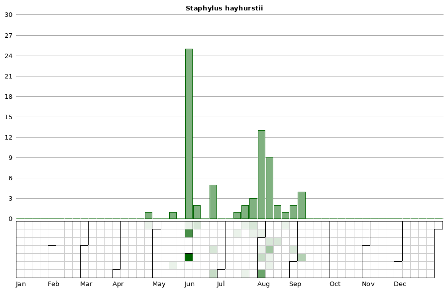
Flight time: Double brooded, with adults flying from the end of May to mid June, and from mid July to early August. Rarely a partial third brood will occur in early September.
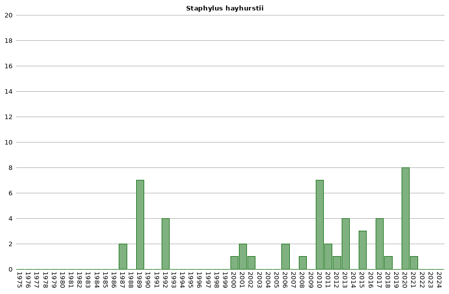
Status: Infrequent to rare breeding resident.
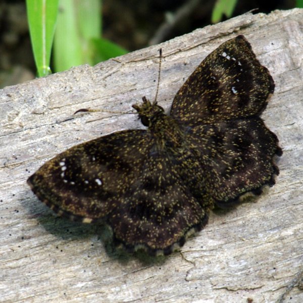
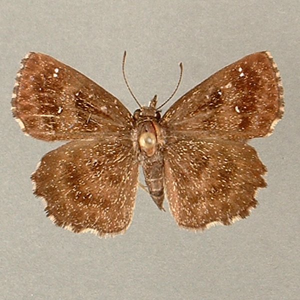
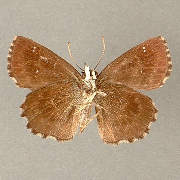
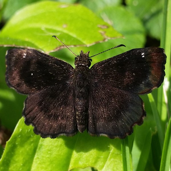
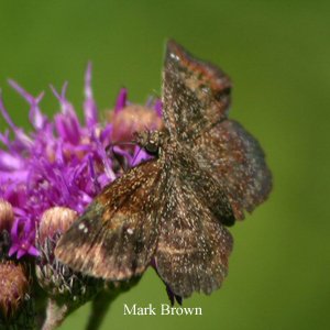
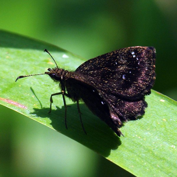
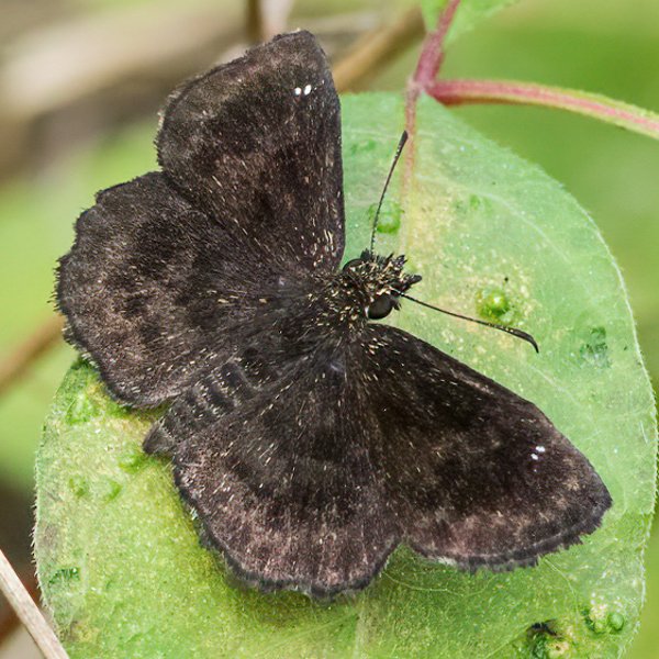
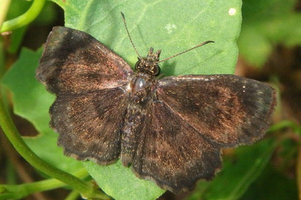
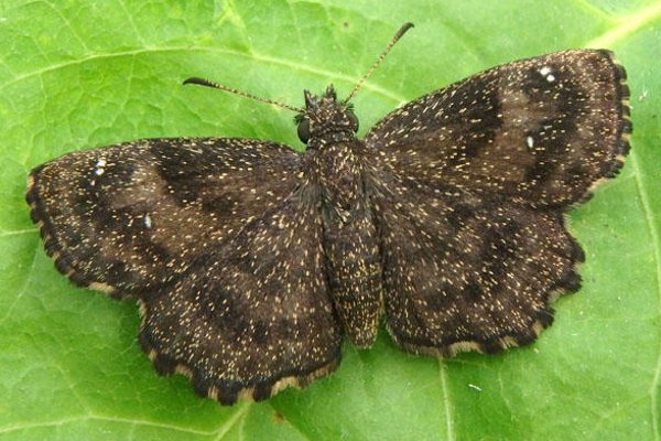
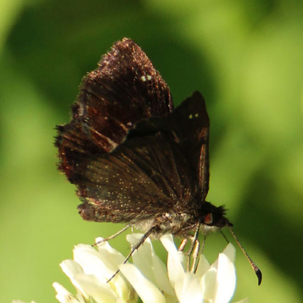
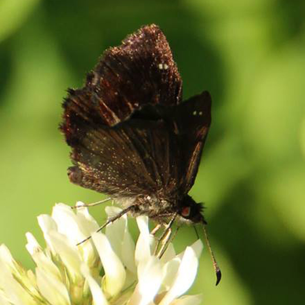
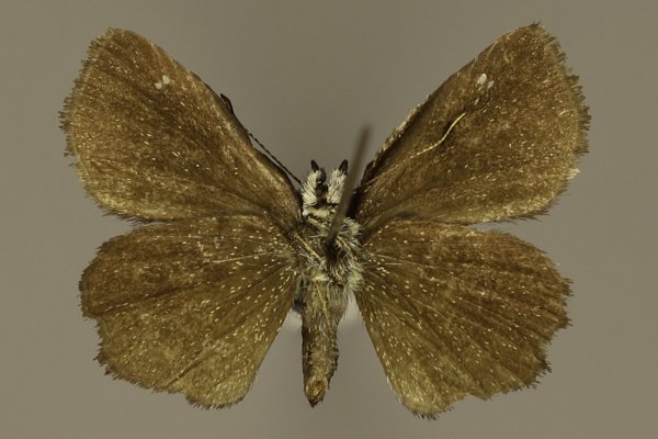
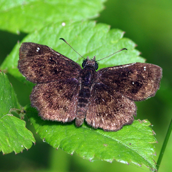
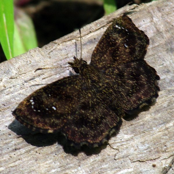
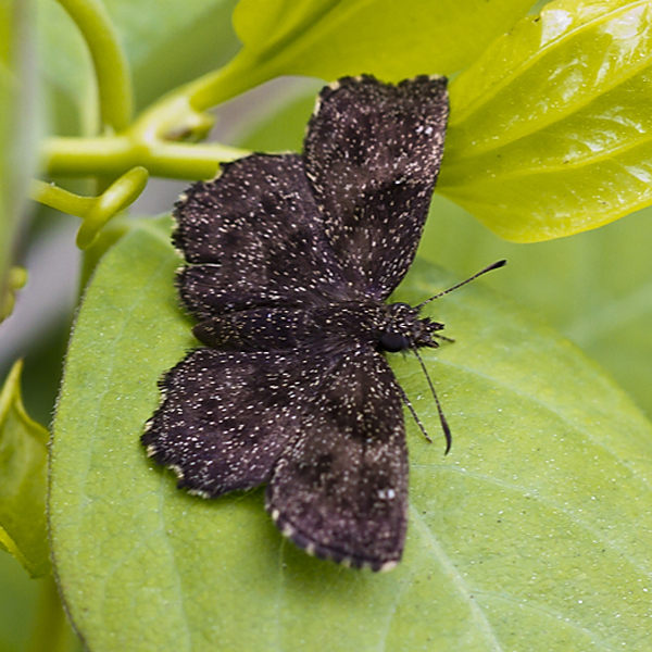
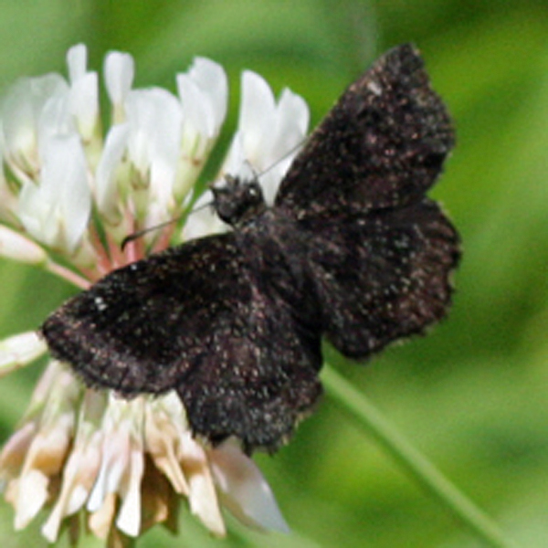
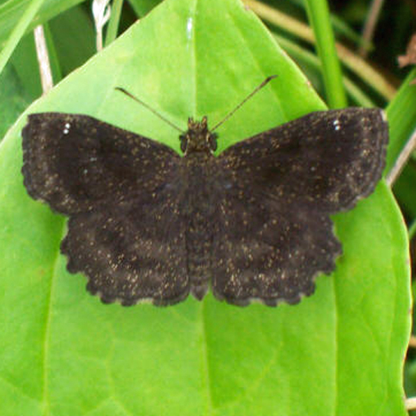
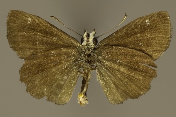
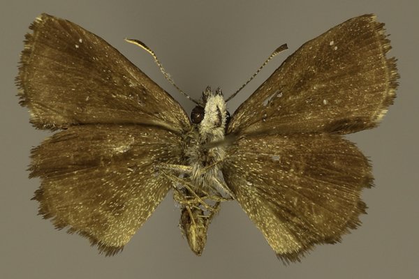
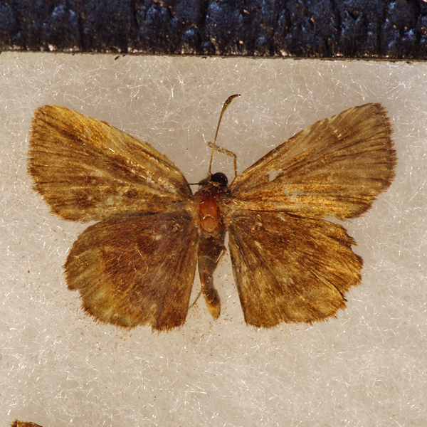
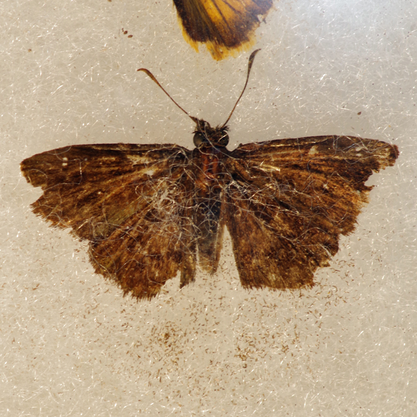
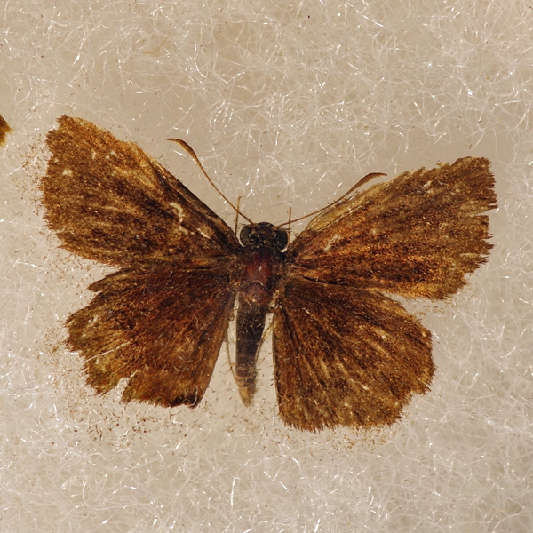
Distinguishing features: This small dark brown skipper has scalloped wing edges in fresh specimens. The forewing below appears to have a checkered fringe. Unlike Pholisora cattulus, S. hayhurstii rests with wings outspread against the surface of the substrate, which is reminiscent of some moths and metalmarks. It is also a lighter brown as compared to P. catullus.
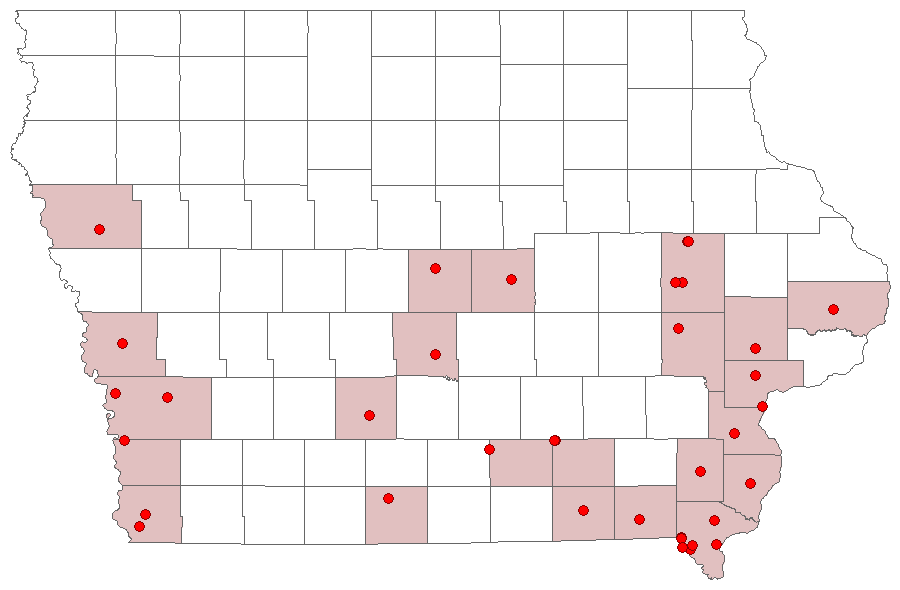
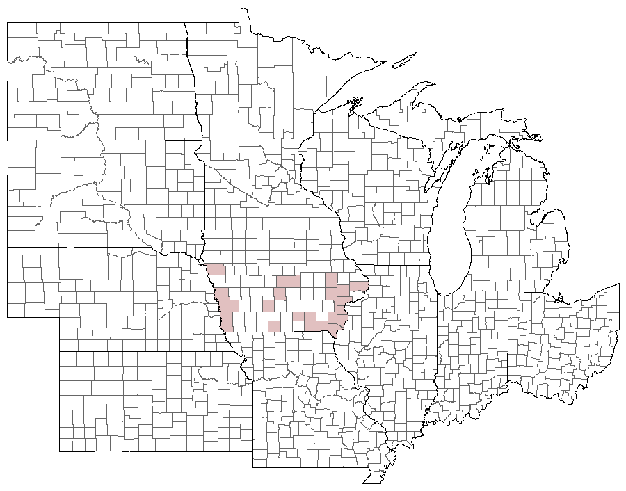
Distribution and habitat: The Scalloped Sooty Wing appears limited to the southern half of the state. It is most often encountered in sandy flood plain forests of River Birch (Betula nigra). However, it has also been encountered Loess Hills forest and wooded groves adjacent to sand prairies.
Natural History: Most of the recent sightings of this species are based upon single individuals. Although its larvae have been reported to eat various members of the Goosefoot family (Chenopodiaceae), including Lambs-quarters (Chenopodium album), the actual host plants in Iowa remain undocumented. Its scattered occurrences and relatively high level of habitat fidelity suggests that it consumes a related species, which is less ubiquitous in the modern landscape.
| Record # | Date | Locale | State | Lat/Lon | Collected By | Count |
|---|---|---|---|---|---|---|
| 308549 | 2021-08-03 | Eddyville Sand Prairie Park | Iowa | 41.153935 -92.619115 | Chris Edwards | 1 |
 275306 275306
|
2020-08-08 | Eddyville Sand Prairie Park | Iowa | 41.154568 -92.618726 | Jay Gilliam | 5 |
| 281960 | 2020-08-04 | Turkey Run Wildlife Area, Lee County | Iowa | 40.558402 -91.679173 | Chris Edwards | 1 |
 282235 282235
|
2020-08-04 | Eddyville Sand Prairie Park | Iowa | 41.155613 -92.617153 | Mark Brown | 1 |
 282237 282237
|
2020-08-04 | Eddyville Sand Prairie Park | Iowa | 41.155613 -92.617153 | Mark Brown | 1 |
| 211137 | 2018-05-28 | Stephens State Forest - Thousand Acre Unit, Lucas County | Iowa | 41.103003 -93.101751 | Mark Brown | 1 |
| 199790 | 2017-08-08 | Shimek State Forest, Lick Creek Unit | Iowa | 40.60888 -91.68361 | Frank Olsen | 1 |
| 192287 | 2017-05-29 | Shimek State Forest, Croton Unit East | Iowa | 40.5686111 -91.6038889 | Mark Brown | 1 |
 197170 197170
|
2017-05-29 | Shimek State Forest, Croton Unit East | Iowa | 40.54693 -91.61435 | Mark Brown | 1 |
 201905 201905
|
2017-05-29 | Shimek State Forest, Croton Unit East | Iowa | 40.5686111 -91.6038889 | Mark Brown | 1 |
 128227 128227
|
2015-07-16 | Bloomfield | Iowa | 40.762434 -92.409856 | Ryan Rasmussen | 1 |
 126286 126286
|
2015-06-04 | Lacey-Keosauqua State Park | Iowa | 40.715 -91.99056 | Jim Durbin | 1 |
 126287 126287
|
2015-06-04 | Lacey-Keosauqua State Park | Iowa | 40.715 -91.99056 | Jim Durbin | 1 |
| 6045 | 2013-09-07 | Shimek State Forest, Croton Unit East | Iowa | 40.543727 -91.615118 | BAMONA | 1 |
| 10147 | 2013-09-07 | Shimek State Forest, Croton Unit East | Iowa | 40.5438889 -91.6152778 | Tom Jantscher | 1 |
| 119383 | 2013-09-07 | Shimek State Forest, Croton Unit East | Iowa | 40.545896 -91.616881 | Chris Edwards | 1 |
 47073 47073
|
2013-08-08 | Shimek State Forest, Croton Unit East | Iowa | 40.54693 -91.61435 | Jim Durbin | 1 |
 138273 138273
|
2012-04-22 | Hitchcock Nature Center | Iowa | 41.41666 -95.8614 | Brian Peterson | 1 |
| 7477 | 2011-07-24 | Folsom Point Preserve | Iowa | 41.153044 -95.796881 | Aaron Brees | 1 |
| 142542 | 2011-07-23 | Rochester Cemetery | Iowa | 41.664504 -91.137696 | IBSN | 1 |
 287035 287035
|
2010-08-05 | Waubonsie State Park | Iowa | 40.676 -95.689 | Jim Durbin | 1 |
 207886 207886
|
2010-05-29 | Waubonsie State Park | Iowa | 40.676 -95.689 | Aaron Brees | 6 |
 207885 207885
|
2008-07-30 | Decatur Wildlife Management Area | Iowa | 40.830629 -93.85059 | Aaron Brees | 1 |
 47072 47072
|
2006-07-22 | Shimek State Forest, Croton Unit East | Iowa | 40.54693 -91.61435 | Jim Durbin | 1 |
 47071 47071
|
2006-05-29 | Leon's Farm, Ohio County | Kentucky | 37.42033 -86.77023 | Jim Durbin | 1 |
| 119384 | 2002-08-10 | Shimek State Forest, Lick Creek Unit | Iowa | 40.61233 -91.685905 | Chris Edwards | 1 |
| 119382 | 2001-08-05 | Heron Bend Conservation Area | Iowa | 40.572222 -91.424444 | Chris Edwards | 1 |
| 119386 | 2001-08-02 | Hawkeye Willdlife Management Area | Iowa | 41.775104 -91.705532 | Chris Edwards | 1 |
| 119385 | 2000-07-22 | Hawkeye Willdlife Management Area | Iowa | 41.775104 -91.705532 | Chris Edwards | 1 |
| 63199 | 1992-08-29 | Hitaga Sand Ridge Prairie Preserve | Iowa | 42.25233 -91.63633 | Frank Olsen | 1 |
 144444 144444
|
1992-08-29 | Hitaga Sand Ridge Prairie Preserve | Iowa | 42.24944 -91.63056 | Frank Olsen | 1 |
| 63198 | 1992-06-20 | Hitaga Sand Ridge Prairie Preserve | Iowa | 42.25233 -91.63633 | Frank Olsen | 1 |
 144408 144408
|
1992-06-20 | Hitaga Sand Ridge Prairie Preserve | Iowa | 42.24944 -91.63056 | Frank Olsen | 1 |
| 63202 | 1989-08-11 | Linn County | Iowa | 42.027289 -91.67275 | Frank Olsen | 1 |
| 63206 | 1989-08-05 | Rock Island Botanical State Preserve | Iowa | 42.02732 -91.72723 | Frank Olsen | 1 |
| 124495 | 1989-08-05 | Rock Island Botanical State Preserve | Iowa | 42.02732 -91.72723 | Frank Olsen | 1 |
 144284 144284
|
1989-08-05 | Rock Island Botanical State Preserve | Iowa | 42.026205 -91.726516 | Frank Olsen | 1 |
| 63205 | 1989-06-24 | Rock Island Botanical State Preserve | Iowa | 42.02732 -91.72723 | Frank Olsen | 1 |
| 124386 | 1989-06-24 | Rock Island Botanical State Preserve | Iowa | 42.02732 -91.72723 | Frank Olsen | 1 |
 144268 144268
|
1989-06-24 | Rock Island Botanical State Preserve | Iowa | 42.026205 -91.726516 | Frank Olsen | 1 |
| 107985 | 1987-09-07 | Big Sand Mound Prairie Preserve, Muscatine County | Iowa | 41.341015 -91.086545 | Dennis Schlicht | 1 |
| 107984 | 1987-07-10 | Big Sand Mound Prairie Preserve, Muscatine County | Iowa | 41.341015 -91.086545 | Dennis Schlicht | 1 |
| 63203 | 1961-08-20 | Polk County | Iowa | 41.6278 -93.50034 | Ron Royer | 1 |
| 63204 | 1961-08-15 | Polk County | Iowa | 41.6278 -93.50034 | Ron Royer | 2 |
| 63200 | 1960-08-02 | Shimek State Forest, Croton Unit East | Iowa | 40.54575 -91.61623 | St. Ambrose Univ. | 1 |
| 63201 | 1960-08-02 | Shimek State Forest, Croton Unit East | Iowa | 40.54575 -91.61623 | St. Ambrose Univ. | 1 |
| 6040 | 1950-06-01 | Clinton County | Iowa | 41.878563 -90.563606 | USGS - NPWRC | 1 |
| 6041 | 1950-06-01 | Des Moines County | Iowa | 40.912338 -91.173698 | USGS - NPWRC | 1 |
| 6042 | 1950-06-01 | Sidney | Iowa | 40.74004 -95.645798 | USGS - NPWRC | 1 |
| 6043 | 1950-06-01 | Harrison County | Iowa | 41.693386 -95.814285 | USGS - NPWRC | 1 |
| 6044 | 1950-06-01 | Lee County | Iowa | 40.706867 -91.443466 | USGS - NPWRC | 1 |
| 6046 | 1950-06-01 | Linn County | Iowa | 42.027289 -91.67275 | USGS - NPWRC | 1 |
| 6047 | 1950-06-01 | Louisa County | Iowa | 41.193298 -91.289101 | USGS - NPWRC | 1 |
| 6048 | 1950-06-01 | Madison County | Iowa | 41.292236 -93.987846 | USGS - NPWRC | 1 |
| 6049 | 1950-06-01 | Marshall County | Iowa | 42.04071 -92.937576 | USGS - NPWRC | 1 |
| 6050 | 1950-06-01 | Muscatine County | Iowa | 41.51569 -91.1353 | USGS - NPWRC | 1 |
| 6051 | 1950-06-01 | Polk County | Iowa | 41.627842 -93.500343 | USGS - NPWRC | 1 |
| 6052 | 1950-06-01 | Pottawattamie County | Iowa | 41.391151 -95.477783 | USGS - NPWRC | 1 |
| 6053 | 1950-06-01 | Story County | Iowa | 42.104046 -93.500343 | USGS - NPWRC | 1 |
| 6054 | 1950-06-01 | Woodbury County | Iowa | 42.316616 -95.983261 | USGS - NPWRC | 1 |
| 107983 | 1936-05-18 | Mount Pleasant | Iowa | 40.982369 -91.542799 | 1 |