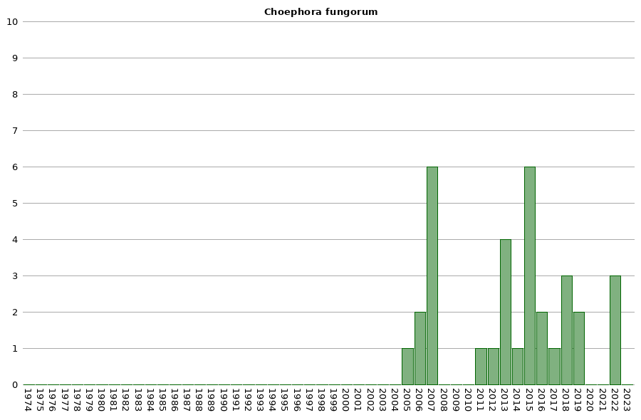
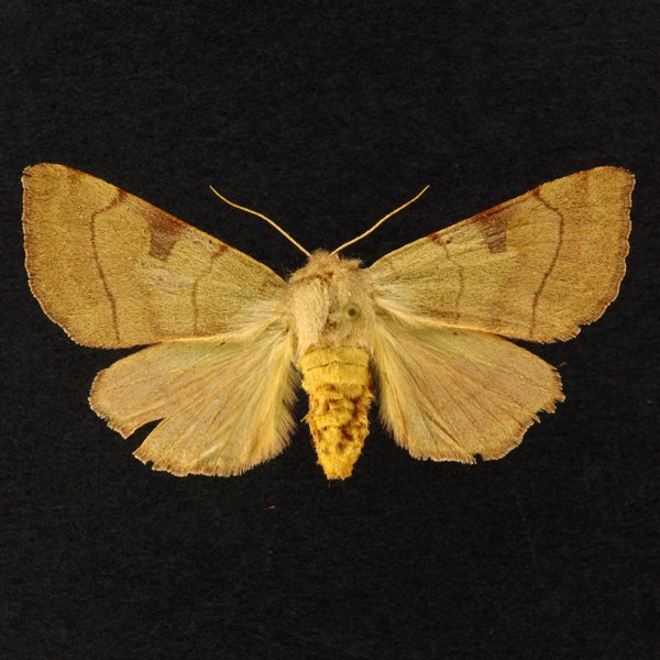
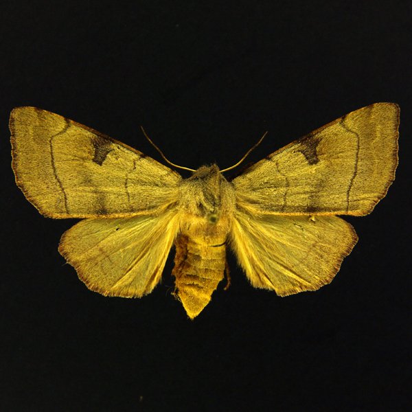
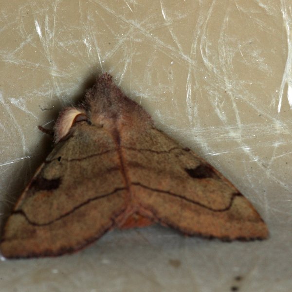
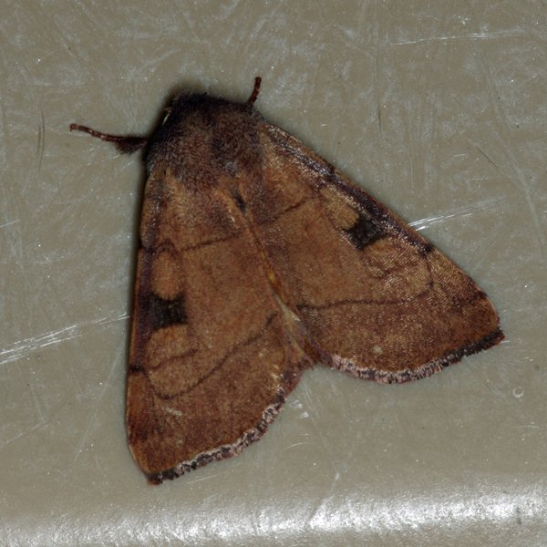
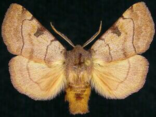
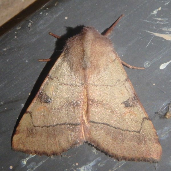
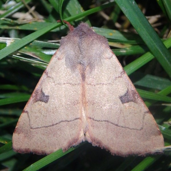
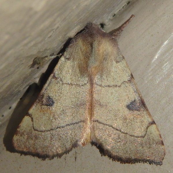
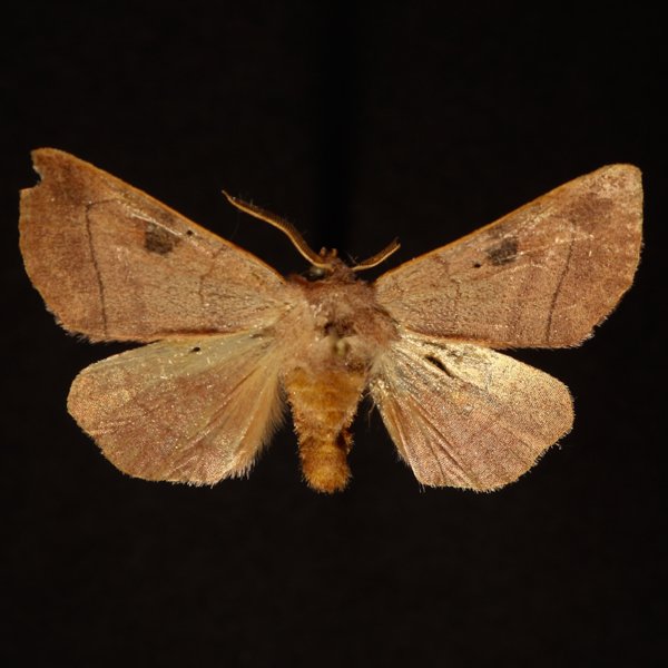
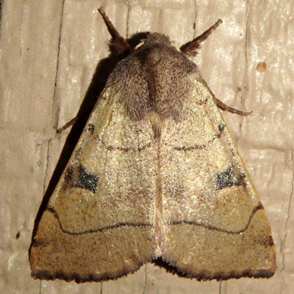
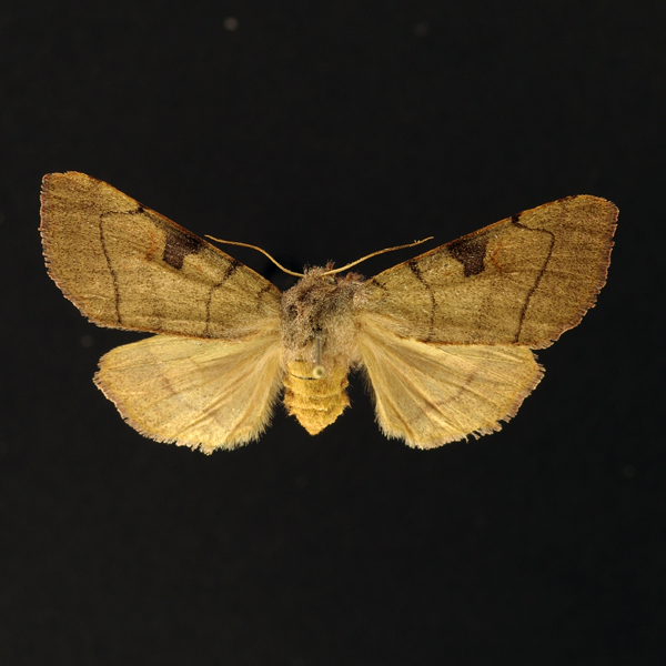
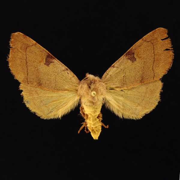
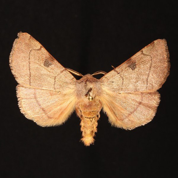
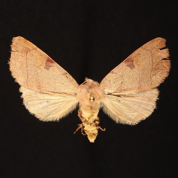
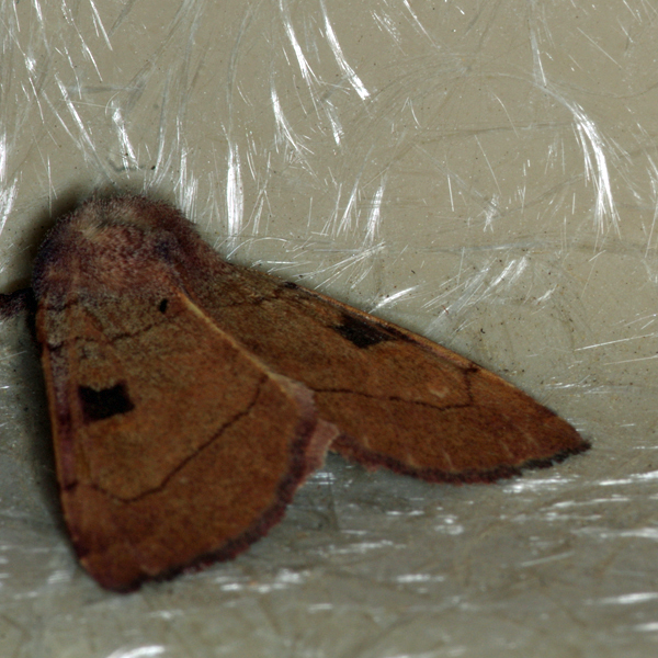
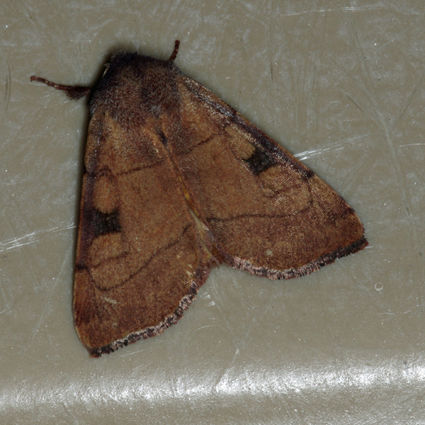
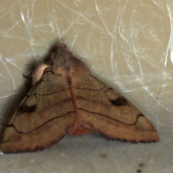
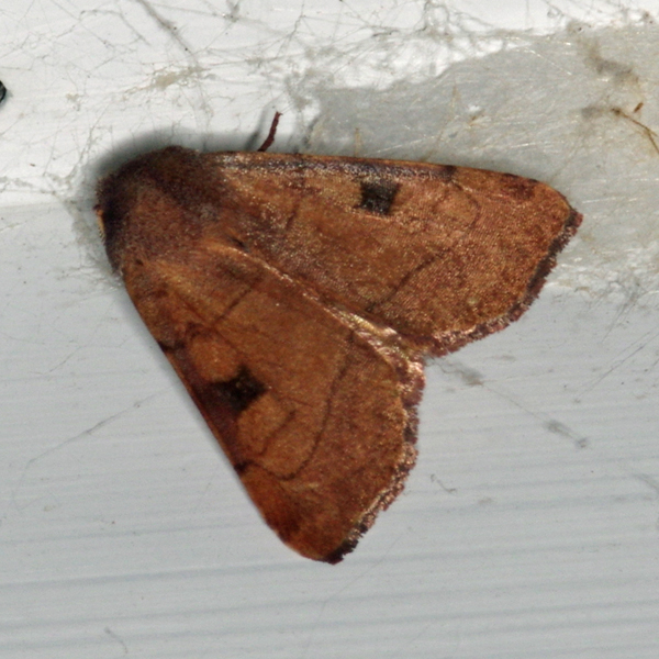
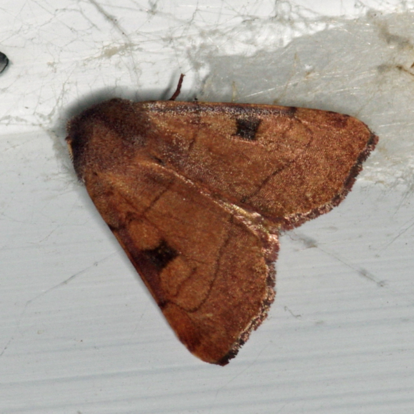
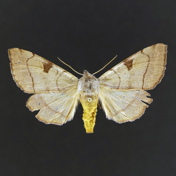
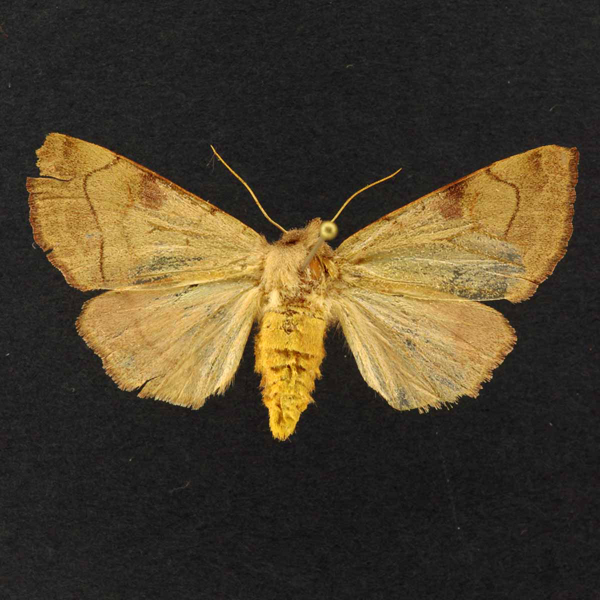
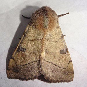
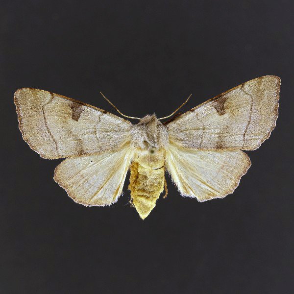
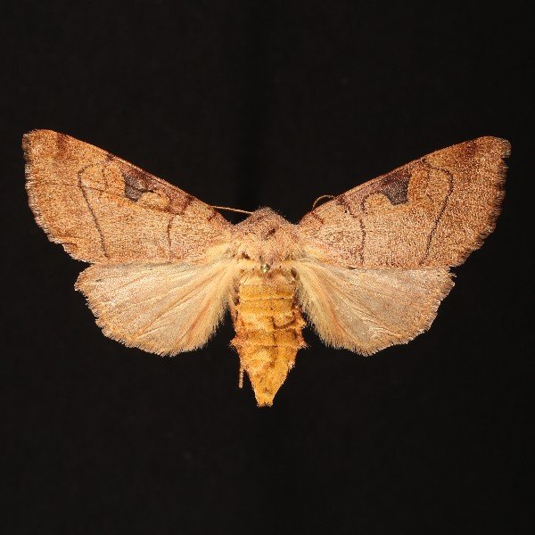
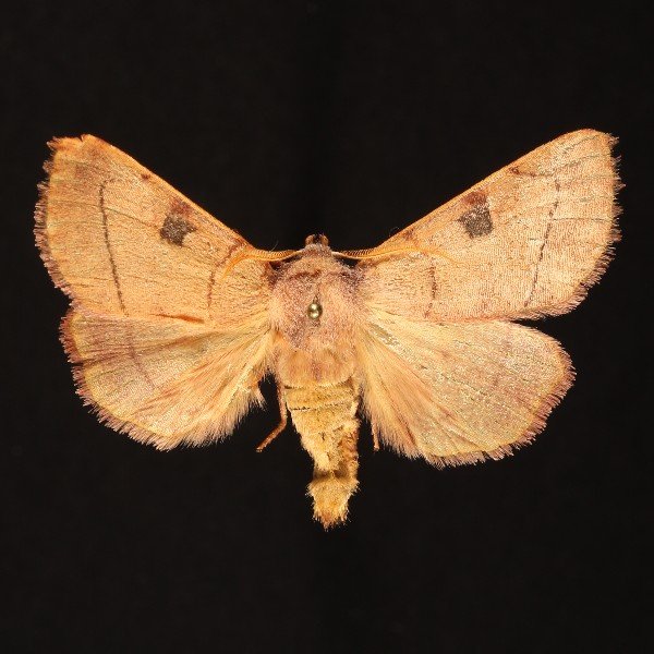
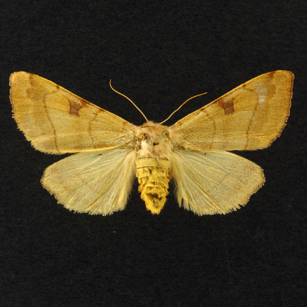
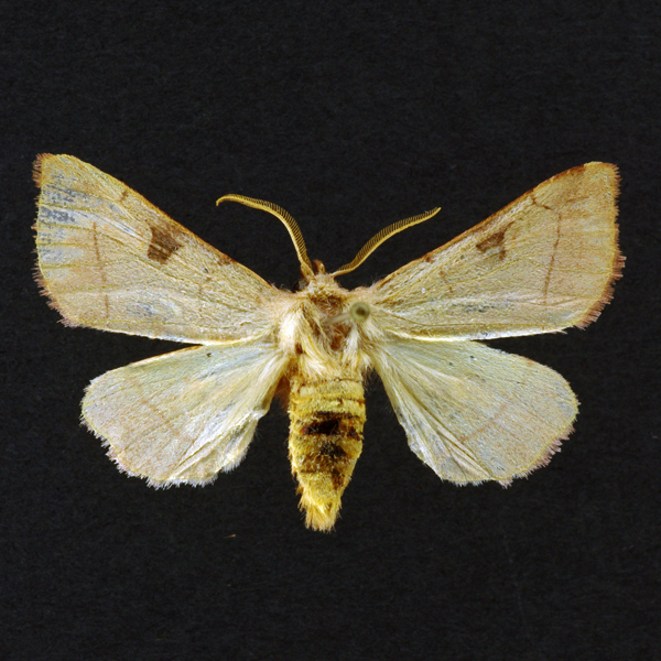
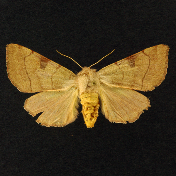
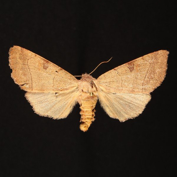
Bent-Lined Dart (Choephora fungorum), Grote and Robinson, 1868 - 10998.000000 - 933543
Wing span: 45mm
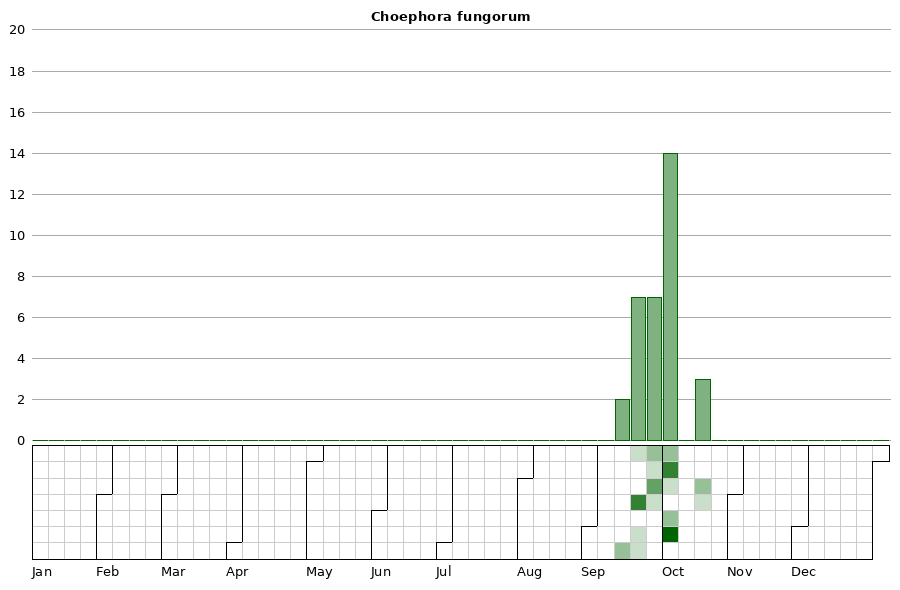
Flight time: September - October
Photos

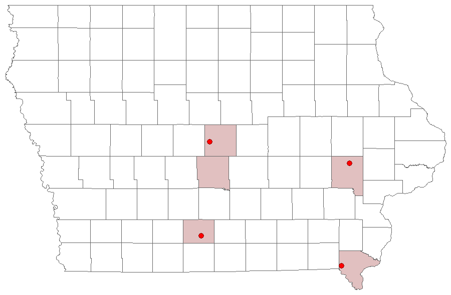
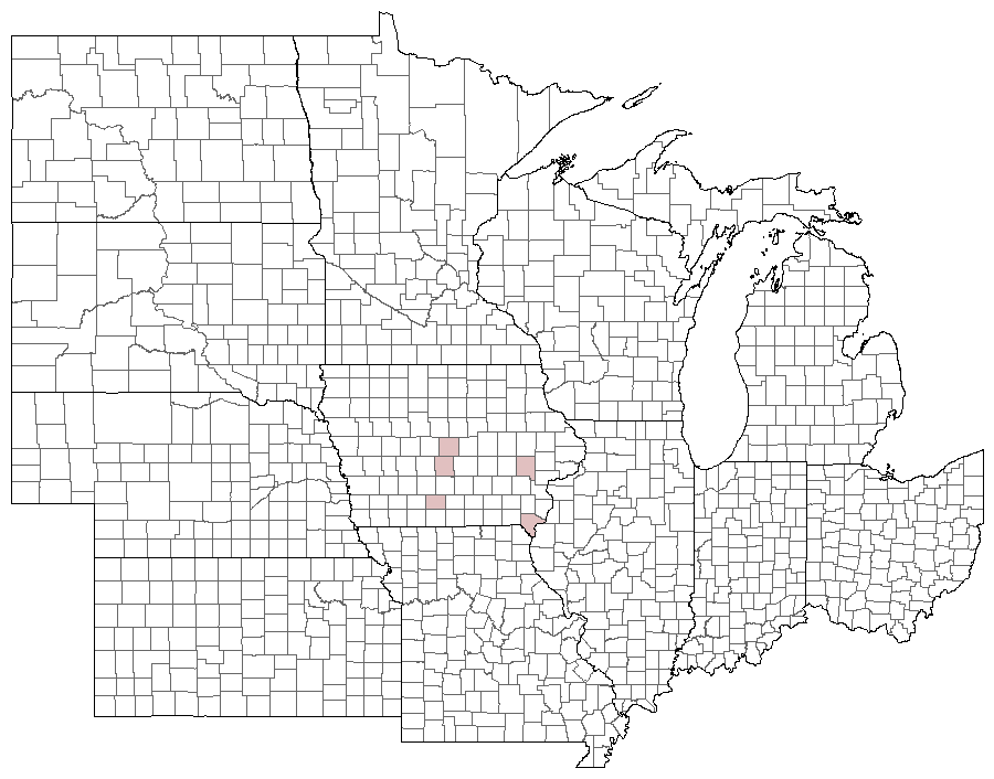
Records
| Record # | Date | Locale | State | Lat/Lon | Collected By | Count |
|---|---|---|---|---|---|---|
 333453 333453
|
2022-10-01 | MacBride Nature Recreation Area | Iowa | 41.786998923333336 -91.568575145 | Mark Brown | 1 |
 333472 333472
|
2022-09-25 | MacBride Nature Recreation Area | Iowa | 41.786998923333336 -91.568575145 | Mark Brown | 1 |
 332475 332475
|
2022-09-24 | MacBride Nature Recreation Area | Iowa | 41.786914743333334 -91.56851765 | Mark Brown | 1 |
 239016 239016
|
2019-09-26 | Ames, Paul | Iowa | 42.02064 -93.623952 | Paul Martsching | 1 |
 239017 239017
|
2019-09-23 | Ames, Paul | Iowa | 42.02064 -93.623952 | Paul Martsching | 1 |
| 223227 | 2018-10-02 | MacBride Nature Recreation Area | Iowa | 41.786729 -91.568057 | Mark Brown | 1 |
 227614 227614
|
2018-10-02 | MacBride Nature Recreation Area | Iowa | 41.786729 -91.568057 | Mark Brown | 1 |
| 223223 | 2018-09-26 | MacBride Nature Recreation Area | Iowa | 41.786729 -91.568057 | Mark Brown | 1 |
 198031 198031
|
2017-09-24 | Ames, Paul | Iowa | 42.02064 -93.623952 | Paul Martsching | 1 |
 177232 177232
|
2016-10-17 | 5031 Old Lyddane Bridge Road | Kentucky | 37.746771 -87.185979 | Jim Durbin | 1 |
 177223 177223
|
2016-10-05 | 5031 Old Lyddane Bridge Road | Kentucky | 37.746771 -87.185979 | Jim Durbin | 1 |
 182394 182394
|
2015-10-06 | 5031 Old Lyddane Bridge Road | Kentucky | 37.746807 -87.185997 | Jim Durbin | 1 |
 182397 182397
|
2015-10-06 | 5031 Old Lyddane Bridge Road | Kentucky | 37.746807 -87.185997 | Jim Durbin | 1 |
 183318 183318
|
2015-10-06 | 5031 Old Lyddane Bridge Road | Kentucky | 37.746771 -87.185979 | Jim Durbin | 1 |
 183321 183321
|
2015-10-06 | 5031 Old Lyddane Bridge Road | Kentucky | 37.746771 -87.185979 | Jim Durbin | 1 |
 182376 182376
|
2015-10-05 | 5031 Old Lyddane Bridge Road | Kentucky | 37.746807 -87.185997 | Jim Durbin | 1 |
 183315 183315
|
2015-10-05 | 5031 Old Lyddane Bridge Road | Kentucky | 37.746771 -87.185979 | Jim Durbin | 1 |
 108160 108160
|
2014-09-26 | Clarke County, Iowa | Iowa | Location Protected | Frank Olsen | 1 |
| 111814 | 2013-10-03 | Polk County, Iowa | Iowa | Location Protected | Aaron Brees | 1 |
| 111813 | 2013-10-02 | Polk County, Iowa | Iowa | Location Protected | Aaron Brees | 1 |
 135912 135912
|
2013-10-02 | Ames, Paul | Iowa | 42.02064 -93.623952 | Paul Martsching | 1 |
| 111812 | 2013-09-22 | Polk County, Iowa | Iowa | Location Protected | Aaron Brees | 1 |
 20599 20599
|
2012-09-16 | Johnson County, Iowa | Iowa | Location Protected | Mark Brown | 1 |
 20598 20598
|
2011-09-27 | Red Fern Timber | Iowa | 40.98317 -93.75317 | Frank Olsen | 1 |
 20596 20596
|
2007-10-17 | 5031 Old Lyddane Bridge Road | Kentucky | 37.746807 -87.185997 | Jim Durbin | 1 |
 20597 20597
|
2007-10-17 | 5031 Old Lyddane Bridge Road | Kentucky | 37.746807 -87.185997 | Jim Durbin | 1 |
 136883 136883
|
2007-09-20 | Ames, Paul | Iowa | 42.02064 -93.623952 | Paul Martsching | 1 |
 136884 136884
|
2007-09-20 | Ames, Paul | Iowa | 42.02064 -93.623952 | Paul Martsching | 1 |
| 207569 | 2007-09-20 | Ames, Paul | Iowa | 42.02064 -93.623952 | Paul Martsching | 2 |
 136882 136882
|
2006-09-16 | Ames, Paul | Iowa | 42.02064 -93.623952 | Paul Martsching | 1 |
| 207568 | 2006-09-16 | Ames, Paul | Iowa | 42.02064 -93.623952 | Paul Martsching | 1 |
 20595 20595
|
2005-10-01 | Shimek State Forest, Donnellson Unit | Iowa | 40.64833 -91.68057 | Jim Durbin | 1 |