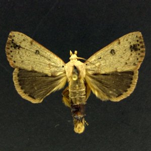
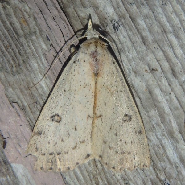
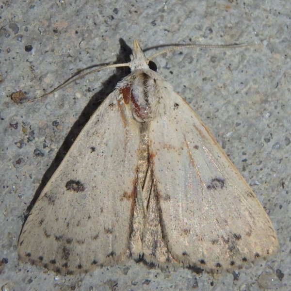
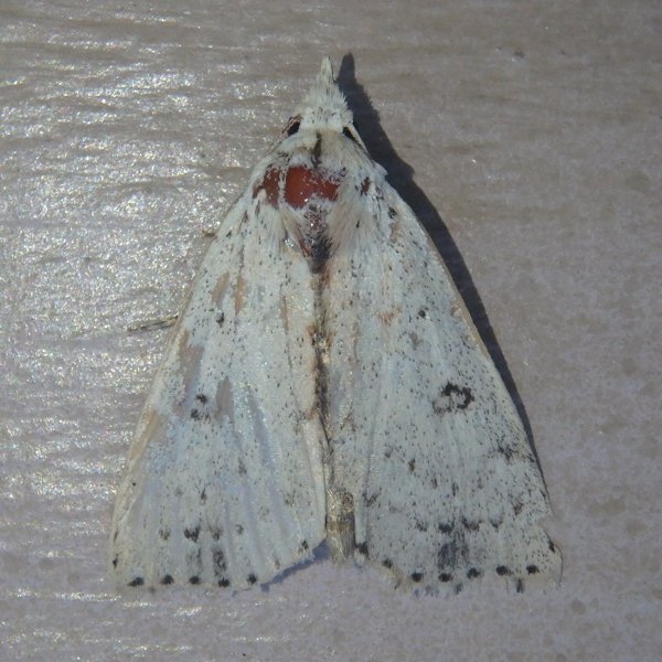
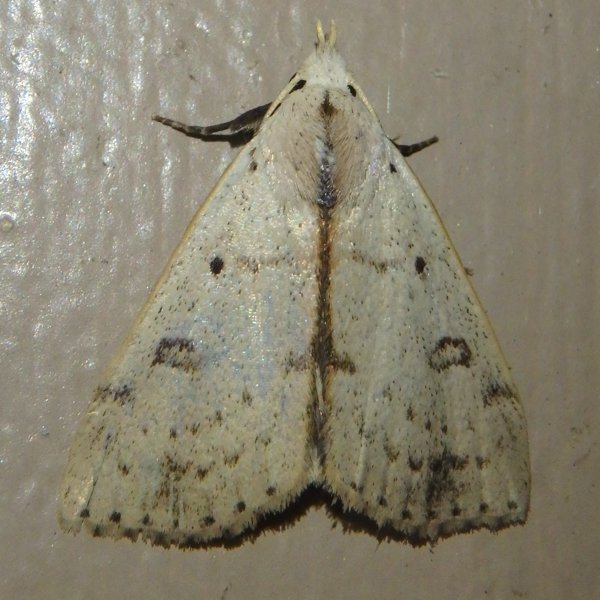
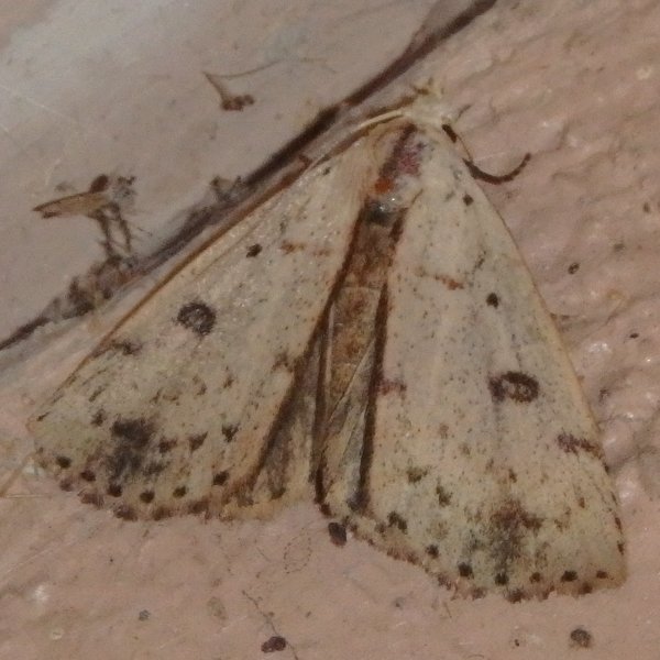
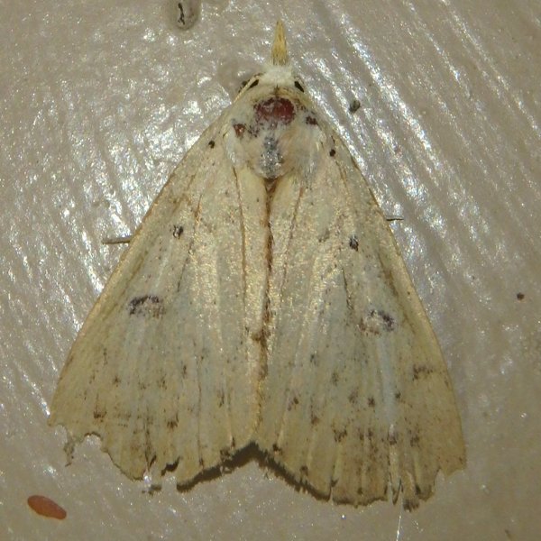
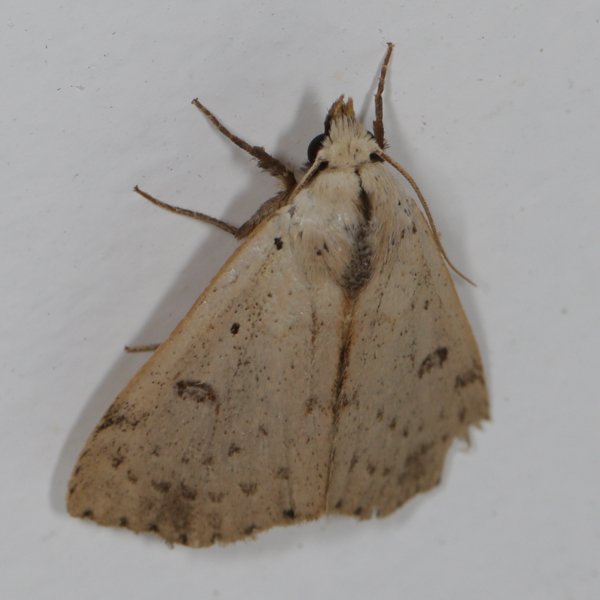
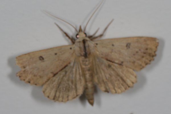
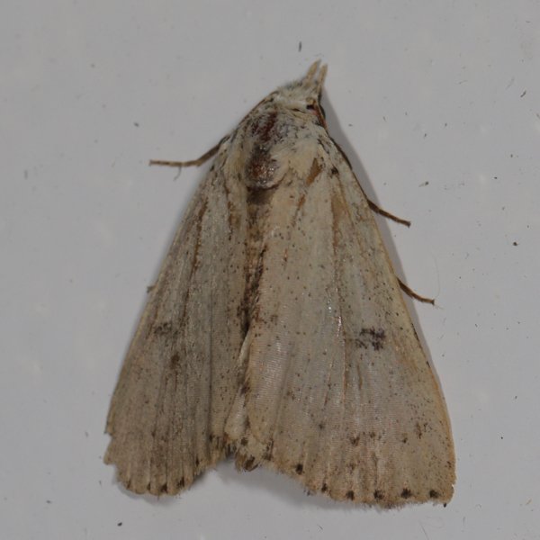
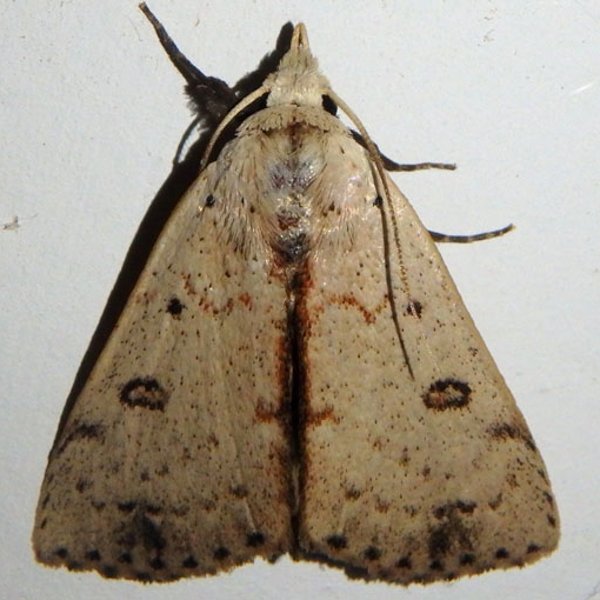
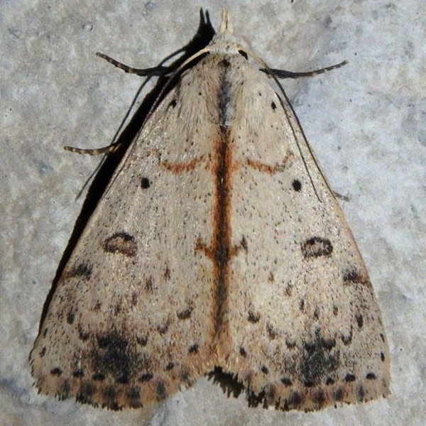
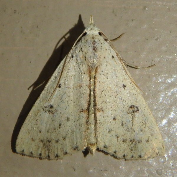
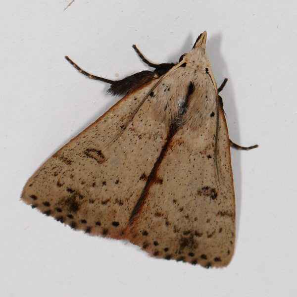
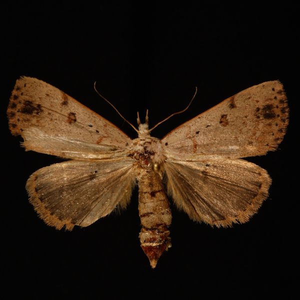
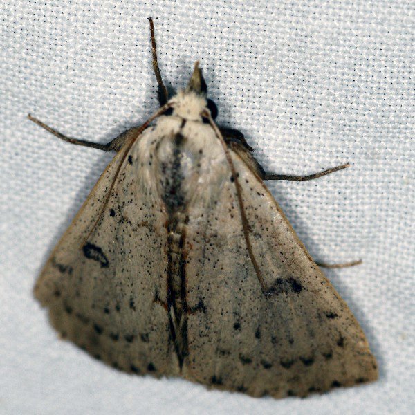
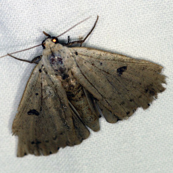
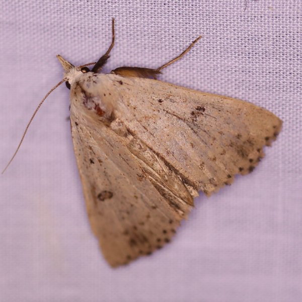
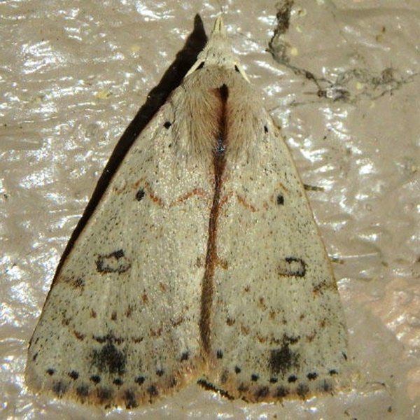
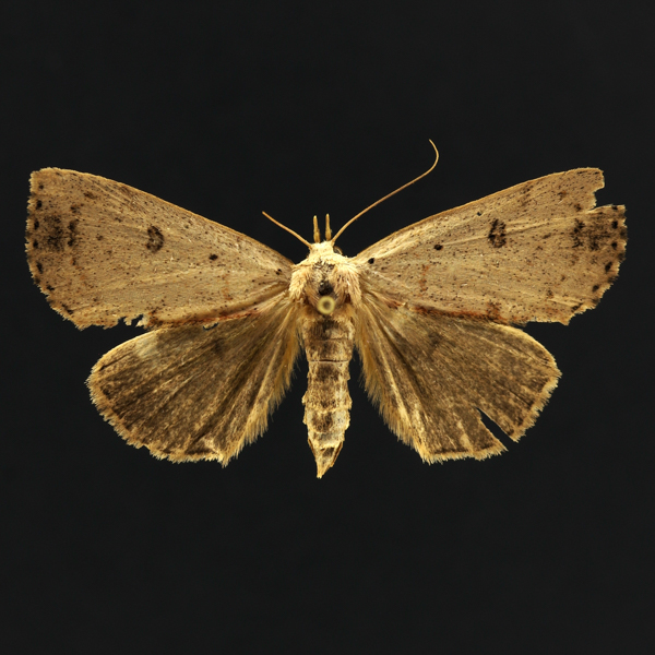
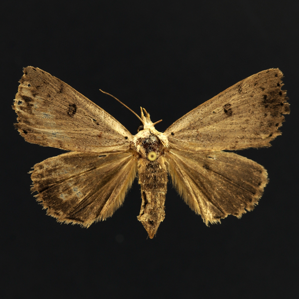
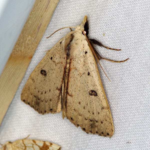
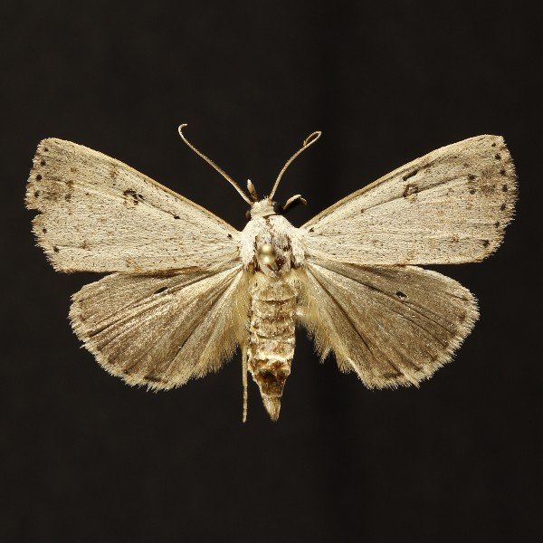
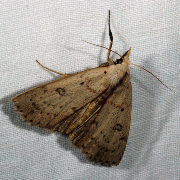
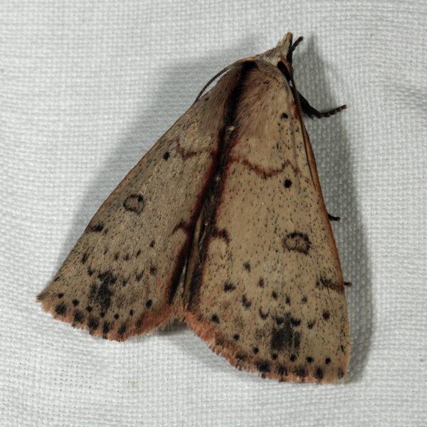
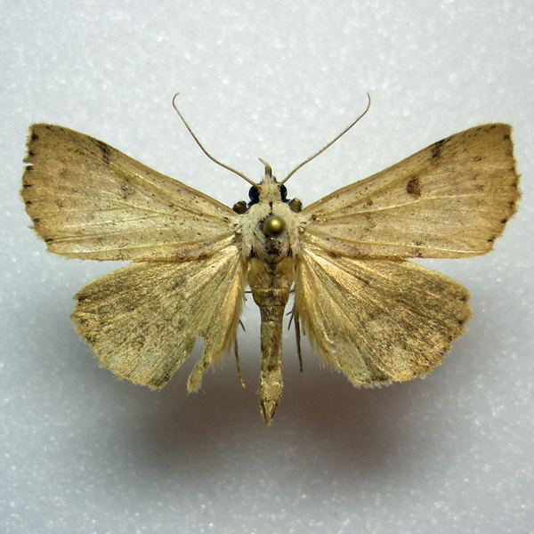
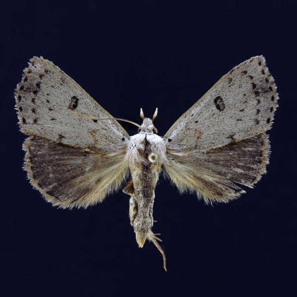
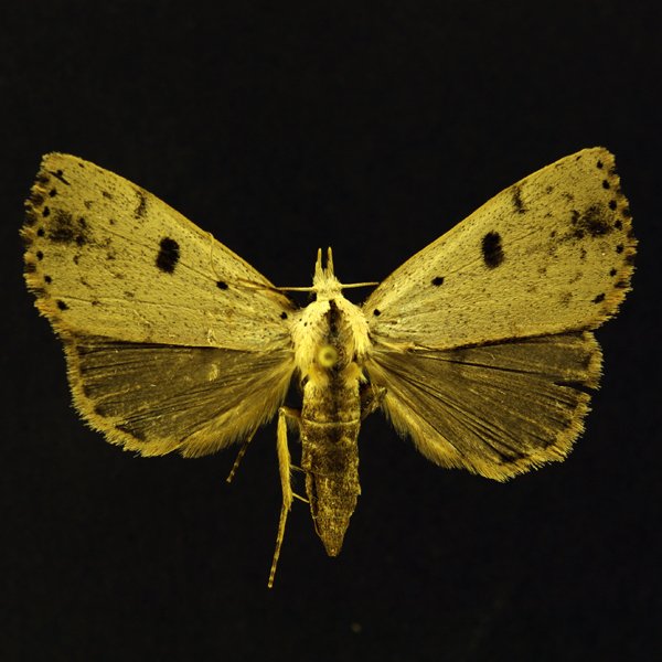
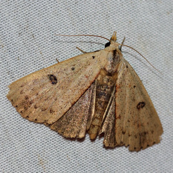
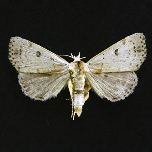
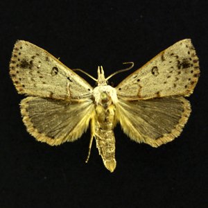
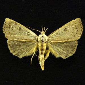
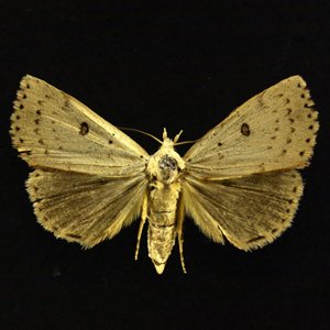
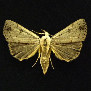
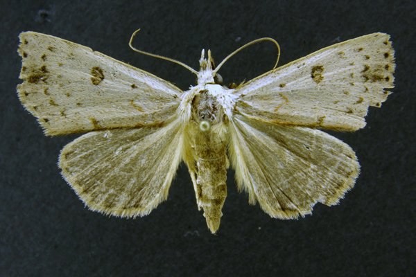
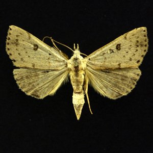
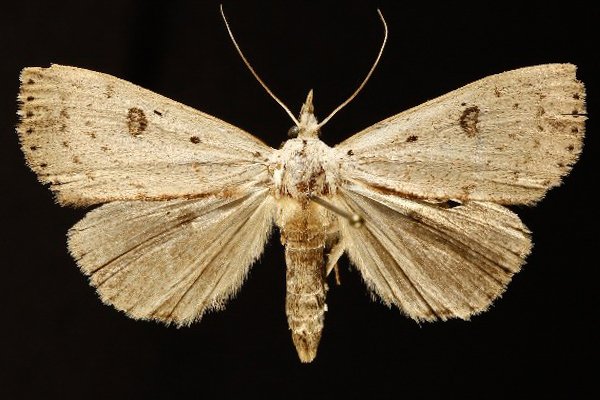
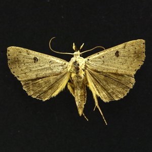
Dead-wood Borer Moth (Scolecocampa liburna), (Geyer, 1837) - 8514.000000 - 930637
Wing span: 38mm
Flight time: June - August


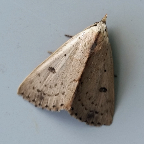
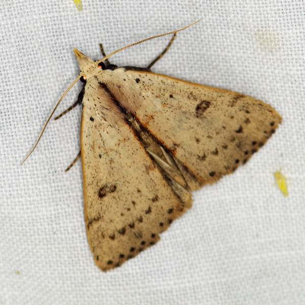
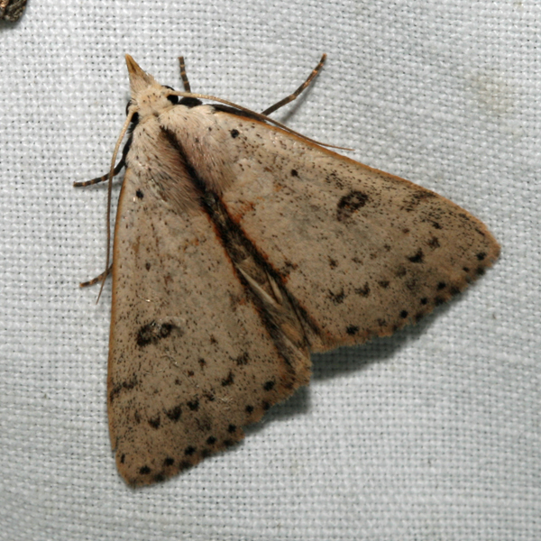
Photos


Records
| Record # | Date | Locale | State | Lat/Lon | Collected By | Count |
|---|---|---|---|---|---|---|
 343649 343649
|
2023-07-10 | MacBride Nature Recreation Area | Iowa | 41.786992051667 -91.568503523333 | Mark Brown | 1 |
 343667 343667
|
2023-07-09 | MacBride Nature Recreation Area | Iowa | 41.786992051667 -91.568503523333 | Mark Brown | 1 |
 343223 343223
|
2023-06-27 | MacBride Nature Recreation Area | Iowa | 41.786686763333 -91.568532451667 | Mark Brown | 1 |
 342946 342946
|
2023-06-21 | MacBride Nature Recreation Area | Iowa | 41.786743538333 -91.568491138333 | Mark Brown | 1 |
 320402 320402
|
2022-07-12 | MacBride Nature Recreation Area | Iowa | 41.7868507 -91.56854348 | Mark Brown | 1 |
 318759 318759
|
2022-07-09 | MacBride Nature Recreation Area | Iowa | 41.78692473 -91.56852435 | Mark Brown | 1 |
 318788 318788
|
2022-07-08 | MacBride Nature Recreation Area | Iowa | 41.78692473 -91.56852435 | Mark Brown | 1 |
 319547 319547
|
2022-07-07 | MacBride Nature Recreation Area | Iowa | 41.78692473 -91.56852435 | Mark Brown | 1 |
 290264 290264
|
2021-07-08 | Hitaga Sand Ridge Prairie Preserve | Iowa | 42.25145774 -91.63021403 | Jim Durbin | 1 |
 290286 290286
|
2021-07-08 | Hitaga Sand Ridge Prairie Preserve | Iowa | 42.25145774 -91.63021403 | Jim Durbin | 1 |
 290293 290293
|
2021-07-08 | Hitaga Sand Ridge Prairie Preserve | Iowa | 42.25145774 -91.63021403 | Jim Durbin | 1 |
 297883 297883
|
2021-07-05 | Johnson County, Iowa | Iowa | Location Protected | Mark Brown | 1 |
 296307 296307
|
2021-06-28 | Johnson County, Iowa | Iowa | Location Protected | Mark Brown | 1 |
 269414 269414
|
2020-07-16 | MacBride Nature Recreation Area | Iowa | 41.78682984 -91.56842158 | Mark Brown | 1 |
 267693 267693
|
2020-06-23 | Matsell Bridge Natural Area | Iowa | 42.13215952 -91.38525882 | Jim Durbin | 1 |
 238960 238960
|
2019-07-26 | Ames, Paul | Iowa | 42.02064 -93.623952 | Paul Martsching | 1 |
 234374 234374
|
2019-07-23 | Hitaga Sand Ridge Prairie Preserve | Iowa | 42.251284 -91.630087 | Jim Durbin | 1 |
 234403 234403
|
2019-07-23 | Hitaga Sand Ridge Prairie Preserve | Iowa | 42.251284 -91.630087 | Jim Durbin | 1 |
 234485 234485
|
2019-07-23 | Hitaga Sand Ridge Prairie Preserve | Iowa | 42.251284 -91.630087 | Jim Durbin | 1 |
 270383 270383
|
2019-07-10 | Jefferson County Park | Iowa | 40.99178878 -91.98610569 | Moni Hayne | 1 |
| 233912 | 2019-07-01 | MacBride Nature Recreation Area | Iowa | 41.786729 -91.568057 | Mark Brown | 1 |
 247214 247214
|
2019-07-01 | MacBride Nature Recreation Area | Iowa | 41.785587 -91.560685 | Mark Brown | 1 |
 222472 222472
|
2018-07-12 | Ames, Paul | Iowa | 42.02064 -93.623952 | Paul Martsching | 1 |
| 226936 | 2018-07-12 | Ames, Paul | Iowa | 42.02064 -93.623952 | Paul Martsching | 1 |
 222471 222471
|
2018-07-10 | Ames, Paul | Iowa | 42.02064 -93.623952 | Paul Martsching | 1 |
 195044 195044
|
2017-07-04 | Sundown Lake Recreation Area | Iowa | 40.830089 -92.747939 | Eric Liskey | 1 |
 171605 171605
|
2016-07-09 | Hitaga Sand Ridge Prairie Preserve | Iowa | 42.250957 -91.632098 | Jim Durbin | 1 |
 200114 200114
|
2016-07-09 | Hitaga Sand Ridge Prairie Preserve | Iowa | 42.250957 -91.632098 | Don F. Becker | 1 |
 171311 171311
|
2016-06-27 | Hitaga Sand Ridge Prairie Preserve | Iowa | 42.250957 -91.632098 | Jim Durbin | 1 |
 133145 133145
|
2015-08-31 | Waubonsie State Park | Iowa | 40.676 -95.689 | Frank Olsen | 1 |
 128226 128226
|
2015-07-16 | Matsell Bridge Natural Area | Iowa | 42.131959 -91.388307 | Jim Durbin | 1 |
 127578 127578
|
2015-06-23 | Matsell Bridge Natural Area | Iowa | 42.131959 -91.388307 | Jim Durbin | 1 |
 108397 108397
|
2014-07-13 | Black Hawk Point Wildlife Management Area | Iowa | 43.4555556 -91.28 | Tom Jantscher | 1 |
 193770 193770
|
2014-07-13 | Hitaga Sand Ridge Prairie Preserve | Iowa | 42.250957 -91.632098 | Jim Durbin | 1 |
 45452 45452
|
2013-07-05 | Waubonsie State Park | Iowa | 40.676 -95.689 | Tom Jantscher | 1 |
 45451 45451
|
2012-06-26 | Wanatee County Park | Iowa | 42.0094 -91.56623 | Jim Durbin | 1 |
 45449 45449
|
2010-05-01 | Ohio County, Kentucky | Kentucky | Location Protected | Jourdan Yeckering | 1 |
 45446 45446
|
2009-07-15 | Pinicon Ridge Park | Iowa | 42.21188 -91.54753 | Jim Durbin | 1 |
 45447 45447
|
2009-07-15 | Pinicon Ridge Park | Iowa | 42.21188 -91.54753 | Jim Durbin | 1 |
 45448 45448
|
2009-07-15 | Pinicon Ridge Park | Iowa | 42.21188 -91.54753 | Jim Durbin | 1 |
 45445 45445
|
2009-07-01 | Wickiup Hill Outdoor Learning Area | Iowa | 42.08398 -91.7651 | Jim Durbin | 1 |
 45444 45444
|
2009-06-12 | Leon's Farm, Ohio County | Kentucky | 37.42033 -86.77023 | Jim Durbin | 1 |
 192 192
|
2007-07-12 | Pleasant Creek State Recreation Area, Linn County | Iowa | 42.11952 -91.81215 | Frank Olsen | 1 |
 45442 45442
|
2007-07-12 | Pleasant Creek State Recreation Area, Linn County | Iowa | 42.11952 -91.81215 | Jim Durbin | 1 |
 191 191
|
2007-07-08 | J. Harold Ennis County Park | Iowa | 41.898488 -91.483092 | Frank Olsen | 1 |
 45441 45441
|
2004-07-04 | Leon's Farm, Ohio County | Kentucky | 37.42033 -86.77023 | Jim Durbin | 1 |
| 143778 | 2000-06-22 | Rock Island Botanical State Preserve | Iowa | 42.025805 -91.72638 | Frank Olsen | 1 |